Disclosure : This site contains affiliate links to products. We may receive a commission for purchases made through these links.
Central Glasgow 1934 – 6.10c
Central Glasgow in 1934 in a fascinating series of reproductions of old Ordnance Survey plans in the Alan Godfrey Editions, ideal for anyone interested in the history of their neighbourhood or family. Three versions have been published for this area. Coverage stretches from West Nile Street westward to Kelvinhaugh Street and Overnewton Square, and from Renfrew Street southward to Houston Street and Wallace Street. Features include Sauchiehall Street, Blythswood Square, Central Station, Queens Dock North and South Basins, Stobcross Goods station, Charing Cross station, Cranston Hill, Finnieston, Anderston, Stobcross Quay, Lancefield Quay, Anderston Quay, Passenger Wharf. Features south of the Clyde include Kingston Dock, Springfield Quay, Clyde Place Quay, General Terminus Quay, Plantation, Plantation Quay, Mavisbank Quay, tramways and depot, east part of Princes Dock, etc. Street directory extracts are on the reverse; in the 1893 edition including Berkeley Street, Blythswood Square, Cadogan Street, Clyde Street, Stobcross Street and Union Street; in the 1934 edition including Bridge Street, Carlton Place, Cadogan Street, Stobcross Street and Union Street.About the Alan Godfrey Editions of the 25″ OS Series:Selected towns in Great Britain and Ireland are covered by maps showing the extent of urban development in the last decades of the 19th and early 20th century. The plans have been taken from the Ordnance Survey mapping and reprinted at about 15 inches to one mile (1:4,340). On the reverse most maps have historical notes and many also include extracts from contemporary directories. Most maps cover about one mile (1.6kms) north/south, one and a half miles (2.4kms) across; adjoining sheets can be combined to provide wider coverage.FOR MORE INFORMATION AND A COMPLETE LIST OF ALL AVAILABLE TITLES PLEASE CLICK ON THE SERIES LINK.

Related Products:
 Central Glasgow 1893 – 6.10a
Central Glasgow 1909 – 6.10b
Central Glasgow 1893 – 6.10a
Central Glasgow 1909 – 6.10b
 Central Liverpool 1906 – 106.14b
Glasgow (Bellahouston & Dumbreck) 1934 – 6.13b
Central Liverpool 1906 – 106.14b
Glasgow (Bellahouston & Dumbreck) 1934 – 6.13b
 Central Liverpool 1890 – 106.14a Colour Edition
Carmyle 1934
Glasgow High Street 1909
Glasgow High Street 1933
Glasgow St Rollox 1933
Belfast North 1920
Central Liverpool 1890 – 106.14a Colour Edition
Carmyle 1934
Glasgow High Street 1909
Glasgow High Street 1933
Glasgow St Rollox 1933
Belfast North 1920
 Swansea 1897 – 24.05
Glasgow Green 1892
Glasgow East End 1893
Partick 1894 – 6.05
Ashford (North) 1934 – 19.16
Swansea 1897 – 24.05
Glasgow Green 1892
Glasgow East End 1893
Partick 1894 – 6.05
Ashford (North) 1934 – 19.16
 Mid Finchley 1934
Central Sunderland 1895 – 8.14
Sheffield Central 1903
Mid Finchley 1934
Central Sunderland 1895 – 8.14
Sheffield Central 1903
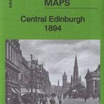 Central Edinburgh 1894 – 3.07
 Goole 1905
 Liverpool North 1906
 Bradford Central 1906
Central Newcastle 1894 – 11a
Coatbridge 1910 – 7.12b
Coatbridge 1897
Westminster & Victoria 1916 – 75.3
Bradford Central 1906
Central Newcastle 1894 – 11a
Coatbridge 1910 – 7.12b
Coatbridge 1897
Westminster & Victoria 1916 – 75.3
 Westminster & Victoria 1894 – 75.2
Central Croydon 1895 – 14.10
Hull (East) 1908 – 240.03b
Motherwell 1910 – 12.13b
Motherwell 1896
Westminster & Victoria 1894 – 75.2
Central Croydon 1895 – 14.10
Hull (East) 1908 – 240.03b
Motherwell 1910 – 12.13b
Motherwell 1896
 Hanworth and North West Hampton 1934
 Hull (East) 1928 – 240.03c
Hull (East) 1890 – 240.03a Colour Edition
Hull (East) 1928 – 240.03c
Hull (East) 1890 – 240.03a Colour Edition
 Kempton Park & SW Hampton 1934 – 25.06
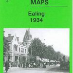 Ealing 1934
Blackpool Central Pier 1909
Manchester North West and Central Salford 1915
Glasgow Queen`s Park 1910
West Hartlepool 1914 – 37.11c
Ealing 1934
Blackpool Central Pier 1909
Manchester North West and Central Salford 1915
Glasgow Queen`s Park 1910
West Hartlepool 1914 – 37.11c