Disclosure : This site contains affiliate links to products. We may receive a commission for purchases made through these links.
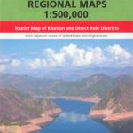
Central Asia: 500K Regional Topographic Maps
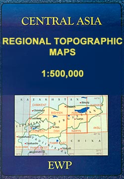
The mountains of Central Asia on at 1:500,000 on 11 detailed, contoured maps derived from the Soviet era topographic survey but with transliterated place names and an English language map legend. The series provides coverage of the Tien Shan and Pamir Mountains, with the whole of Kyrgyzstan, northern Tajikistan, plus the adjoining regions of Uzbekistan (including Tashkent and Samarkand), southern Kazakhstan (with Almaty) and the Sinkiang Province of China.The maps have contours at 100m intervals, enhanced by altitude colouring and relief shading, with plenty of spot heights and names of various mountain chains, peaks, valleys, etc. Additional colouring and/or graphics indicate glaciers, cliffs, rock boulders, sands, ridges and dunes, mud and salt flats, different types of vegetation, etc. The maps show all the information expected of topographic mapping at this scale, including detailed presentation of local roads and tracks, railways, aerodromes, isolated settlements, national and internal administrative borders, etc. Latitude and longitude grid is drawn at 20โ€ and 30โ€ respectively.The series was prepared in mid-2000s when all the place names have been transliterated from the original Russian mapping and given, where possible, modern local names for larger towns. Each map provides a guide to the transliteration, as well as English and German glossary for the abbreviations.Map legend is in English.

Related Products:
 Pamir East
 Pamir West
 Osh
Osh
 Tashkent
 Almaty
 Aksu
Aksu
 Bishkek
Karakol
Bishkek
Karakol
 Naryn
Naryn
 Shymkent (Chimkent)
 Spain: CNIG 500K Regional Road Maps
 Tajikistan: 500K Regional Maps
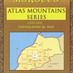 Morocco: Atlas Mountains Topographic Maps
 Norway: Nordeca 500K Regional Road Maps
 Central Asia (Road Edition)
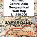
 Central Asia Geographical Edition Gizi Map
 Galicia: Santiago de Compostela – Leรณn 500K CNIG Regional Map No.1
 Madrid – Toledo – Zagaroza 500K CNIG Regional Map No. 6
 Central Asia Road Edition Wall Map
 Central Asia Geographical Edition Wall Map
 India: Reise Know-How Regional Road Maps
 Extremadura: Badajoz – Toledo – Cรณrdoba 500K CNIG Regional Map No. 8
 China: GiziMap Regional Maps
 Valencia – Alicante – Murcia 500K CNIG Regional Map No. 9
 Barcelona – Zaragoza – Castellรณn de la Plana 500K CNIG Regional Map No. 7
 Pyrenees East – Barcelona – Costa Brava 500K CNIG Regional Map No. 4
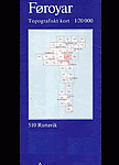 Faroe Islands: 20K Topographic Survey Maps
 Germany: BKG 200K Topographic Maps
 Andalucรญa West: Cรณrdoba – Seville – Mรกlaga 500K CNIG Regional Map No. 11
 Salamanca – Sierra de Gredos – Madrid 500K CNIG Regional Map No. 5
 Pyrenees West – Zaragoza – Santander – Burgos 500K CNIG Regional Map No. 3
 Straits of Gibraltar – Costa del Sol – Almerรญa 500K CNIG Regional Map No. 13
 Andalucรญa East: Granada – Almerรญa – Murcia 500K CNIG Regional Map No. 12
 Russia: Topographic Maps of Elbrus and Western Caucasus
 USA: Reise Know-How Regional Touring Maps
 Austria: 200K Topographic Survey Province Maps
 Asia: Maps International Political Wall Maps
 Ukraine: Kartografija 500K Road Maps
 France: Michelin 500K Road Maps