Disclosure : This site contains affiliate links to products. We may receive a commission for purchases made through these links.
Central and North Norway: Bodรธ – Lofoten
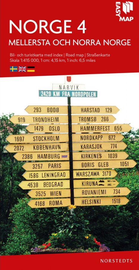
Northern Norway from Bodรธ to the Lofoten Islands at 1:415,000 in a series indexed, double-sided regional road maps from the Norstedts Kartforlaget presenting the country on five maps at scales varying from 1:275,000 to 1:440,000. Topography is indicated by relief shading, with colouring for forested areas and boundaries of Norway’s numerous national parks.Road network highlights National Tourist Routes and indicates roads not suitable for caravans. Driving distances are marked on main routes. Railway lines are shown with stations and local airports are marked. The maps also show main shipping routes along the country’s coastline. Symbols show locations of tourist cabins, campsites, tourist information offices, etc. The maps have no geographical coordinates. The index is in a separate booklet attached to the map cover. Map legend includes English.To see the other titles in this series please click on the series link.

Related Products:
 Central Norway: Trondheim – Mo i Rana
 North Norway: Narvik – Tromsรธ ‘“ Hammerfest – Vadsรธ
 Southern Norway North: Sognefjorden – Jotunheimen NP – Rondane NP – Trondheim
 Norway: Norstedts Regional Road Maps
 North Norway South: Mo i Rana ‘“ Bodรธ ‘“ Narvik – Tromsรธ
 Southern Norway South: Oslo – Stavanger – Bergen – Hardangervidda NP
 North Norway North: Tromsรธ ‘“ Hammerfest – Kirkenes
 Central Norway: Dombas – Trondheim – Namsos – Mo i Rana
 South Norway North: Hamar – Jotunheimen NP – Rondane NP – Trondheim
 Norway Central – Trondheim ‘“ Lillehammer – Alesund F&B
 South Norway South: Oslo – Stavanger – Bergen – Hardangervidda
 Norway North – Narvik F&B
 Norway North Cape – Hammerfest F&B
 Norway: Nordeca 500K Regional Road Maps
 Southern Norway North – Oslo – Bergen – Rondvassbu – Galdhopiggen Cappelen Sectional Road Map
 Central Norway – Lofoten – Narvik – Bronnoysund K+F Regional Road Map
 Norway F&B Supertouring Road Atlas SPIRAL-BOUND
 Norway: Cappelen Regional Road Maps
 Norway South Reise Know-How
 Norway: 500K Topographic Survey of Svalbard/Spitsbergen
 Norway Hallwag Road Map
 Southern Sweden and Norway Adventure Map
 Norway Cappelens Road Atlas A4 SPIRAL-BOUND
 Central Norrland Norstedts Regional Map 5
 Norway: Freytag & Berndt Regional Road Maps
 Norway South – Oslo – Bergen – Stavanger F&B
Norway Cappelen Motorcycle Map-Set
Norway South – Oslo – Bergen – Stavanger F&B
Norway Cappelen Motorcycle Map-Set
 Lofoten – Vesteralen Islands – Senja Cappelen Sectional Road Map
 Southern Norway South – Oslo – Stavanger – Bergen – Hardangervidda Cappelen Sectional Road Map
 North Central – Great Plains USA 02 Hallwag Road Map
 Norway Nordeca Road Map
 Norway F&B
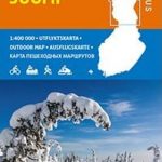 Finland North Karttakeskus Outdoor Road Map
 Bavaria North – Saxony – Thuringia K+F Regional Road Map
 Spain North 500K CNIG 2
 Finland North Karttakeskus Road Map
 North Sea Coast – Bremen – Hamburg K+F Regional Road Map
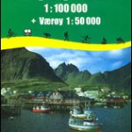 Lofoten – Vaeroy
 Oslo / Bergen & South of Norway ITMB
 Lofoten Climbs Rockfax: Rock Climbing on Lofoten and Stetind in Arctic Norway