Disclosure : This site contains affiliate links to products. We may receive a commission for purchases made through these links.
Central Africa & Zanzibar c.1900

Related Products:
 Rhodesia & Central Africa Showing Gold Fields c.1900
Africa: Industries & Communications c.1900
French North Africa: Morocco & Algeria c.1900
Rhodesia & Central Africa Showing Gold Fields c.1900
Africa: Industries & Communications c.1900
French North Africa: Morocco & Algeria c.1900
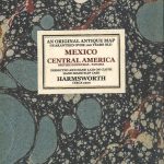 Mexico & Central America c.1900
 Central United States c.1900
 South Africa: Industries & Communications c.1900
Central Asia & the Indian Frontier c.1900
South Africa: Industries & Communications c.1900
Central Asia & the Indian Frontier c.1900
 North-Central United States & Chicago c.1900
Northern England and North & Central Scotland c.1900
North-Central United States & Chicago c.1900
Northern England and North & Central Scotland c.1900
 Central Canada: Manitoba, Saskatchewan & Eastern Ontario c.1900
West Indies & Central America: Industries & Communications c.1900
Central Canada: Manitoba, Saskatchewan & Eastern Ontario c.1900
West Indies & Central America: Industries & Communications c.1900
 Africa East & Central ITMB
 Africa South & Central ITMB
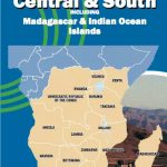 Africa Central & South Map Studio
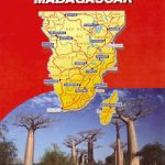
 Africa Central & South – Madagascar Michelin
 Africa Central & South – Madagascar WATERPROOF
 Admiralty Chart 1322 – Ports and Anchorages in Central West Africa
 World Rail Atlas and Historical Summary: Vol. 7 North, East and Central Africa
 Lingala-English/English-Lingala Dictionary & Phrasebook: A Language of Central Africa
 Berlitz Phrase Book & Dictionary Central & South Africa (Bilingual dictionary)
 Africa: Eye on Africa – Thirty Years of Africa Images, Selected by Salgado Himself
 The Zanzibar Wife
 The Wreck of the Zanzibar
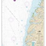
 NGA Chart 61015 – Webi Jubba to Zanzibar
 Zanzibar Island
The Beauty of Zanzibar
Zanzibar Island
The Beauty of Zanzibar
 Zanzibar – the Spice Island
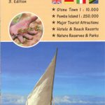
 Zanzibar Stone Town
 Tanzania – Zanzibar Michelin
 Zanzibar Bradt Guide
 Southern Africa: South Africa – Swaziland – Nambia – Botswana – Zambia
 Kilimanjaro – Tanzania – Safari – Zanzibar
 The Zanzibar Chest – A Memoir of Love and War
 Zanzibar Globetrotter Travel Guide
 Insight Guides Tanzania & Zanzibar
 Zanzibar & Pemba Footprint Handbook
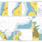
 Admiralty Chart 665 – Approaches to Zanzibar
 Landfalls – On the Edge of Islam from Zanzibar to the Alhambra
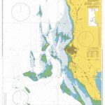
 Admiralty Chart 3211 – Zanzibar Harbour
 Camino Portugues Central: Porto to Santiago de Compostela via Central Route