Disclosure : This site contains affiliate links to products. We may receive a commission for purchases made through these links.
Categories
-
Best Sellers
-

Rรผgen – Hiddensee – Stralsund K+F Outdoor 14
Rรผgen Island on the Baltic coast of Germany at 1:50,000 from Kรผmmerly+Frey in a series GPS compatible, double-sided maps printed on durable, waterproof and tear-resistant plastic Read More » -
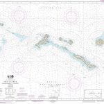
NOAA Chart 16440 – Rat Islands’”Semisopochnoi Island to Buldir lsland
NOAA maintains the nautical charts and publications for U.S. coasts and the Great Lakes. Over a thousand charts cover 95,000 miles of shoreline and 3.4 million Read More » -

Crawley & Horsham – Cranleigh & Billingshurst OS Explorer Active Map OL34 (waterproof)
Crawley and Horsham area of Sussex and Surrey on a detailed topographic and GPS compatible map OL34, waterproof version, from the Ordnance Survey’s 1:25,000 Explorer series. Read More » -
La Robla CNIG Topo 129
Topographic coverage of mainland Spain at 1:50,000 in the MTN50 (Mapa Topogrรกfico Nacional) series from the Centro Nacional de Informaciรณn Geografica, the country’s civilian survey organization. Read More » -

R.A. Motor Drive for EQ1 (with Multi-Speed Handset)
We keep this item in our warehouse and it may take a month to reach you.Can be fitted to any of our telescopes supplied with the Read More » -

Bengali Cooking: Seasons and Festivals
Bengal is home to both Hindus and Muslims who farm the fertile Ganges delta for rice and vegetables as well as fishing the region`s myriad rivers. Read More » -
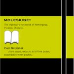
Moleskine Black Pocket Plain Notebook Softcover
The Moleskine Plain Soft Cover Notebook has 192 plain pages of acid-free paper, thread bound into the hardwearing, black synthetic `Moleskine` cover. There is an elastic Read More » -

The Detective Dog
There once was a dog with a keen sense of smell. She was known far and wide as Detective Dog Nell.Peter`s dog Nell has an amazing Read More » -
Sahagun CNIG Topo 196
-

รnge
Topographic survey of Sweden at 1:50,000, the Terrรคngkartan, from the Lantmรคteriet, covering most of the country in 244 double-sided maps. Please note: the mountainous regions of Read More »
-


