Category Archives: Travel Guides
NGA Chart 57082 – Port of Tema
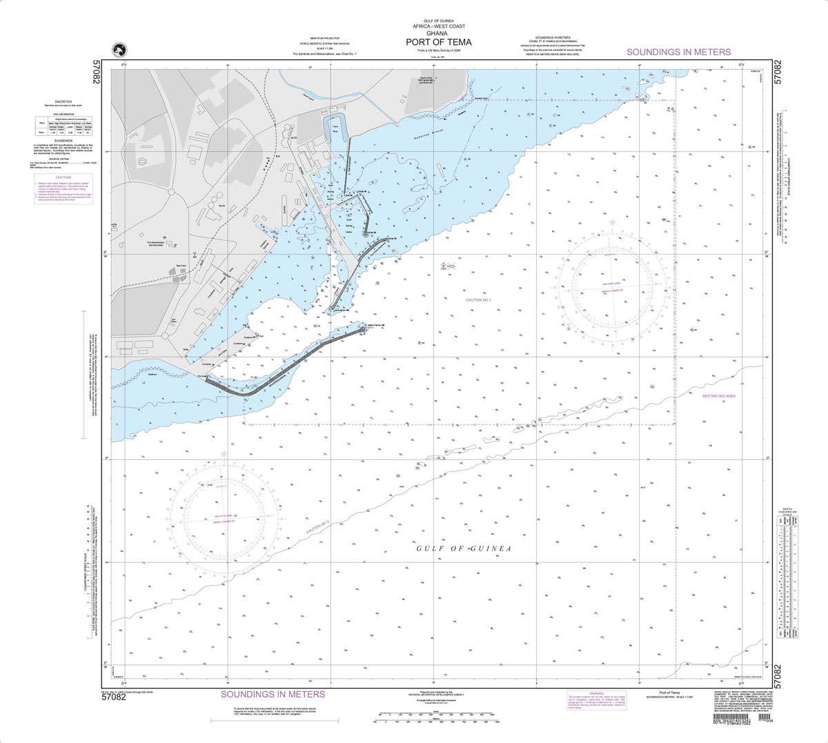
Produced by the US Government, National Geospatial-Intelligence Agency (NGA) charts provide information for the International Waters. They are printed on demand at our London shop and are supplied as flat charts.PLEASE NOTE: NGA charts are not updated often, therefore some may no longer be suitable for safe navigation and should be used for reference only.
NGA Chart 71006 – Tanjung Jamboaye to Singkil
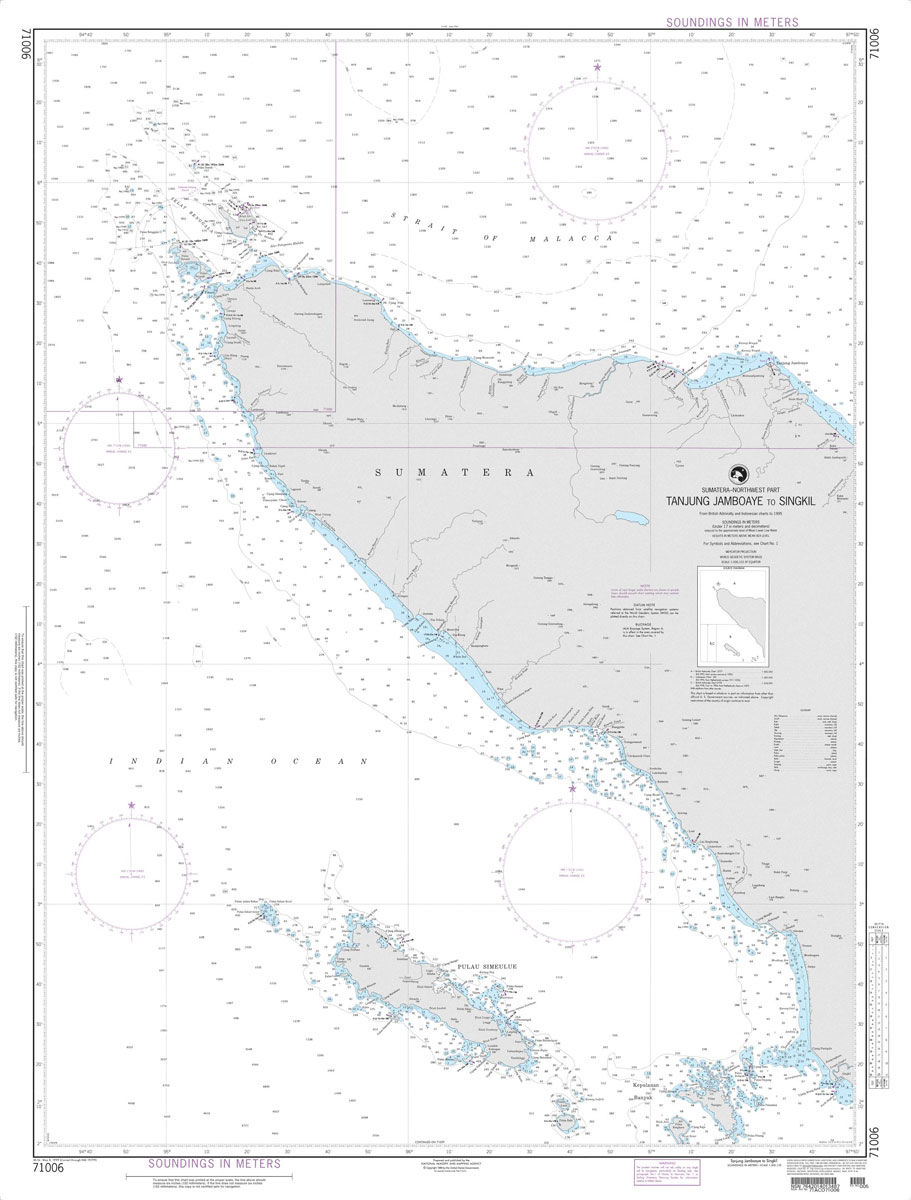
Produced by the US Government, National Geospatial-Intelligence Agency (NGA) charts provide information for the International Waters. They are printed on demand at our London shop and are supplied as flat charts.PLEASE NOTE: NGA charts are not updated often, therefore some may no longer be suitable for safe navigation and should be used for reference only.
NGA Chart 57169 – Limbe Shipyard
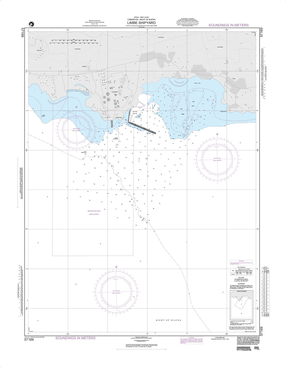
Produced by the US Government, National Geospatial-Intelligence Agency (NGA) charts provide information for the International Waters. They are printed on demand at our London shop and are supplied as flat charts.PLEASE NOTE: NGA charts are not updated often, therefore some may no longer be suitable for safe navigation and should be used for reference only.
NGA Chart 71009 – Singkil to Padang Incl Adj Islands
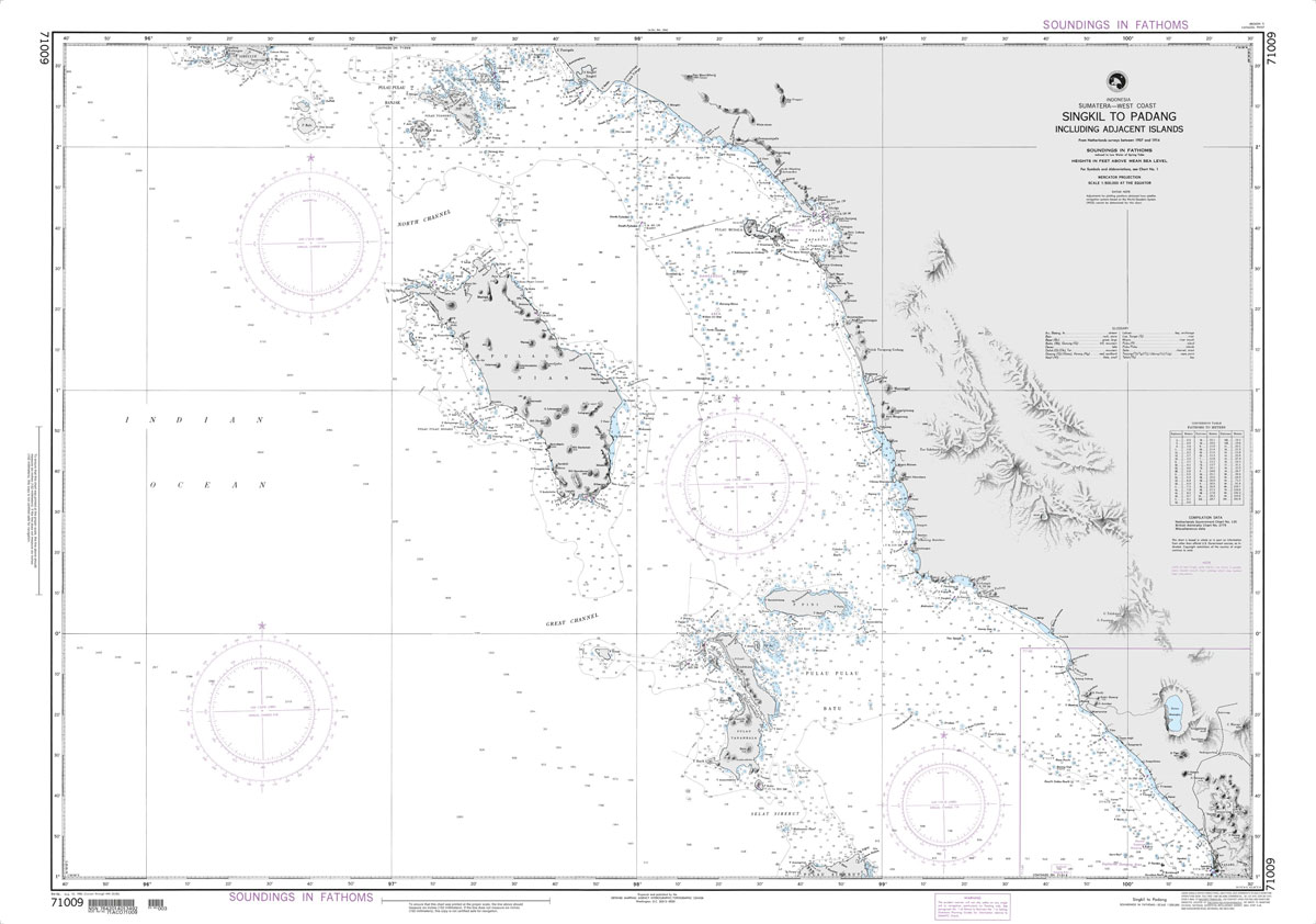
Produced by the US Government, National Geospatial-Intelligence Agency (NGA) charts provide information for the International Waters. They are printed on demand at our London shop and are supplied as flat charts.PLEASE NOTE: NGA charts are not updated often, therefore some may no longer be suitable for safe navigation and should be used for reference only.
NGA Chart 57182 – Approaches to Libreville and Owenda
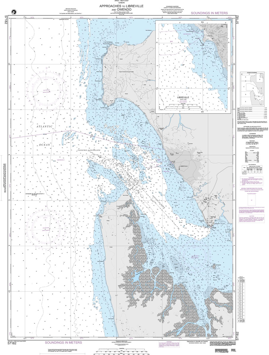
Produced by the US Government, National Geospatial-Intelligence Agency (NGA) charts provide information for the International Waters. They are printed on demand at our London shop and are supplied as flat charts.PLEASE NOTE: NGA charts are not updated often, therefore some may no longer be suitable for safe navigation and should be used for reference only.
NGA Chart 71015 – Bengkulu to Selat Sunda including Pulau Mega and Pulau Enggano
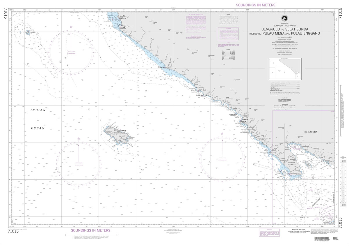
Produced by the US Government, National Geospatial-Intelligence Agency (NGA) charts provide information for the International Waters. They are printed on demand at our London shop and are supplied as flat charts.PLEASE NOTE: NGA charts are not updated often, therefore some may no longer be suitable for safe navigation and should be used for reference only.
NGA Chart 57183 – Port of Owendo

Produced by the US Government, National Geospatial-Intelligence Agency (NGA) charts provide information for the International Waters. They are printed on demand at our London shop and are supplied as flat charts.PLEASE NOTE: NGA charts are not updated often, therefore some may no longer be suitable for safe navigation and should be used for reference only.
NGA Chart 54089 – Tivat
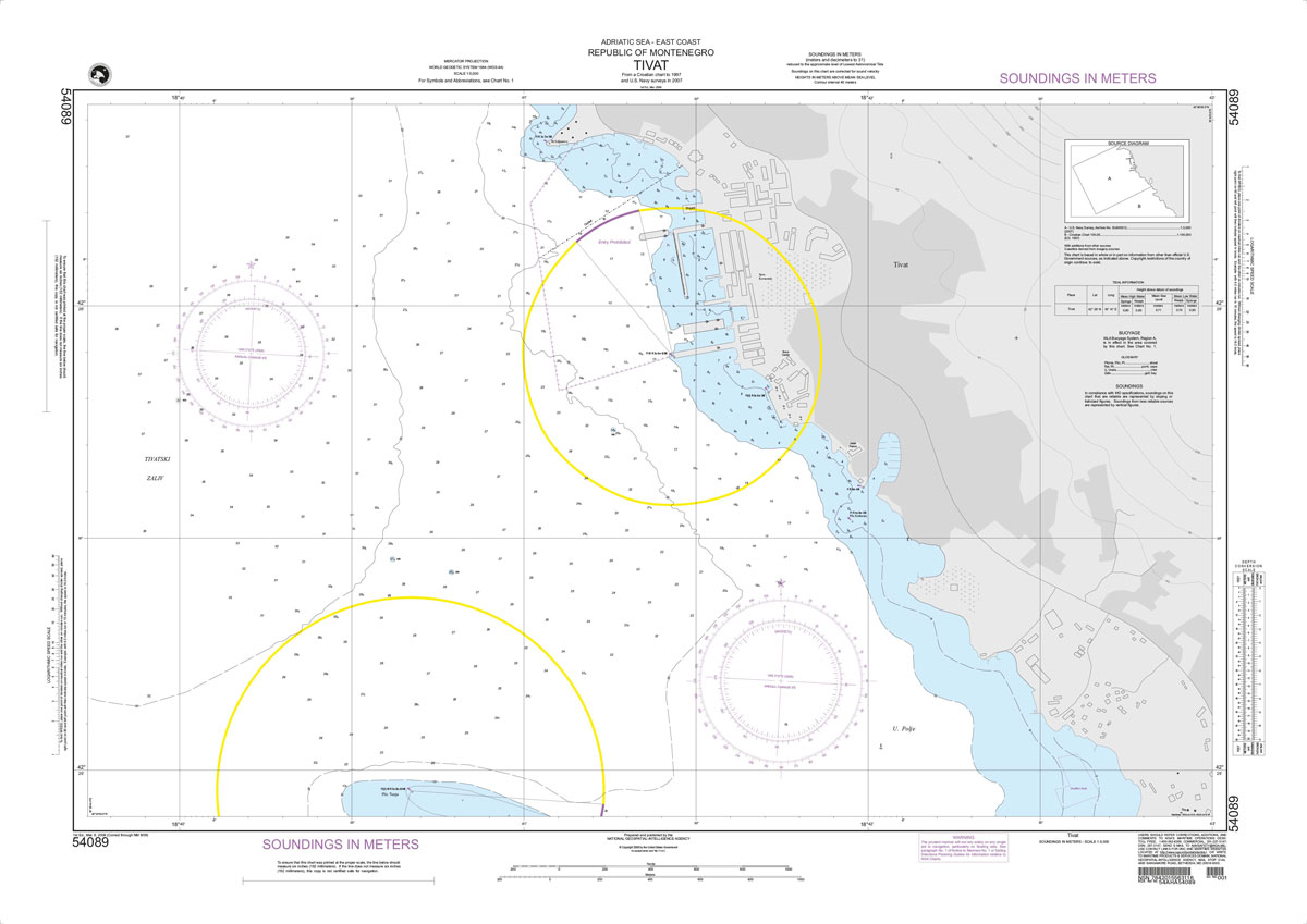
Produced by the US Government, National Geospatial-Intelligence Agency (NGA) charts provide information for the International Waters. They are printed on demand at our London shop and are supplied as flat charts.PLEASE NOTE: NGA charts are not updated often, therefore some may no longer be suitable for safe navigation and should be used for reference only.
NGA Chart 54090 – Entrance to the Adriatic Sea
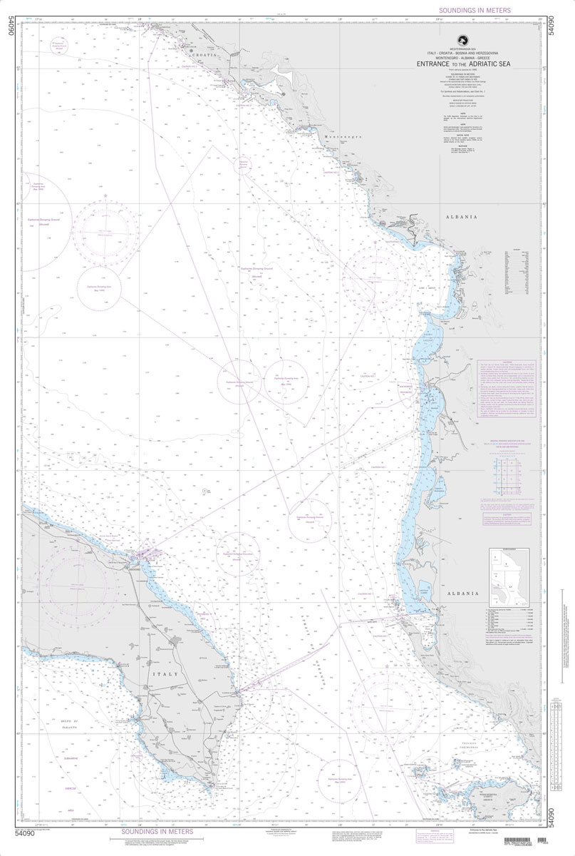
Produced by the US Government, National Geospatial-Intelligence Agency (NGA) charts provide information for the International Waters. They are printed on demand at our London shop and are supplied as flat charts.PLEASE NOTE: NGA charts are not updated often, therefore some may no longer be suitable for safe navigation and should be used for reference only.
NGA Chart 54091 – Bar Harbor and Approaches
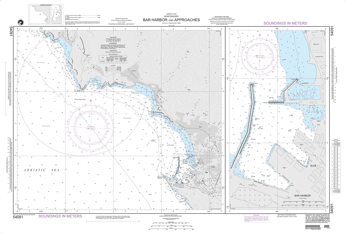
Produced by the US Government, National Geospatial-Intelligence Agency (NGA) charts provide information for the International Waters. They are printed on demand at our London shop and are supplied as flat charts.PLEASE NOTE: NGA charts are not updated often, therefore some may no longer be suitable for safe navigation and should be used for reference only.
NGA Chart 54230 – Port of Neum
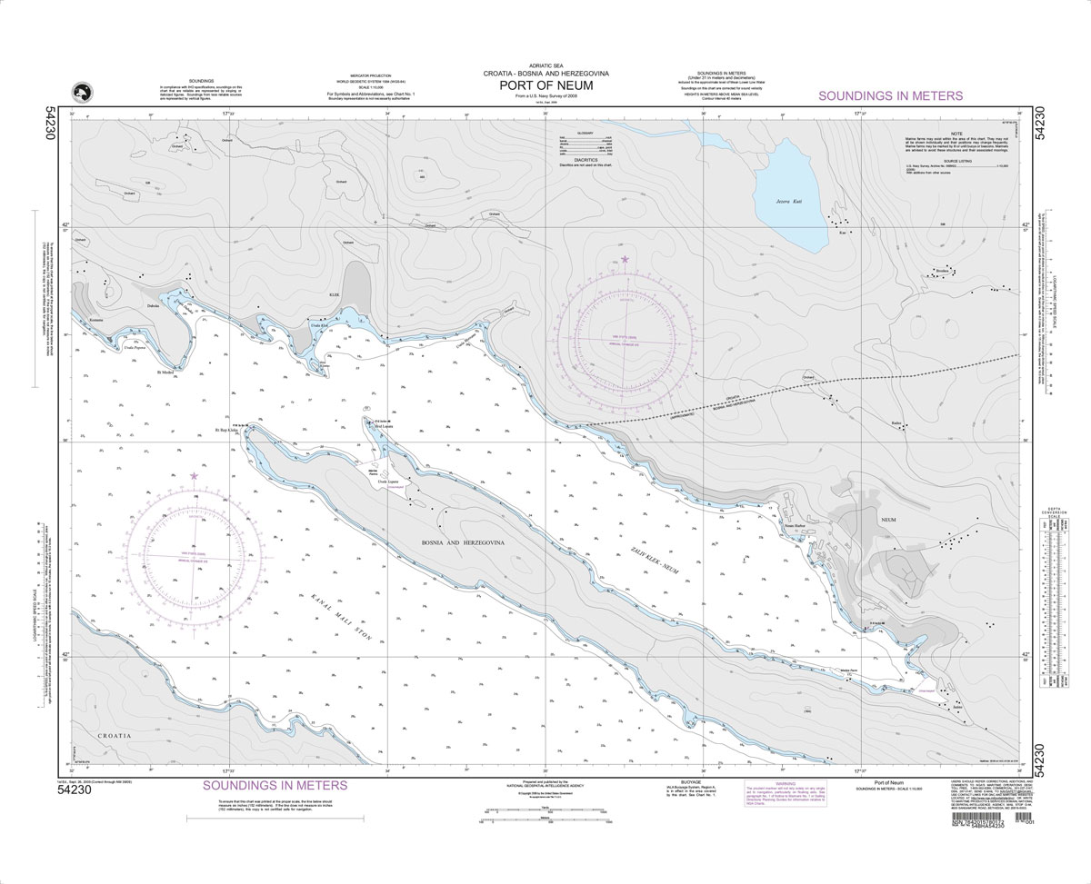
Produced by the US Government, National Geospatial-Intelligence Agency (NGA) charts provide information for the International Waters. They are printed on demand at our London shop and are supplied as flat charts.PLEASE NOTE: NGA charts are not updated often, therefore some may no longer be suitable for safe navigation and should be used for reference only.
NGA Chart 54265 – Port of Vlore
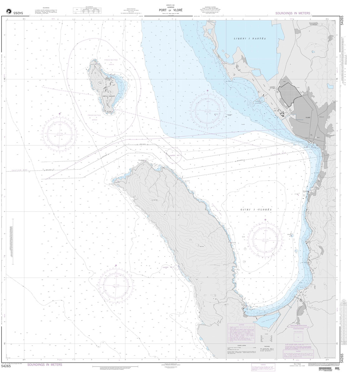
Produced by the US Government, National Geospatial-Intelligence Agency (NGA) charts provide information for the International Waters. They are printed on demand at our London shop and are supplied as flat charts.PLEASE NOTE: NGA charts are not updated often, therefore some may no longer be suitable for safe navigation and should be used for reference only.
NGA Chart 54266 – Ports of Durres and Vlore
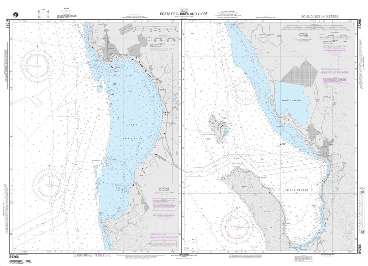
Produced by the US Government, National Geospatial-Intelligence Agency (NGA) charts provide information for the International Waters. They are printed on demand at our London shop and are supplied as flat charts.PLEASE NOTE: NGA charts are not updated often, therefore some may no longer be suitable for safe navigation and should be used for reference only.
NGA Chart 54267 – Durres and Approaches
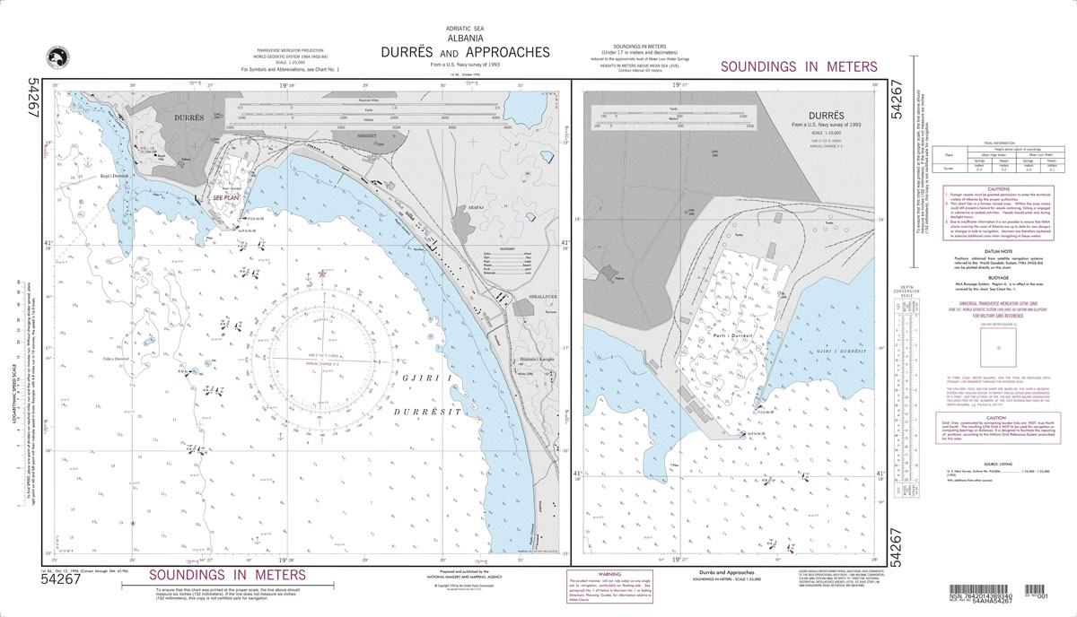
Produced by the US Government, National Geospatial-Intelligence Agency (NGA) charts provide information for the International Waters. They are printed on demand at our London shop and are supplied as flat charts.PLEASE NOTE: NGA charts are not updated often, therefore some may no longer be suitable for safe navigation and should be used for reference only.
NGA Chart 51225 – Agadir and Approaches

Produced by the US Government, National Geospatial-Intelligence Agency (NGA) charts provide information for the International Waters. They are printed on demand at our London shop and are supplied as flat charts.PLEASE NOTE: NGA charts are not updated often, therefore some may no longer be suitable for safe navigation and should be used for reference only.
NGA Chart 55001 – Black Sea

Produced by the US Government, National Geospatial-Intelligence Agency (NGA) charts provide information for the International Waters. They are printed on demand at our London shop and are supplied as flat charts.PLEASE NOTE: NGA charts are not updated often, therefore some may no longer be suitable for safe navigation and should be used for reference only.
NGA Chart 51240 – El Jorf Lasfar
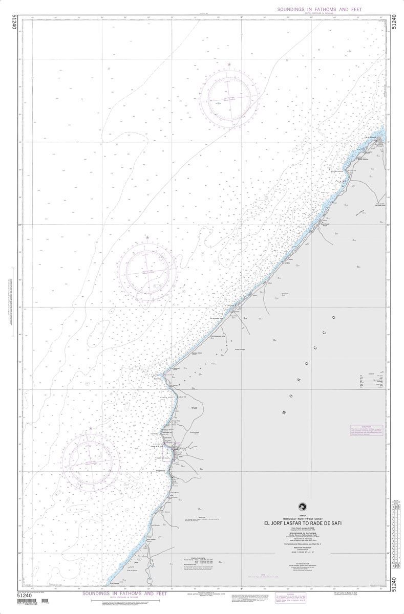
Produced by the US Government, National Geospatial-Intelligence Agency (NGA) charts provide information for the International Waters. They are printed on demand at our London shop and are supplied as flat charts.PLEASE NOTE: NGA charts are not updated often, therefore some may no longer be suitable for safe navigation and should be used for reference only.
NGA Chart 55141 – Port of Bat`umi
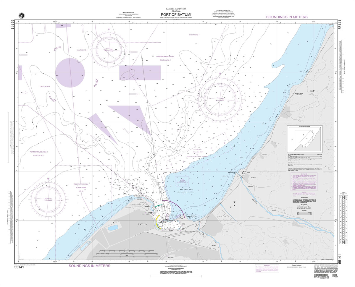
Produced by the US Government, National Geospatial-Intelligence Agency (NGA) charts provide information for the International Waters. They are printed on demand at our London shop and are supplied as flat charts.PLEASE NOTE: NGA charts are not updated often, therefore some may no longer be suitable for safe navigation and should be used for reference only.
NGA Chart 51261 – Arquipelago da Madeira
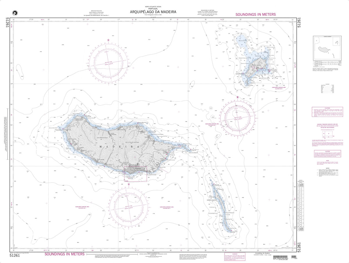
Produced by the US Government, National Geospatial-Intelligence Agency (NGA) charts provide information for the International Waters. They are printed on demand at our London shop and are supplied as flat charts.PLEASE NOTE: NGA charts are not updated often, therefore some may no longer be suitable for safe navigation and should be used for reference only.
NGA Chart 57061 – Outer Approaches to Takoradi and Sekondi
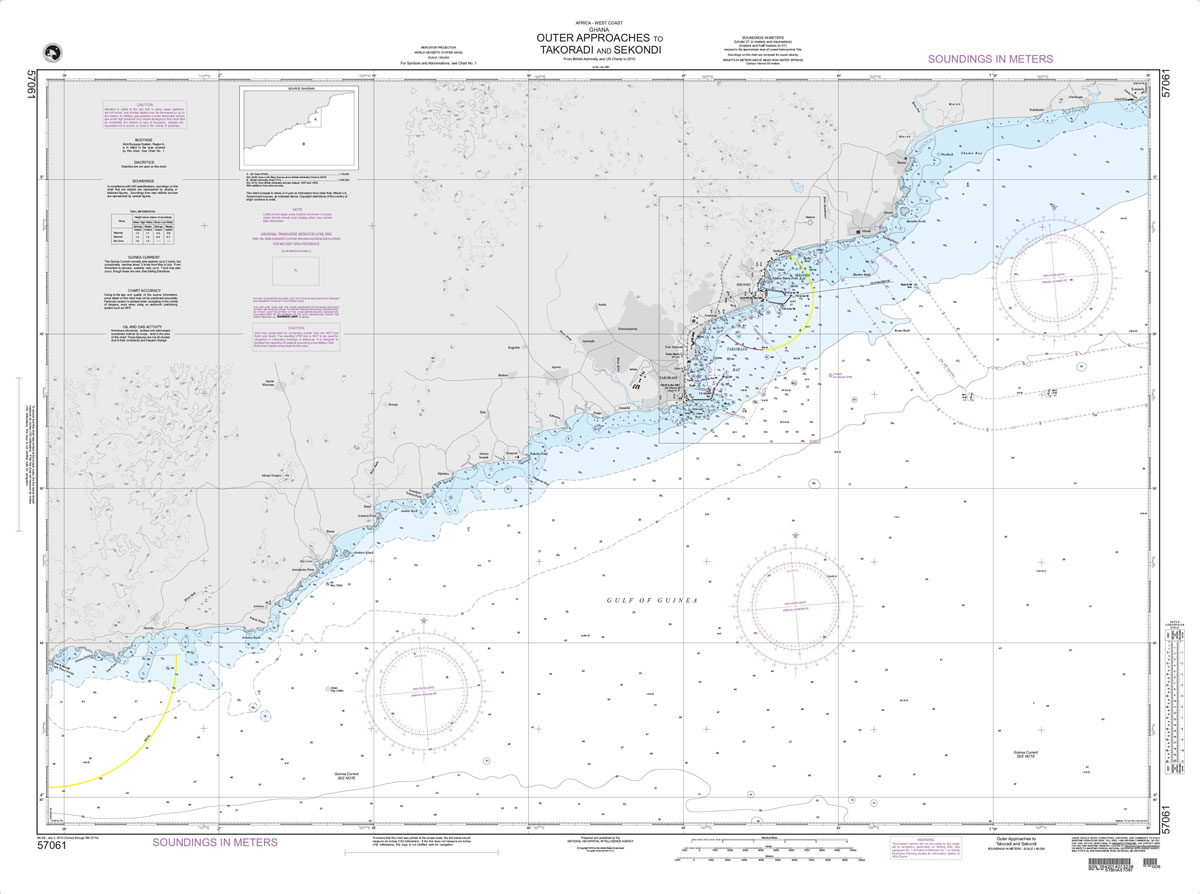
Produced by the US Government, National Geospatial-Intelligence Agency (NGA) charts provide information for the International Waters. They are printed on demand at our London shop and are supplied as flat charts.PLEASE NOTE: NGA charts are not updated often, therefore some may no longer be suitable for safe navigation and should be used for reference only.