Category Archives: Travel Guides
Wales A-Z Wall Map PAPER
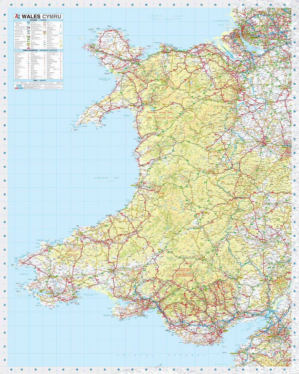
This A-Z map of Wales is a full colour road map showing the whole of Wales on one side. This map extends to also cover Liverpool to the north, Shrewsbury to the east and Weston-Super-Mare to the south.Map detail is shown at a clear 2.2 kms to 1 cm (3.5 miles to 1 inch) and
Newcastle upon Tyne Premier A-Z Wall Map
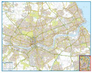
This A-Z Premier Map of Newcastle Upon Tyne is a full colour street map which includes a large scale city centre map.Covering an area extending to:DinningtonSeaton BurnDudley (part)Whitley BayTynemouthSouth ShieldsCastletown (part)Washington (part)SunnisideBlaydonWest DentonNewcastle International AirportAlso included:inset map of Throckley and NewburnLarge scale city centre map of Newcastle Upon TynePostcode districts, one-way streets and safety camera
Devon A-Z Visitors` Wall Map PAPER
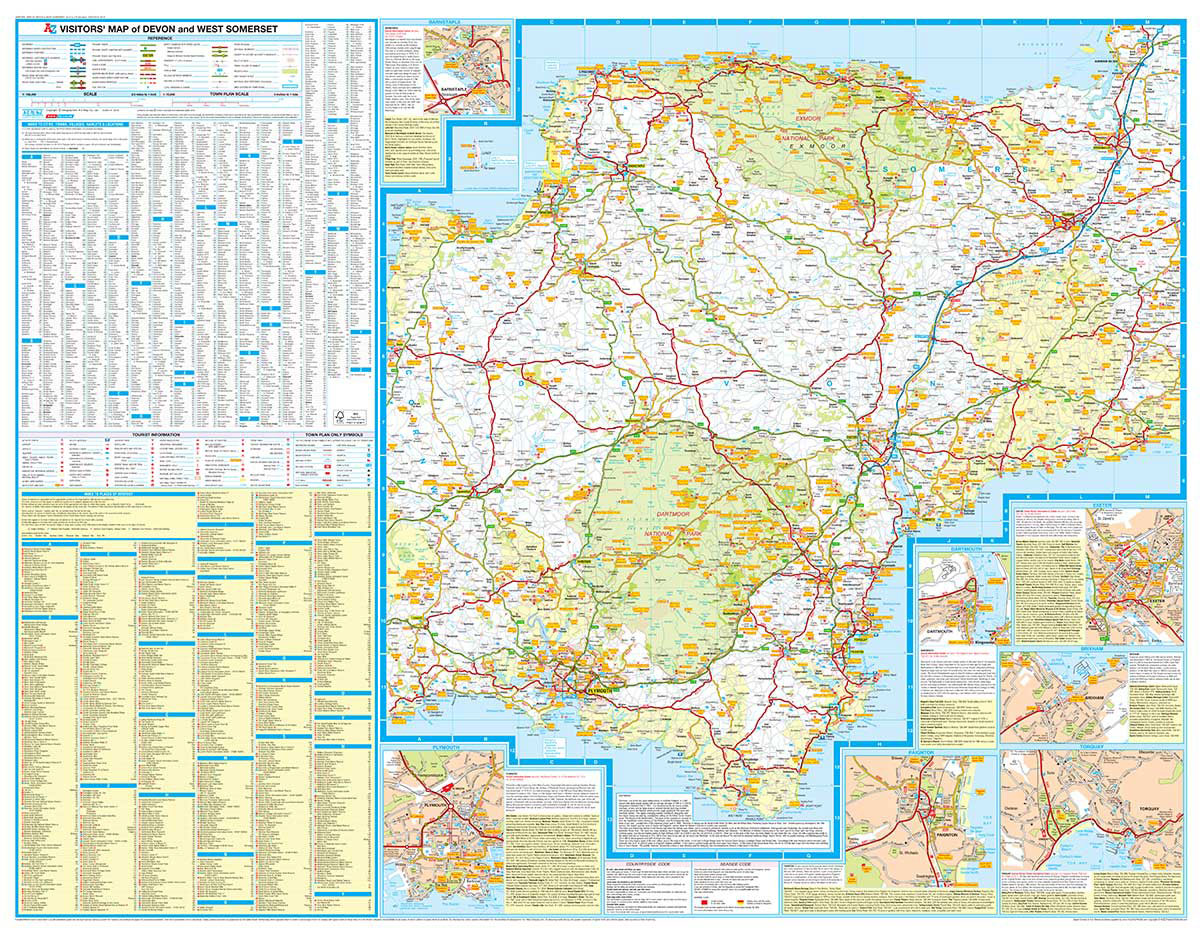
This full colour Visitors` Map of Devon covers the whole county, extending into Somerset as far as Ilminster.Published at a clear 2.5 miles to 1 inch scale (1.6 kms to 1 cm), the detailed road map includes primary route destinations, selected safety camera locations, selected caravan and camping sites, visitor attractions and places of interest.There
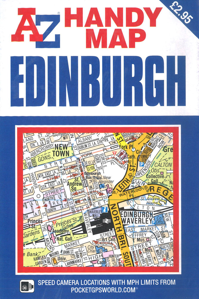
Edinburgh Premier A-Z Wall Map PAPER
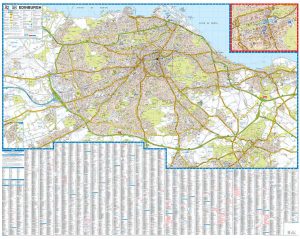
This A-Z Premier Map of Edinburgh is a full colour, single sided street map which includes a large scale city centre inset map.Covering an area extending to:CramondGrantonLeithPortobelloMusselburghWhitecraigDalkeithLoanheadFairmileheadJuniper GreenCurrieBalerno (inset)Edinburgh AirportPostcode districts, one-way streets, the tram network and safety camera locations with speed limits are featured on the mapping.
Lake District A-Z Visitors` Wall Map PAPER
This full colour Visitors` Map of the Lake District includes a detailed road map at a clear 1 mile to 1 inch (1:63,360) scale, town centre street maps, place of interest details and much more.Coverage extends from Cockermouth and Penrith in the north to Ulverston and Grange-over-Sands in the south and from the M6 in
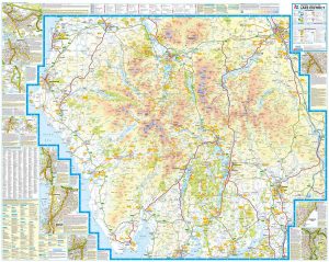
Peak District A-Z Visitors` Wall Map PAPER

This full colour visitors` map of the Peak District covers the whole of the Peak District National Park extending to:HuddersfieldWakefieldRotherhamChesterfieldIlkestonStoke-on-TrentMacclesfieldManchesterThe detailed road mapping, which includes contour colouring, highlights the locations of a wide range of visitor attractions and places of interest – the ideal choice for those planning outdoor pursuits and general touring within this
Isle of Wight A-Z Visitors` Wall Map
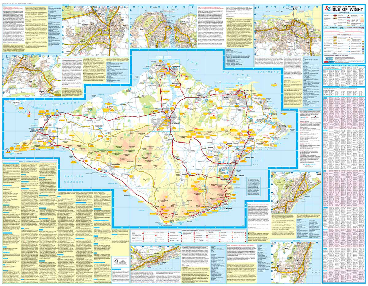
This full colour Visitors` Map of the Isle of Wight includes a detailed road map at a clear 1.5 miles to 1 inch (1:42,240) scale, town centre street maps, place of interest details, ferry information and much more.The road map features safety camera locations with speed limits; selected fuel stations, caravan and camping sites; visitor
Southampton – Eastleigh – Fawley – Hythe – Romsey A-Z Street Atlas
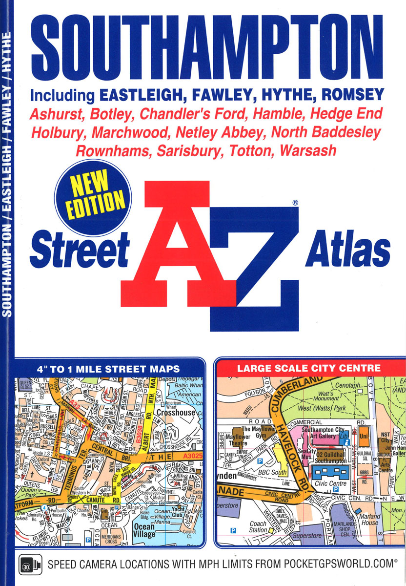
This A-Z map of Southampton features 50 pages of street mapping extending to include:Eastleigh, Fawley, Hythe, Romsey, Southampton Airport, Totton, Chandler`s Ford, Hamble-le-Rice, Hedge End, North Baddesley, Swaythling, West EndA large scale city centre map of Southampton is also included.Postcode districts, one-way streets, safety cameras with speed limits and National Park boundaries are featured on
John Muir Way A-Z Adventure Atlas
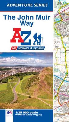
The John Muir Way Adventure Atlas features 54 pages of continuous Ordnance Survey 1:25000 mapping providing complete coverage of both the walking and cycling routes. The book includes a route planner showing distances between places and the amenities available, featuring: Information Centres, Hotels/B&Bs, Youth Hostels, Campsites (seasonal opening), Public Houses, Shops, Restaurants, Cafes (seasonal opening)
London A-Z Map
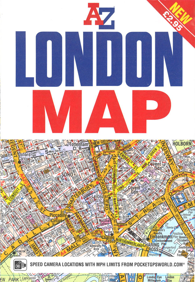
The A-Z London Map is a self-covered, fold-out sheet map which combines our instantly recognizable A-Z street mapping with a street index on the reverse. Published at a scale of 3.5 inches to 1 mile, the map extends out from central London to:* Highbury and Hackney in the north*Clapham Common and Lewisham in the south*Notting
Northern England A-Z Wall Map PAPER
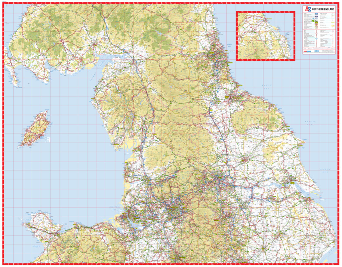
Northern England at 1:316,800 (5 miles to 1 inch) from A-Z on an indexed road map providing map coverage Staffordshire, Lincolnshire and northern Wales to the south-western Scotland. The index is on the reverse. Current edition of this title was published in 2015.Maps in this ‘Five miles to 1 inch” series from A-Z show areas
Edinburgh A-Z Handy Map
This A-Z map of Edinburgh is a self-covered, double-sided street map covering an area that extends to include:- Craigmillar- Dalry- Holyrood Park- Iverleith- Leith- Murrayfield- Pilton- Prestonfield- Ravelston- RestalrigAlso included on the reverse side of the sheet is a large scale (9 inches to 1 mile) city centre map of Edinburgh which identifies the many
East Midlands A-Z Wall Map PAPER
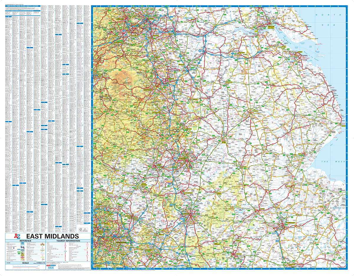
This A-Z map of the East Midlands is a full colour, single sided road map which, in addition to covering the region, extends to:BradfordLeedsKingston upon HullSkegnessBostonElyHuntingdonCoventryBirminghamBuxtonHalifaxMap detail is shown at a clear 2 kms to 1 cm (3.156 miles to 1 inch) and includes the following features:Motorways open with full junction detail, motorways under construction
Cambridge A-Z Handy Map
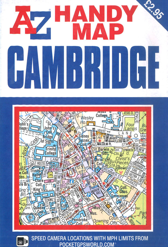
This A-Z map of Cambridge is a self-covered, double-sided street map covering an area that extends to include:- Barnwell- Chesterton- Eddington- Girton (part)- Grantchester- Newnham- Romsey Town- Trumpington (part)Also included on the reverse side of the sheet is a large scale (9 inches to 1 mile) city centre map of Cambridge covering all of the
Hampshire, Dorset & Wiltshire Visitors` A-Z Wall Map PAPER
This A-Z Visitors` Map of Hampshire, Dorset and Wiltshire is a full colour, single sided sheet map. Featuring continuous road mapping from Oxford and Stroud to the south coast (including the Isle of Wight), and from Newport and Lyme Regis to Chichester and Maidenhead in the east.Map detail is shown at a clear 2.75 miles
Plymouth A-Z Handy Map
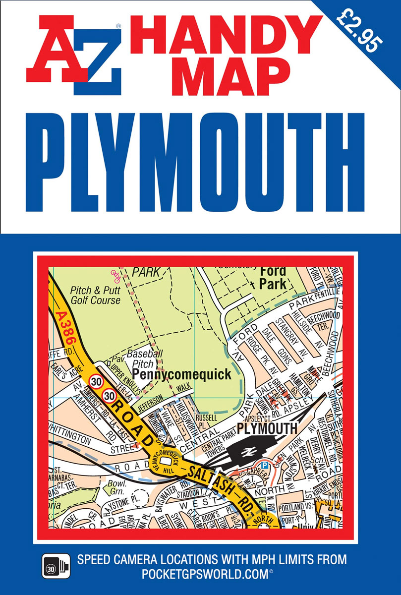
This A-Z map of Plymouth, Britain`s Ocean City, is a self-covered, double-sided street map covering an area that extends to:’: St. Budeaux’: Manadon’: Leigham’: Plymstock’: Cremyll’: TorpointAlso included on the reverse side of the sheet is a large scale (9 inches to 1 mile) city centre map of Plymouth which identifies the many important tourist
Glasgow Premier A-Z Wall Map PAPER
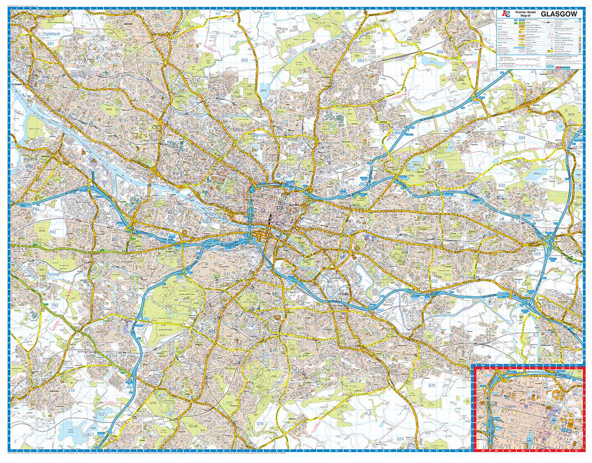
This A-Z Premier Map of Glasgow is a single sided street map covering an area extending to Bearsden, Lenzie, Bargeddie, Carmunnock and Renfrew. A large scale city centre map of Glasgow is also included.This A-Z Premier Map of Glasgow is a full colour, single sided street map covering an area extending to:BearsdenBishopbriggsLenzieMuirheadBargeddieUddingston (part)CarmunnockWhitecraigsBarrheadRenfrewClydebankAlso included is
England Coast Path Adventure Map – Minehead to Brean Down
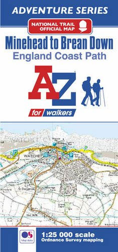
The A-Z Adventure Series of maps combines the best of OS and A-Z, creating the perfect companion for walkers, off-road cyclists, horse riders and anyone wishing to explore the great outdoors.This official Minehead to Brean Down Adventure Map covers a 58 mile (93km) section of the England Coast Path, a new National Trail around England`s
Cardiff A-Z Street Plan Wall Map
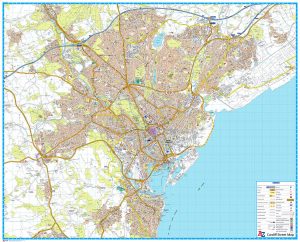
This Street Map of Cardiff is extracted from A-Z digital data to ensure that the latest A-Z revision is available as a printed sheet map.The map area covers:CardiffCardiff Bay & DocksDinas PowysEly (Trelรกi)LLandaffLlanishen (Llanisien)Marshfield (Maerun)Michaelston-super-ElyMorganstown (Treforgan)PenarthPentyrchRadyr (Radur)Rumney (Rhymni)St Fagans (Sain Ffagan)St MellonsThornhillWenvoe (Gwenfรด)Whitchurch (Yr Eglwys Newydd)A-Z Street Mapping includes:Distinctive road classification coloursUnder construction and proposed
South West Coast Path 2 – North Cornwall A-Z Adventure Atlas
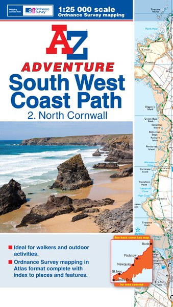
This A-Z Adventure Atlas of the SW Coast Path North Cornwall features 41 pages of continuous OS mapping covering the route from the Devon/Cornwall border to Land`s End. The trail is easy to follow, highlighted in yellow to stand out from other footpaths, with mileage markers to gauge distances when planning your own sections of