Category Archives: Travel Guides
CCC Orkney and Shetland Islands: Including North and Northeast Scotland – Edition 2
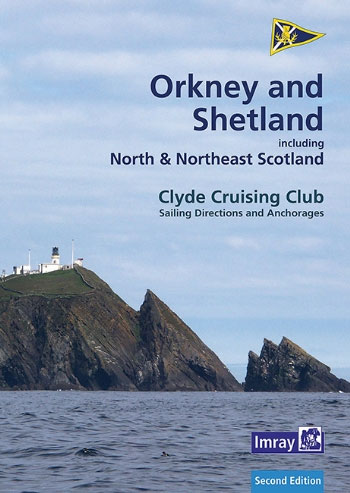
This is a completely new volume for the Orkney and Shetland Islands and includes Fair Isle. It also covers the `jumping off` harbours on south side of the Pentland Firth and the mainland coast of Scotland between Inverness and Cape Wrath. The area has been fully researched by the authors during the last two seasons.
West Aegean: The Attic Coast, Eastern Peloponnese, Western Cyclades and Northern Sporades: 2019
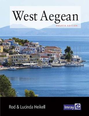
The Imray West Aegean pilot by Rod Heikell is a cruising guide to the coasts and islands around Athens, the adjacent islands in the Cyclades and the Eastern Peloponnisos to Monemvasia, with additional extensions to cover the mainland coast of Greece and the adjacent coast of Evia to Volos, and the Northern Sporades including Skiathos.
Ionian
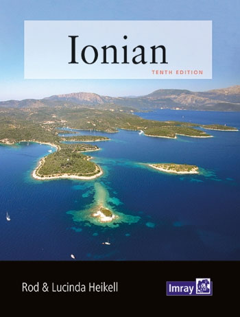
Like its companions West Aegean and East Aegean, Ionian contains detailed information on many of the smaller harbours and anchorages that cannot be adequately covered in Rod Heikell`s major guides Greek Waters Pilot and Turkish Waters and Cyprus Pilot. These handy-sized cruising companions are ideal for charterers and flotilla sailors who are in the area
Italian Waters Pilot 10th Ed
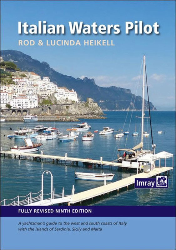
New 10th Edition`Italian Waters Pilot` is the only guide for yachtsmen in English that covers the coasts of the Tyrrhenian Sea, Sardinia, Sicily, the Ionian `heel` and Malta in one volume. This ninth edition contains numerous revisions throughout, but in particular the text, plans and photographs have been completely overhauled. There are a large number
East Aegean 2021
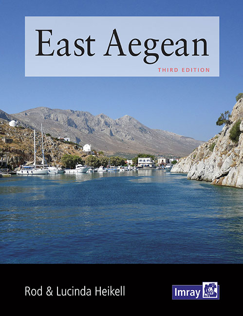
Rod Heikell`s latest guide, `East Aegean`, covers Patmos, Kalimnos, Kos, Rhodes and islands in between on the Greek side. On the Turkish side, the ports of Gumusluk, Bodrum, Marmaris and Fethiye, as well as almost every anchorage on the coast, and islands between as far east as Kas and Kekova are included. In the same
Y40 River Exe – Laminated chart
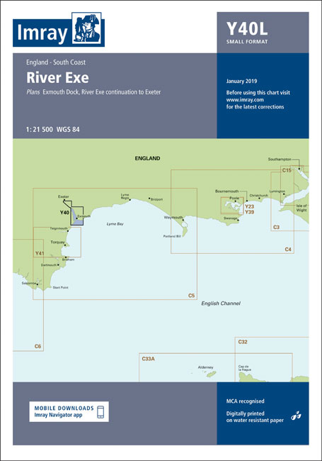
Laminated chart Y40Plans included:Exmouth Dock (1:7500)River Exe continuation to Exeter (1:21 500)
The Cruising Almanac 2021
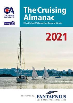
The Cruising Almanac is an annual publication first published over 100 years ago and long regarded as the perfect on board companion for cruising yachts. Compiled by The Cruising Association and Imray, it covers Northwest Europe from the Shetlands and southern Norway to Gibraltar and West Ireland to the Baltic. For 2020 the text is
C31 Dover Strait to Le Havre

Plans included:Sovereign Harbour (1:20 000)Boulogne-sur-Mer (1:25 000)Le Trรฉport (1:17 500)Dieppe (1:17 500)St-Valรฉry-en-Caux (1:12 500)Fรฉcamp (1:15 000)Approaches to Le Havre & River Seine (1:100 000)Le Havre Yacht Harbour (1:10 000)On this edition the chart specification has been improved to show coloured light flashes. Depths have been updated from the latest available surveys. The firing practice areas
2400 West Country Chart Pack – 2019 edition
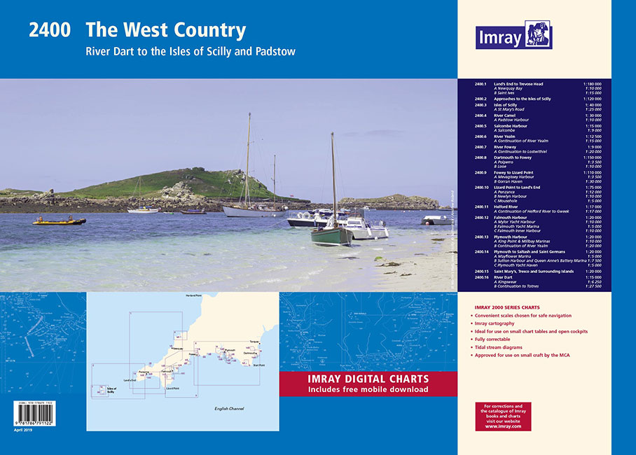
On this edition the latest depth surveys have been applied. The chart of the River Dart has been reschemed to show larger scale coverage of Kingswear and Dartmouth. Harbour plans of Polperro and a larger scale (1:9000) plan of Salcombe are included for the first time. The harbour plan of Padstow has increased coverage to
E3 Arquipelago de Madeira
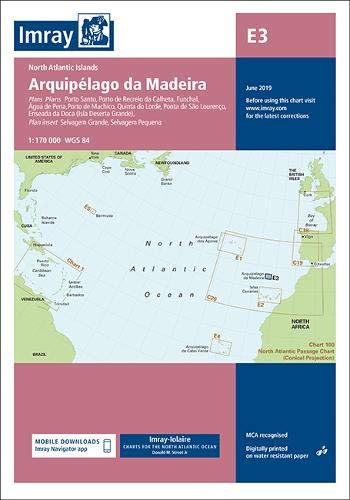
Plans included:Porto Santo (1:25 000)Porto de Recreio da Calheta (1:6250)Funchal (1:10 000)รgua de Pena (1:5000)Porto de Machico (1:7500)Quinta do Lorde (1:5000)Ponta de Sรฃo Lourenรงo (1:30 000)Enseada da Doca (Isla Deserta Grande) (1:25 000)Selvagem Grande (1:30 000)Selvagem Pequena (1:30 000)On this edition the chart specification has been improved to show coloured light flashes. There has been
Imray Chart M24: Golfo di Trieste to Losinj and Rab
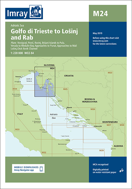
Chart scale 1:220 000Plans included:Novigrad (1:15 000)Porec (1:15 000)Rovinj (1:15 000)Brijuni Otoci to Pula (1:85 000)Veruda to Medulin Bay (1:85 000)Approaches to Punat (1:20 000)Approaches to Mali Losinj (1:40 000)Otok Ilovik Channel (1:20 000)On this edition the chart specification has been improved to show coloured light flashes. The latest depth surveys have been included where
Y43 River Dart
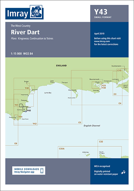
Plans included:Kingswear (1:6250)Continuation to Totnes (1:27 500)First edition. Part of the small format Y series (A2 size), this replicates sheet 2400.16 from the 2400 West Country Chart Pack
Y44 Salcombe

Plans included:Salcombe (1:9000)First edition. Part of the small format Y series (A2 size), this replicates sheet 2400.5 from the 2400 West Country Chart Pack
Y46 River Fowey
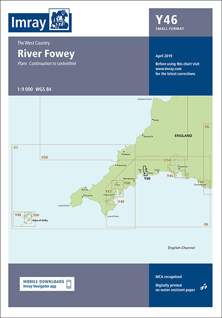
Plans included:Continuation to Lostwithiel (1:20 000)Part of the small format Y series (A2 size), this replicates sheet 2400.7 (no longer available) from the 2400 West Country Chart Pack.
Y47 Falmouth Harbour

Plans included:Mylor Yacht Harbour (1:10 000)Falmouth Marina (1:5000)Falmouth Inner Harbour (1:10 000)First edition. Part of the small format Y series (A2 size), this replicates sheet 2400.12 from the 2400 West Country Chart Pack
Y48 Helford River
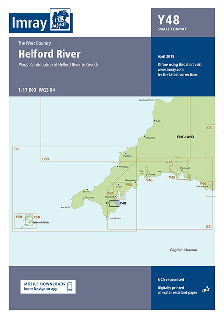
Plans included:Continuation of Helford River to Gweek (1:17 000)First edition. Part of the small format Y series (A2 size), this replicates sheet 2400.11 from the 2400 West Country Chart Pack
Perth Flexi Map
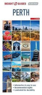
Insight Guides Flexi Map Perth:This easy to use, full-colour, water-proof map is all you need to navigate Perth. It also includes handy destination detail on Perth environs and Fremantle and tips on top attractions and getting around.ยท Combines clear, up-to-date cartography with destination detail, stylish design and stunning photography ยท The main map is at
2300 Dorset and Devon Coasts Chart Pack – 2019 edition
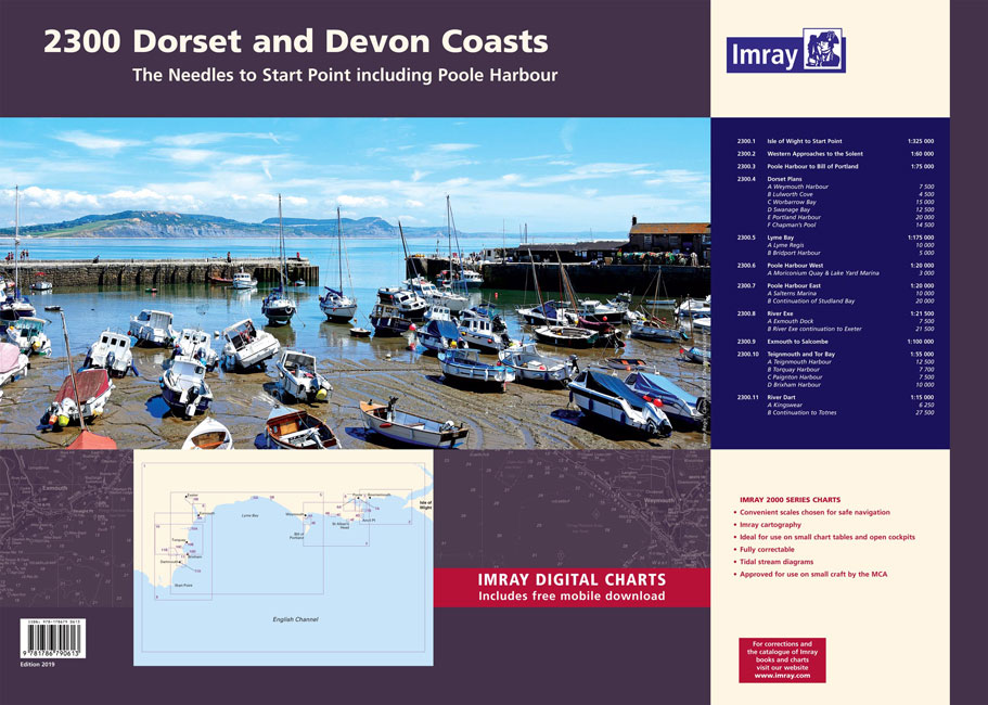
A pack of 9 charts for the Dorset and Devon coasts. The pack includes:2300.1 Isle of Wight to Start Point1: 325 000 WGS 842300.2 Western Approaches to the Solent1: 60 000 WGS 842300.3 Poole Harbour to Bill of Portland1: 75 000 WGS 842300.4 Dorset Plans1: various WGS 84Plans Weymouth Harbour, Lulworth Cove, Worbarrow Bay, Swanage
Spain & Portugal Insight Travel Map

Travel Map Spain & Portugal is an indexed, road map at 1:800 000. It includes city plans of Barcelona, Seville, Valencia and Lisbon. Coverage also includes maps of Balearic Islands, Canary Islands, the Azores and Madeira. Places of interest, including national parks, nature reserves and heritage sites, are listed and accompanied by a wide range
C69 Loch Ryan to Belfast Lough and Strangford Lough
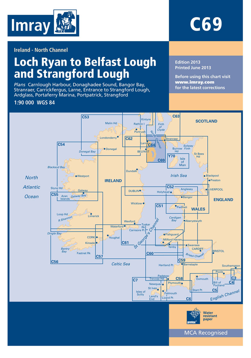
Plans included: Carnlough Harbour (sketch plan) Larne (1:18,500) Carrickfergus (1:15,000) Bangor Bay (1:17,500) Donaghadee Sound (1:25,000) Entrance to Strangford Lough (1:37,500) Portaferry Marina (1:7,500) Strangford (1:5,000) Ardglass (1:15,000) Stranraer (1:12,500) Portpatrick (1:6,000) This 2013 edition has been fully updated throughout using the latest available depth surveys.