Category Archives: Travel Guides
Pays Corbiรจres Minerovois ร pied FFRP Topo-guide No. P116
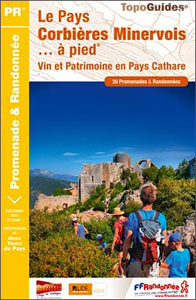
Pays Corbiรจres Minerovois ร pied, FFRP topo-guide Ref. No.P116, with 30 day walks of varying length and difficulty in the Pay Cathare area of the eastern Pyrenees, south-east of Carcassonne. Each walk is presented on a separate colour extract from IGN’s topographic survey of France at 1:25,000, with its description cross-referenced to the map. Current
GR59/GR59A/GR559/GR509: L`Echappรฉe jurassienne FFRP Topo-guide No. 390
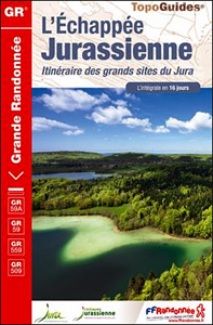
L`Echappรฉe jurassienne, FFRP topo-guide Ref. No. 390, covering 293km-long route which combines several hiking trails across the heart of the French Jura between Dole in the north and Saint-Claude in the south, along the.GR59, 59A, 559 and 509. The route includes many of the Jura’s best natural locations: Grande Saline and Saline Royale classified by
GR654 Chemins de St-Jacques: Vรฉzelay – Pรฉrigueux FFRP Topo-guide No. 6542
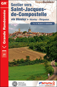
Chemins de St-Jacques: Vรฉzelay – Pรฉrigueux, FFRP topoguide Ref. no. 6542, covering the 744km route along the GR654 the Way of St. Jamezs from Vรฉzelay via Limoges to Pรฉrigueux. Current edition of this title was published in March 2015.ABOUT THE FFRP (Fรฉdรฉration franรงaise de la randonnรฉe pรฉdestre) TOPOGUIDES: published in a handy A5 paperback format,
GRP: Tours et Ronde du Canigรณ FFRP Topo-guide No. 6600
Tours et Ronde du Canigรณ, FFRP topoguide Ref. no. 6600, covering 395kms of routes in the eastern Pyrenees, including a tour of Canigou itself and sections of the GR10. Current edition of this title was published in June 2015.ABOUT THE FFRP (Fรฉdรฉration franรงaise de la randonnรฉe pรฉdestre) TOPOGUIDES: published in a handy A5 paperback format,
Le Haut Pays du Velay ร pied FFRP Topo-guide No. P436
Le Haut Pays du Velay ร pied, FFRP topo-guide Ref. No. P436, with 15 day walks of varying length and difficulty. Each walk is presented on a separate colour extract from IGN’s topographic survey of France at 1:25,000, with its description cross-referenced to the map. Current edition of this title was published in June 2015.To
La Cรดte Picarde ร pied FFRP Topo-guide No. P804
La Cรดte Picarde ร pied, FFRP topo-guide Ref. No.P804, with 26 day walks of varying length and difficulty in the area around Amiens and the estuary of the Somme. Each walk is presented on a separate colour extract from IGN’s topographic survey of France at 1:25,000, with its description cross-referenced to the map. Current edition
Marais du Cotentin et du Bessin PNR ร pied FFRP Topo-guide No. PN20
Marais du Cotentin et du Bessin Parc Naturel Rรฉgional ร pied, FFRP topo-guide Ref. No. PN20, with 33 day walks of varying length and difficulty in the southern part of the Cotentin Peninsula, including a walk along the Utah Beach of the 1944 D-Day Landings. Each day walk is presented on a separate colour extract
Le parc naturel rรฉgional Normandie Maine ร pied FFRP Topo-guide No. PN21
Le parc naturel rรฉgional Normandie Maine ร pied, FFRP topo-guide Ref. No. PN21, with 33 day walks of varying length and difficulty in the park. Each walk is presented on a separate colour extract from IGN’s topographic survey of France at 1:25,000, with its description cross-referenced to the map. Current edition of this title was
GR de Pays: Tours en Hautes Terres d`Oc FFRP Topo-guide No. 811
Tours en Hautes Terres d`Oc, FFRP topoguide Ref. No. 811, covering a 230km circular route in the Parc Naturel Rรฉgional du Haut-Languedoc, with additional descriptions of 14 day walks in the region. Current edition of this title was published in July 2015.ABOUT THE FFRP (Fรฉdรฉration franรงaise de la randonnรฉe pรฉdestre) TOPOGUIDES: published in a handy
Les Portes de Bretagne ร pied FFRP Topo-guide No. 355

Les Portes de Bretagne ร pied, FFRP topo-guide Ref. No. P355, with 43 walks of varying length and difficulty in the department of ‘Ille-et-Vilaine east of Rennes. Current edition of this title was published in August 2014.To see the list of other FFRP guides with day walks please click on the series link.ABOUT THE FFRP
GRP: La Haute Vallรฉe du Thorรฉ FFRP Topo-guide No. 812
La Haute Vallรฉe du Thorรฉ, FFRP topoguide Ref. no. 812, covering an 82 km circuit in the Parc naturel rรฉgional du Haut-Languedoc, plus six day walks in the area. Current edition of this title was published in May 2015.ABOUT THE FFRP (Fรฉdรฉration franรงaise de la randonnรฉe pรฉdestre) TOPOGUIDES: published in a handy A5 paperback format,
Aux confluents de la Seine, de l`Yonne et du Loing ร pied FFRP Topo-guide No. P774
Aux confluents de la Seine, de l`Yonne et du Loing ร pied, FFRP topo-guide Ref. No. P774, with 33 day walks of varying length and difficulty around the confluence of these three rivers, just east of the Fontainebleau Forest. Each walk is presented on a separate colour extract from IGN’s topographic survey of France at
GR2: La Seine ร pied en Ile de France FFRP Topo-guide No. 203
More than 10 days of hiking following the course of the Seine between Montereau (77) and Vernon (27).La Seine ร pied en Ile de France, FFRP topoguide Ref. no. 203, covering a 262kms route along the GR2 from Monterau-Fault-Yonne to Vernon following the Seine, including in the suburbs of Paris and across the capital, with
GR36/36A: Traversรฉe de l`Aude – Pays Cathare FFRP Topo-guide No. 360
Traversรฉe de l`Aude – Pays Cathare, FFRP topoguide Ref. No.360, covering the 150km long GR360 across the department of Aude in south-western France from the Montaigne Noire via Carcassonne to St-Paul-de-Fenouillet in the Pyrenees. Several variants from the southern half of the route offer possibilities for shorter local tours. Current edition of this title was
Le Languedoc-Roussillon ร pied FFRP Topo-guide No. RE13
Le Languedoc-Roussillon ร pied, FFRP topo-guide Ref. No. RE13, with 50 day walks in the some of the most visited departments in France: Lozรจre, Gard, Hรฉrault, Aude and Pyrรฉnรฉes Orientales which include Mende, Alรจs, Nรฎmes, Montpellier, Bรฉziers, Narbonne, Carcassonne and Perpignan. Each day walk is presented on a separate colour extract from IGN’s topographic survey
GR300: Randonnรฉes en Centre – Val-de-Loire de gare en gare FFRP Topo-guide No. 300
Randonnรฉes en Centre – Val-de-Loire de gare en gare, FFRP topoguide Ref. no. 300, with 18 routes from one to six days long linking SNCF railway stations. Six of the routes can covered in one day; the longest one is a 93km walk from Bourges to Sancerre. The walks link some of France’s most interesting
GRP Tours dans le Pays Haut Languedoc et Vignobles FFRP Topo-guide No. 3400

Tours dans le Pays Haut Languedoc et Vignobles, FFRP topoguide Ref. no. 3400, covering several routes and circuits, over 446kms in all, in the area west of Lodรจve and Bรฉziers. Current edition of this title was published in May 2014.ABOUT THE FFRP (Fรฉdรฉration franรงaise de la randonnรฉe pรฉdestre) TOPOGUIDES: published in a handy A5 paperback
GR654 Sentier St-Jacques: Perigueux – Roncevaux FFRP Topo-guide No. 6543
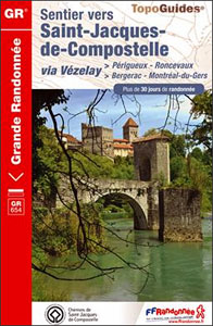
Sentier St-Jacques: Perigueux – Roncevaux, FFRP topoguide Ref. no. 6543, covering the second part of the Way of St James route along the GR654 which starts in Vรฉzelay, the section from Perigueux to the Pyrenees. Also covered is an eastern route from Bergerac to Montrรฉal-de-Gers. Current edition of this title was published in June 2014.ABOUT
Les Hautes Alpes ร pied FFRP Topo-guide No. D005
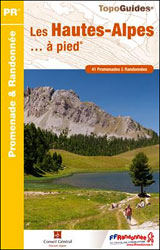
Les Hautes Alpes ร pied, FFRP topo-guide Ref. No. D005, with 41 day walks of varying length and difficulty in the French Alps, including in the Ecrins Massif, Queyras, Brianรงonnais and in the environs of Gap. Each walk is presented on a separate colour extract from IGN’s topographic survey of France at 1:25,000 or 1:50,000,
GR430: Chemin de St-Regis – Entre Velay et Vivarais FFRP Topo-guide No. 430
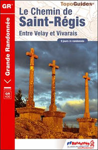
Chemin de St-Regis – Entre Velay et Vivarais, FFRP topoguide Ref. no. 430, covering a 210km circuit eastwards from Le Puy-en-Velay in the mountains of the Ardรจche region. Current edition of this title was published in October 2014.ABOUT THE FFRP (Fรฉdรฉration franรงaise de la randonnรฉe pรฉdestre) TOPOGUIDES: published in a handy A5 paperback format, the