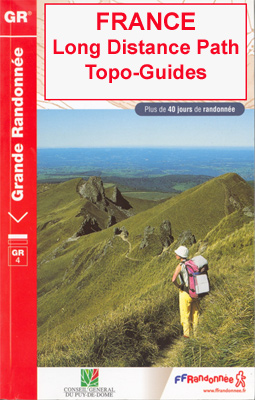
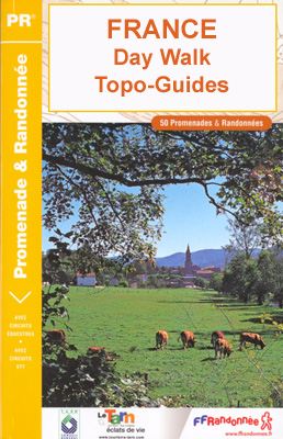
Category Archives: Travel Guides
La Haute Traversรฉe de Belledonne – Le sentier des Bergers
The complete crossing of a mountain range! Can we dream of anything better for a hiker in search of roaming? Located at the gates of major cities, this hike is considered difficult, but oh so beautiful.The GR 738, a figure that says a lot about the link between Savoie and Isรจre, two departments that make
Le Chemin de Saint-Guilhem-le-Desert – Lozere – Aveyron – Gard – Herault

Le chemin de Saint-Guilhem-le Dรฉsert, FFRP topoguide Ref. No. 4834, covering the 340kms of hiking routes between Aumont-Aubrac in the Massif Central, across the Cevennes, to Saint-Guilhem-le-Dรฉsert near Montpellier. Current edition of this title was published in July 2018ABOUT THE FFRP (Fรฉdรฉration franรงaise de la randonnรฉe pรฉdestre) TOPOGUIDES: published in a handy A5 paperback format,
Pyrรฉnรฉes Ariรฉgeoises – La traversรฉe des Pyrรฉnรฉes et tours du Val du Garbet et du Biros GR10

Pyrรฉnรฉes Ariรฉgeoises, FFRP topoguide, Ref. No. 1090, covering the third section of the GR10 along the Pyrenees from the Atlantic to the Mediterranean ‘“ a 335-km long walk from Bagnรจres-de-Luchon to Mรฉrens-les-Vals. Given the mountainous terrain, the guide also provides a detailed route profile for this part of the GR10, annotated with timings in either
Lyon ร pied VI08

Lyon ร pied, FFRP topo-guide Ref. No. VI08, with six thematic walks within the city centre and across the suburbs, all marked on detailed street plans cross-referenced to the descriptions. Current edition of this title was published in November 2013.ABOUT THE FFRP (Fรฉdรฉration franรงaise de la randonรฉe pรฉdestre) TOPOGUIDES: published in a handy A5 paperback
Tour du Cotentin – Littorral de la Normandie GR223

Tour du Cotentin, FFRP topoguide Ref. no. 200, covering the GR223 along the coast of the Cotentin Peninsula from Isigny-sur-Mer to Mont-St-Michel, including the Utah Beach of the D-Day Normandy Landings. Together with several variants off the main route, the guide provides coverage of nearly 600kms of hiking trails. Current edition of this title was
Le long des Chateaux de la Loire GR3/GR3B

Le long des Chร: teaux de la Loire, FFRP topoguide Ref. No. 333, covering 552km route along the Loire from Bonny-sur-Loire across Orlรฉans, Blois and Tours to Angers. Current edition of this title was published in May 2018.The Loire is world famous for its castles and gardens, now classified as World Heritage by UNESCO. The
Volcan du Cantal et Pays de Saint-Flour – Haute-Auvergne GR400/4

Volcan du Cantal: Pays de Saint-Flour et de Ruynes-en-Margeride, FFRP topoguide, Ref. No. 400, covering 600kms of long-distance paths in the Cantal region of the Massif Central, which can also be walked as shorter circuits. Current edition of this title was published in July 2013.To see other titles in this series please click on the
Tour du Queyras GR58

Tour du Queyras, FFRP topoguide Ref. No. 505, covering in addition to the tour of this picturesque mountain range several other circular routes within the Parc Rรฉgional du Queyras. Current edition of this title was published in July 2015.ABOUT THE FFRP (Fรฉdรฉration franรงaise de la randonnรฉe pรฉdestre) TOPOGUIDES: published in a handy A5 paperback format,
Tour des Monts d`Aubrac GRP/GR60/GR6

Tour des Monts d`Aubrac, FFRP topoguide Ref. No. 616, covering 259kms of hiking circuits in the Massif Central along the GR6, GR60 and GR65. Current edition of this title was published in May 2016.ABOUT THE FFRP (Fรฉdรฉration franรงaise de la randonnรฉe pรฉdestre) TOPOGUIDES: published in a handy A5 paperback format, the guides are the best
Tour du Mont-Lozere et du Causse Mรฉjean GR6/GR68

Tours du Mont-Lozรจre et du Causse Mรฉjean, FFRP topo-guide Ref. No. 631, with the two circular tours, a 117-km Tour du Mont Lozรจre and a 111-km Tour du Causse Mรฉjean, plus additional trails along the GR7 and GR70.ABOUT THE FFRP (Fรฉdรฉration franรงaise de la randonnรฉe pรฉdestre) TOPOGUIDES: published in a handy A5 paperback format, the
L`Ardรจche ร pied D007

L`Ardรจche ร pied, FFRP topo-guide Ref. No.D007, with 46 day walks of varying length and difficulty in the department of Ardรจche in the Massif Central. Each walk is presented on a separate colour extract from IGN’s topographic survey of France at 1:25,000, with its description cross-referenced to the map. Current edition of this title was
Jura ร pied 46PR

Le Jura ร pied, FFRP topo-guide Ref. No. D039, with 46 day walks of varying length and difficulty in the department of Jura in the southern part of the Jura Mountains. Each walk is presented on a separate colour extract from IGN’s topographic survey of France at 1:25,000, with its description cross-referenced to the map.
La Traversee der Alpes La Vanoise – PN de la Vanoise GR5/GR55

15 days in altitude from the Tarentaise to Modane, heart of the Maurienne. Description also of Via Alpina.La Vanoise (including Parc National de la Vanoise), FFRP topoguide Ref. no. 530, covering the second section of the GR5 in the French Alps between Landry and Modane, its lower variant on the GR5E along the river Arc,
Tour de Beaufortain
GRP: Tour de Beaufortain, FFRP topo-guide ref. no. 731, one of the titles from an extensive series of light, high quality, A5 paperback guides to the Sentiers de Grande Randonnรฉe, the GR routes, a dense network of long-distance footpaths across the French countryside. Each topo-guide covers either a circular route, or part of a longer
L`Ain ร pied D001

L`Ain ร pied, FFRP topo-guide Ref. No. D001, with 46 day walks in the department of Ain in the southern part of the French Jura Mountains, including the Crรชte de la Neige, Grand Colombier, etc. Each day walk is presented on a separate colour extract from IGN’s topographic survey of France at 1:25,000, with its
L`Ariรจge ร pied – du Piรฉmont aux Pyrรฉnรฉes

L`Ariรจge ร pied, FFRP topo-guide Ref. No.D009, with 40 day walks of varying length and difficulty in the department of Ariรจge in the French Pyrenees. Each walk is presented on a separate colour extract from IGN’s topographic survey of France at 1:25,000, with its description cross-referenced to the map. Current edition of this title was
Les Bouches-du-Rhone … a Pied – La Provence

Les Bouche-du-Rhรดne ร pied, FFRP topo-guide Ref. No. D013, with 42 day walks of varying length and difficulty in the Department of Bouche-du-Rhรดne on the Mediterranean coast of France. Coverage includes walks near Marseille, Aix-les-Provence, the Alpilles chain with St-Rรฉmy-de Provence, Arles, etc. Each walk is presented on a separate colour extract from IGN’s topographic
La Charente-Maritime ร pied

La Charente-Maritime ร pied, FFRP topo-guide Ref. No. D017, with 37 day walks of varying length and difficulty in the department, between La Rochelle and the Gironde, including Ile de Rรฉ, Ile d’Olรฉron and Ile d’Aix. Each walk is presented on a separate colour extract from IGN’s topographic survey of France at 1:25,000, with its


