Category Archives: Travel Guides
France IGN Road Map 901
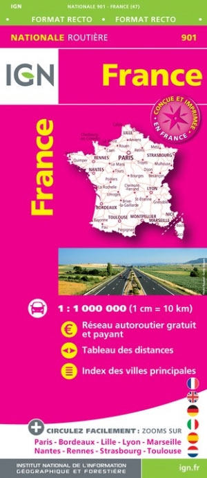
A single sided detailed IGN road map of France at a scale of 1:1 million with place name index of major towns. There is also an enlargement of Paris and the area surrounding. Details of toll roads are also given on the map, as are distances between major cities, with a multilingual legend.
France IGN Road Map 2020 WATERPROOF
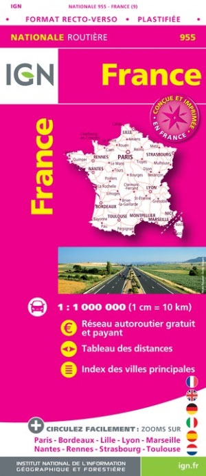
An laminated IGN route map of France enables you to plan your journeys across France. Includes table of distances and index of principal towns as well as map enlargements for Paris, Bordeaux, Lille, Lyon, Marseille, Nantes, Rennes, Strasbourg and Toulouse.
France IGN XL Road Map
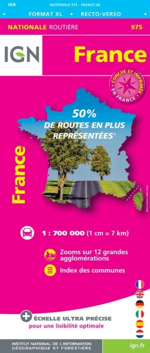
Ultra precise scale for optimal readability :750,000 (1cm = 7.5km) front and back 50% more roads. 2.5 times more municipalities represented a complete index of 9,000 municipalities. Legend in six languages.
France North-West IGN Road Map
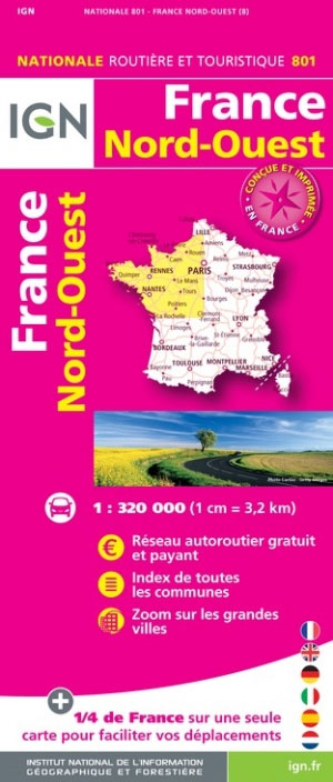
A single sided detailed IGN road map of France at a scale of 1:320,000 with place name index of major towns. It shows the entire motorway network for route planning with tourist information for exploring France at its best.
France North-East IGN Road Map 2020
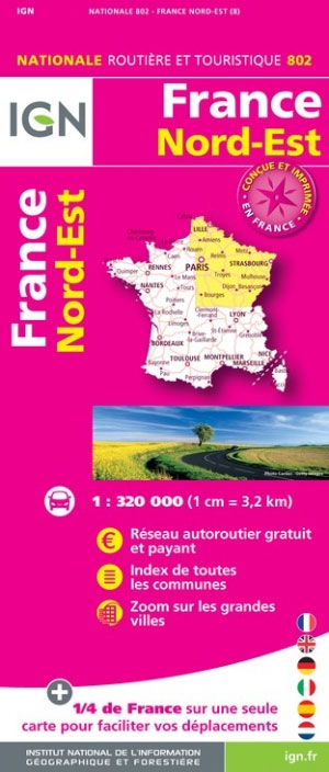
A road map of north east France including Calais, Lille, Paris, Strasbourg, Nevers, Moulins and Besancon showing the entire motorway network for route planning and exploring France. Includes tourist information and a place name index.
France South-West IGN Road Map 2020

A regional road maps of south west France showing the entire motorway network for route planning and exploring France at its best. Includes tourist information and a place name index.
France South-East IGN Road Map 804

A regional road map of south east France showing the entire motorway network for route planning with tourist information for exploring France at its best. Includes a place name index.
Chalons-en-Champagne – Marson IGN 2914SB
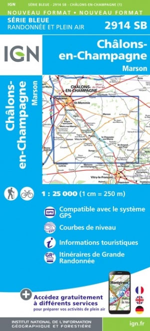
Topographic survey of France at 1:25,000 in IGN`s excellent TOP25 / Sรฉrie Bleue series. All the maps are GPS compatible, with a 1km UTM grid plus latitude and longitude lines at 5’ intervals. Contours are at 5m intervals except for mountainous areas where the maps have contours at 10m intervals, vividly enhanced by hill shading
France – Ways of St James IGN Map 922
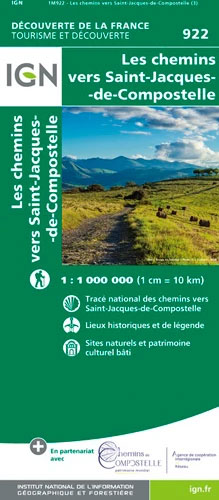
France: Ways of St James to Compostela Map from the IGN presents an overview of all the routes across France taken by pilgrims on their way to Santiago de Compostela and the tomb of the apostle St James – the greatest of all goals for thousands of pilgrims in Europe during the Middle Ages. The
Vitry-le-Francois – Sompuis IGN 2915SB
Topographic survey of France at 1:25,000 in IGN`s excellent TOP25 / Sรฉrie Bleue series. All the maps are GPS compatible, with a 1km UTM grid plus latitude and longitude lines at 5’ intervals. Contours are at 5m intervals except for mountainous areas where the maps have contours at 10m intervals, vividly enhanced by hill shading
Monts du Lyonnais IGN 2932ET
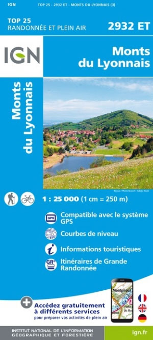
Topographic survey of France at 1:25,000 in IGN`s excellent TOP25 / Sรฉrie Bleue series. All the maps are GPS compatible, with a 1km UTM grid plus latitude and longitude lines at 5’ intervals. Contours are at 5m intervals except for mountainous areas where the maps have contours at 10m intervals, vividly enhanced by hill shading
Hauts-de-France IGN Regional NR01
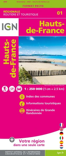
IGN publishes its new collection of regional maps including the official division of the 13 new regions. The largest regions are well represented on a single map. These maps are double sided and in 6 languages.
Foret de Mormal IGN 2706OT
Topographic survey of France at 1:25,000 in IGN`s excellent TOP25 / Sรฉrie Bleue series. All the maps are GPS compatible, with a 1km UTM grid plus latitude and longitude lines at 5’ intervals. Contours are at 5m intervals except for mountainous areas where the maps have contours at 10m intervals, vividly enhanced by hill shading
Laon – Sissonne IGN 2710SB
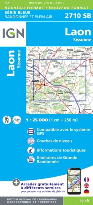
Topographic survey of France at 1:25,000 in IGN`s excellent TOP25 / Sรฉrie Bleue series. All the maps are GPS compatible, with a 1km UTM grid plus latitude and longitude lines at 5’ intervals. Contours are at 5m intervals except for mountainous areas where the maps have contours at 10m intervals, vividly enhanced by hill shading
Sezanne – Connantre IGN 2715SB
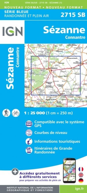
Topographic survey of France at 1:25,000 in IGN`s excellent TOP25 / Sรฉrie Bleue series. All the maps are GPS compatible, with a 1km UTM grid plus latitude and longitude lines at 5’ intervals. Contours are at 5m intervals except for mountainous areas where the maps have contours at 10m intervals, vividly enhanced by hill shading
Arlanc – Saint-Antheme IGN 2733SB
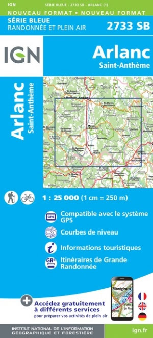
Topographic survey of France at 1:25,000 in IGN`s excellent TOP25 / Sรฉrie Bleue series. All the maps are GPS compatible, with a 1km UTM grid plus latitude and longitude lines at 5’ intervals. Contours are at 5m intervals except for mountainous areas where the maps have contours at 10m intervals, vividly enhanced by hill shading
Craponne-sur-Arzon – Allegre – la Chaise-Dieu IGN 2734SB
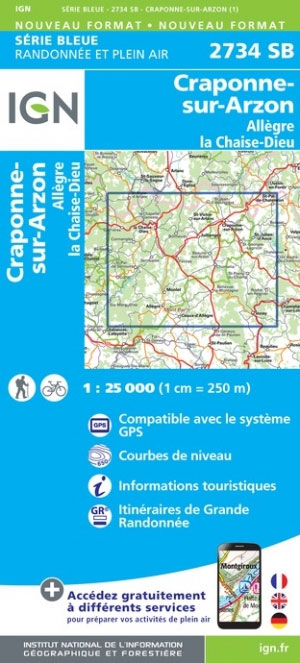
Topographic survey of France at 1:25,000 in IGN`s excellent TOP25 / Sรฉrie Bleue series. All the maps are GPS compatible, with a 1km UTM grid plus latitude and longitude lines at 5’ intervals. Contours are at 5m intervals except for mountainous areas where the maps have contours at 10m intervals, vividly enhanced by hill shading
le Puy-en-Velay – Loudes IGN 2735SB
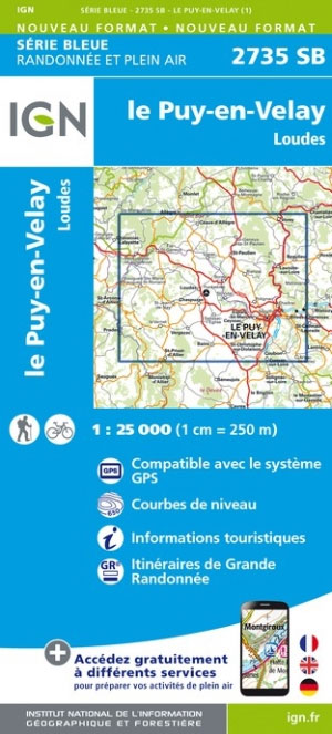
Topographic survey of France at 1:25,000 in IGN`s excellent TOP25 / Sรฉrie Bleue series. All the maps are GPS compatible, with a 1km UTM grid plus latitude and longitude lines at 5’ intervals. Contours are at 5m intervals except for mountainous areas where the maps have contours at 10m intervals, vividly enhanced by hill shading