Category Archives: Travel Guides
Mariners` Routeing Guide 5521 – Irish Sea
Routeing Guides provide important passage planning information in addition to details of traffic separation schemes for the major shipping areas of the English Channel, North Sea, Gulf of Suez, Malacca and Singapore Straits.
Mariners` Routeing Guide 5522 – West Coast of Scotland to Pentland Firth
Routeing Guides provide important passage planning information in addition to details of traffic separation schemes for the major shipping areas of the English Channel, North Sea, Gulf of Suez, Malacca and Singapore Straits.
Germany Hand Flag

100% polyester, screen printed flag on a 30cm wooden pole with a white plastic ball cap.
New Zealand Hand Flag
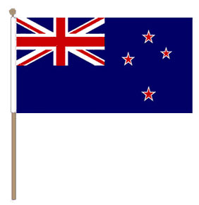
100% polyester, screen printed flag on a 30cm wooden pole with a white plastic ball cap.
Greece Hand Flag

100% polyester, screen printed flag on a 30cm wooden pole with a white plastic ball cap.
Admiralty Chart 1438 – Harbours on the East Coast of Scotland
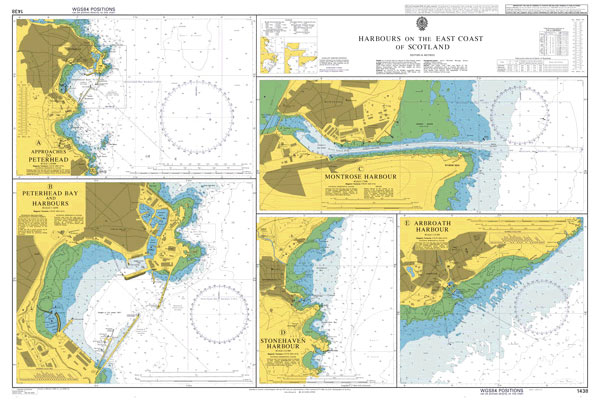
Admiralty standard nautical charts comply with Safety of Life at Sea (SOLAS) regulations and are ideal for professional, commercial and recreational use. Charts within the series consist of a range of scales, useful for passage planning, ocean crossings, coastal navigation and entering port.Standard Admiralty charts are folded to fit in a chart table drawer. If
Admiralty Chart 3132 – Strait of Gibraltar to Arquipelago da Madeira
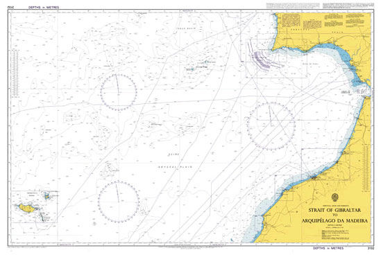
NEW EDITION OUT ON 09/04/2020Admiralty standard nautical charts comply with Safety of Life at Sea (SOLAS) regulations and are ideal for professional, commercial and recreational use. Charts within the series consist of a range of scales, useful for passage planning, ocean crossings, coastal navigation and entering port.Standard Admiralty charts are folded to fit in a
England (St George`s Cross) Hand Flag
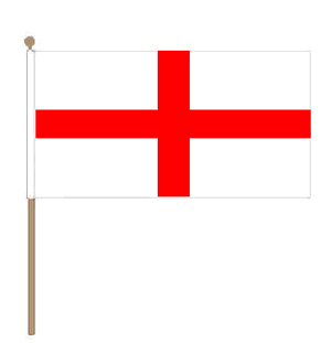
100% polyester, screen printed flag on a 30cm wooden pole with a white plastic ball cap.
Gallipoli Campaign Map and Guide
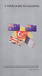
Detailed and very informative map of the Gallipoli Peninsula from Footstep Maps designed to show locations of the various landing sites, cemeteries and monuments of the Dardanelles Campaign during World War I. The map, prepared by its Australian publishers in cooperation with the Commonwealth Graves Commission, concentrates on highlighting sites particularly connected with the ANZAC
Admiralty Chart 2182C – North Sea Northern Sheet
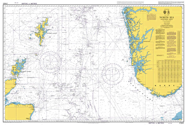
NEW EDITION OUT ON 03/06/2021Admiralty standard nautical charts comply with Safety of Life at Sea (SOLAS) regulations and are ideal for professional, commercial and recreational use. Charts within the series consist of a range of scales, useful for passage planning, ocean crossings, coastal navigation and entering port.Standard Admiralty charts are folded to fit in a
Union Jack Hand Flag (6″x4″)
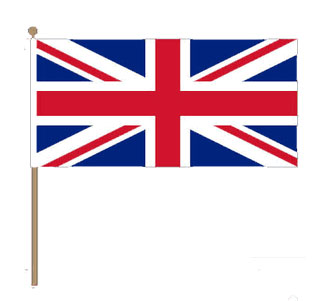
100% polyester, screen printed Union Jack on a 30cm wooden pole with a white plastic ball cap
Admiralty Chart 562 – Valencia
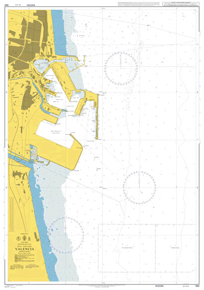
NEW EDITION OUT ON 21/10/2021Admiralty standard nautical charts comply with Safety of Life at Sea (SOLAS) regulations and are ideal for professional, commercial and recreational use. Charts within the series consist of a range of scales, useful for passage planning, ocean crossings, coastal navigation and entering port.Standard Admiralty charts are folded to fit in a
Australia Hand Flag

100% polyester, screen printed Australia flag on a 30cm wooden pole with a white plastic ball cap.
London Airfix Tea Towel – Set of Three

This is a set of the London Airfix Tea Towels, one each colour, blue, red and black by designer Victoria Eggs. These are practical accessories that will add a touch of colour and style to your kitchen. The London themed Airfix designs pay homage to the renowned model-making kits and include bold silhouettes of London’s
USA hand flag

100% polyester, screen printed USA flag on a 30cm wooden pole with a white plastic ball cap.
Admiralty Chart 146 – Aberdeen Harbour Berths
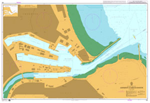
Admiralty standard nautical charts comply with Safety of Life at Sea (SOLAS) regulations and are ideal for professional, commercial and recreational use. Charts within the series consist of a range of scales, useful for passage planning, ocean crossings, coastal navigation and entering port.Standard Admiralty charts are folded to fit in a chart table drawer. If