Category Archives: Travel Guides
Reg 5.1 Chesapeake Bay & Delaware Bay
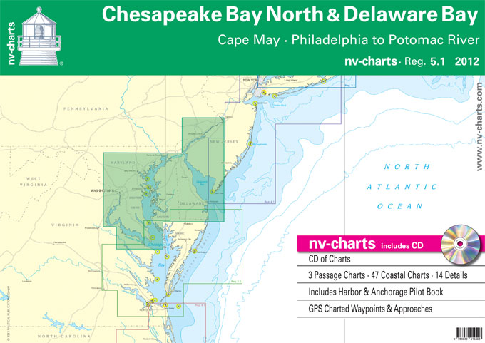
Passage ChartsC0 New York to Cape Fear 1: 1,300,000 C1 Cape May to Great Machipongo Inlet 1: 340,000 C2 Chesapeake Bay ยท North 1: 340,000Coastal ChartsC3 Cape May to Fenwick Island 1: 100,000 C4 Delaware Bay ยท South 1: 100,000 C5 Delaware Bay ยท North 1: 100,000 C6 Chesapeake Bay to Delaware River 1: 100,000
Reg 5.2 Chesapeake Bay South
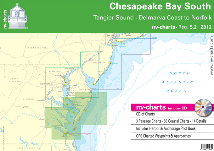
Passage ChartsC0 Chesapeake Bay ยท New York to Cape Fear 1: 1,300,000 C1 Chesapeake Bay ยท South 1: 340,000 C2 Cape May to Great Machipongo Inlet 1: 340,000Coastal ChartsC3 Taylors Island to Point Lookout 1: 100,000 C4 Tangier Sound ยท Pocomoke Sound 1: 100,000 C5 Point Lookout to Rappahannock River 1: 100,000 C6 Rappahannock River
Reg 6.1 Virginia & N Carolina Coast
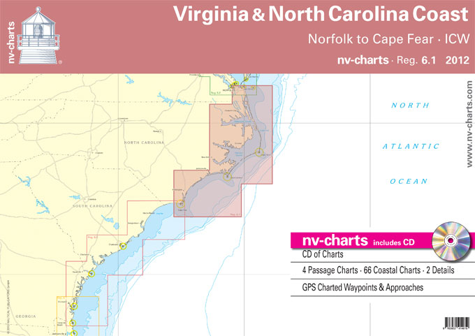
Passage ChartsC1 Norfolk to Wilmington 1: 1,300,000 C2 Cape Henry to Cape Hatteras 1: 340,000 C3 Cape Hatteras to Cape Lookout 1: 340,000 C4 Cape Lookout to Cape Fear 1: 340,000Coastal and Detail ChartsC5 Albemarle Sound ยท West 1: 80,000 C6 Albemarle Sound 1: 80,000 C7A Chowan River 1: 80,000 C7B Perquimans & Little River
Admiralty Chart 8002 – Southampton Port Approach Guide
ADMIRALTY Port Approach Guides are single, port-scale charts that contain a wide range of planning information for some of the world`s busiest approaches. Taken from existing ADMIRALTY charts and publications, this information can help to simplify a number of passage planning tasks and support Master Pilot Exchange (MPX).Port Approach Guides include planning information for individual
Morse Code Flip Cards (0065)

36 cards showing the Morse symbol, both letters and numerals, with the back of the card giving the meaning. Also in the set is a useful instruction card. For those mariners needing a knowledge of Morse these Flip Cards have proved to be a quick and simple method of learning and checking.37 cards in total.
Instructional Chart 5041 – Thames Estuary
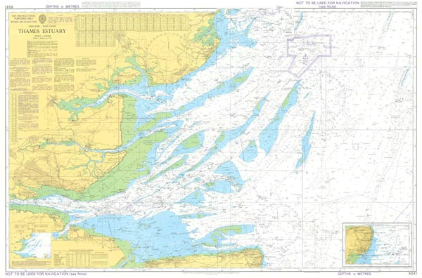
Instructional charts are useful for training and examination puposes. They are not maintained for the latest information and should not be used for navigation.
Rules of the Road Flip Cards (0063)

These cards show the view forward from the deck of various vessels (power, sailing and fishing) of developing traffic situations at sea. In each case the mariner has to decide the correct course of action to navigate his vessel through the hazard. The reverse of the card gives the proper course and also quotes the
Instructional Chart 5046 – English Channel – Newhaven to Calais
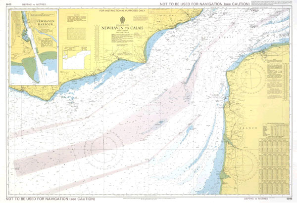
Instructional charts are useful for training and examination puposes. They are not maintained for the latest information and should not be used for navigation.
Sound & Light Signal Flip Cards (0064)

This pack of Flip Cards illustrates the signals made by ships at sea, and covers lights, fog signals and the usual distress and search and rescue signals. They differ from the Lights and Shapes cards in that they show signals rather than navigation signs. The meaning is shown on the back of the card as
Instructional Chart 5053 – English Channel – Western and Central Portions
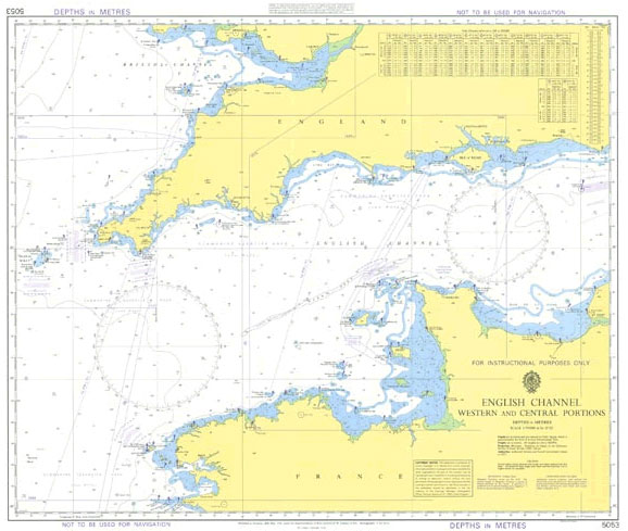
Admiralty Instructional charts are designed to be used for training. They contain all the features of a standard Admiralty nautical chart. PLEASE NOTE: instructional charts are not updated to the latest Notice to Mariners and should not be used for navigation.
Instructional Chart 5130 – Irish Sea with Saint George`s Channel and North Channel
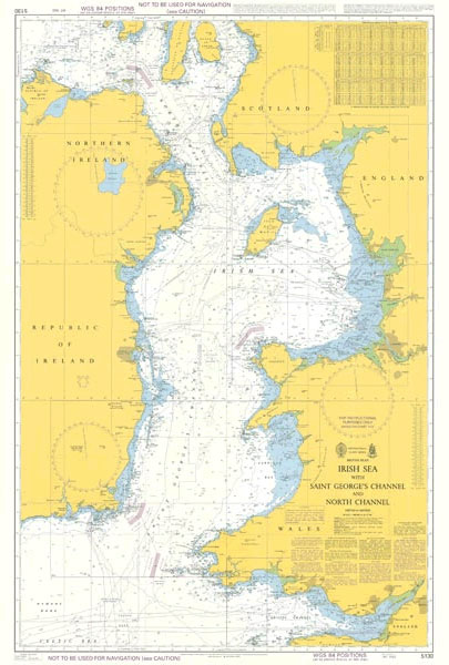
Admiralty Instructional charts are designed to be used for training. They contain all the features of a standard Admiralty nautical chart. PLEASE NOTE: instructional charts are not updated to the latest Notice to Mariners and should not be used for navigation.
Instructional Chart 5135 – Cape Breton to Delaware Bay
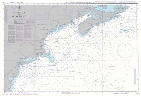
Admiralty Instructional charts are designed to be used for training. They contain all the features of a standard Admiralty nautical chart. PLEASE NOTE: instructional charts are not updated to the latest Notice to Mariners and should not be used for navigation.
Mariners` Routeing Guide 5507 – Strait of Canakkale and Approaches
NEW EDITION OUT ON 24/06/2021Routeing Guides provide important passage planning information in addition to details of traffic separation schemes for the major shipping areas of the English Channel, North Sea, Gulf of Suez, Malacca and Singapore Straits.
Admiralty Chart 1473 – Trieste and Approaches
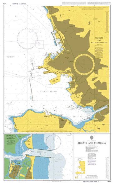
NEW EDITION OUT ON 16/04/2020Admiralty standard nautical charts comply with Safety of Life at Sea (SOLAS) regulations and are ideal for professional, commercial and recreational use. Charts within the series consist of a range of scales, useful for passage planning, ocean crossings, coastal navigation and entering port.Standard Admiralty charts are folded to fit in a
Admiralty Chart 1351 – Approaches to Calais
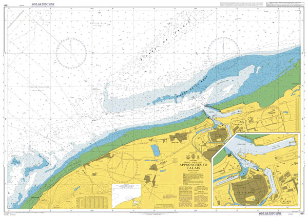
NEW EDITION ON 04/03/2021Admiralty standard nautical charts comply with Safety of Life at Sea (SOLAS) regulations and are ideal for professional, commercial and recreational use. Charts within the series consist of a range of scales, useful for passage planning, ocean crossings, coastal navigation and entering port.Standard Admiralty charts are folded to fit in a chart
Admiralty Chart 2808 – St Johns River Mayport to Jacksonville
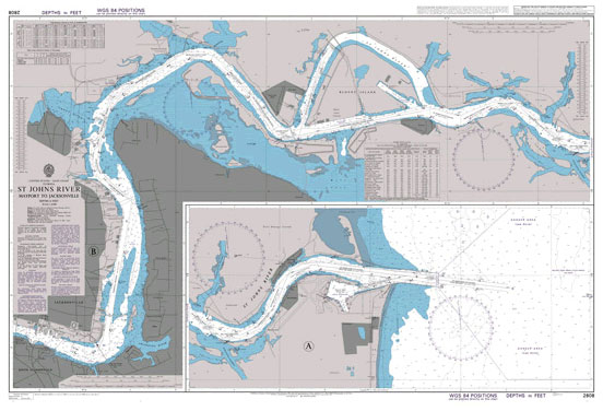
Admiralty standard nautical charts comply with Safety of Life at Sea (SOLAS) regulations and are ideal for professional, commercial and recreational use. Charts within the series consist of a range of scales, useful for passage planning, ocean crossings, coastal navigation and entering port.Standard Admiralty charts are folded to fit in a chart table drawer. If
Admiralty Chart 2227 – Tallinn and Approaches
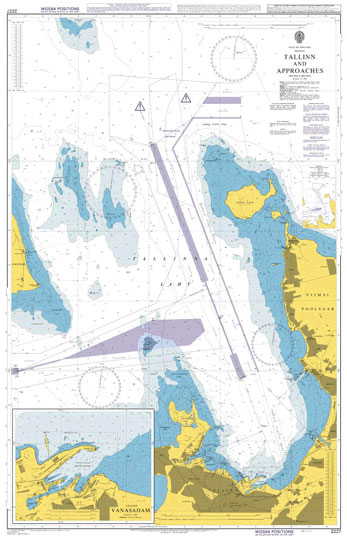
Admiralty standard nautical charts comply with Safety of Life at Sea (SOLAS) regulations and are ideal for professional, commercial and recreational use. Charts within the series consist of a range of scales, useful for passage planning, ocean crossings, coastal navigation and entering port.Standard Admiralty charts are folded to fit in a chart table drawer. If