Category Archives: Travel Guides
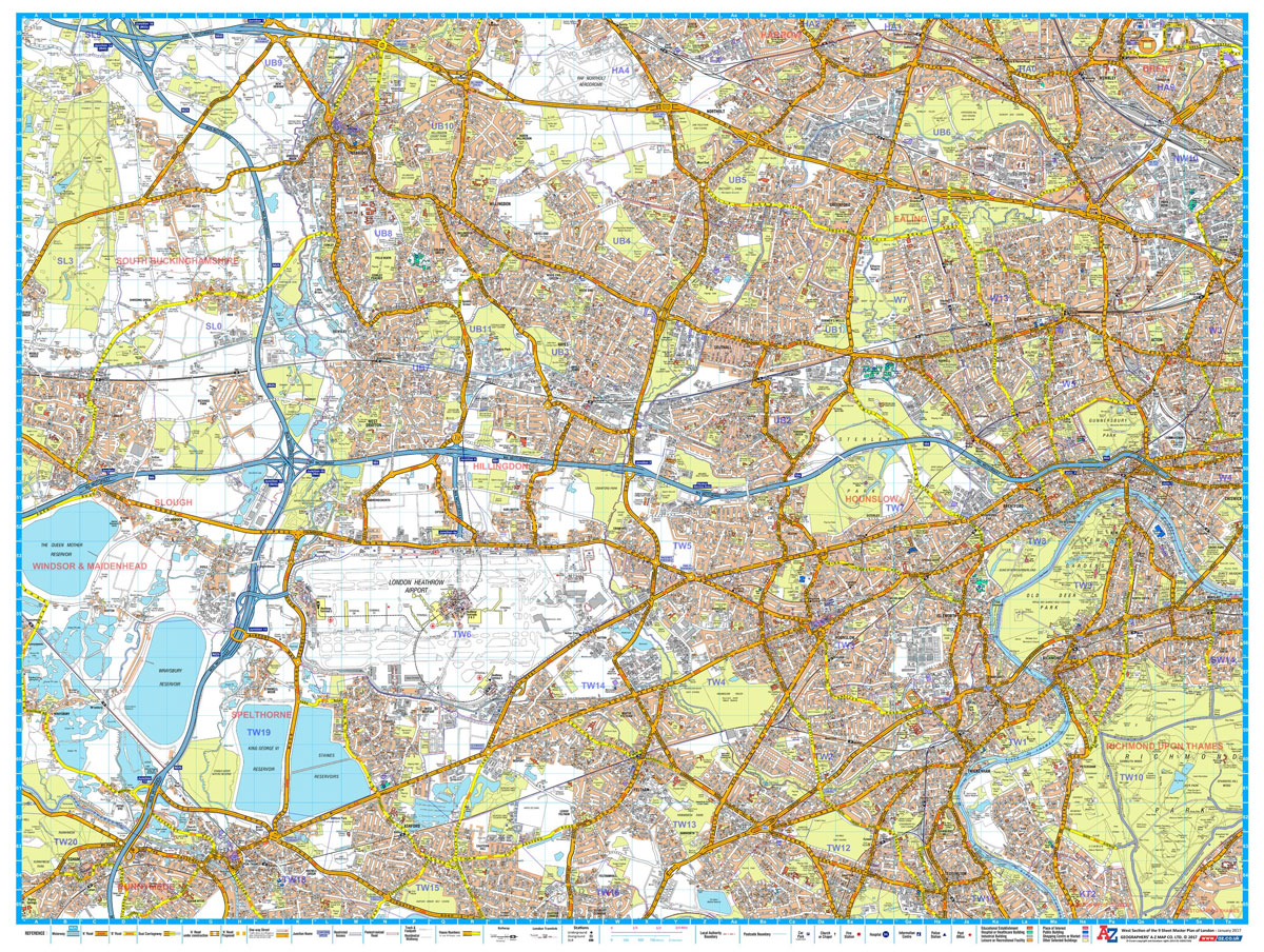
A-Z London Master Map – South East 1016 x 763 mm
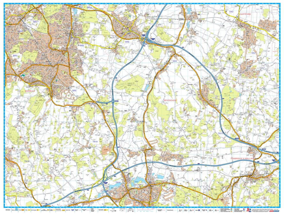
A-Z Street Map of South East London. This Master Plan is one of a series of 9 street maps covering the Greater London area, which can be joined and mounted for display. Featuring A-Z`s iconic street mapping, these maps include postcode district and local authority boundaries. Second edition, published January 2017.
Binnen 1 Berlin & Markische Gewasser
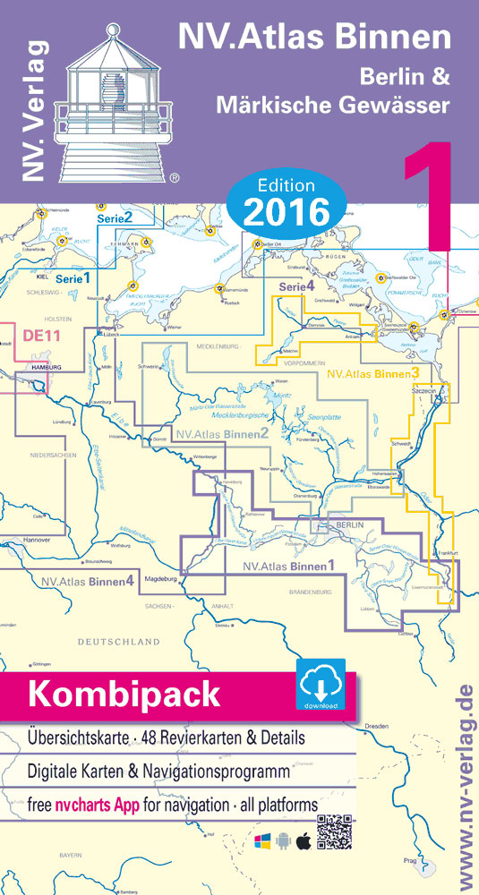
Language: German.Format: Paper, digital raster charts via NV Charts App.A colored set of charts specially designed for inland waterway navigation, spiral bound with charts and details to scale 1 : 35.000 (format 40 x 21 cm).Practical to work with, precise information.Detailed charts and a German script with depths, overhead clearance, locks, moorings and points of
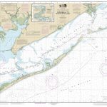
Reg 1.1 Maine – Canadian Border to Cape Elizabeth
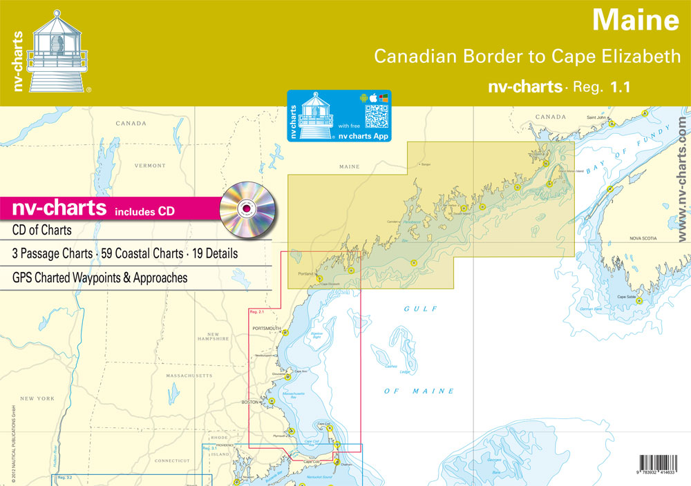
Paper and digital raster charts on CD with GPS Charted Waypoints & Approaches.Passage ChartsC1 Gulf of Maine 1: 1,300,000 C2 Canadian Border to Mount Desert Island 1: 340,000 C3 Mount Desert Island to Portland 1: 340,000 Coastal Charts and DetailsC4 Grand Manan Channel 1: 80,000 C5 Cutler to Head Harbor I. 1: 80,000 C6 Head
Reg 2.1 Massachusetts – Cape Elizabeth to Cape Cod
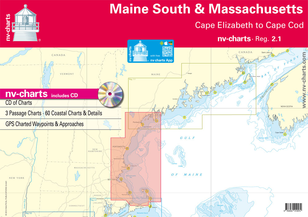
Passage ChartsC1 Gulf of Maine 1: 1,300,000 C2 Bigelow Bight 1: 340,000 C3 Massachusetts Bay 1: 340,000 Coastal Charts and DetailsC4 Halfway Rock to Cape Elizabeth 1: 80,000 C5 Cape Elizabeth to Cape Arundel 1: 80,000 C6 Cape Arundel to Isles of Shoals 1: 80,000 C7 Isles of Shoals to Cape Ann Lt. 1: 80,000
Reg 3.2 Long Island Sound
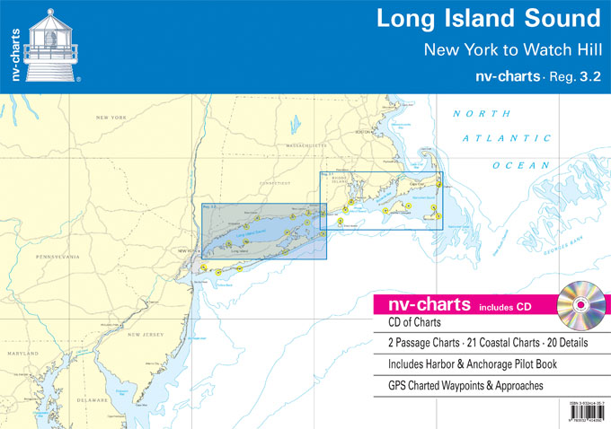
Passage ChartsC0 New York to Boston 1: 1,300,000 C1 Long Island Sound 1: 340,000 Coastal ChartsC2 Execution Rocks to Stratford Shoal 1: 100,000 C3 Stratford Shoal to Falkner Island 1: 100,000 C4 Falkner Island to Gardiners Island 1: 100,000 C5 Block Island Sound 1: 100,000 C6 East River to Execution Rocks 1: 45,000 C7 Execution
Reg 4.1 New Jersey Coast
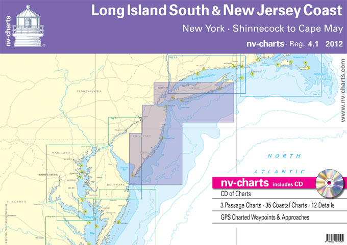
Passage ChartsC1 Block Island to Cape Hatteras 1: 1,300,000 C2 Long Island South Coast 1: 340,000 C3 Sandy Hook to Cape May 1: 340,000 Coastal ChartsC4 Shinnecock Inlet to Narrow Bay 1: 80,000 C5 Narrow Bay to Fire Island Inlet 1: 80,000 C6 Fire Island Inlet to East Rockaway Inlet 1: 80,000 C7 Approaches to
Reg 5.1 Chesapeake Bay & Delaware Bay
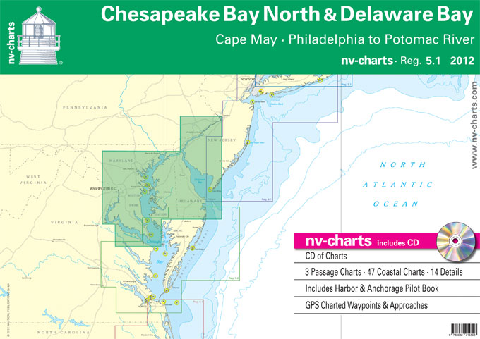
Passage ChartsC0 New York to Cape Fear 1: 1,300,000 C1 Cape May to Great Machipongo Inlet 1: 340,000 C2 Chesapeake Bay ยท North 1: 340,000Coastal ChartsC3 Cape May to Fenwick Island 1: 100,000 C4 Delaware Bay ยท South 1: 100,000 C5 Delaware Bay ยท North 1: 100,000 C6 Chesapeake Bay to Delaware River 1: 100,000
Reg 5.2 Chesapeake Bay South
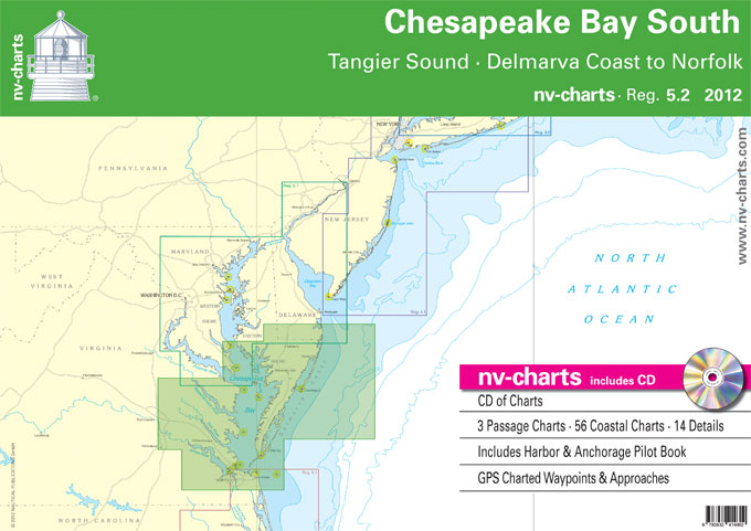
Passage ChartsC0 Chesapeake Bay ยท New York to Cape Fear 1: 1,300,000 C1 Chesapeake Bay ยท South 1: 340,000 C2 Cape May to Great Machipongo Inlet 1: 340,000Coastal ChartsC3 Taylors Island to Point Lookout 1: 100,000 C4 Tangier Sound ยท Pocomoke Sound 1: 100,000 C5 Point Lookout to Rappahannock River 1: 100,000 C6 Rappahannock River
Reg 6.1 Virginia & N Carolina Coast
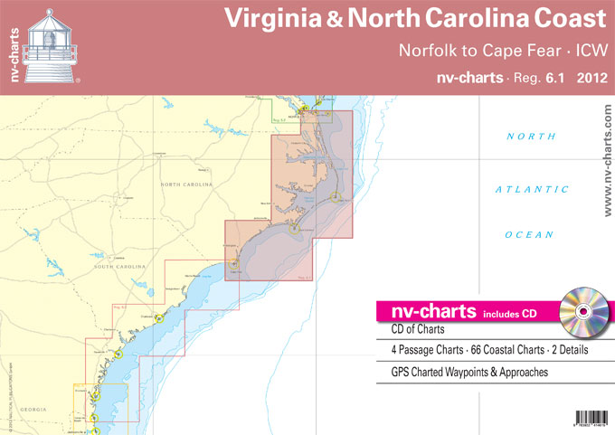
Passage ChartsC1 Norfolk to Wilmington 1: 1,300,000 C2 Cape Henry to Cape Hatteras 1: 340,000 C3 Cape Hatteras to Cape Lookout 1: 340,000 C4 Cape Lookout to Cape Fear 1: 340,000Coastal and Detail ChartsC5 Albemarle Sound ยท West 1: 80,000 C6 Albemarle Sound 1: 80,000 C7A Chowan River 1: 80,000 C7B Perquimans & Little River
Reg 8.1 Florida North, Fernandia Beach to St. Augustine
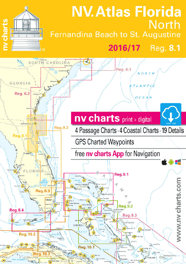
Passage ChartsC1 Morehead City to Daytona Beach 1: 1,300,000 C2 Cape Fear to Georgetown 1: 340,000 C3 Georgetown to Beaufort 1: 340,000 C4 Beaufort to Cumberland Island 1: 340,000 Coastal and Detail ChartsC5 Cape Fear River to Shallotte Inlet 1: 40,000 C6 Little River Inlet to North Myrtle Beach 1: 40,000 C7 Waccamaw River 1:
Reg 8.2 Florida East, St. Augustine to Lake Worth Inlet
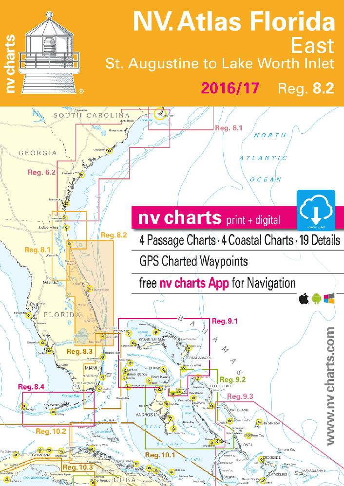
Passage ChartsC1 Morehead City to Daytona Beach 1: 1,300,000 C2 Cape Fear to Georgetown 1: 340,000 C3 Georgetown to Beaufort 1: 340,000 C4 Beaufort to Cumberland Island 1: 340,000 Coastal and Detail ChartsC5 Cape Fear River to Shallotte Inlet 1: 40,000 C6 Little River Inlet to North Myrtle Beach 1: 40,000 C7 Waccamaw River 1:
Admiralty Chart 1589 – Almeria
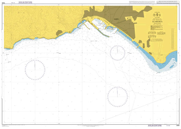
NEW EDITION OUT ON 23/09/2021Admiralty standard nautical charts comply with Safety of Life at Sea (SOLAS) regulations and are ideal for professional, commercial and recreational use. Charts within the series consist of a range of scales, useful for passage planning, ocean crossings, coastal navigation and entering port.Standard Admiralty charts are folded to fit in a
Weems & Plath LightRule – CEVNI 191
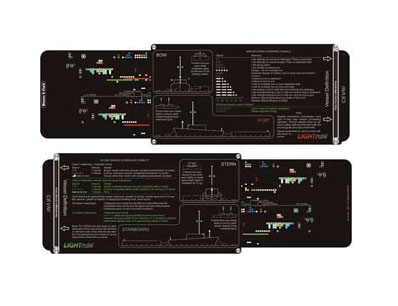
This version of the LightRule is for the European Inland Waterways which have a unique system of lights for vessel identification called CEVNI. This simple to use vessel identification tool shows the actual view of vessels for port, starboard, bow and stern lights on European Inland Waterways.The right bank or right-hand side of the channel
Spain Merchant flag – 1 yard – sewn

We are able to source a wide range of courtesy flags. Flags are available in many sizes and can be sewn or printed on 100% Ministry Of Defence Standard Woven and Knitted Polyester. Flags are supplied with rope and toggle. If you would like more information, have a custom size request or cannot find a
Italy National Flag – 1 yard – sewn
We are able to source a wide range of courtesy flags. Flags are available in many sizes and can be sewn or printed on 100% Ministry Of Defence Standard Woven and Knitted Polyester. Flags are supplied with rope and toggle. If you would like more information, have a custom size request or cannot find a