Category Archives: Travel Guides
Admiralty Chart 2628 – Portsmouth Harbour, Northern Part
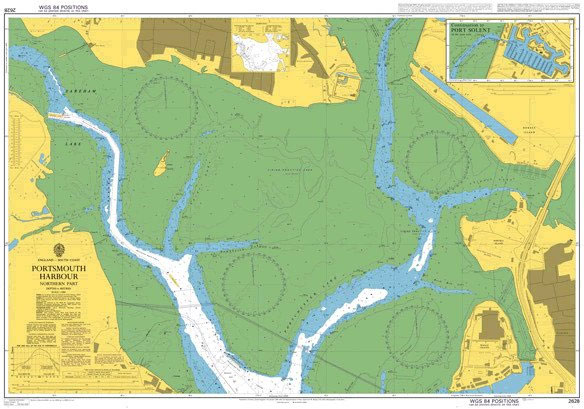
Wonderful 72x105cm sea chart of the waters around Britain and Ireland. The chart shows the depth of the sea, clearly showing the areas which, but for small depth of water, would be land. Flooded lands and sunken islands, the stuff of legendsยฟ Lighthouses are also shown. A decorative map for anyone interested in the sea.
Admiralty Chart 2628 – Portsmouth Harbour Northern Part
Admiralty standard nautical charts comply with Safety of Life at Sea (SOLAS) regulations and are ideal for professional, commercial and recreational use. Charts within the series consist of a range of scales, useful for passage planning, ocean crossings, coastal navigation and entering port.Standard Admiralty charts are folded to fit in a chart table drawer. If
Northern Ireland Hand Flag
100% polyester, screen printed flag on a 30cm wooden pole with a white plastic ball cap.
Czech Hand Flag

100% polyester, screen printed flag on a 30cm wooden pole with a white plastic ball cap.
Hungary Hand Flag

100% polyester, screen printed flag on a 30cm wooden pole with a white plastic ball cap.
Kings & Queens Mug

Learn all the kings and queens of England in your coffee break with this wonderfully descriptive and informative depiction from Picturemaps.
Hema Maps Australia Handy 777 x 652 mm
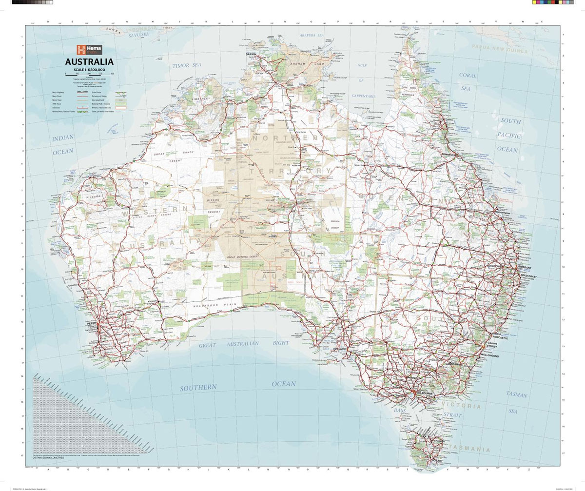
A country map of Australia that includes city maps for compact travel use.
A-Z London Master Map – North East 1016 x 763 mm
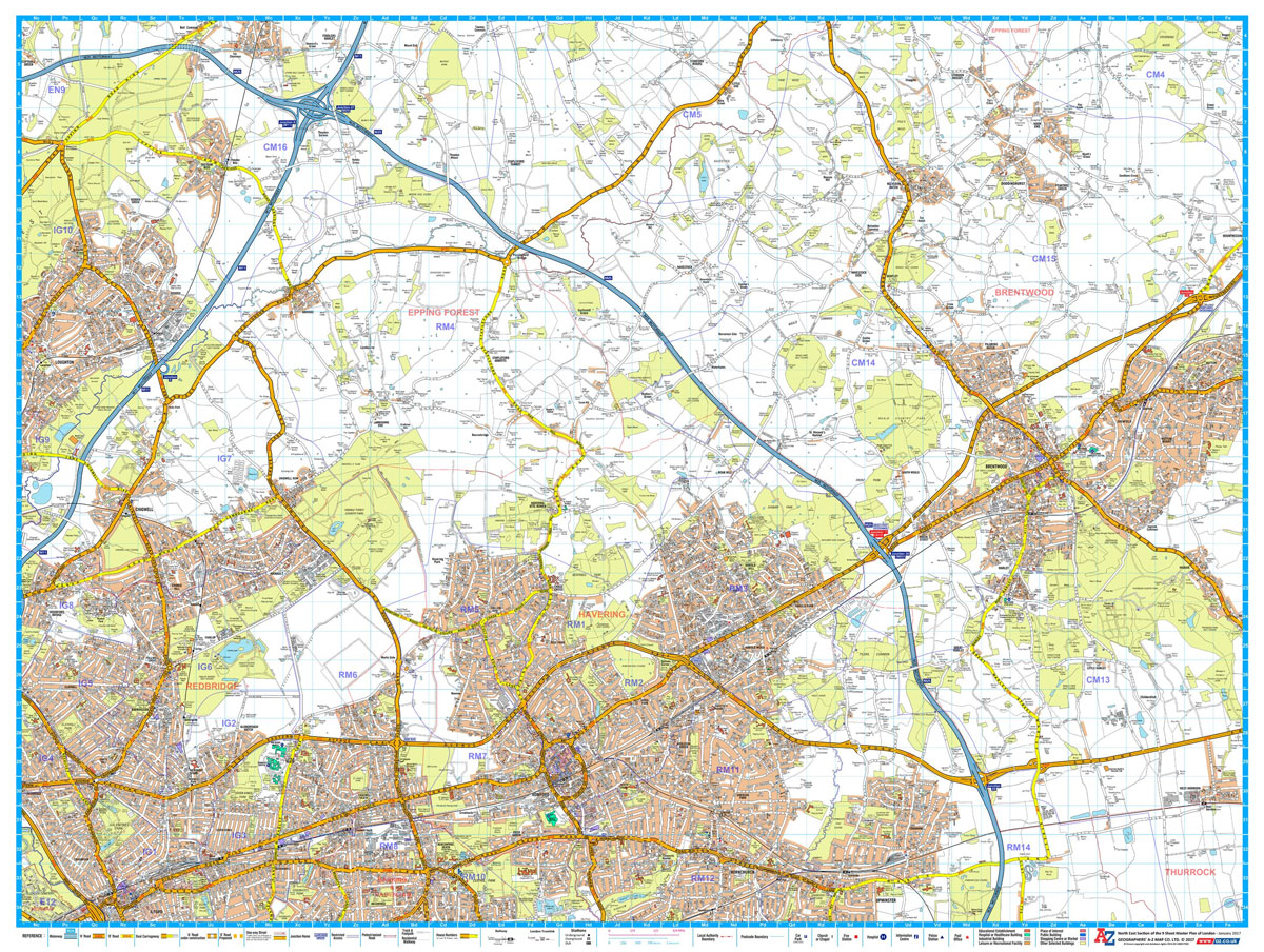
A-Z Street Map of North East London. This Master Plan is one of a series of 9 street maps covering the Greater London area, which can be joined and mounted for display. Featuring A-Z`s iconic street mapping, these maps include postcode district and local authority boundaries. Second edition, published January 2017.
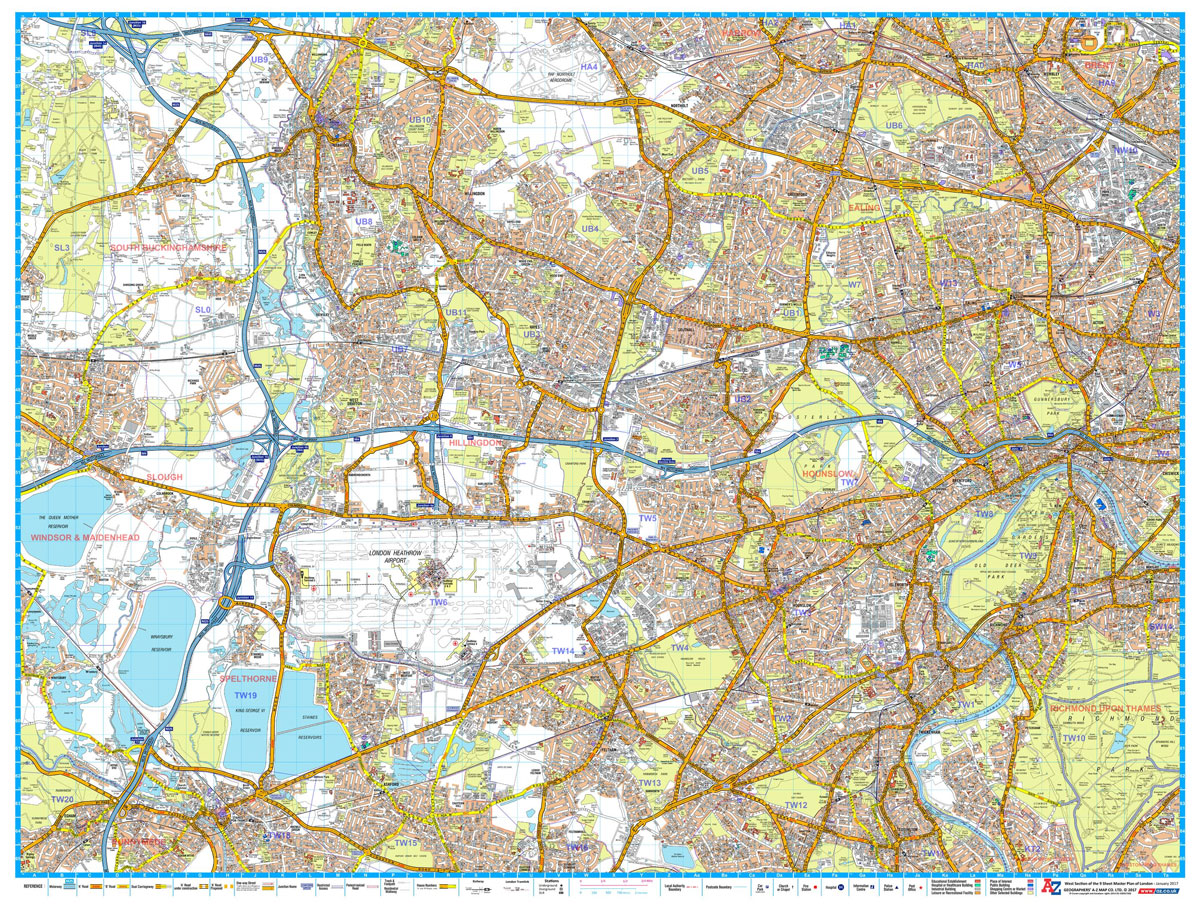
A-Z Maps A-Z London Master Map – East 1016 X 763 mm
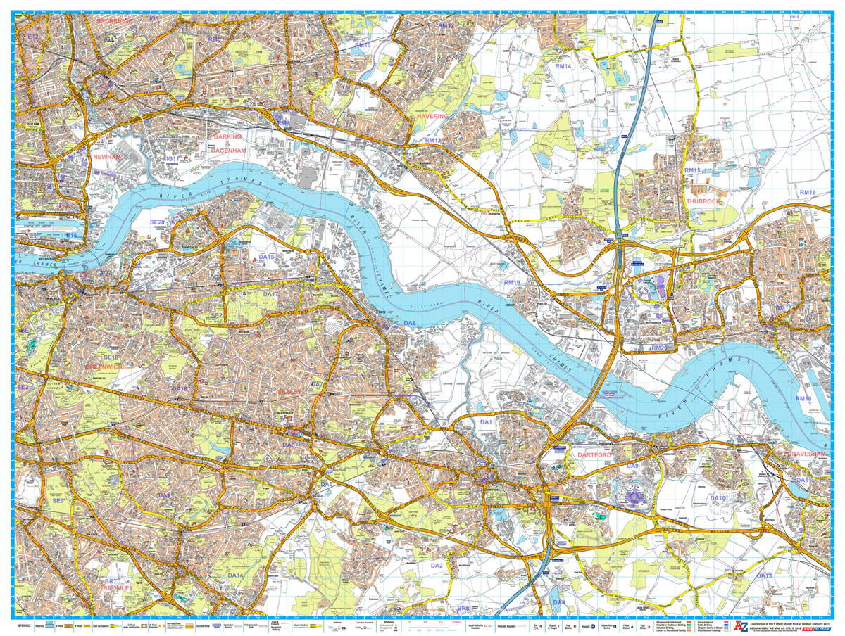
A-Z Street Map of East London. This Master Plan is one of a series of 9 street maps covering the Greater London area, which can be joined and mounted for display. Featuring A-Z`s iconic street mapping, these maps include postcode district and local authority boundaries. Second edition, published January 2017.

A-Z London Master Map – South East 1016 x 763 mm
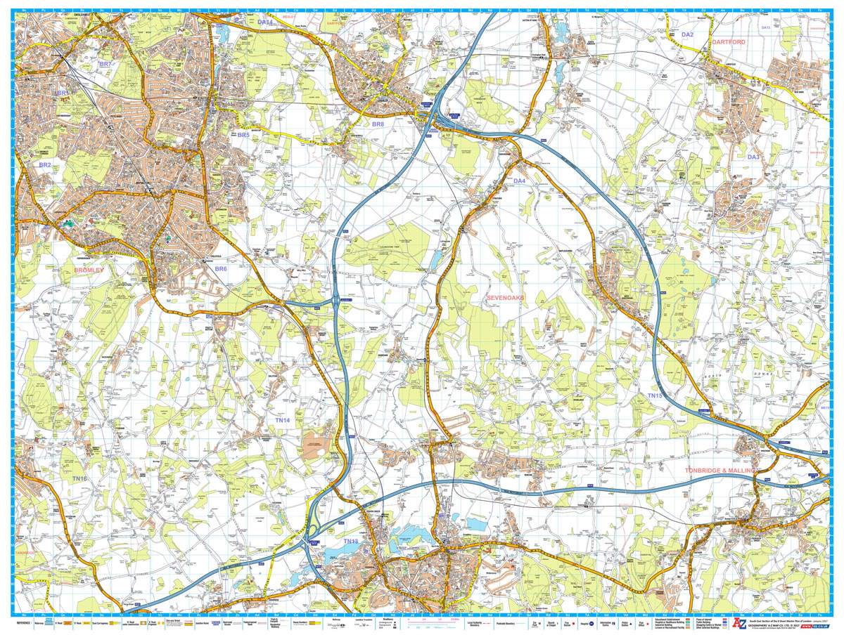
A-Z Street Map of South East London. This Master Plan is one of a series of 9 street maps covering the Greater London area, which can be joined and mounted for display. Featuring A-Z`s iconic street mapping, these maps include postcode district and local authority boundaries. Second edition, published January 2017.
Admiralty Chart 3841 – Mississippi – Pascagoula Harbour
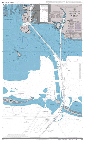
Admiralty standard nautical charts comply with Safety of Life at Sea (SOLAS) regulations and are ideal for professional, commercial and recreational use. Charts within the series consist of a range of scales, useful for passage planning, ocean crossings, coastal navigation and entering port.Standard Admiralty charts are folded to fit in a chart table drawer. If