Category Archives: Travel Guides
Stanford`s London 1862 Gift Wrapping Paper – Pink Version
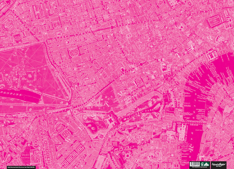
This sheet of wrapping paper features a colour-modified vintage map of London circa 1862 from the Edward Stanford cartographic collection.Please note this is not an up to date map of London.Perfect for wrapping special presents. Its high decorative qualities make it also ideal for framing and other creative purposes.
CHS Chart 4241 – Lockeport To Cape Sable
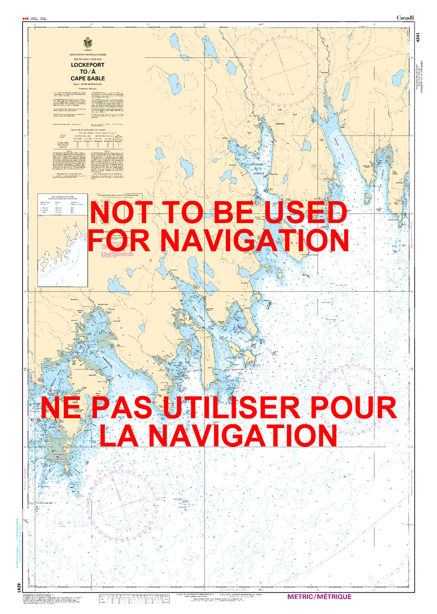
The official Canadian charts provide an excellent range of scales for the whole length of Canada`s coastline as well as the Grat Lakes and comply with Safety of Life at Sea (SOLAS) regulations.PLEASE NOTE: Canadian Hydrographic Service charts are ordered on demand, please allow 1-2 weeks for the order to arrive at Stanfords.
Natural Resources Canada North Circumpolar Region Wall Map – Bilingual – Atlas of Canada 1087 x 921 mm
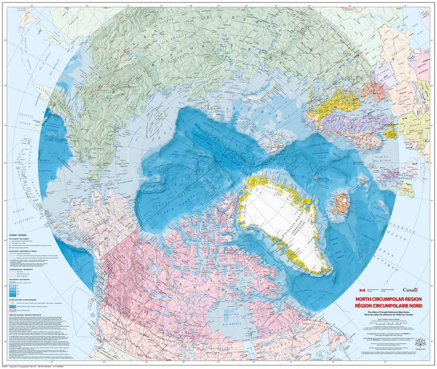
The Arctic Sea and the North Circumpolar Region on a beautiful wall map from Natural Resources Canada, the country’s topographic survey organization. The map covers an area north of 55ยบ of latitude, with countries presented in lovely pastel colours against the surrounding seas which have bathymetric colouring. Relief shading shows the terrain on land and

Hardie Grant Western Australia State 711 x 941 mm
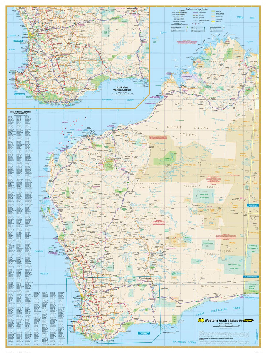
Western Australia state map coverage including an inset with coverage of south west Western Australia at a scale of 1:1,870,000 covering Lancelin & Kalgoorlie-Boulder in the north, Albany in the south & Norseman & Esperance in the east. This map clearly shows dual carriageways, national highways, and other roads, distances between towns, route numbers, towns
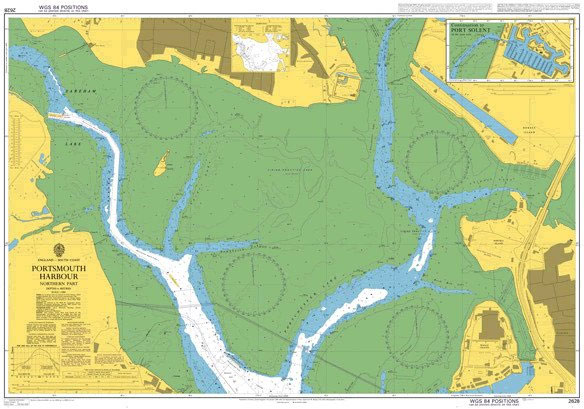
Admiralty Chart 2628 – Portsmouth Harbour, Northern Part
Wonderful 72x105cm sea chart of the waters around Britain and Ireland. The chart shows the depth of the sea, clearly showing the areas which, but for small depth of water, would be land. Flooded lands and sunken islands, the stuff of legendsยฟ Lighthouses are also shown. A decorative map for anyone interested in the sea.
Admiralty Chart 2628 – Portsmouth Harbour Northern Part
Admiralty standard nautical charts comply with Safety of Life at Sea (SOLAS) regulations and are ideal for professional, commercial and recreational use. Charts within the series consist of a range of scales, useful for passage planning, ocean crossings, coastal navigation and entering port.Standard Admiralty charts are folded to fit in a chart table drawer. If
Admiralty Chart 1445 – Port of Ravenna
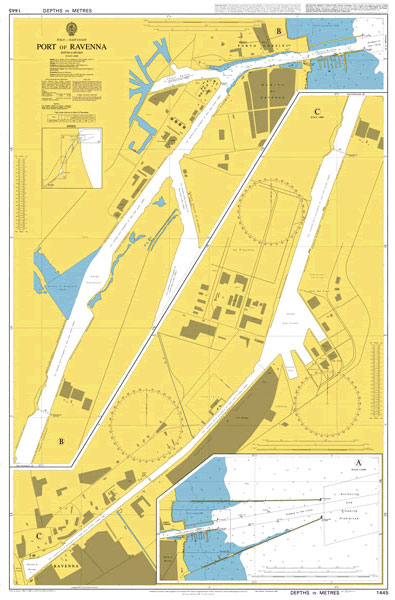
Admiralty standard nautical charts comply with Safety of Life at Sea (SOLAS) regulations and are ideal for professional, commercial and recreational use. Charts within the series consist of a range of scales, useful for passage planning, ocean crossings, coastal navigation and entering port.Standard Admiralty charts are folded to fit in a chart table drawer. If
CHS Chart 4234 – Country Island To Barren Island

The official Canadian charts provide an excellent range of scales for the whole length of Canada`s coastline as well as the Grat Lakes and comply with Safety of Life at Sea (SOLAS) regulations.PLEASE NOTE: Canadian Hydrographic Service charts are ordered on demand, please allow 1-2 weeks for the order to arrive at Stanfords.
Admiralty Chart 1444 – Ancona and Falconara Marittima with Approaches
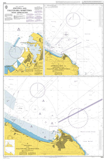
NEW EDITION OUT ON 12/03/2020Admiralty standard nautical charts comply with Safety of Life at Sea (SOLAS) regulations and are ideal for professional, commercial and recreational use. Charts within the series consist of a range of scales, useful for passage planning, ocean crossings, coastal navigation and entering port.Standard Admiralty charts are folded to fit in a
CHS Chart 4235 – Barren Island To Taylors Head
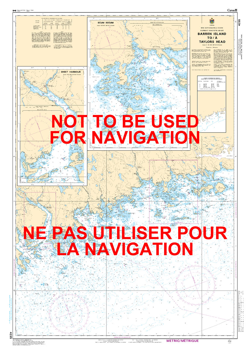
The official Canadian charts provide an excellent range of scales for the whole length of Canada`s coastline as well as the Grat Lakes and comply with Safety of Life at Sea (SOLAS) regulations.PLEASE NOTE: Canadian Hydrographic Service charts are ordered on demand, please allow 1-2 weeks for the order to arrive at Stanfords.
Reg 8.3 Florida Southeast, Lake Worth to Plantation Key
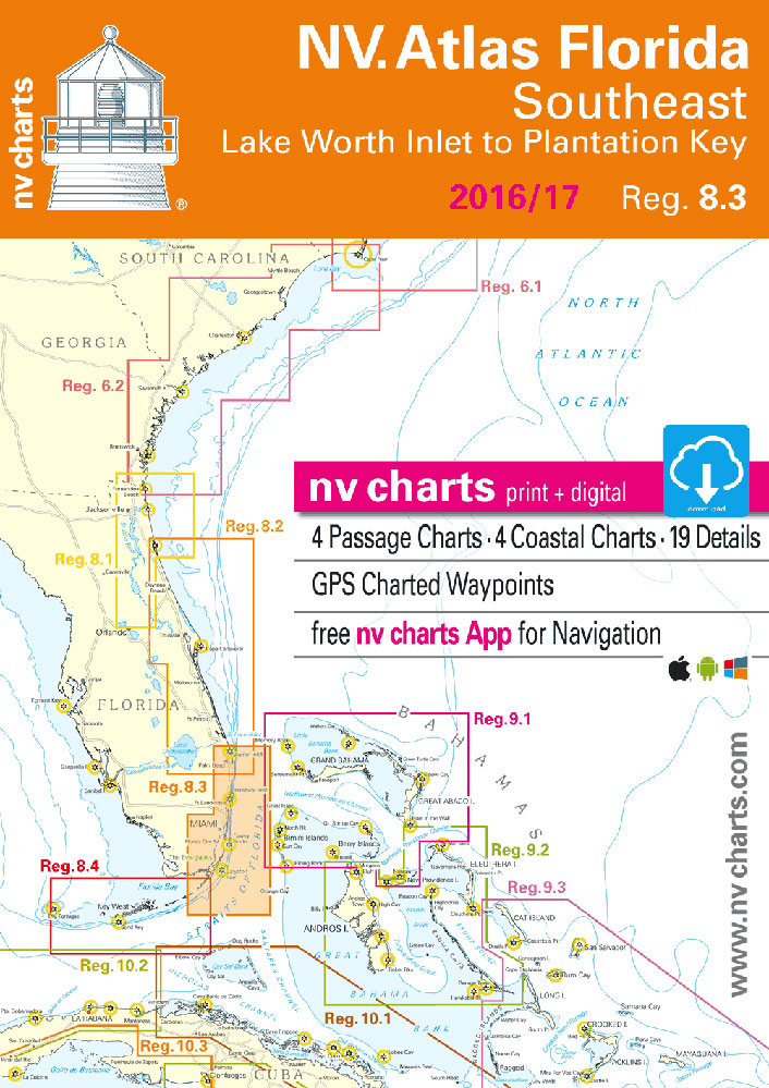
Passage ChartsC0 Caribbean Sea 1: 6,500,000 C1 Florida 1: 1,300,000 C2 Miami to Lake Worth Inlet & Bahama Banks 1: 340,000 C3 Miami to Cape Sable 1: 340,000 C4 Dry Tortugas to Big Pine Key 1: 340,000 Coastal ChartsC 5 Fort Lauderdale to Miami 1: 100,000 C 6 Miami to Key Largo 1: 100,000 C
CHS Chart 4236 – Taylors Head To Shut-In Island
The official Canadian charts provide an excellent range of scales for the whole length of Canada`s coastline as well as the Grat Lakes and comply with Safety of Life at Sea (SOLAS) regulations.PLEASE NOTE: Canadian Hydrographic Service charts are ordered on demand, please allow 1-2 weeks for the order to arrive at Stanfords.
Admiralty Chart AUS171 – Hobart to Norfolk Bay
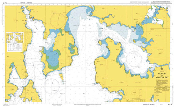
NEW EDITION OUT ON 19/08/2021Admiralty standard nautical charts comply with Safety of Life at Sea (SOLAS) regulations and are ideal for professional, commercial and recreational use. Charts within the series consist of a range of scales, useful for passage planning, ocean crossings, coastal navigation and entering port.Standard Admiralty charts are folded to fit in a
CHS Chart 4237 – Approaches to Halifax Harbour and Sambro Harbour
The official Canadian charts provide an excellent range of scales for the whole length of Canada`s coastline as well as the Grat Lakes and comply with Safety of Life at Sea (SOLAS) regulations.PLEASE NOTE: Canadian Hydrographic Service charts are ordered on demand, please allow 1-2 weeks for the order to arrive at Stanfords.