Category Archives: Travel Guides
SEMAR Chart 352.1A – Cabo de San Lucas, Baja California Sur
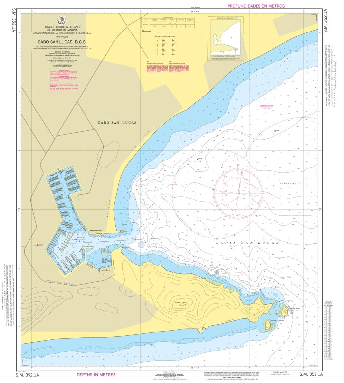
Official Mexican Hydrographic Office charts (SEMAR – Secretarรญa de Marina Armada de Mรฉxico) offer a great range of scales for ports along the Mexico`s Pacific coast. Available to order from Stanfords. Also available: – General and Regional charts of Mexico – Charts for ports along the Gulf of Mexico and the Caribbean coast For more
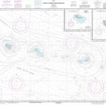
SEMAR Chart 352.2 – San Jose del Cabo, Baja California Sur
Official Mexican Hydrographic Office charts (SEMAR – Secretarรญa de Marina Armada de Mรฉxico) offer a great range of scales for ports along the Mexico`s Pacific coast. Available to order from Stanfords. Also available: – General and Regional charts of Mexico – Charts for ports along the Gulf of Mexico and the Caribbean coast For more
SEMAR Chart 511.2 – Bahias de Manzanillo y Santiago, Colima
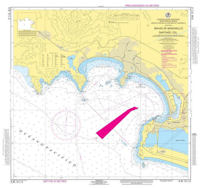
Official Mexican Hydrographic Office charts (SEMAR – Secretarรญa de Marina Armada de Mรฉxico) offer a great range of scales for ports along the Mexico`s Pacific coast. Available to order from Stanfords. Also available: – General and Regional charts of Mexico – Charts for ports along the Gulf of Mexico and the Caribbean coast For more
SEMAR Chart 711 – Brazos Santiago to El Mezquital
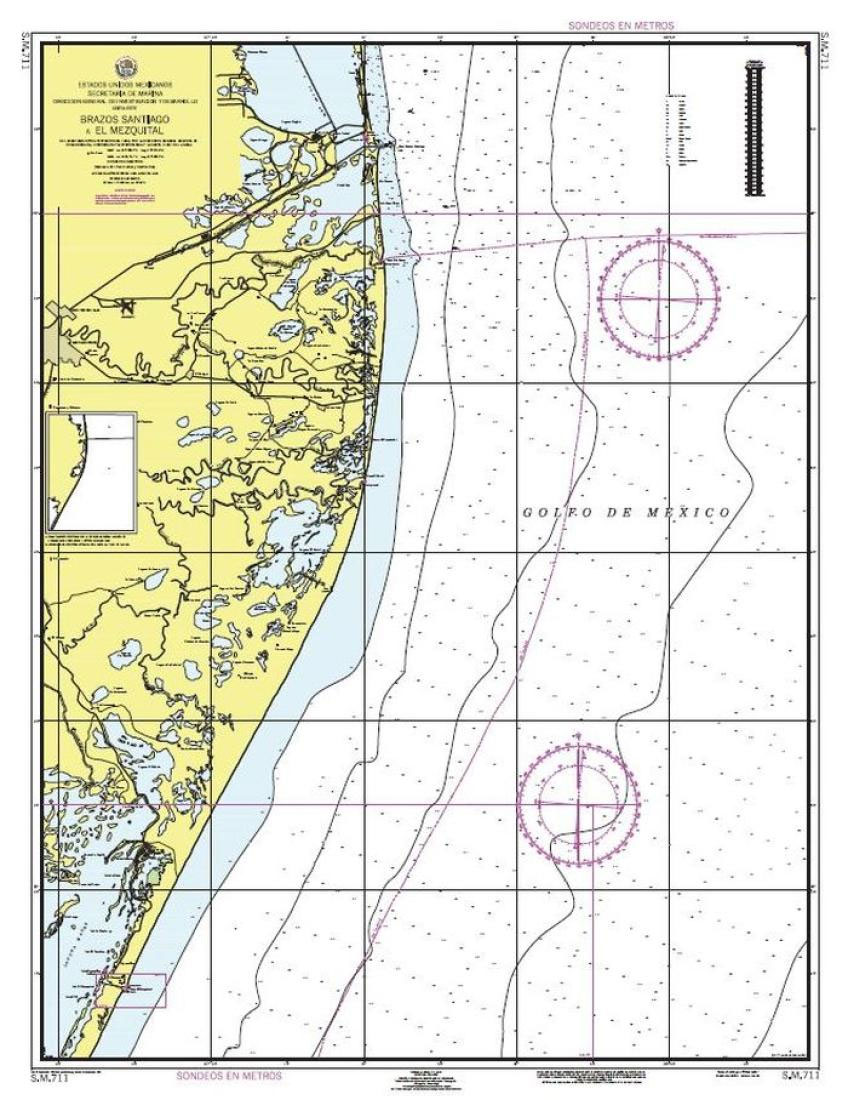
Official Mexican Hydrographic Office charts (SEMAR – Secretarรญa de Marina Armada de Mรฉxico) offer a great range of scales for ports along the Mexico Gulf and Mexico`s Caribbean coast. Available to order from Stanfords. Also available: – General and Regional charts of Mexico – Charts for ports along the Pacific coast of Mexico For more
SEMAR Chart 010 – Ensenada to Mazatlan, Including California Gulf
Official Mexican Hydrographic Office charts (SEMAR – Secretarรญa de Marina Armada de Mรฉxico) for the coast waters of Mexico offer a great range of scales. General and Regional charts cover large areas of the coastline and are great for planning. Available to order from Stanfords. Also available: – Charts for ports along the Pacific coast
SEMAR Chart 231.3 – Santa Rosalia, Baja California Sur
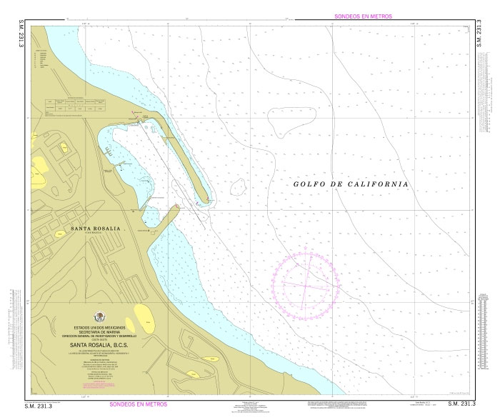
Official Mexican Hydrographic Office charts (SEMAR – Secretarรญa de Marina Armada de Mรฉxico) offer a great range of scales for ports along the Mexico`s Pacific coast. Available to order from Stanfords. Also available: – General and Regional charts of Mexico – Charts for ports along the Gulf of Mexico and the Caribbean coast For more
SEMAR Chart 200 – California Gulf, Northern Part
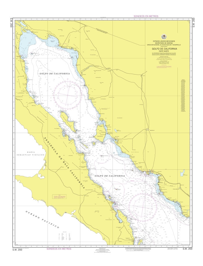
Official Mexican Hydrographic Office charts (SEMAR – Secretarรญa de Marina Armada de Mรฉxico) for the coast waters of Mexico offer a great range of scales. General and Regional charts cover large areas of the coastline and are great for planning. Available to order from Stanfords. Also available: – Charts for ports along the Pacific coast
SEMAR Chart 300 – Punta San Pablo to Mazatlan, including south of California Gulf
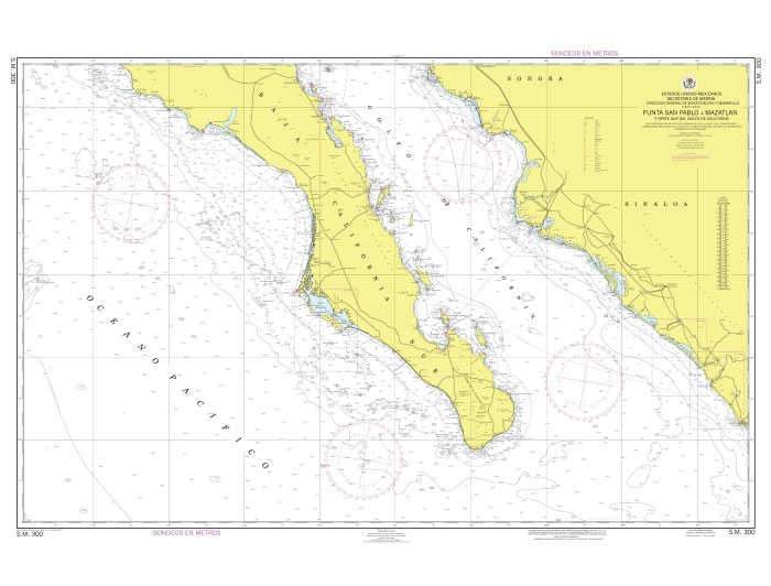
Official Mexican Hydrographic Office charts (SEMAR – Secretarรญa de Marina Armada de Mรฉxico) for the coast waters of Mexico offer a great range of scales. General and Regional charts cover large areas of the coastline and are great for planning. Available to order from Stanfords. Also available: – Charts for ports along the Pacific coast
SEMAR Chart 300B – Cabo San Lazaro to Cabo San Lucas, including south of California Gulf
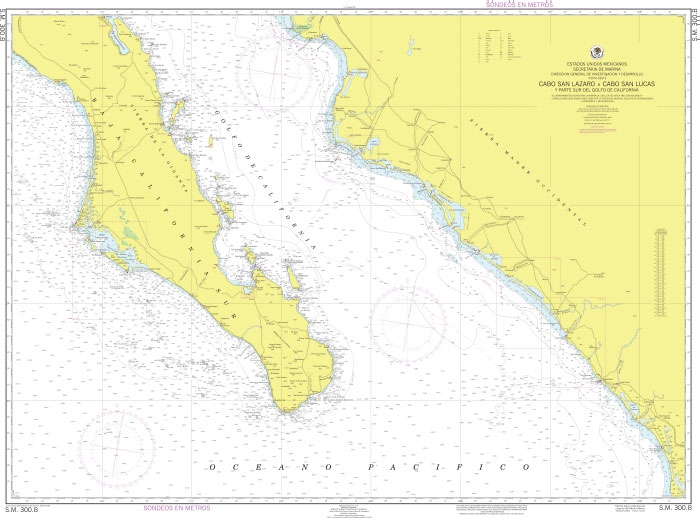
Official Mexican Hydrographic Office charts (SEMAR – Secretarรญa de Marina Armada de Mรฉxico) for the coast waters of Mexico offer a great range of scales. General and Regional charts cover large areas of the coastline and are great for planning. Available to order from Stanfords. Also available: – Charts for ports along the Pacific coast
SEMAR Chart 111.2 – El Rosarito, Baja California
Official Mexican Hydrographic Office charts (SEMAR – Secretarรญa de Marina Armada de Mรฉxico) offer a great range of scales for ports along the Mexico`s Pacific coast. Available to order from Stanfords. Also available: – General and Regional charts of Mexico – Charts for ports along the Gulf of Mexico and the Caribbean coast For more
SEMAR Chart 111.4 – El Sauzal, Baja California
Official Mexican Hydrographic Office charts (SEMAR – Secretarรญa de Marina Armada de Mรฉxico) offer a great range of scales for ports along the Mexico`s Pacific coast. Available to order from Stanfords. Also available: – General and Regional charts of Mexico – Charts for ports along the Gulf of Mexico and the Caribbean coast For more
SEMAR Chart 111.5 – Bahia de Todos Santos, Baja California
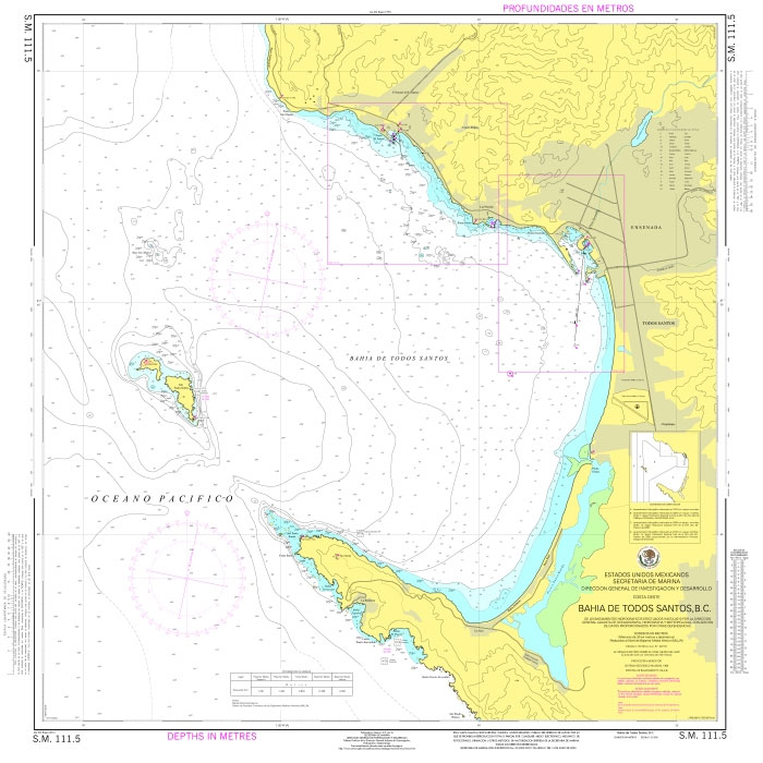
Official Mexican Hydrographic Office charts (SEMAR – Secretarรญa de Marina Armada de Mรฉxico) offer a great range of scales for ports along the Mexico`s Pacific coast. Available to order from Stanfords. Also available: – General and Regional charts of Mexico – Charts for ports along the Gulf of Mexico and the Caribbean coast For more
SEMAR Chart 111.6 – Ensenada, Baja California
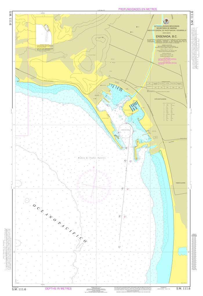
Official Mexican Hydrographic Office charts (SEMAR – Secretarรญa de Marina Armada de Mรฉxico) offer a great range of scales for ports along the Mexico`s Pacific coast. Available to order from Stanfords. Also available: – General and Regional charts of Mexico – Charts for ports along the Gulf of Mexico and the Caribbean coast For more
SEMAR Chart 111.8 – Costa Azul , Baja California
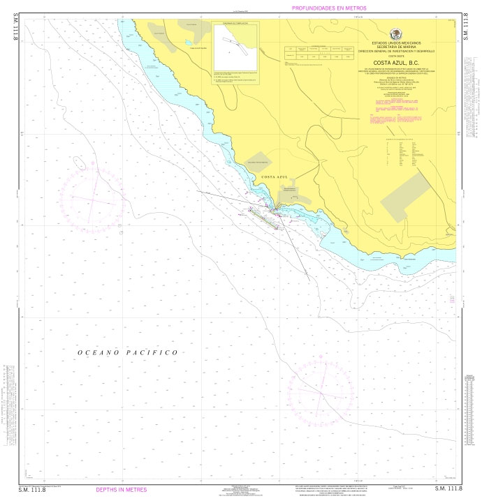
Official Mexican Hydrographic Office charts (SEMAR – Secretarรญa de Marina Armada de Mรฉxico) offer a great range of scales for ports along the Mexico`s Pacific coast. Available to order from Stanfords. Also available: – General and Regional charts of Mexico – Charts for ports along the Gulf of Mexico and the Caribbean coast For more
SEMAR Chart 121.1 – Bahia Santa Maria, Baja California
Official Mexican Hydrographic Office charts (SEMAR – Secretarรญa de Marina Armada de Mรฉxico) offer a great range of scales for ports along the Mexico`s Pacific coast. Available to order from Stanfords. Also available: – General and Regional charts of Mexico – Charts for ports along the Gulf of Mexico and the Caribbean coast For more
SEMAR Chart 133.2 – Bahia Santa Rosalita, Baja California
Official Mexican Hydrographic Office charts (SEMAR – Secretarรญa de Marina Armada de Mรฉxico) offer a great range of scales for ports along the Mexico`s Pacific coast. Available to order from Stanfords. Also available: – General and Regional charts of Mexico – Charts for ports along the Gulf of Mexico and the Caribbean coast For more
SEMAR Chart 141.3 – Laguna Ojo de Liebre, Baja California
Official Mexican Hydrographic Office charts (SEMAR – Secretarรญa de Marina Armada de Mรฉxico) offer a great range of scales for ports along the Mexico`s Pacific coast. Available to order from Stanfords. Also available: – General and Regional charts of Mexico – Charts for ports along the Gulf of Mexico and the Caribbean coast For more
SEMAR Chart 142.6 – Bahia Tortugas, Baja California Sur
Official Mexican Hydrographic Office charts (SEMAR – Secretarรญa de Marina Armada de Mรฉxico) offer a great range of scales for ports along the Mexico`s Pacific coast. Available to order from Stanfords. Also available: – General and Regional charts of Mexico – Charts for ports along the Gulf of Mexico and the Caribbean coast For more
Admiralty Chart 4939 – Canada – British Columbia
NEW EDITION OUT ON 31/12/2020Admiralty standard nautical charts comply with Safety of Life at Sea (SOLAS) regulations and are ideal for professional, commercial and recreational use. Charts within the series consist of a range of scales, useful for passage planning, ocean crossings, coastal navigation and entering port.Standard Admiralty charts are folded to fit in a
SEMAR Chart 211.1 – Bahia San Felipe, Baja California
Official Mexican Hydrographic Office charts (SEMAR – Secretarรญa de Marina Armada de Mรฉxico) offer a great range of scales for ports along the Mexico`s Pacific coast. Available to order from Stanfords. Also available: – General and Regional charts of Mexico – Charts for ports along the Gulf of Mexico and the Caribbean coast For more