Category Archives: Travel Guides
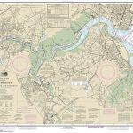
Admiralty Chart AUS237 – Brisbane River The Bar to Lytton Reach
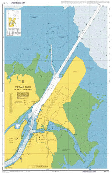
Admiralty standard nautical charts comply with Safety of Life at Sea (SOLAS) regulations and are ideal for professional, commercial and recreational use. Charts within the series consist of a range of scales, useful for passage planning, ocean crossings, coastal navigation and entering port.Standard Admiralty charts are folded to fit in a chart table drawer. If
Admiralty Chart AUS238 – Brisbane River – Lytton Reach to Victoria Bridge
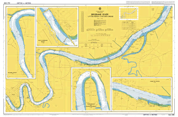
Admiralty standard nautical charts comply with Safety of Life at Sea (SOLAS) regulations and are ideal for professional, commercial and recreational use. Charts within the series consist of a range of scales, useful for passage planning, ocean crossings, coastal navigation and entering port.Standard Admiralty charts are folded to fit in a chart table drawer. If
Admiralty Chart AUS262 – Approaches to Cairns
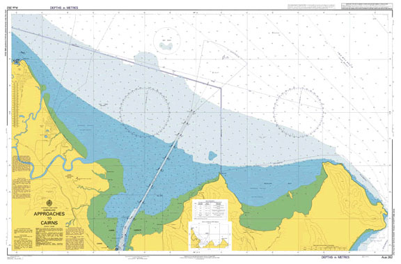
NEW EDITION ON 04/03/2021Admiralty standard nautical charts comply with Safety of Life at Sea (SOLAS) regulations and are ideal for professional, commercial and recreational use. Charts within the series consist of a range of scales, useful for passage planning, ocean crossings, coastal navigation and entering port.Standard Admiralty charts are folded to fit in a chart
Admiralty Chart AUS292 – Adolphus Channel to Prince of Wales Channel
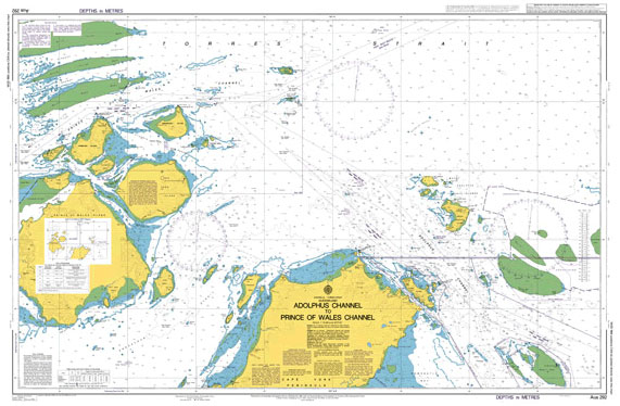
Admiralty standard nautical charts comply with Safety of Life at Sea (SOLAS) regulations and are ideal for professional, commercial and recreational use. Charts within the series consist of a range of scales, useful for passage planning, ocean crossings, coastal navigation and entering port.Standard Admiralty charts are folded to fit in a chart table drawer. If
SEMAR Chart 321.7 – Portulano Loreto, Baja California Sur
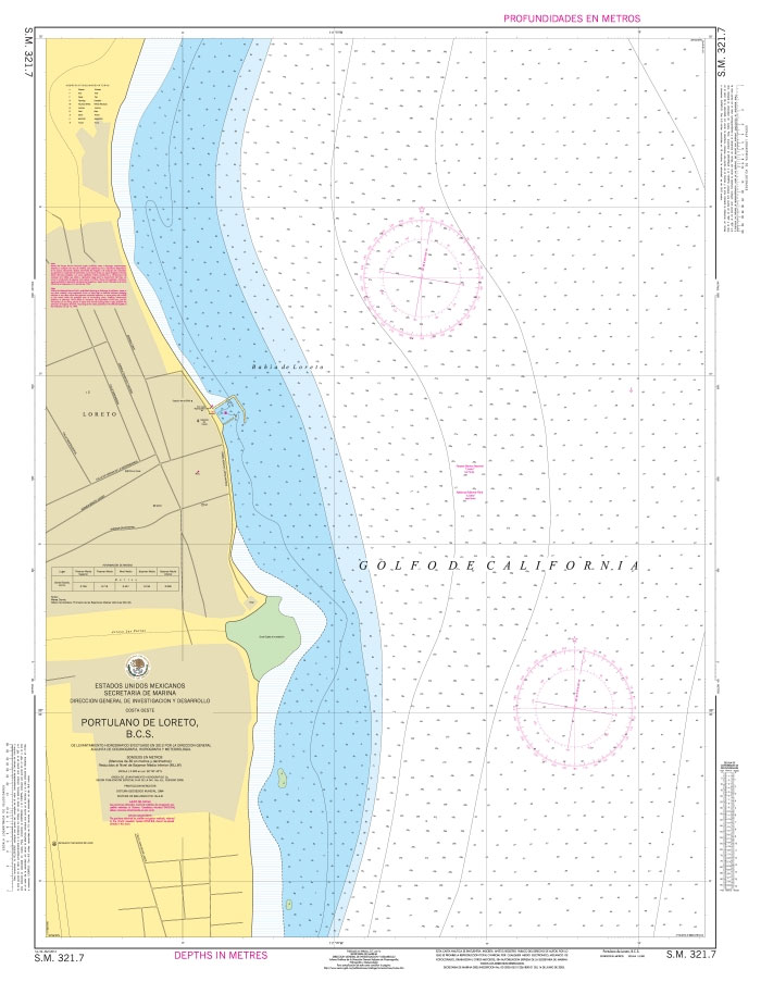
Official Mexican Hydrographic Office charts (SEMAR – Secretarรญa de Marina Armada de Mรฉxico) offer a great range of scales for ports along the Mexico`s Pacific coast. Available to order from Stanfords. Also available: – General and Regional charts of Mexico – Charts for ports along the Gulf of Mexico and the Caribbean coast For more
SEMAR Chart 323.5 – Canal de San Lorenzo, Baja California Sur
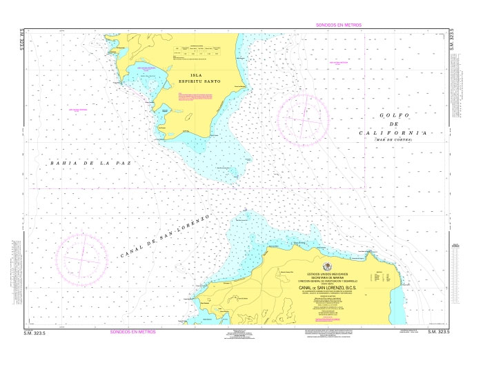
Official Mexican Hydrographic Office charts (SEMAR – Secretarรญa de Marina Armada de Mรฉxico) offer a great range of scales for ports along the Mexico`s Pacific coast. Available to order from Stanfords. Also available: – General and Regional charts of Mexico – Charts for ports along the Gulf of Mexico and the Caribbean coast For more
SEMAR Chart 341.2 – Puerto San Carlos, Baja California Sur
Official Mexican Hydrographic Office charts (SEMAR – Secretarรญa de Marina Armada de Mรฉxico) offer a great range of scales for ports along the Mexico`s Pacific coast. Available to order from Stanfords. Also available: – General and Regional charts of Mexico – Charts for ports along the Gulf of Mexico and the Caribbean coast For more
SEMAR Chart 342 – Cabo San Lazaro to Isla Creciente, Baja California Sur
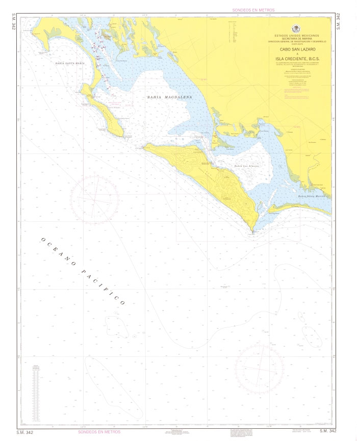
Official Mexican Hydrographic Office charts (SEMAR – Secretarรญa de Marina Armada de Mรฉxico) offer a great range of scales for ports along the Mexico`s Pacific coast. Available to order from Stanfords. Also available: – General and Regional charts of Mexico – Charts for ports along the Gulf of Mexico and the Caribbean coast For more
SEMAR Chart 342.2 – Puerto Cortes, Baja California Sur (Bahia las Almejas)
Official Mexican Hydrographic Office charts (SEMAR – Secretarรญa de Marina Armada de Mรฉxico) offer a great range of scales for ports along the Mexico`s Pacific coast. Available to order from Stanfords. Also available: – General and Regional charts of Mexico – Charts for ports along the Gulf of Mexico and the Caribbean coast For more
SEMAR Chart 352 – Banco Golden Gate to Bahia San Jose del Cabo, Baja California Sur
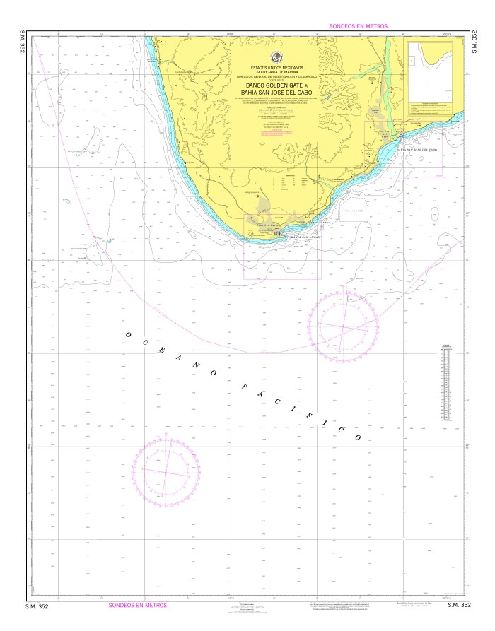
Official Mexican Hydrographic Office charts (SEMAR – Secretarรญa de Marina Armada de Mรฉxico) offer a great range of scales for ports along the Mexico`s Pacific coast. Available to order from Stanfords. Also available: – General and Regional charts of Mexico – Charts for ports along the Gulf of Mexico and the Caribbean coast For more
SEMAR Chart 352.1 – Bahia de San Lucas, Baja California Sur
Official Mexican Hydrographic Office charts (SEMAR – Secretarรญa de Marina Armada de Mรฉxico) offer a great range of scales for ports along the Mexico`s Pacific coast. Available to order from Stanfords. Also available: – General and Regional charts of Mexico – Charts for ports along the Gulf of Mexico and the Caribbean coast For more
SEMAR Chart 352.1A – Cabo de San Lucas, Baja California Sur
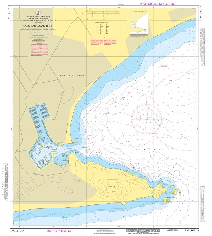
Official Mexican Hydrographic Office charts (SEMAR – Secretarรญa de Marina Armada de Mรฉxico) offer a great range of scales for ports along the Mexico`s Pacific coast. Available to order from Stanfords. Also available: – General and Regional charts of Mexico – Charts for ports along the Gulf of Mexico and the Caribbean coast For more
SEMAR Chart 352.2 – San Jose del Cabo, Baja California Sur
Official Mexican Hydrographic Office charts (SEMAR – Secretarรญa de Marina Armada de Mรฉxico) offer a great range of scales for ports along the Mexico`s Pacific coast. Available to order from Stanfords. Also available: – General and Regional charts of Mexico – Charts for ports along the Gulf of Mexico and the Caribbean coast For more
SEMAR Chart 511.2 – Bahias de Manzanillo y Santiago, Colima
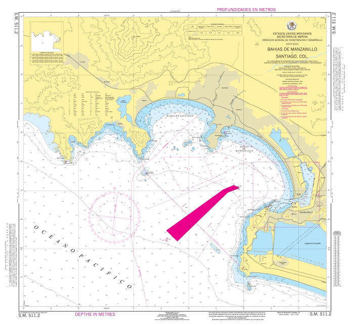
Official Mexican Hydrographic Office charts (SEMAR – Secretarรญa de Marina Armada de Mรฉxico) offer a great range of scales for ports along the Mexico`s Pacific coast. Available to order from Stanfords. Also available: – General and Regional charts of Mexico – Charts for ports along the Gulf of Mexico and the Caribbean coast For more
SEMAR Chart 711 – Brazos Santiago to El Mezquital
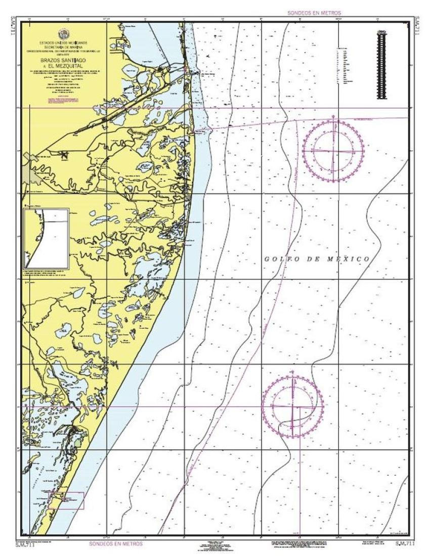
Official Mexican Hydrographic Office charts (SEMAR – Secretarรญa de Marina Armada de Mรฉxico) offer a great range of scales for ports along the Mexico Gulf and Mexico`s Caribbean coast. Available to order from Stanfords. Also available: – General and Regional charts of Mexico – Charts for ports along the Pacific coast of Mexico For more
Admiralty Chart 4648 – South Island
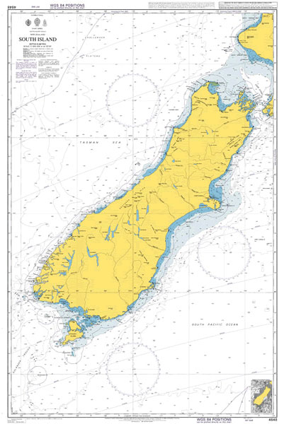
NEW EDITION OUT ON 30/07/2020Admiralty standard nautical charts comply with Safety of Life at Sea (SOLAS) regulations and are ideal for professional, commercial and recreational use. Charts within the series consist of a range of scales, useful for passage planning, ocean crossings, coastal navigation and entering port.Standard Admiralty charts are folded to fit in a
SEMAR Chart 232.1 – Bahia Santa Ines, Baja California Sur
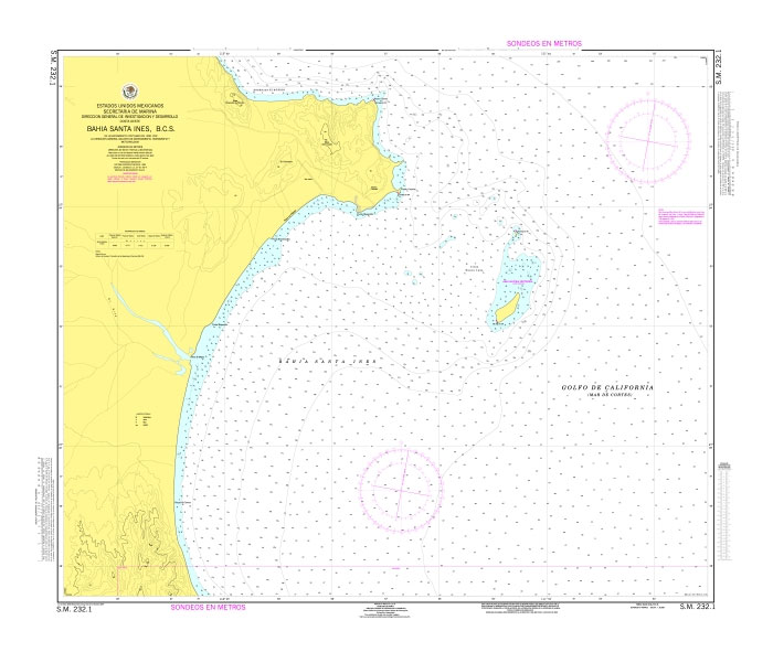
Official Mexican Hydrographic Office charts (SEMAR – Secretarรญa de Marina Armada de Mรฉxico) offer a great range of scales for ports along the Mexico`s Pacific coast. Available to order from Stanfords. Also available: – General and Regional charts of Mexico – Charts for ports along the Gulf of Mexico and the Caribbean coast For more
Admiralty Chart 4640 – North Island
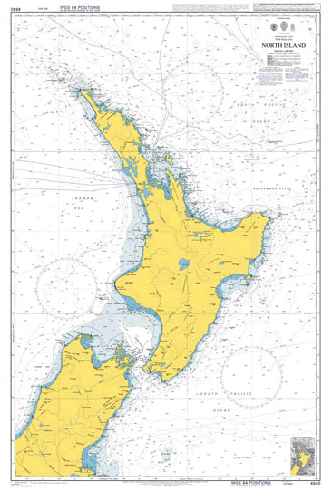
NEW EDITION OUT ON 30/07/2020Admiralty standard nautical charts comply with Safety of Life at Sea (SOLAS) regulations and are ideal for professional, commercial and recreational use. Charts within the series consist of a range of scales, useful for passage planning, ocean crossings, coastal navigation and entering port.Standard Admiralty charts are folded to fit in a
SEMAR Chart 232.2 – Mulege, Baja California Sur
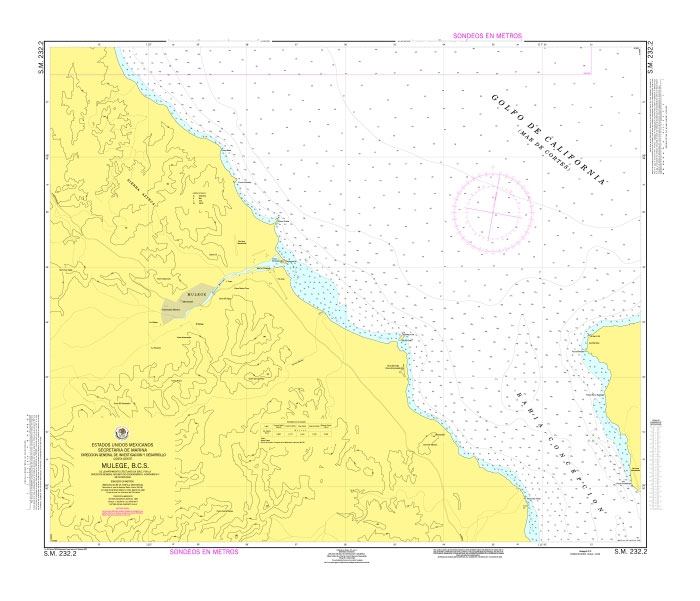
Official Mexican Hydrographic Office charts (SEMAR – Secretarรญa de Marina Armada de Mรฉxico) offer a great range of scales for ports along the Mexico`s Pacific coast. Available to order from Stanfords. Also available: – General and Regional charts of Mexico – Charts for ports along the Gulf of Mexico and the Caribbean coast For more
Admiralty Chart NZ5323 – Auckland Harbour West
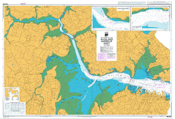
Admiralty standard nautical charts comply with Safety of Life at Sea (SOLAS) regulations and are ideal for professional, commercial and recreational use. Charts within the series consist of a range of scales, useful for passage planning, ocean crossings, coastal navigation and entering port.Standard Admiralty charts are folded to fit in a chart table drawer. If