Category Archives: Travel Guides
Clarice Bean: Think Like an Elf

Join the one and only Clarice Bean and `Think Like an Elf` in this irresistible and spectacularly sparkling Christmas story from the inimitable Lauren Child. Clarice Bean usually looks forward to Christmas.Except this year it is going to be a quiet-ish Christmas in her house, which doesn`t feel right because Christmas is all about noisiness
Living Planet: The Web of Life on Earth

A new, fully updated narrative edition of David Attenborough`s seminal biography of our world, `The Living Planet`.Nowhere on our planet is devoid of life. Plants and animals thrive or survive within every extreme of climate and habitat that it offers. Single species, and often whole communities adapt to make the most of ice cap and
Cloud Cuckoo Land
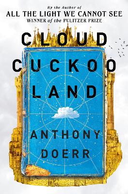
From the Pulitzer Prize-winning author of `All the Light We Cannot See` comes a triumph of imagination and compassion, a soaring story of resilience, hope – and a book. “Sets him comfortably alongside Tolkien and David Mitchell, and he is a much more elegant writer than two of those … `Cloud Cuckoo Land` is an
Birmingham & the Heart of England Collins Nicholson Waterways Guide 3
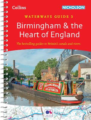
The bestselling guides to Britain`s canals and rivers for 50 years. For all users of the inland waterways. This established, popular and practical guide covers the canals and waterways around Birmingham and central England. Covered in this guide are: Ashby Canal; Birmingham Canal Navigations (Main Line); Birmingham & Fazeley Canal; Coventry Canal; Erewash Canal; Grand
Norfolk Broads Collins Nicholson Waterways Guide
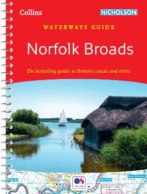
Norfolk Broads Waterways Guide published by Collins under their Nicholson imprint in a series of spiral-bound guides to Britain’s inland waterways. The guide covers the Broads National Park, including the Norfolk and Suffolk Broads, and the rivers Waveney, Yare, Bure, Ant, Thurne and Chet. The Norfolk Broads guide has a much bigger introductory section than
A-Z Birmingham Hidden Walks: Discover 20 routes in and around the city
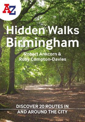
Discover hidden gems around Birmingham. Featuring 20 walking routes in and around the city, including lesser-known circuits and details on popular walks. Accompanied by guided walking instructions and written by local experts, A-Z Birmingham Hidden Walks is the perfect way to explore the city in a new light. Small enough to fit in a bag
A-Z Edinburgh Hidden Walks: Discover 20 routes in and around the city
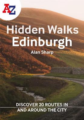
Discover hidden gems around Edinburgh. Featuring 20 walking routes in and around the city, including lesser-known circuits and details on popular walks. Accompanied by guided walking instructions and written by a local expert, A-Z Edinburgh Hidden Walks is the perfect way to explore the city in a new light. Small enough to fit in a
A-Z Oxford Hidden Walks: Discover 20 routes in and around the city
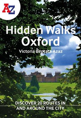
Discover hidden gems around Oxford. Featuring 20 walking routes in and around the city, including lesser-known circuits and details on popular walks. Accompanied by guided walking instructions and written by a local expert, A-Z Oxford Hidden Walks is the perfect way to explore the city in a new light. Small enough to fit in a
A-Z York Hidden Walks: Discover 20 routes in and around the city
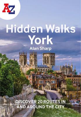
Discover hidden gems around York. Featuring 20 walking routes in and around the city, including lesser-known circuits and details on popular walks. Accompanied by guided walking instructions and written by a local expert, A-Z York Hidden Walks is the perfect way to explore the city in a new light. Small enough to fit in a
Britain and Northern Ireland Collins Essential Road Atlas 2022 A4 SPIRAL-BOUND
This A4 road atlas with popular lie-flat spiral binding features clear, detailed road mapping, at a scale of 3.2 miles to 1 inch (1:200,000) for England, Wales and Southern Scotland and at 4.2 miles to 1 inch (1:266,000) in Northern Scotland, with land height shown by attractive layer colouring. Main features* Route planning section including
A-Z London Hidden Walks: Discover 20 routes in and around the city

Discover hidden gems around London. Featuring 20 walking routes in and around the city, including lesser-known circuits and details on popular walks. Accompanied by guided walking instructions and written by a local expert, A-Z London Hidden Walks is the perfect way to explore the city in a new light. Small enough to fit in a
Britain and Ireland Collins Handy Road Atlas 2022 A5 SPIRAL-BOUND
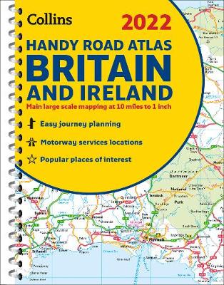
This easy-to-use, handy A5 sized road atlas with popular lie-flat spiral binding features extremely clear route planning maps of Britain and Ireland and fits neatly into your glove box, briefcase or bag. The atlas has been fully updated. The maps of Britain are at 9.9 miles to 1 inch (1:625,000) and the whole of Ireland
A-Z Bristol & Bath Hidden Walks: Discover 20 routes in and around the cities
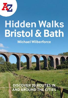
Discover hidden gems in and around Bristol and Bath. Featuring 20 walking routes, including lesser-known circuits and details on popular walks. Accompanied by guided walking instructions and written by a local expert, A-Z Bristol & Bath Hidden Walks is the perfect way to explore the city in a new light. Small enough to fit in
Britain Collins Road Map 2023
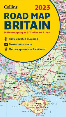
Full colour double-sided map of Great Britain at 8.7 miles to 1 inch (1:550,000), with clear, detailed road network and administrative areas shown in colour.With its political colouring of counties and unitary authorities it is ideal for business users but it is also perfect for tourists as a route planning map.Main features* Fully updated* Counties
Bournemouth A-Z Street Atlas
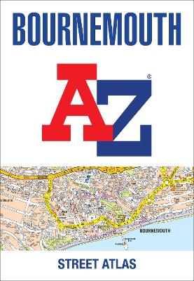
This street atlas of Bournemouth is a full colour paperback featuring 63 pages of continuous street mapping to include: PooleChristchurchBlashfordRingwoodWimborne MinsterFerndownBournemouth AirportBarton on SeaMilford on SeaLymington In addition, there are seperate coverages of Verwood, Lyndhurst and Brockenhurst, an inset of Three Legged Cross and large scale town centre maps of Bournemouth and Poole. Postcode districts,
Yorkshire Dales Park Rangers Favourite Walks
Walking guide to the Yorkshire Dales National Park, with 20 best routes chosen by the park rangers. Each walk varies in length from 2 to 10 km and can be completed in less than 4 hours. 20 best routes chosen and written by National Park rangers Walks from 2 to 10kmDetailed description for each walk
Notes from a Summer Cottage: The Intimate Life of the Outside World
“I went for a walk around the garden. A great tit warbled above a patch of coltsfoot. I felt a thousand discoveries awaited…” `Notes from a Summer Cottage` by Nina Burton is a beautifully written nature memoir about the time spent renovating her late mother`s cottage in the Swedish countryside, and all the species that
Fife Collins Pocket Map
Handy little full colour map of the coastal Kingdom of Fife. Detailed mapping and tourist information from Dundee in the North to Edinburgh in the south and from Fife coast in the east to Stirling in the west. Ancestral home of Scottish monarchs, world-famous for its golf and some of Scotland`s best scenic attractions, the
Cheltenham A-Z Pocket Street Map
This up-to-date detailed A-Z street map includes more than 2,000 streets in and around Cheltenham. As well as the Cheltenham Racecourse, the other areas covered include Badgeworth, The Reddings, Up Hatherley, Charlton Kings, Montpellier, Battledown, Hayden, Swindon and Prestbury. The large-scale street map includes the following:* Places of interest* Postcode districts, one-way streets and car
Manchester A-Z Pocket Street Map
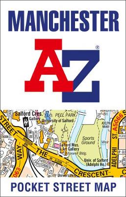
This up-to-date detailed A-Z street map includes more than 4,500 streets in and around Manchester. As well as the Northern Quarter and Spinningfields, the other areas covered include Moss Side, Ordsall, Weaste, Salford, Seedley, Lower Kersal, Strangeways, Miles Platting and West Gorton. The large-scale street map includes the following:* Places of interest* Postcode districts, one-way