Category Archives: Travel Guides
SHOM Chart 7276 – Abords de Valencia
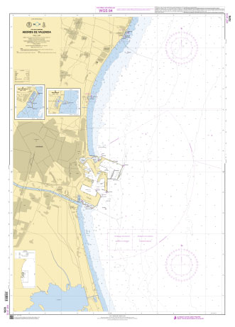
PLEASE NOTE: the chart will be ordered for you if not currently in stock. Please allow 1-2 weeks for the chart to reach Stanfords. SHOM charts are produced by the French Government and comply with Safety of Life at Sea (SOLAS) regulations. They are ideal for professional, commercial and recreational use. Charts within the series
CHS Chart 5365 – Cap du Prince-De-Galles to Davies Island
The official Canadian charts provide an excellent range of scales for the whole length of Canada`s coastline as well as the Grat Lakes and comply with Safety of Life at Sea (SOLAS) regulations. PLEASE NOTE: Canadian Hydrographic Service charts are ordered on demand, please allow 1-2 weeks for the order to arrive at Stanfords.
NZ22 Kermadec Islands to East Cape

Nautical charts for New Zealand, created by Land Information New Zealand (LINZ), are printed on demand at Stanfords after your order is placed and processed. They provide a detailed coverage of the coastline with a varied range of scales – from overall route planning to detailed harbour charts.Notices to Mariners are available via this link.Source:
CHS Chart 5399 – Egg Island to Eskimo Point
The official Canadian charts provide an excellent range of scales for the whole length of Canada`s coastline as well as the Grat Lakes and comply with Safety of Life at Sea (SOLAS) regulations. PLEASE NOTE: Canadian Hydrographic Service charts are ordered on demand, please allow 1-2 weeks for the order to arrive at Stanfords.
CHS Chart 5400 – Cape Churchill to Egg River

The official Canadian charts provide an excellent range of scales for the whole length of Canada`s coastline as well as the Grat Lakes and comply with Safety of Life at Sea (SOLAS) regulations. PLEASE NOTE: Canadian Hydrographic Service charts are ordered on demand, please allow 1-2 weeks for the order to arrive at Stanfords.
CHS Chart 7220 – Lancaster Sound, Eastern Approaches
The official Canadian charts provide an excellent range of scales for the whole length of Canada`s coastline as well as the Grat Lakes and comply with Safety of Life at Sea (SOLAS) regulations. PLEASE NOTE: Canadian Hydrographic Service charts are ordered on demand, please allow 1-2 weeks for the order to arrive at Stanfords.
CHS Chart 7302 – Lady Ann Strait to Smith Sound
The official Canadian charts provide an excellent range of scales for the whole length of Canada`s coastline as well as the Grat Lakes and comply with Safety of Life at Sea (SOLAS) regulations. PLEASE NOTE: Canadian Hydrographic Service charts are ordered on demand, please allow 1-2 weeks for the order to arrive at Stanfords.
CHS Chart 7304 – Lincoln Sea
The official Canadian charts provide an excellent range of scales for the whole length of Canada`s coastline as well as the Grat Lakes and comply with Safety of Life at Sea (SOLAS) regulations. PLEASE NOTE: Canadian Hydrographic Service charts are ordered on demand, please allow 1-2 weeks for the order to arrive at Stanfords.
CHS Chart 7502 – Gulf of Boothia and Committee Bay
The official Canadian charts provide an excellent range of scales for the whole length of Canada`s coastline as well as the Grat Lakes and comply with Safety of Life at Sea (SOLAS) regulations. PLEASE NOTE: Canadian Hydrographic Service charts are ordered on demand, please allow 1-2 weeks for the order to arrive at Stanfords.
CHS Chart 7573 – M`Clintock Channel, Larsen Sound and Franklin Strait
The official Canadian charts provide an excellent range of scales for the whole length of Canada`s coastline as well as the Grat Lakes and comply with Safety of Life at Sea (SOLAS) regulations. PLEASE NOTE: Canadian Hydrographic Service charts are ordered on demand, please allow 1-2 weeks for the order to arrive at Stanfords.
CHS Chart 7621 – Amundsen Gulf
Includes a plan for Sachs Harbour at 1:50,000.The official Canadian charts provide an excellent range of scales for the whole length of Canada`s coastline as well as the Grat Lakes and comply with Safety of Life at Sea (SOLAS) regulations. PLEASE NOTE: Canadian Hydrographic Service charts are ordered on demand, please allow 1-2 weeks for
CHS Chart 7051 – Cumberland Sound
The official Canadian charts provide an excellent range of scales for the whole length of Canada`s coastline as well as the Grat Lakes and comply with Safety of Life at Sea (SOLAS) regulations. PLEASE NOTE: Canadian Hydrographic Service charts are ordered on demand, please allow 1-2 weeks for the order to arrive at Stanfords.
CHS Chart 7832 – Eglington Island to Cape Kellett
The official Canadian charts provide an excellent range of scales for the whole length of Canada`s coastline as well as the Grat Lakes and comply with Safety of Life at Sea (SOLAS) regulations. PLEASE NOTE: Canadian Hydrographic Service charts are ordered on demand, please allow 1-2 weeks for the order to arrive at Stanfords.
CHS Chart 7052 – Cape Mercy to Kangeeak Point
The official Canadian charts provide an excellent range of scales for the whole length of Canada`s coastline as well as the Grat Lakes and comply with Safety of Life at Sea (SOLAS) regulations. PLEASE NOTE: Canadian Hydrographic Service charts are ordered on demand, please allow 1-2 weeks for the order to arrive at Stanfords.
CHS Chart 7950 – Jones Sound, Norwegian Bay and Queens Channel
The official Canadian charts provide an excellent range of scales for the whole length of Canada`s coastline as well as the Grat Lakes and comply with Safety of Life at Sea (SOLAS) regulations. PLEASE NOTE: Canadian Hydrographic Service charts are ordered on demand, please allow 1-2 weeks for the order to arrive at Stanfords.
CHS Chart 7053 – Paallavvik to Kangiqtugaapik
The official Canadian charts provide an excellent range of scales for the whole length of Canada`s coastline as well as the Grat Lakes and comply with Safety of Life at Sea (SOLAS) regulations. PLEASE NOTE: Canadian Hydrographic Service charts are ordered on demand, please allow 1-2 weeks for the order to arrive at Stanfords.
CHS Chart 7951 – Bathurst Island to Borden Island
The official Canadian charts provide an excellent range of scales for the whole length of Canada`s coastline as well as the Grat Lakes and comply with Safety of Life at Sea (SOLAS) regulations. PLEASE NOTE: Canadian Hydrographic Service charts are ordered on demand, please allow 1-2 weeks for the order to arrive at Stanfords.
CHS Chart 7065 – Mill Island to Winter Island
The official Canadian charts provide an excellent range of scales for the whole length of Canada`s coastline as well as the Grat Lakes and comply with Safety of Life at Sea (SOLAS) regulations. PLEASE NOTE: Canadian Hydrographic Service charts are ordered on demand, please allow 1-2 weeks for the order to arrive at Stanfords.
CHS Chart 7952 – Cape Manning to Borden Island
The official Canadian charts provide an excellent range of scales for the whole length of Canada`s coastline as well as the Grat Lakes and comply with Safety of Life at Sea (SOLAS) regulations. PLEASE NOTE: Canadian Hydrographic Service charts are ordered on demand, please allow 1-2 weeks for the order to arrive at Stanfords.
CHS Chart 7066 – Cape Dorchester to Spicer Islands
The official Canadian charts provide an excellent range of scales for the whole length of Canada`s coastline as well as the Grat Lakes and comply with Safety of Life at Sea (SOLAS) regulations. PLEASE NOTE: Canadian Hydrographic Service charts are ordered on demand, please allow 1-2 weeks for the order to arrive at Stanfords.