Category Archives: Travel Guides
NZ14902 McMurdo Station and Scott Base
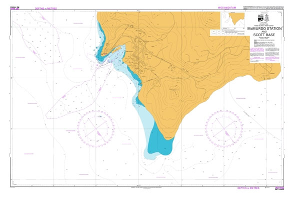
Nautical charts for New Zealand, created by Land Information New Zealand (LINZ), are printed on demand at Stanfords after your order is placed and processed. They provide a detailed coverage of the coastline with a varied range of scales – from overall route planning to detailed harbour charts.Notices to Mariners are available via this link.Source:
NZ7142 Greymouth Harbour and Approaches
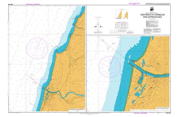
Plan included:Greymouth Harbour 1:10,000Nautical charts for New Zealand, created by Land Information New Zealand (LINZ), are printed on demand at Stanfords after your order is placed and processed. They provide a detailed coverage of the coastline with a varied range of scales – from overall route planning to detailed harbour charts.Notices to Mariners are available
NZ2687 Pitt Strait
Plans included:Owenga 1:10,000Flower Pot 1:10,000Nautical charts for New Zealand, created by Land Information New Zealand (LINZ), are printed on demand at Stanfords after your order is placed and processed. They provide a detailed coverage of the coastline with a varied range of scales – from overall route planning to detailed harbour charts.Notices to Mariners are
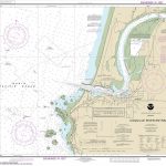
NZ7132 Approaches to Westport
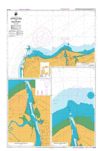
Plan included:Westport Harbour – South 1:7,000Westport Harbour – North 1:7,000Nautical charts for New Zealand, created by Land Information New Zealand (LINZ), are printed on demand at Stanfords after your order is placed and processed. They provide a detailed coverage of the coastline with a varied range of scales – from overall route planning to detailed
NZ6144 Abel Tasman
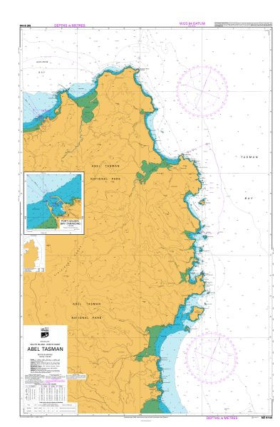
Plan included:Port Golden Bay (Tarakohe) 1:10,000Nautical charts for New Zealand, created by Land Information New Zealand (LINZ), are printed on demand at Stanfords after your order is placed and processed. They provide a detailed coverage of the coastline with a varied range of scales – from overall route planning to detailed harbour charts.Notices to Mariners
NZ2863 Approaches to Waitangi

Plans included:Port Hutt 1:10,000Ocean Bay 1:12,500Nautical charts for New Zealand, created by Land Information New Zealand (LINZ), are printed on demand at Stanfords after your order is placed and processed. They provide a detailed coverage of the coastline with a varied range of scales – from overall route planning to detailed harbour charts.Notices to Mariners
NZ2867 Pitt Strait
Plans included:Owenga 1:10,000Flower Pot 1:10,000Nautical charts for New Zealand, created by Land Information New Zealand (LINZ), are printed on demand at Stanfords after your order is placed and processed. They provide a detailed coverage of the coastline with a varied range of scales – from overall route planning to detailed harbour charts.Notices to Mariners are
NZ2411 Snares Islands / Tini Heke and Solander Island (Hautere)
Plans included:Solander Island (Hautere) 1:30,000Snares Islands / Tini Heke 1:30,000Ho Ho Bay 1:7,500Nautical charts for New Zealand, created by Land Information New Zealand (LINZ), are printed on demand at Stanfords after your order is placed and processed. They provide a detailed coverage of the coastline with a varied range of scales – from overall route
NZ6912 Plans in Stewart Island / Rakiura
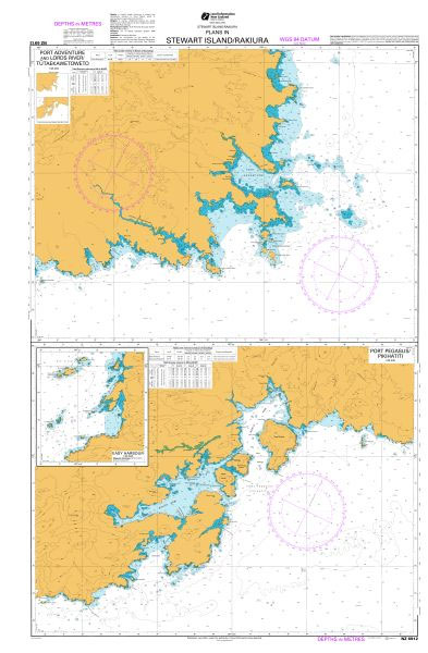
Plans included:Port Pegasus / Pikihatiti 1:40,000Easy Harbour 1:40,000Port Adventure and Lords River / Tutaekawetoweto 1:40,000Nautical charts for New Zealand, created by Land Information New Zealand (LINZ), are printed on demand at Stanfords after your order is placed and processed. They provide a detailed coverage of the coastline with a varied range of scales – from
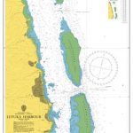
NZ6825 Paterson Inlet / Whaka a Te Wera
Plans included:Horseshoe Bay to Ulva Island 1:15,000Continuation West to Prices Inlet 1:15,000Nautical charts for New Zealand, created by Land Information New Zealand (LINZ), are printed on demand at Stanfords after your order is placed and processed. They provide a detailed coverage of the coastline with a varied range of scales – from overall route planning
NZ7654 Chalky and Preservation Inlets
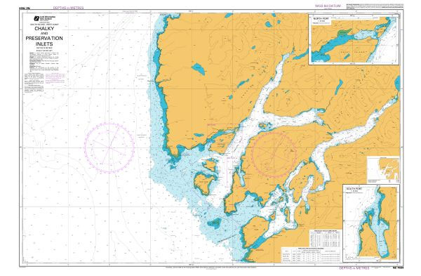
Plans included:South Port 1:25,000North Port 1:25,000Nautical charts for New Zealand, created by Land Information New Zealand (LINZ), are printed on demand at Stanfords after your order is placed and processed. They provide a detailed coverage of the coastline with a varied range of scales – from overall route planning to detailed harbour charts.Notices to Mariners
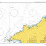
NZ72 Cape Foulwind to Heretaniwha Point
Nautical charts for New Zealand, created by Land Information New Zealand (LINZ), are printed on demand at Stanfords after your order is placed and processed. They provide a detailed coverage of the coastline with a varied range of scales – from overall route planning to detailed harbour charts.Notices to Mariners are available via this link.Source:
NZ7653 Breaksea Sound and Dusky Sound
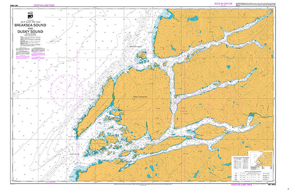
Nautical charts for New Zealand, created by Land Information New Zealand (LINZ), are printed on demand at Stanfords after your order is placed and processed. They provide a detailed coverage of the coastline with a varied range of scales – from overall route planning to detailed harbour charts.Notices to Mariners are available via this link.Source:
NZ71 Greymouth to Kahurangi Point
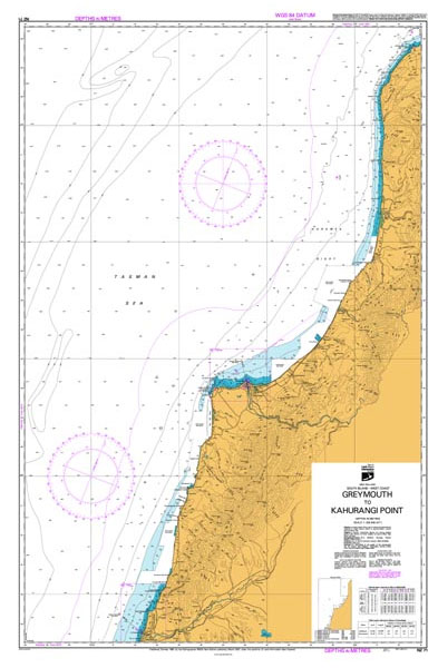
Nautical charts for New Zealand, created by Land Information New Zealand (LINZ), are printed on demand at Stanfords after your order is placed and processed. They provide a detailed coverage of the coastline with a varied range of scales – from overall route planning to detailed harbour charts.Notices to Mariners are available via this link.Source:
NZ7655 Breaksea Sound
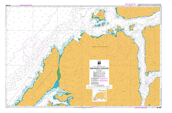
Nautical charts for New Zealand, created by Land Information New Zealand (LINZ), are printed on demand at Stanfords after your order is placed and processed. They provide a detailed coverage of the coastline with a varied range of scales – from overall route planning to detailed harbour charts.Notices to Mariners are available via this link.Source:
NZ268 Chatham Islands
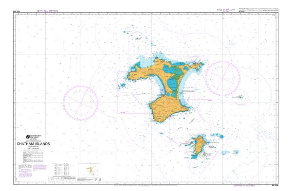
Nautical charts for New Zealand, created by Land Information New Zealand (LINZ), are printed on demand at Stanfords after your order is placed and processed. They provide a detailed coverage of the coastline with a varied range of scales – from overall route planning to detailed harbour charts.Notices to Mariners are available via this link.Source:
NZ7656 Dusky Sound
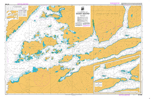
Plan included:Continuation of Dusky Sound 1:25,000Nautical charts for New Zealand, created by Land Information New Zealand (LINZ), are printed on demand at Stanfords after your order is placed and processed. They provide a detailed coverage of the coastline with a varied range of scales – from overall route planning to detailed harbour charts.Notices to Mariners
NZ3111 Campell Island / Motu Ihupuku, Bounty Islands and the Antipodes Island Group
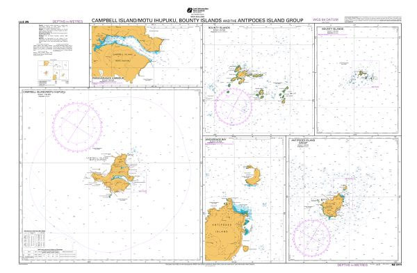
Plans included:Campbell Island/Motu Ihupuku 1:150,000Bounty Islands 1:100,000Antipodes Island Group 1:100,000Perseverance Harbour 1:50,000Bounty Islands 1:25,000Anchorage Bay 1:25,000Nautical charts for New Zealand, created by Land Information New Zealand (LINZ), are printed on demand at Stanfords after your order is placed and processed. They provide a detailed coverage of the coastline with a varied range of scales –
NZ7624 Charles Sound to Dagg Sound
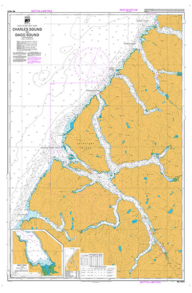
Plan included:Deep Cove 1:10,000Nautical charts for New Zealand, created by Land Information New Zealand (LINZ), are printed on demand at Stanfords after your order is placed and processed. They provide a detailed coverage of the coastline with a varied range of scales – from overall route planning to detailed harbour charts.Notices to Mariners are available
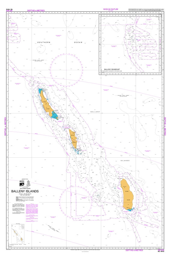
NZ14912 Balleny Islands

Nautical charts for New Zealand, created by Land Information New Zealand (LINZ), are printed on demand at Stanfords after your order is placed and processed. They provide a detailed coverage of the coastline with a varied range of scales – from overall route planning to detailed harbour charts.Notices to Mariners are available via this link.Source: