Category Archives: Travel Guides
Thames Estuary, Rochester & Southend-on-Sea OS Landranger Map 178 (paper)
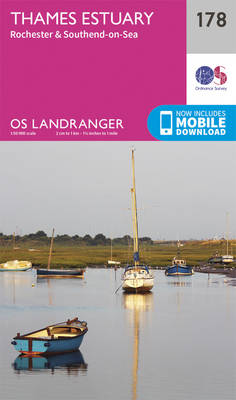
Thames Estuary with Rochester and Southend-on-Sea, including a section of the North Downs Way / E2 European Long-Distance Path, on a paper version of map No. 178 from the Ordnance Survey’s Landranger series at 1:50,000, with contoured and GPS compatible topographic mapping plus tourist information.MOBILE DOWNLOADS: As well as the physical edition of the map,
Canterbury, East Kent, Dover & Margate OS Landranger Map 179 (paper)
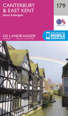
Eastern Kent with Canterbury, Dover and Margate, including sections of the North Downs Way and the E2 and E9 European Long-Distance Paths, on a paper version of map No. 179 from the Ordnance Survey’s Landranger series at 1:50,000, with contoured and GPS compatible topographic mapping plus tourist information.MOBILE DOWNLOADS: As well as the physical edition
Barnstaple, Ilfracombe, Lynton & Bideford OS Landranger Map 180 (paper)
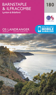
Barnstaple and Ilfracombe area, including the western part of the Exmoor National Park and a section of the South West Coast Path, on a paper version of map No. 180 from the Ordnance Survey’s Landranger series at 1:50,000, with contoured and GPS compatible topographic mapping plus tourist information.MOBILE DOWNLOADS: As well as the physical edition
Minehead, Brendon Hills, Dulverton & Tiverton OS Landranger Map 181 (paper)
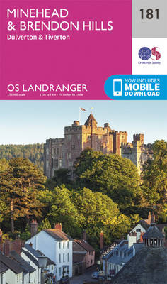
Minehead with the eastern part of the Exmoor National Park including Brendon Hills, on a paper version of map No. 181 from the Ordnance Survey’s Landranger series at 1:50,000, with contoured and GPS compatible topographic mapping plus tourist information.MOBILE DOWNLOADS: As well as the physical edition of the map, each Landranger title now includes a
Weston-super-Mare, Bridgwater & Wells OS Landranger Map 182 (paper)
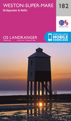
Weston-super-Mare – Bridgwater – Wells area, including the Mendip and Polden Hills, on a paper version of map No. 182 from the Ordnance Survey’s Landranger series at 1:50,000, with contoured and GPS compatible topographic mapping plus tourist information.MOBILE DOWNLOADS: As well as the physical edition of the map, each Landranger title now includes a code
Yeovil, Frome, Shaftesbury & Shepton Mallet OS Landranger Map 183 (paper)

Yeovil and Frome area on a paper version of map No. 183 from the Ordnance Survey’s Landranger series at 1:50,000, with contoured and GPS compatible topographic mapping plus tourist information.MOBILE DOWNLOADS: As well as the physical edition of the map, each Landranger title now includes a code for downloading after purchase its digital version onto
Salisbury & The Plain – Amesbury OS Landranger Map 184 (paper)

Salisbury with Salisbury Plain and Cranborne Chase on a paper version of map No. 184 from the Ordnance Survey’s Landranger series at 1:50,000, with contoured and GPS compatible topographic mapping plus tourist information.MOBILE DOWNLOADS: As well as the physical edition of the map, each Landranger title now includes a code for downloading after purchase its
Winchester, Basingstoke, Andover & Romsey OS Landranger Map 185 (paper)
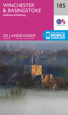
Winchester and Basingstoke area, including the westernmost part of the South Downs National Park and a section of the South Downs Way, on a paper version of map No. 185 from the Ordnance Survey’s Landranger series at 1:50,000, with contoured and GPS compatible topographic mapping plus tourist information.MOBILE DOWNLOADS: As well as the physical edition
Aldershot, Guildford, Camberley & Haslemere OS Landranger Map 186 (paper)
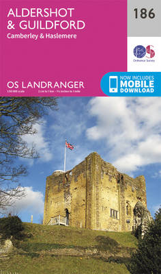
Aldershot and Guildford area, including the northern part of the South Downs National Park and a section of the North Downs Way / E2 European Long-distance Path, on a paper version of map No. 186 from the Ordnance Survey’s Landranger series at 1:50,000, with contoured and GPS compatible topographic mapping plus tourist information.MOBILE DOWNLOADS: As
Dorking, Reigate, Crawley & Horsham OS Landranger Map 187 (paper)
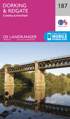
Dorking and Reigate area, including a section of the North Downs Way / E2 European Long-distance Path, on a paper version of map No. 187 from the Ordnance Survey’s Landranger series at 1:50,000, with contoured and GPS compatible topographic mapping plus tourist information.MOBILE DOWNLOADS: As well as the physical edition of the map, each Landranger
Maidstone, Royal Tunbridge Wells, Sevenoaks & Tonbridge OS Landranger Map 188 (paper)
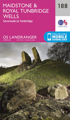
Maidstone, Tunbridge Wells and the High Weald area, including a section of the North Downs Way / E2 European Long-distance Path, on a paper version of map No. 188 from the Ordnance Survey’s Landranger series at 1:50,000, with contoured and GPS compatible topographic mapping plus tourist information.MOBILE DOWNLOADS: As well as the physical edition of
Bury St Edmunds, Sudbury & Stowmarket OS Landranger Map 155 (paper)
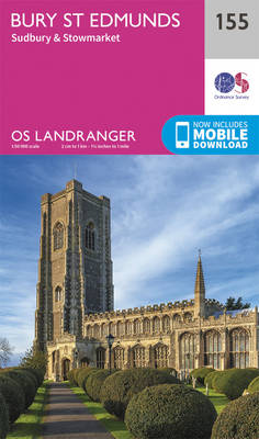
Suffolk around Bury St Edmunds, Sudbury and Stowmarket, including part of the E2 European Long-distance path, on a paper version of map No. 155 from the Ordnance Survey’s Landranger series at 1:50,000, with contoured and GPS compatible topographic mapping plus tourist information.MOBILE DOWNLOADS: As well as the physical edition of the map, each Landranger title
St David`s & Haverfordwest OS Landranger Map 157 (paper)
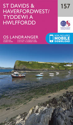
Pembrokeshire Coast National Park between Pembroke in the south and Fishguard in the north including St Davids, and with coverage extending inland beyond Haverfordwest, on a paper version of map No. 157 from the Ordnance Survey’s Landranger series at 1:50,000, with contoured and GPS compatible topographic mapping plus tourist information.MOBILE DOWNLOADS: As well as the
Tenby & Pembroke OS Landranger Map 158 (paper)
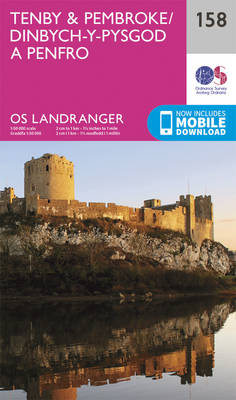
Southern coast of Wales between Pentywyn, Tenby and Pembroke, including part of the Pembrokeshire Coast National Park, on a paper version of map No. 158 from the Ordnance Survey’s Landranger series at 1:50,000, with contoured and GPS compatible topographic mapping plus tourist information.MOBILE DOWNLOADS: As well as the physical edition of the map, each Landranger
Swansea, Gower & Carmarthen OS Landranger Map 159 (paper)

Southern Wales between Swansea, Carmarthen and Llandeilo, including the Gower Peninsula, on a paper version of map No. 159 from the Ordnance Survey’s Landranger series at 1:50,000, with contoured and GPS compatible topographic mapping plus tourist information.MOBILE DOWNLOADS: As well as the physical edition of the map, each Landranger title now includes a code for
Brecon Beacons OS Landranger Map 160 (paper)
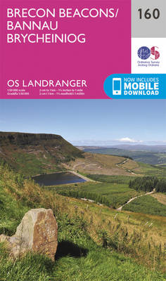
The central and western part of the Brecon Beacons National Park on a paper version of map No. 160 from the Ordnance Survey’s Landranger series at 1:50,000, with contoured and GPS compatible topographic mapping plus tourist information.MOBILE DOWNLOADS: As well as the physical edition of the map, each Landranger title now includes a code for
The Black Mountains – Abergavenny OS Landranger Map 161 (paper)
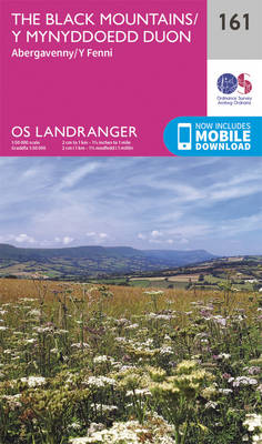
The Black Mountains in the Brecon Beacons National Park, including a part of the Offa’s Dyke Path, on a paper version of map No. 161 from the Ordnance Survey’s Landranger series at 1:50,000, with contoured and GPS compatible topographic mapping plus tourist information.MOBILE DOWNLOADS: As well as the physical edition of the map, each Landranger
Cheltenham, Cirencester & Stow-on-the-Wold OS Landranger Map 163 (paper)

Cheltenham and Cirencester area, including sections of the Thames Path, the Cotswold Way and the E2 European Long-distance Path, on a paper version of map No. 163 from the Ordnance Survey’s Landranger series at 1:50,000, with contoured and GPS compatible topographic mapping plus tourist information.MOBILE DOWNLOADS: As well as the physical edition of the map,
Oxford, Chipping Norton & Bicester OS Landranger Map 164 (paper)

Oxford area, including sections of the Thames Path and the E2 European Long-distance Path, on a paper version of map No. 164 from the Ordnance Survey’s Landranger series at 1:50,000, with contoured and GPS compatible topographic mapping plus tourist information.MOBILE DOWNLOADS: As well as the physical edition of the map, each Landranger title now includes
Aylesbury, Leighton Buzzard, Thame & Berkhamsted OS Landranger Map 165 (paper)
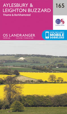
Aylesbury, Leighton Buzzard and Thame area, including Chiltern Hills with part of the Ridgeway, on a paper version of map No. 165 from the Ordnance Survey’s Landranger series at 1:50,000, with contoured and GPS compatible topographic mapping plus tourist information.MOBILE DOWNLOADS: As well as the physical edition of the map, each Landranger title now includes