Category Archives: Travel Guides
Winchester, Basingstoke, Andover & Romsey OS Landranger Active Map 185 (waterproof)
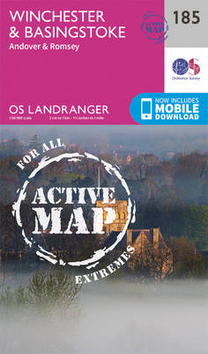
Winchester and Basingstoke area, including the westernmost part of the South Downs National Park and a section of the South Downs Way, on a waterproof and tear-resistant OS Active version of map No. 185 from the Ordnance Survey’s Landranger series at 1:50,000, with contoured and GPS compatible topographic mapping plus tourist information.MOBILE DOWNLOADS: As well
Vale of Glamorgan West, Porthcawl & Rhondda OS Landranger Active Map 170 (waterproof)

The Vale of Glamorgan, Rhondda and Port Talbot area on a waterproof and tear-resistant OS Active version of map No. 170 from the Ordnance Survey’s Landranger series at 1:50,000, with contoured and GPS compatible topographic mapping plus tourist information.MOBILE DOWNLOADS: As well as the physical edition of the map, each Landranger title now includes a
Cardiff, Newport & Pontypool OS Landranger Active Map 171 (waterproof)

Cardiff, Newport and Pontypool area, including the Mouth of the Severn, on a waterproof and tear-resistant OS Active version of map No. 171 from the Ordnance Survey’s Landranger series at 1:50,000, with contoured and GPS compatible topographic mapping plus tourist information.MOBILE DOWNLOADS: As well as the physical edition of the map, each Landranger title now
Bristol, Bath, Thornbury & Chew Magna OS Landranger Active Map 172 (waterproof)

Bristol and Bath area, including the southern section of the Cotswold Way, on a waterproof and tear-resistant OS Active version of map No. 172 from the Ordnance Survey’s Landranger series at 1:50,000, with contoured and GPS compatible topographic mapping plus tourist information.MOBILE DOWNLOADS: As well as the physical edition of the map, each Landranger title
Swindon, Devizes, Marlborough & Trowbridge OS Landranger Active Map 173 (waterproof)

Swindon – Devizes area, including the westernmost section of the Ridgeway and part of the Thames Path, on a waterproof and tear-resistant OS Active version of map No. 173 from the Ordnance Survey’s Landranger series at 1:50,000, with contoured and GPS compatible topographic mapping plus tourist information.MOBILE DOWNLOADS: As well as the physical edition of
Newbury, Wantage, Hungerford & Didcot OS Landranger Active Map 174 (waterproof)

Newbury – Wantage area, including a section of the Ridgeway along the Lambourn Downs, on a waterproof and tear-resistant OS Active version of map No. 174 from the Ordnance Survey’s Landranger series at 1:50,000, with contoured and GPS compatible topographic mapping plus tourist information.MOBILE DOWNLOADS: As well as the physical edition of the map, each
Reading, Windsor, Henley-on-Thames & Bracknell OS Landranger Active Map 175 (waterproof)

Reading ‘“ Windsor area, including a section of the Thames Path / E2 European Long-distance Path, on a waterproof and tear-resistant OS Active version of map No. 175 from the Ordnance Survey’s Landranger series at 1:50,000, with contoured and GPS compatible topographic mapping plus tourist information.MOBILE DOWNLOADS: As well as the physical edition of the
London West, Rickmansworth & Staines OS Landranger Active Map 176 (waterproof)

West London, from The City, Tottenham and Croydon westwards to Windsor, on a waterproof and tear-resistant OS Active version of map No. 176 from the Ordnance Survey’s Landranger series at 1:50,000, with contoured and GPS compatible topographic mapping plus tourist information.MOBILE DOWNLOADS: As well as the physical edition of the map, each Landranger title now
London East, Billericay & Gravesend OS Landranger Active Map 177 (waterproof)

London eastwards from King’s Cross, Wood Green and Croydon, including south-western Essex and north-western Kent, on a waterproof and tear-resistant OS Active version of map No. 177 from the Ordnance Survey’s Landranger series at 1:50,000, with contoured and GPS compatible topographic mapping plus tourist information.MOBILE DOWNLOADS: As well as the physical edition of the map,
Thames Estuary, Rochester & Southend-on-Sea OS Landranger Active Map 178 (waterproof)

Thames Estuary with Rochester and Southend-on-Sea, including a section of the North Downs Way / E2 European Long-Distance Path, on a waterproof and tear-resistant OS Active version of map No. 178 from the Ordnance Survey’s Landranger series at 1:50,000, with contoured and GPS compatible topographic mapping plus tourist information.MOBILE DOWNLOADS: As well as the physical
Canterbury, East Kent, Dover & Margate OS Landranger Active Map 179 (waterproof)
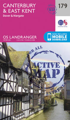
Eastern Kent with Canterbury, Dover and Margate, including sections of the North Downs Way and the E2 and E9 European Long-Distance Paths, on a waterproof and tear-resistant OS Active version of map No. 179 from the Ordnance Survey’s Landranger series at 1:50,000, with contoured and GPS compatible topographic mapping plus tourist information.MOBILE DOWNLOADS: As well
Lampeter & Llandovery OS Landranger Active Map 146 (waterproof)
Central Wales around Lampeter and Llandovery on a waterproof and tear-resistant OS Active version of map No. 146 from the Ordnance Survey’s Landranger series at 1:50,000, with contoured and GPS compatible topographic mapping plus tourist information.MOBILE DOWNLOADS: As well as the physical edition of the map, each Landranger title now includes a code for downloading
Oxford, Chipping Norton & Bicester OS Landranger Active Map 164 (waterproof)

Oxford area, including sections of the Thames Path and the E2 European Long-distance Path, on a waterproof and tear-resistant OS Active version of map No. 164 from the Ordnance Survey’s Landranger series at 1:50,000, with contoured and GPS compatible topographic mapping plus tourist information.MOBILE DOWNLOADS: As well as the physical edition of the map, each
Elan Valley & Builth Wells OS Landranger Active Map 147 (waterproof)

Central Wales around the Elan Valley and Builth Wells, including a part of the Glyndwr’s Way long-distance trail, on a waterproof and tear-resistant OS Active version of map No. 147 from the Ordnance Survey’s Landranger series at 1:50,000, with contoured and GPS compatible topographic mapping plus tourist information.MOBILE DOWNLOADS: As well as the physical edition
Aylesbury, Leighton Buzzard, Thame & Berkhamsted OS Landranger Active Map 165 (waterproof)

Aylesbury, Leighton Buzzard and Thame area, including Chiltern Hills with part of the Ridgeway, on a waterproof and tear-resistant OS Active version of map No. 165 from the Ordnance Survey’s Landranger series at 1:50,000, with contoured and GPS compatible topographic mapping plus tourist information.MOBILE DOWNLOADS: As well as the physical edition of the map, each
Presteigne & Hay-on-Wye OS landranger Active Map 148 (waterproof)

The borderlands of England and Wales around Presteigne and Hay-on-Wye, including parts of Offa’s Dyke and Glyndwr’s long-distance trails, on a waterproof and tear-resistant OS Active version of map No. 148 from the Ordnance Survey’s Landranger series at 1:50,000, with contoured and GPS compatible topographic mapping plus tourist information.MOBILE DOWNLOADS: As well as the physical
Hereford, Leominster, Bromyard & Ledbury OS Landranger Active Map 149 (waterproof)
The area around Hereford, Leominster, Bromyard and Ledbury on a waterproof and tear-resistant OS Active version of map No. 149 from the Ordnance Survey’s Landranger series at 1:50,000, with contoured and GPS compatible topographic mapping plus tourist information.MOBILE DOWNLOADS: As well as the physical edition of the map, each Landranger title now includes a code
Worcester, The Malverns, Evesham & Tewkesbury OS Landranger Active Map 150 (waterproof)

The area around Worcester, Great Malvern, Evesham and Tewkesbury, including the Malvern Hills and part of the Cotswold Way / E2 European Long-distance Path, on a waterproof and tear-resistant OS Active version of map No. 150 from the Ordnance Survey’s Landranger series at 1:50,000, with contoured and GPS compatible topographic mapping plus tourist information.MOBILE DOWNLOADS:
Stratford-upon-Avon, Warwick & Banbury OS Landranger Active Map 151 (waterproof)

The area between Stratford-upon-Avon, Warwick and Banbury, including the northern part of the Cotswold Hills and part of the Cotswold Way / E2 European Long-distance Path, on a waterproof and tear-resistant OS Active version of map No. 151 from the Ordnance Survey’s Landranger series at 1:50,000, with contoured and GPS compatible topographic mapping plus tourist
Northampton, Milton Keynes, Buckingham & Daventry OS Landranger Active Map 152 (waterproof)
The area around Northampton, Milton Keynes, Buckingham and Daventry, on a waterproof and tear-resistant OS Active version of map No. 152 from the Ordnance Survey’s Landranger series at 1:50,000, with contoured and GPS compatible topographic mapping plus tourist information.MOBILE DOWNLOADS: As well as the physical edition of the map, each Landranger title now includes a