Category Archives: Travel Guides
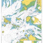
Admiralty Chart 1411 – Irish Sea Western Part

NEW EDITION OUT ON 15/04/2021Admiralty standard nautical charts comply with Safety of Life at Sea (SOLAS) regulations and are ideal for professional, commercial and recreational use. Charts within the series consist of a range of scales, useful for passage planning, ocean crossings, coastal navigation and entering port.Standard Admiralty charts are folded to fit in a
WWI Trench Map: Bixschoote (20 SW 4 – ed. 5A)

Bixschoote (20 SW 4 – ed. 5A) in a series of British Army trench maps from the WWI, reproduced by G.H. Smith & Son at approximately 7/10th of the original scales quoted against each title. The map shows trenches corrected to 30.6.1917 and covers the area east of the Yser canal, including the Ypres Salient,
Admiralty Chart 2035 – Western Approaches to The Solent
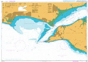
Admiralty standard nautical charts comply with Safety of Life at Sea (SOLAS) regulations and are ideal for professional, commercial and recreational use. Charts within the series consist of a range of scales, useful for passage planning, ocean crossings, coastal navigation and entering port.Standard Admiralty charts are folded to fit in a chart table drawer. If
WWI Trench Map: Nieuport (12 SW 1 – ed. 3A)
Nieuport (12 SW 1 – ed. 3A) in a series of British Army trench maps from the WWI, reproduced by G.H. Smith & Son at approximately 7/10th of the original scales quoted against each title. The map covers the by now alomost forgotten part of the British Front on the Belgium coastline and shows trenches
WWI Trench Map: Vimy (44A SW 3 – ed. 11A)
Vimy (44A SW 3 – ed. 11A) in a series of British Army trench maps from the WWI, reproduced by G.H. Smith & Son at approximately 7/10th of the original scales quoted against each title. The map shows trenches corrected to 8.5.1918, with the front line now well to the north-east of Vimy.Maps in this
The Western Front

Double-sided map of the Western Front across northern France and Belgium during World War I, presenting the battlefields in a series of map panels annotated with present day monuments and/or front lines and directions of various offensives, plus extensive informative additional notes and numerous photos.On one side separate panels show the main battlefield areas with
Flag of Spain (State flag, with coat of arms)

Flags are a great way to show some national pride, pay homage to a fondly remembered visit abroad, celebrate a special occasion, or simply decorate the wall of your room.Flags measure 5’x 3’ (152.4 x 91.44cm), are made from 100% polyester and come with two brass eyelets for fastening.
WWI Trench Map: Gheluvelt (28 NE 3 – ed. 5A)
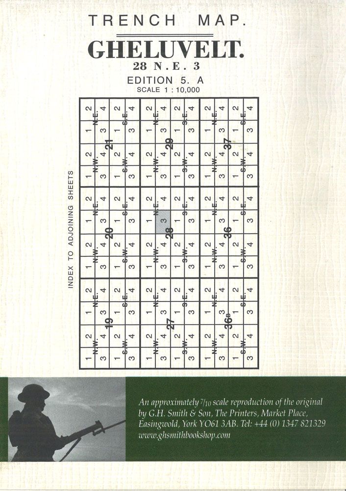
Gheluvelt (28 NE 3 – ed. 5A) in a series of British Army trench maps from the WWI, reproduced by G.H. Smith & Son at approximately 7/10th of the original scales quoted against each title. The map shows trenches corrected to 1.4.1917 and covers the Ypres Salient with the Menin Road and the German defences
WWI Trench Map: Houplines (36 NW2 & NE 1 – ed. 9A)
Houplines (36 NW 2 & NE 1 – ed. 9A) in a series of British Army trench maps from the WWI, reproduced by G.H. Smith & Son at approximately 7/10th of the original scales quoted against each title. The map covers the area around Armentiรจres, Houplines and Frelinghien – the land of the “Mademoiselle from
WWI Trench Map: Honnecourt (57B SW 3 – ed. 1A)
Honnecourt (57B SW 3 – ed. 1A) in a series of British Army trench maps from the WWI, reproduced by G.H. Smith & Son at approximately 7/10th of the original scales quoted against each title. The map shows German defences on and east of the Canal de St.Quentin, with trenches corrected to 19.5.1917.Maps in this
WWI Trench Map: Wytschaete (Whitesheet: 28 SW 2 – ed. 5A)

Wytschaete (28 SW 2 – ed. 5A) in a series of British Army trench maps from the WWI, reproduced by G.H. Smith & Son at approximately 7/10th of the original scales quoted against each title. This very clear detailed map shows trenches corrected to 1.4.1917, the week before the battle of the Messines (Messen) Ridge.Maps
WWI Trench Map: Albert (57D SE – ed. 5E)
Albert (57D SE – ed. 5E) in a series of British Army trench maps from the WWI, reproduced by G.H. Smith & Son at approximately 7/10th of the original scales quoted against each title. The map shows British and German trenches from Auchonvillers to Albert as on 17.7.1918.Maps in this series show both the British
WWI Trench Map: Hebuterne (57D NE parts of 3 & 4 – ed. 2)
Hebuterne (57D NE parts of 3 & 4 – ed. 2) in a series of British Army trench maps from the WWI, reproduced by G.H. Smith & Son at approximately 7/10th of the original scales quoted against each title. The map covers the front line from Gommecourt down through Serre to the Redon Ridge, showing
WWI Trench Map: Beauquesne (57D SW – ed.2B)
Beauquesne (57D SW – ed.2B) in a series of British Army trench maps from the WWI, reproduced by G.H. Smith & Son at approximately 7/10th of the original scales quoted against each title. The map shows British defence lines to the east of Albert from Beauquesne to Pierregot, updated to 20.5.1918.Maps in this series show
WWI Trench Map: Roclincourt (51B NW 1 – ed. 5A)
Roclincourt (51B NW 1 – ed. 5A)) in a series of British Army trench maps from the WWI, reproduced by G.H. Smith & Son at approximately 7/10th of the original scales quoted against each title. The map covers the front from Roclincourt to Neuville St. Vaast with trenches corrected to 27.12.1916. Also included is a
WWI Trench Map: Bapaume (57C NW – ed. 8B)

Bapaume (57C NW – ed. 8B, local) in a series of British Army trench maps from the WWI, reproduced by G.H. Smith & Son at approximately 7/10th of the original scales quoted against each title. The map shows enemy organisation and artillery positions to the north-west and north-east of Bapaume, with trenches revised to 4.6.1918.Maps
WWI Trench Map: Beaumont (57D SE 2 – ed. 4A)
Beaumont (57D SE 2 – ed. 4A) in a series of British Army trench maps from the WWI, reproduced by G.H. Smith & Son at approximately 7/10th of the original scales quoted against each title. The map covers Beaumont Hamel, Thiepval Wood, Mensil and Grandcourt,showing German lines updated to 17.2.1917 after German February retreat.Maps in
WWI Trench Map: Zonnebeke (28 NE 1 – ed. 7A)

Zonnebeke (28 NE 1 – ed. 7A) in a series of British Army trench maps from the WWI, reproduced by G.H. Smith & Son at approximately 7/10th of the original scales quoted against each title. The map shows the position of the German trenches during the 3rd Battle of Ypres (Passendaele / Passendale) corrected to
WWI Trench Map: Arras (51B NW 3 – ed. 6A)
Arras (51B NW 3 – ed. 6A) in a series of British Army trench maps from the WWI, reproduced by G.H. Smith & Son at approximately 7/10th of the original scales quoted against each title. The map shows the front before the battle of Arras, with trenches corrected to 27.12.1916.Maps in this series show both
WWI Trench Map: Zonnebeke (28 NE 1 – ed. 9A)
Zonnebeke (28 NE 1 – ed. 9A) in a series of British Army trench maps from the WWI, reproduced by G.H. Smith & Son at approximately 7/10th of the original scales quoted against each title. The map shows the front line after the 3rd Battle of Ypres (Passendaele / Passendale) with trenches corrected to 5.12.1917.Maps