Categories
-
Best Sellers
-
The Cheviot 1901-13 – 5
The Cheviot in 1901-1913 in a series of reproductions of Ordnance Survey’s famous “Inch to the Mile” maps published in the Alan Godfrey Editions to provide Read More » -

Eastern Gritstone: Froggatt to Black Rocks
Climbing guide from the British Mountaineering Council, covering Froggatt to Black Rocks, some of the most popular climbs Derbyshire has to offer.The guide has an introduction Read More » -

Corsica 1768 Historical Wall Map
Historical 1768 map of The Isle of Corsica.Unlike most maps nowadays this one has the left of the map as North.The map was made to serve Read More » -

Pig`s Foot: A Novel
Oscar Mandinga, great-grandchild of the founders of a small hamlet of wooden shacks and red earth deep in the Cuban hinterland, is a sardonic teller of Read More » -

Night Sounds
Discover the magic of the night in this enchanting sound book. Little children will love listening to sleeping cats purring, owls twit-twooing and bats squeaking when Read More » -

Shropshire Pevsner Architectural Guide
Shropshire Pevsner Architectural Guide, in a series of publications begun with the express aim of providing up-to-date guides to the most significant buildings in every part Read More » -
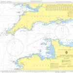
Instructional Chart 5053 – English Channel – Western and Central Portions
Admiralty Instructional charts are designed to be used for training. They contain all the features of a standard Admiralty nautical chart. PLEASE NOTE: instructional charts are Read More » -

Bury St Edmunds, Sudbury & Stowmarket OS Landranger Active Map 155 (waterproof)
Suffolk around Bury St Edmunds, Sudbury and Stowmarket, including part of the E2 European Long-distance path, on a waterproof and tear-resistant OS Active version of map Read More » -
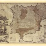
Spain and Portugal in the Reign of Charles III Wall Map
The Iberian Peninsula on a reproduction of a map published by the Dutch cartographic and engraving firm of Danckerts showing the theatres of regional conflicts during Read More » -

CHS Chart 4823 – Cape Ray to Garia Bay
The official Canadian charts provide an excellent range of scales for the whole length of Canada`s coastline as well as the Grat Lakes and comply with Read More »
-


