Category Archives: Shower Curtains
Arabian Designs
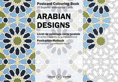
PEPIN(R) Postcard Colouring Books contain 20 postcards (format 10 x 15 cm, 4 x 6 in) of superior 250gsm acid-free and age resistant drawing paper, printed with 20 exceptional designs in very light lines. The printing is done in such a way that, depending on the techniques used, the original outline will be hardly visible
Lulea Sverigeserien Topo50 115
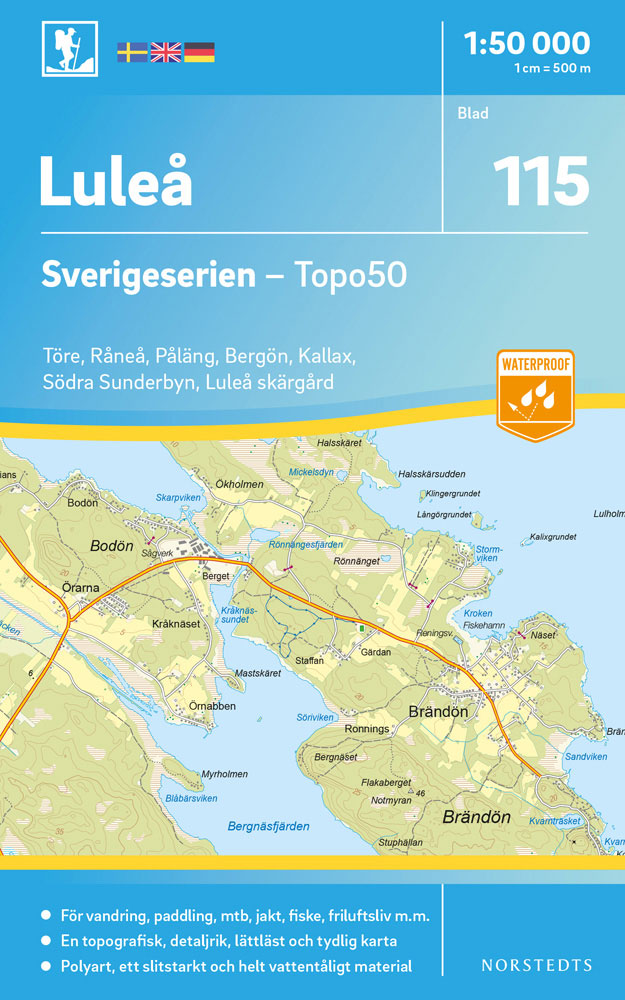
Sverigeserien is an outdoor map series consisting of 116 sheets with coverage of southern and central Sweden and the northern coastline. The map is suitable for outdoor activities such as hiking, excursions, trail running, hunting, fishing, riding, cycling, mountain biking, paddling, skating and much more. Every sheet covers an area of 45x68km.These topographical maps in
Netherlands Cycling Atlas
Bicycle maps from all over the Netherlands bundled into the most complete bike atlas in the Netherlands, scale 1: 100,000 the LF routes all node routes with distances between the nodes mention of small roads mention of cycle paths locations of campsites and bed & breakfast addresses, with web links locations of catering and attractions
Kalix Sverigeserien Topo50 116
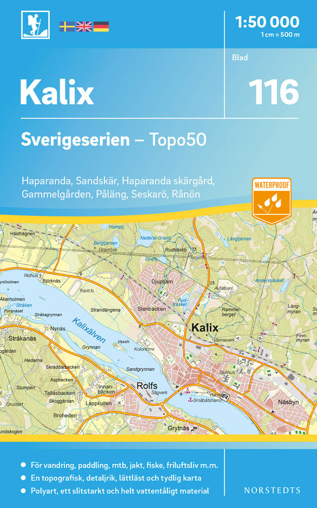
Sverigeserien is an outdoor map series consisting of 116 sheets with coverage of southern and central Sweden and the northern coastline. The map is suitable for outdoor activities such as hiking, excursions, trail running, hunting, fishing, riding, cycling, mountain biking, paddling, skating and much more. Every sheet covers an area of 45x68km.These topographical maps in
Hanko Jussarรถ Bromarv Water Touring Map
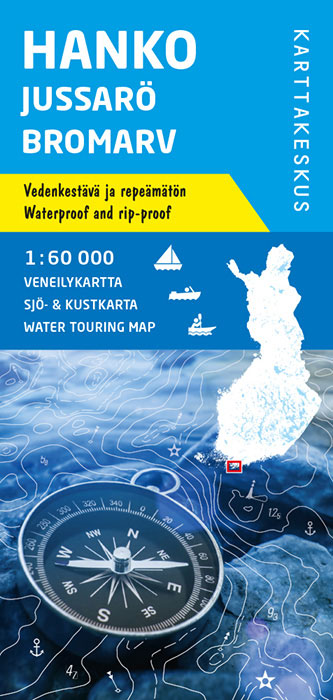
Karttakeskus’ Water touring maps are a completely new type of map series. The pre-folded maps made of waterproof and rip-proof material can fit into a small space on the boat, but when opened, they cover a wide area. In this way, the water touring map is e.g. an excellent planning tool alongside electronic navigation solutions,
Hiittinen Tulliniemi Paraisten Water Touring Map

Karttakeskus’ Water touring maps are a completely new type of map series. The pre-folded maps made of waterproof and rip-proof material can fit into a small space on the boat, but when opened, they cover a wide area. In this way, the water touring map is e.g. an excellent planning tool alongside electronic navigation solutions,
New York Street Food

New York has a history of immigration that results in one of the most dynamic street food scenes in the world. Those who believe food in New York should cost a pretty penny and can only be found in beautifully styled restaurants probably haven`t been further than downtown Manhattan. This book takes you to the
Bjurholm Sverigeserien Topo50 105

Sverigeserien is an outdoor map series consisting of 116 sheets with coverage of southern and central Sweden and the northern coastline. The map is suitable for outdoor activities such as hiking, excursions, trail running, hunting, fishing, riding, cycling, mountain biking, paddling, skating and much more. Every sheet covers an area of 45x68km.These topographical maps in
Vannas Sverigeserien Topo50 106

Sverigeserien is an outdoor map series consisting of 116 sheets with coverage of southern and central Sweden and the northern coastline. The map is suitable for outdoor activities such as hiking, excursions, trail running, hunting, fishing, riding, cycling, mountain biking, paddling, skating and much more. Every sheet covers an area of 45x68km.These topographical maps in
Umea Sverigeserien Topo50 107

Sverigeserien is an outdoor map series consisting of 116 sheets with coverage of southern and central Sweden and the northern coastline. The map is suitable for outdoor activities such as hiking, excursions, trail running, hunting, fishing, riding, cycling, mountain biking, paddling, skating and much more. Every sheet covers an area of 45x68km.These topographical maps in
Vindeln Sverigeserien Topo50 108
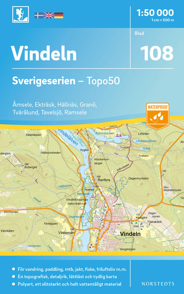
Sverigeserien is an outdoor map series consisting of 116 sheets with coverage of southern and central Sweden and the northern coastline. The map is suitable for outdoor activities such as hiking, excursions, trail running, hunting, fishing, riding, cycling, mountain biking, paddling, skating and much more. Every sheet covers an area of 45x68km.These topographical maps in
Burtrask Sverigeserien Topo50 109

Sverigeserien is an outdoor map series consisting of 116 sheets with coverage of southern and central Sweden and the northern coastline. The map is suitable for outdoor activities such as hiking, excursions, trail running, hunting, fishing, riding, cycling, mountain biking, paddling, skating and much more. Every sheet covers an area of 45x68km.These topographical maps in
Boliden Sverigeserien Topo50 110

Sverigeserien is an outdoor map series consisting of 116 sheets with coverage of southern and central Sweden and the northern coastline. The map is suitable for outdoor activities such as hiking, excursions, trail running, hunting, fishing, riding, cycling, mountain biking, paddling, skating and much more. Every sheet covers an area of 45x68km.These topographical maps in
Stode Sverigeserien Topo50 95

Sverigeserien is an outdoor map series consisting of 116 sheets with coverage of southern and central Sweden and the northern coastline. The map is suitable for outdoor activities such as hiking, excursions, trail running, hunting, fishing, riding, cycling, mountain biking, paddling, skating and much more. Every sheet covers an area of 45x68km.These topographical maps in
Skelleftea Sverigeserien Topo50 111

Sverigeserien is an outdoor map series consisting of 116 sheets with coverage of southern and central Sweden and the northern coastline. The map is suitable for outdoor activities such as hiking, excursions, trail running, hunting, fishing, riding, cycling, mountain biking, paddling, skating and much more. Every sheet covers an area of 45x68km.These topographical maps in
Sundsvall Sverigeserien Topo50 96

Sverigeserien is an outdoor map series consisting of 116 sheets with coverage of southern and central Sweden and the northern coastline. The map is suitable for outdoor activities such as hiking, excursions, trail running, hunting, fishing, riding, cycling, mountain biking, paddling, skating and much more. Every sheet covers an area of 45x68km.These topographical maps in