Category Archives: Non-Fiction & Reference
NP69A East Coasts of Central America and Gulf of Mexico Pilot

It covers the western Caribbean Sea and the Gulf of Mexico from Punta Terraba to Cape Sable including Yucatan Channel.Cubre el Mar Caribe occidental y el Golfo de Mรฉxico desde Punta Terraba hasta el Cabo Sable, incluido el Canal de Yucatรกn.
London Adventure Walks

From the authors of the highly successful Adventures Walks for Families In and Around London comes London Adventure Walks, offering 25 carefully devised, imaginative explorations of London – all starting from points easily accessible by public transport – specifically designed to appeal to children. Intriguing explorations of the historic (Tudor London/Dick Whittington/Fire of London/Florence Nightingale),
NP63 Persian Gulf Pilot 2021
It covers the Persian Gulf and its approaches from Ra`s Al Junayz in the southwest to Gwatar Bay in the east.Cubre el Golfo Pรฉrsico y sus aproximaciones desde Ra`s Al Junayz en el suroeste hasta la Bahรญa de Gwatar en el este.
Places In Syria – A Pocket Grand Tour

This pocket-sized guide to Syria from Frances Lincoln aims to give you a grand tour of the country in one nifty little tome with the help of the highly readable Francis Russell. The guide describes fifty-seven places in Syria, a country rich in ancient history and more.Following an itinerary that allows the independent sightseer to
NP30 China Sea Pilot Vol 1 – Edition 2021
It covers the West Side of South China Sea from Tanjung Lompat on the Eastern Side of Peninsula Malaysia to Zheland Yan in China, Pulau-Pulau Anambas, Hainan Dao, and the islands and banks bordering the main route from Singapore Strait to Hong Kong.Cubre el lado oeste del mar del sur de China desde Tanjung Lompat
NP5 South America Pilot Vol. 1 Edition 2021
OUT ON 07/10/2021This edition ofย South America Pilot Vol. I (NP 5)ย in the British Admiralty Sailing Directions series. It covers the North-eastern and Eastern coasts of South American from Cabo Orange to Cabo Tres Puntas.Esta ediciรณn de Sudamรฉrica Pilot Vol. I (NP 5) en la serie British Admiralty Sailing Directions. Cubre las costas nororiental y oriental
NP68 East Coast of the United States Pilot Vol 1 – Edition 2021
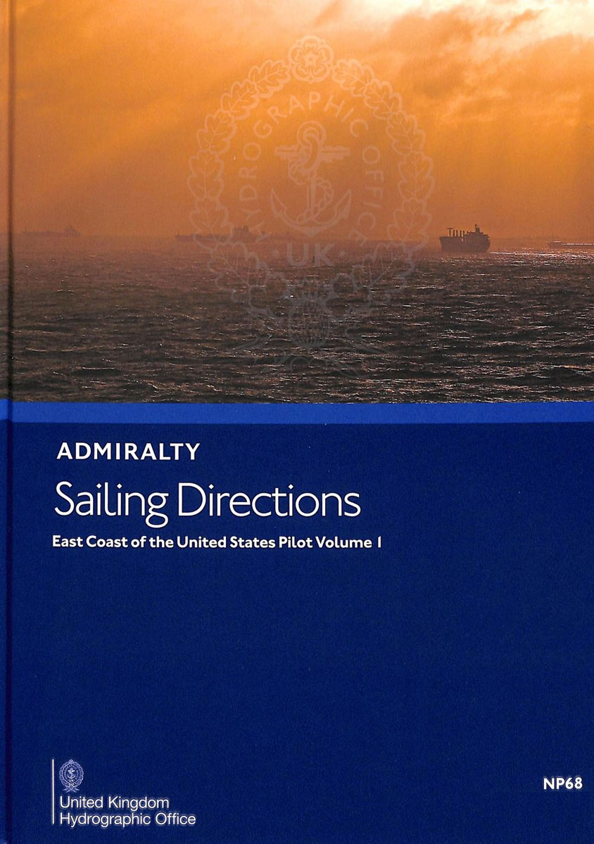
It covers the east coast of the United States from Great Wass Island to Barnegat Inlet. A new or revised edition is due for publication within the coming year.Cubre la costa este de los Estados Unidos desde Great Wass Island hasta Barnegat Inlet. Se debe publicar una ediciรณn nueva o revisada dentro del prรณximo aรฑo.
Admiralty Leisure Folio SC5603 – Falmouth To Hartland Point SUPERCEDED
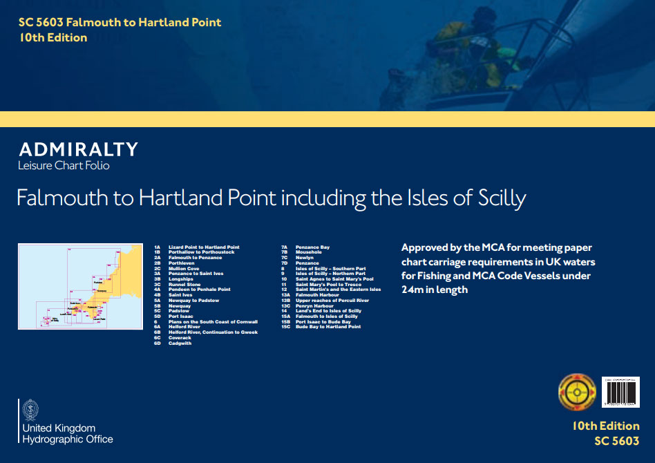
****NEW EDITION WILL BE RELEASED ON 31ST OF MAY, 2018.**** PLEASE CONTACT US FOR MORE INFORMATION OR TO PREORDER.
ADMIRALTY Leisure Folio SC 5621 – Ireland East Coast, Carlingford Lough to Waterford
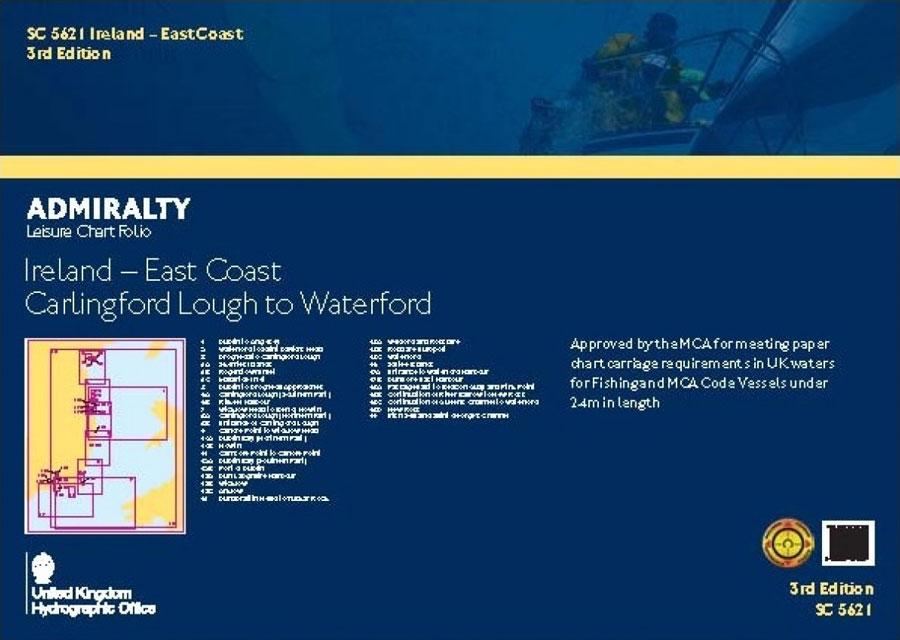
SC5621 – Ireland – East CoastCharts included:5621.1 – Dublin to Anglesey5621.2 – Waterford to Saint David`s Head5621.3 – Drogheda to Carlingford Lough5621.4 – Carlingford Lough to Waterford5621.5 – Dublin Bay to Droheda5621.6 – Carlingford Lough to Waterford5621.7 – Ben of Howth to Wicklow Head5621.8 – Carlingford Lough to Waterford5621.9 – Wicklow Head Cahore Point5621.10 –
ADMIRALTY Leisure Folio SC 5605 – Chichester to Ramsgate and Calais to Oostende

NEW EDITION OUT ON 23/01/2020Charts included in this folio:1A Western approaches to Dover Strait1B Northern approaches to Dover Strait2 Dover to Calais3 Chichester to Worthing4A Worthing to Newhaven4B Shoreham Harbour – Western Arm and River Adur5A Newhaven to Hastings5B Sovereign Harbour6A Hastings to Dungeness6B Rye7 Dungeness to South Foreland8 Dover to Deal9 Deal to Ramsgate10
ADMIRALTY Leisure Folio SC 5622 – Ireland South Coast, Waterford to Kinsale
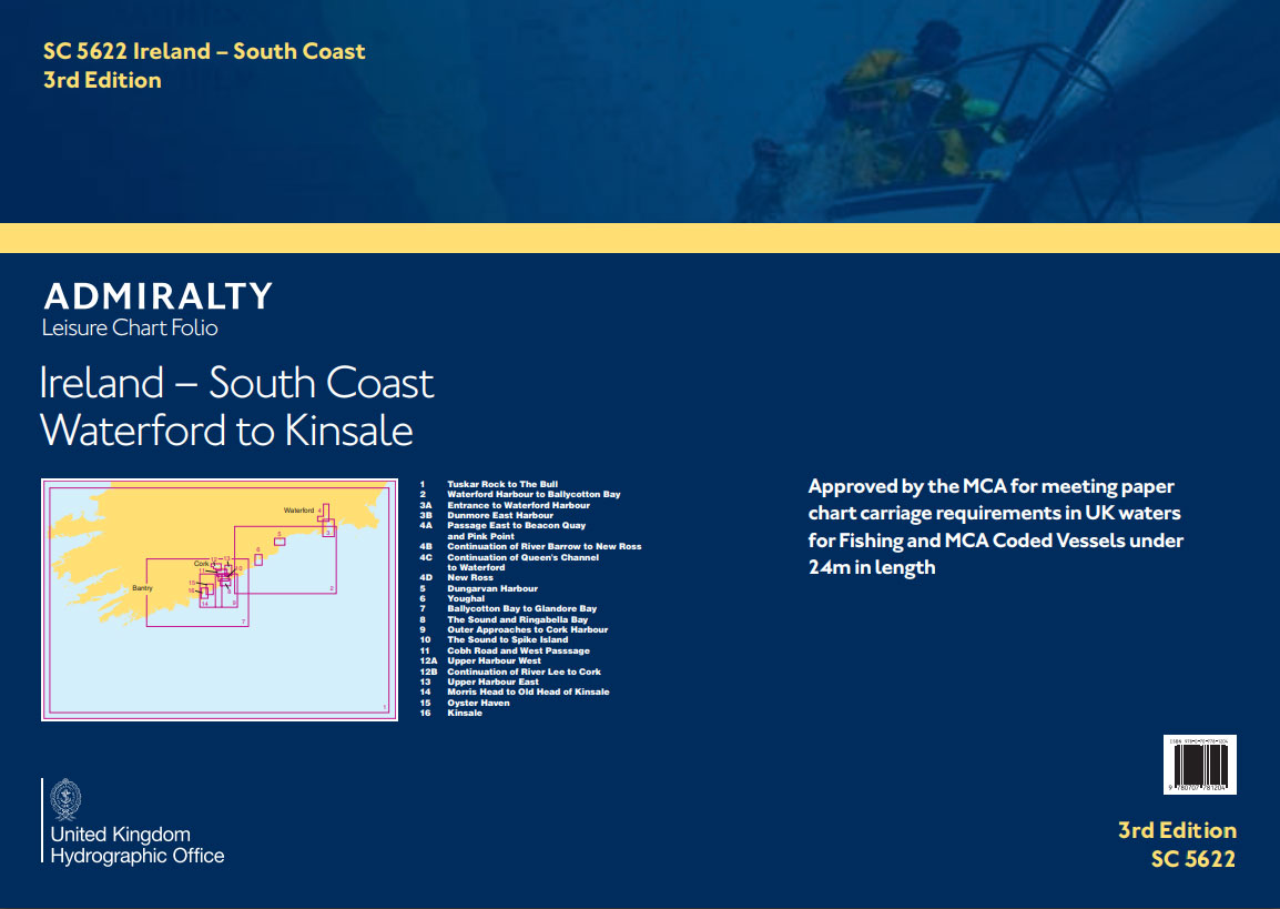
SC5622 – Ireland – South CoastCharts included:5622.1 – Tuskar Rock to The Bull5622.2 – Waterford Harbour to Ballycotton Bay5622.3 – Entrance to Waterford Harbour5622.4 – Passage East to Beacon Quay and Pink Point5622.5 – Dungarvan Harbour5622.6 – Youghal5622.7 – Ballycotton Bay to Glandore Bay5622.8 – The Sound and Ringabella Bay5622.9 – Outer Approaches to Cork
ADMIRALTY Leisure Folio SC 5604 – Channel Islands
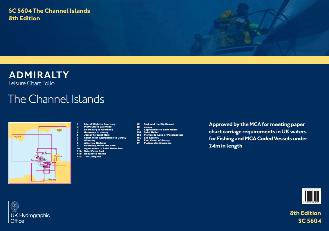
SC5604 – Channel IslandsCharts included in this folio:- 5604.1 Isle of Wight to Guernsey. 1:325,000- 5604.2 Plymouth to Guernsey. 1:325,000- 5604.3 Cherbourg to Guernsey. 1:150,000- 5604.4 Guernsey to Jersey. 1:150,000- 5604.5 Jersey to Saint-Malo. 1:150,000- 5604.6 South West Approaches to Jersey. 1:150,000- 5604.7 Alderney. 1:25,000- 5604.8 Alderney Harbour. 1:6,000- 5604.9 Guernsey, Herm and Sark. 1:50,000-
ADMIRALTY Leisure Folio SC 5614 – East Coast, Orford Ness to Whitby
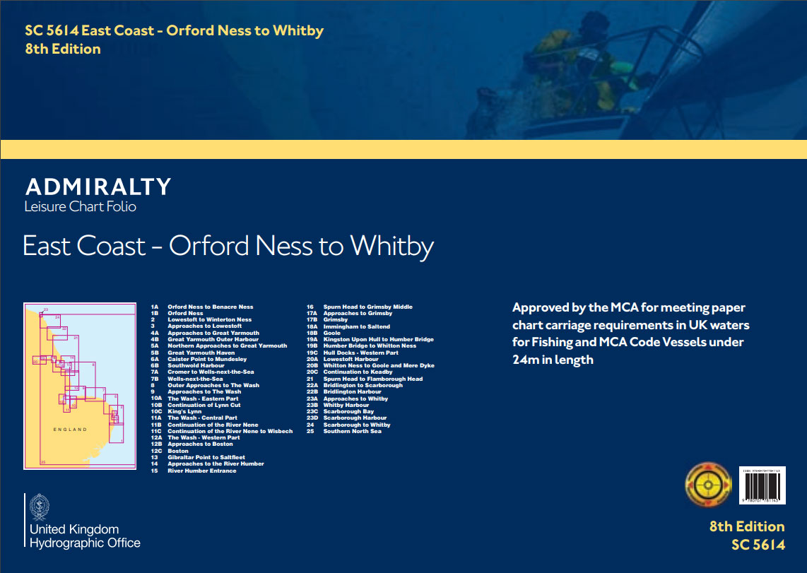
ADMIRALTY Leisure Chart Folios contain A2 charts to support coastal navigation around the UK. Quality assured by maritime experts at the UKHO, each folio contains appropriate chart coverage and scales to help leisure yachtsmen, motor boat cruisers, ocean racing skippers and other leisure mariners maintain safety of life at sea.Charts include:*Weekly Notices to Mariners (NMs)
ADMIRALTY Leisure Folio SC 5608 – Bristol Channel
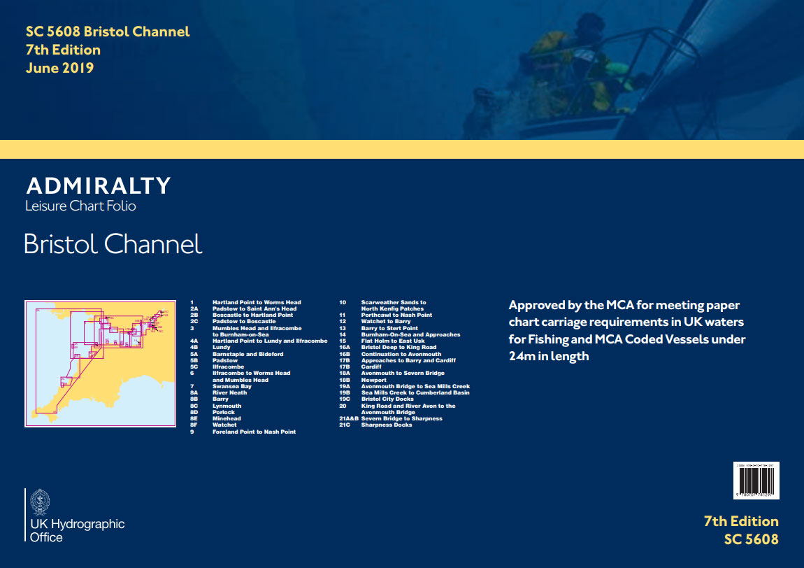
Charts included in this folio:1 Hartland Point to Worms Head2A Padstow to Saint Ann`s Head2B Boscastle to Hartland Point2C Padstow to Boscastle3 Mumbles Head and Ilfracombe to Burnham-on-Sea4A Hartland Point to Lundy and Ilfracombe4B Lundy5A Barnstaple and Bideford5B Padstow5C Ilfracombe6 Ilfracombe to Worms Head and Mumbles Head7 Swansea Bay8A River Neath8B Barry8C Lynmouth8D Porlock8E Minehead8F
City of York Companion

“The City of York Companion” provides a unique insight into one of the most famous and historic cities in England. The authors have combined impressive calligraphy for the complete text and evocative drawings to produce an outstanding record of a city which the Romans established in AD 71 and occupied for almost 300 years. Most
Build your dream house in France

There are currently 100,000 Britons living in France, and several factors make it the preferred location for them, such as its geographical proximity to the UK, the availability of health, education and transport services, a lower population density than the UK, and climatic and cultural factors.When looking to purchase a property, often only two options
NP206 Tide Tables – North Pacific Ocean 2022

NEW EDITION OUT ON 08/10/2020Worldwide tidal height information, revised annually for greater accuracy, makes it easier to plan your departaure and arrival times.The tables include daily high and low-water times and heights for standard ports, times and height differences for secondary ports and harmonic constants for all ports where they are known.
NP208 Tide Tables – South East Atlantic Ocean 2022
Worldwide tidal height information, revised annually for greater accuracy, makes it easier to plan your departaure and arrival times.The tables include daily high and low-water times and heights for standard ports, times and height differences for secondary ports and harmonic constants for all ports where they are known.
NP71 West Indies Pilot Vol 2
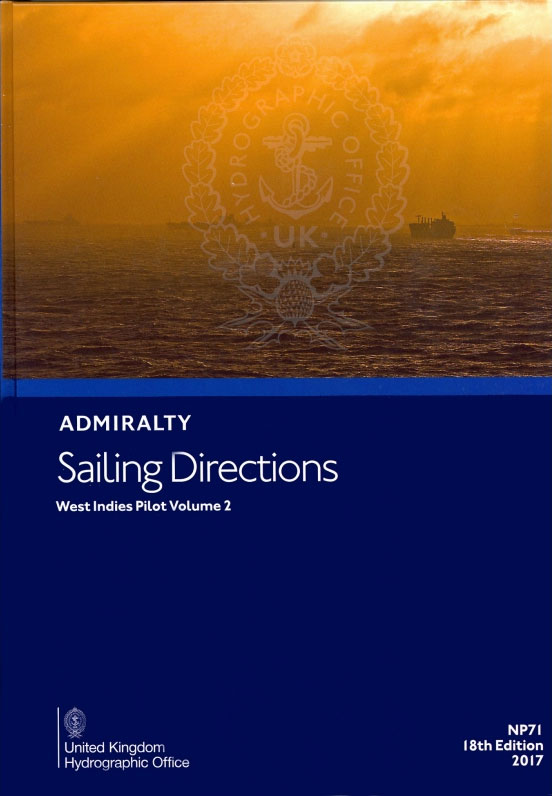
It covers the Mona Passage, Puerto Rico and the Virgin Islands, Leeward and Windward Islands from Anguilla to Grenada.This publication is in continuous revision.Cubre el Paso de Mona, Puerto Rico y las Islas Vรญrgenes, Sotavento y las Islas de Barlovento desde Anguila a Granada.Esta publicaciรณn estรก en continua revisiรณn.
NP133A Paper Chart Maintenance Record
The purpose of the Paper Chart Maintenance Record is to provide the mariner with an easy method for maintaining a record of all Admiralty Notices to Mariners (NMs) and updates affecting charts held.It also provides an authoritative document which helps to assist maritime authorities in the auditing of the mariner`s chart outfit. It is vital