Categories
-
Best Sellers
-

Caldas da Rainha
Topographic survey of Portugal at 1:100,000 from the Instituto Geogrรกfico Portuguรชs, the country’s civilian survey organisation. The maps have contours at 50m intervals and in addition Read More » -
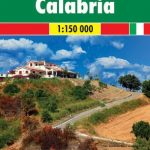
Calabria F&B Top 10 Tips
Italian region of Calabria at a detailed scale of 1:150,000 on a map in Freytag & Berndt’s very popular ‘Top 10 Tips” series. A booklet attached Read More » -

Admiralty chart 64 – Approaches to Rabigh
Admiralty standard nautical charts comply with Safety of Life at Sea (SOLAS) regulations and are ideal for professional, commercial and recreational use. Charts within the series Read More » -

Admiralty Chart 3734 – Khalifa Bin Salman Port & Approaches
Admiralty standard nautical charts comply with Safety of Life at Sea (SOLAS) regulations and are ideal for professional, commercial and recreational use. Charts within the series Read More » -

The History of Us
Liverpool 1985 Kathleen, Adam and Jocelyn are three teenage friends who bond over an unconventional nativity play. They all have ambitions, they all have dreams. Adam Read More » -

Bucharest Street Atlas
Spiral-bound, indexed street atlas of the city and the surrounding districts, with lists of public transport lines, hotels, museums, theatres, hospitals, etc. Municipal boundaries are drawn, Read More » -

DK Eyewitness Travel Guide Belgium & Luxembourg
The DK Eyewitness Travel Guide Belgium & Luxembourg will lead you straight to the top attractions these countries have to offer. This easy-to-use guide provides information Read More » -

Admiralty Chart JP64B – Nippon, Honshu – East Coast, Sendai-Shiogama Ko, Sendai
Admiralty standard nautical charts comply with Safety of Life at Sea (SOLAS) regulations and are ideal for professional, commercial and recreational use. Charts within the series Read More » -

Berlin Tales
Berlin Tales is a collection of seventeen translated stories associated with Berlin. The book provides a unique insight into the mind of this fascinating city through Read More » -

Northern Agrafa – Plastira Lake Anavasi 4.1
Northern Agrafa – Plastira Lake area at 1:50,000 on a light, waterproof and tear-resistant, GPS compatible contoured map from Anavasi, including on the reverse English descriptions Read More »
-


