Category Archives: Maps
Kukรซsi Prefecture

Kukรซsi Prefecture at 1:100,000 in a series of handy size, waterproof and tear-resistant, contoured and GPS compatible road maps from the Tirana-based publishers Vektor. Landscape is presented by altitude colouring and contours lines at 100m intervals, with spot heights and a few more names of topographic features than found on Vektor’s 200K road maps of
Kurbini Prefecture

Kurbini Prefecture at 1:60,000 in a series of handy size, waterproof and tear-resistant, contoured and GPS compatible road maps from the Tirana-based publishers Vektor. Landscape is presented by altitude colouring and contours lines at 100m intervals, with spot heights and a few more names of topographic features than found on Vektor’s 200K road maps of
Lezha Prefecture

Lezha Prefecture at 1:90,000 in a series of handy size, waterproof and tear-resistant, contoured and GPS compatible road maps from the Tirana-based publishers Vektor. Landscape is presented by altitude colouring and contours lines at 100m intervals, with spot heights and a few more names of topographic features than found on Vektor’s 200K road maps of
Librazhdi Prefecture

Librazhdi Prefecture at 1:110,000 in a series of handy size, waterproof and tear-resistant, contoured and GPS compatible road maps from the Tirana-based publishers Vektor. Landscape is presented by altitude colouring and contours lines at 100m intervals, with spot heights and a few more names of topographic features than found on Vektor’s 200K road maps of
Lushnja Prefecture

Lushnja Prefecture at 1:100,000 in a series of handy size, waterproof and tear-resistant, contoured and GPS compatible road maps from the Tirana-based publishers Vektor. Landscape is presented by altitude colouring and contours lines at 100m intervals, with spot heights and a few more names of topographic features than found on Vektor’s 200K road maps of
Malรซsia e Madhe Prefecture

Malรซsia e Madhe Prefecture at 1:150,000 in a series of handy size, waterproof and tear-resistant, contoured and GPS compatible road maps from the Tirana-based publishers Vektor. Landscape is presented by altitude colouring and contours lines at 100m intervals, with spot heights and a few more names of topographic features than found on Vektor’s 200K road
Mallakastra Prefecture

Mallakastra Prefecture at 1:60,000 in a series of handy size, waterproof and tear-resistant, contoured and GPS compatible road maps from the Tirana-based publishers Vektor. Landscape is presented by altitude colouring and contours lines at 100m intervals, with spot heights and a few more names of topographic features than found on Vektor’s 200K road maps of
Fieri Prefecture

Fieri Prefecture at 1:100,000 in a series of handy size, waterproof and tear-resistant, contoured and GPS compatible road maps from the Tirana-based publishers Vektor. Landscape is presented by altitude colouring and contours lines at 100m intervals, with spot heights and a few more names of topographic features than found on Vektor’s 200K road maps of
Mati Prefecture

Mati Prefecture at 1:90,000 in a series of handy size, waterproof and tear-resistant, contoured and GPS compatible road maps from the Tirana-based publishers Vektor. Landscape is presented by altitude colouring and contours lines at 100m intervals, with spot heights and a few more names of topographic features than found on Vektor’s 200K road maps of
Mount Athos
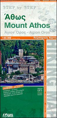
Mount Athos at 1:60,000 on a GPS compatible, contoured map from Orama Editions printed on light, waterproof and tear-resistant synthetic paper, with on the reverse descriptions of several hiking routes between the area’s famous monasteries.On one side is the whole Mount Athos peninsula with the Amouliani Island and coverage extending north-west beyond the town of
Albania North
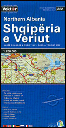
Northern Albania at 1:200,000 in a series of three indexed, GPS compatible touring maps from the Tirana-based cartographic publishers Vektor with a vivid presentation of the country’s topography through contours and bold altitude colouring, plus locations of campsites, beaches and other places of interest. Coverage extends south to Laรง and Peshkopi.Road network is graded into
Albania Central
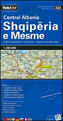
Central Albania at 1:200,000 in a series of three indexed, GPS compatible touring maps from the Tirana-based cartographic publishers Vektor with a vivid presentation of the country’s topography through contours and bold altitude colouring, plus locations of campsites, beaches and other places of interest. Coverage extends from Laรง north of Tirana to Fier, Berat and
Albania South
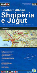
Southern Albania at 1:200,000 in a series of three indexed, GPS compatible touring maps from the Tirana-based cartographic publishers Vektor with a vivid presentation of the country’s topography through contours and bold altitude colouring, plus locations of campsites, beaches and other places of interest. Coverage starts just north of Vlorรซ on the coast and from
Berati Prefecture

Berati Prefecture at 1:100,000 in a series of handy size, waterproof and tear-resistant, contoured and GPS compatible road maps from the Tirana-based publishers Vektor. Landscape is presented by altitude colouring and contours lines at 100m intervals, with spot heights and a few more names of topographic features than found on Vektor’s 200K road maps of
Bulqiza Prefecture

Bulqiza Prefecture at 1:100,000 in a series of handy size, waterproof and tear-resistant, contoured and GPS compatible road maps from the Tirana-based publishers Vektor. Landscape is presented by altitude colouring and contours lines at 100m intervals, with spot heights and a few more names of topographic features than found on Vektor’s 200K road maps of
Delvina Prefecture

Delvina Prefecture at 1:75,000 in a series of handy size, waterproof and tear-resistant, contoured and GPS compatible road maps from the Tirana-based publishers Vektor. Landscape is presented by altitude colouring and contours lines at 100m intervals, with spot heights and a few more names of topographic features than found on Vektor’s 200K road maps of
Devolli Prefecture

Devolli Prefecture at 1:80,000 in a series of handy size, waterproof and tear-resistant, contoured and GPS compatible road maps from the Tirana-based publishers Vektor. Landscape is presented by altitude colouring and contours lines at 100m intervals, with spot heights and a few more names of topographic features than found on Vektor’s 200K road maps of


