Category Archives: Maps
West of Scotland Sea Kayaking Map

Sea kayaking map of the western coast of Scotland from See Kayak Oban publishers, showing best routes from the mainland to and around the islands, plus a street plan of Oban and plenty of tourist information.On one side is a map at 1:210,000 approx showing the coast from Glasgow and the Clyde, Bute, Jura and
214 Wainwright Fells and the tarns of the Lake District Wall Map

This beautifully illustrated wall map of the Lake District, depicts all of Wainwrights 214 Lakeland Fells, over two hundred Lakeland Tarns, twenty-three Youth Hostels, the road networks and towns and villages of the area.Each fell and tarn is grid referenced and colour coded to correspond with Wainwright`s classic Pictorial Guides. An ideal map for summit
Tien Shan: Lake Issyk-Kul North 100K Goskartografiya Trekking Map

The area between Lake Issyk-Kul and the Kazakhstan border on a contoured and GPS compatible, double-sided topographic map at 1:100,000 from Goskartografiya in Bishkek, with all place names in the Cyrillic alphabet and an English map legend. Coverage extends eastwards from Orlovka, just west of the E125 road linking the lake with Tokmok, to Semenovka
Myrtle Beach & The Grand Strand SC
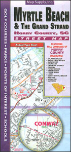
Myrtle Beach and The Grand Strand area on the coast of South Carolina on a double-sided, indexed street plan from Map Supply Inc, with an additional road map extending coverage further inland to cover the rest of the Horry County. The plan highlights various facilities and places of interest, including hiking trails, locations of campsites,
Israel 100 Recommended Sites Road Map

Indexed road map of Israel, clearly defining areas of Palestinian control or joint authority and highlighting the country’s 100 most interesting sites. The bulk of the country, to just beyond Be’er Sheva, is shown at 1:250,000, with the Negev Desert at 1:400,000. Colouring identifies areas of full Palestinian control as well as those with joint


