Category Archives: Maps
Tosbotn Nordeca 10111

Map No. 10111, Tosbotn, in the new topographic survey of Norway at 1:50,000 covering the country on 195 double-sided sheets and first published by Nordeca in 2011 – 2012; fully GPS compatible, indicating waymarked footpaths, campsites, tourist huts, illuminated ski runs, etc.The maps, now published by Nordeca, the successors to Statens Kartverk and its subsequent
Skackerfjallen Nordeca 10096
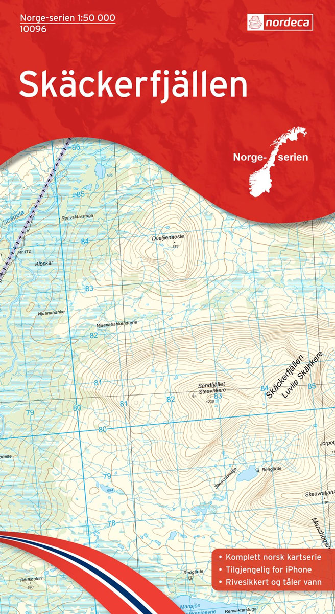
Map No. 10096, Skรคckerfjรคllen, in the new topographic survey of Norway at 1:50,000 covering the country on 195 double-sided sheets and first published by Nordeca in 2011 – 2012; fully GPS compatible, indicating waymarked footpaths, campsites, tourist huts, illuminated ski runs, etc.The maps, now published by Nordeca, the successors to Statens Kartverk and its subsequent
Susendalen Nordeca 10112

Map No. 10112, Susendalen, in the new topographic survey of Norway at 1:50,000 covering the country on 195 double-sided sheets and first published by Nordeca in 2011 – 2012; fully GPS compatible, indicating waymarked footpaths, campsites, tourist huts, illuminated ski runs, etc.The maps, now published by Nordeca, the successors to Statens Kartverk and its subsequent
Halten Nordeca 10097
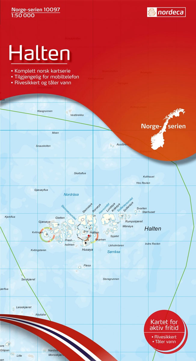
Map No. 10097, Halten, in the new topographic survey of Norway at 1:50,000 covering the country on 195 double-sided sheets and first published by Nordeca in 2011 – 2012; fully GPS compatible, indicating waymarked footpaths, campsites, tourist huts, illuminated ski runs, etc.The maps, now published by Nordeca, the successors to Statens Kartverk and its subsequent
Finnbuliin Nordeca 10098
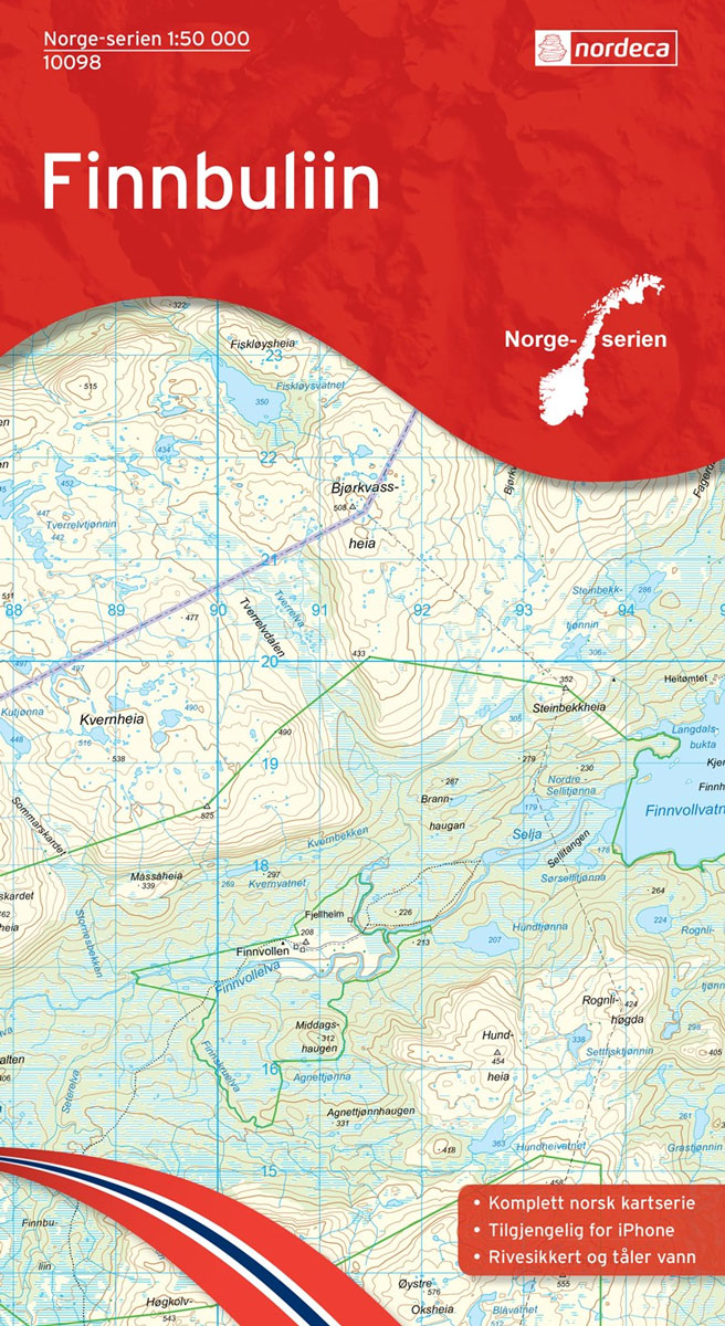
Map No. 10098, Finnbuliin in the new topographic survey of Norway at 1:50,000 covering the country on 195 double-sided sheets and first published by Nordeca in 2011 – 2012; fully GPS compatible, indicating waymarked footpaths, campsites, tourist huts, illuminated ski runs, etc.The maps, now published by Nordeca, the successors to Statens Kartverk and its subsequent
Snasa Nordeca 10099
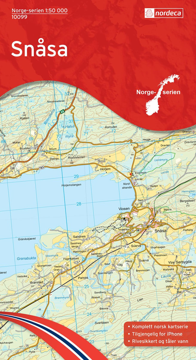
Map No. 10099, Snรฅsa, in the new topographic survey of Norway at 1:50,000 covering the country on 195 double-sided sheets and first published by Nordeca in 2011 – 2012; fully GPS compatible, indicating waymarked footpaths, campsites, tourist huts, illuminated ski runs, etc.The maps, now published by Nordeca, the successors to Statens Kartverk and its subsequent
Sรธrli Nordeca 10100
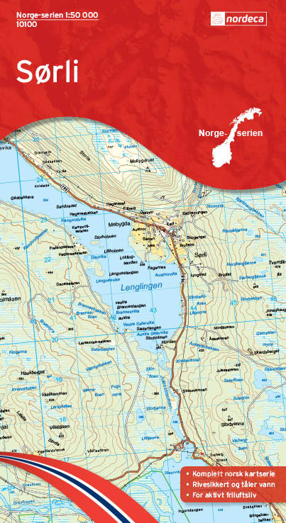
Map No. 10100, Sรธrli, in the new topographic survey of Norway at 1:50,000 covering the country on 195 double-sided sheets and first published by Nordeca in 2011 – 2012; fully GPS compatible, indicating waymarked footpaths, campsites, tourist huts, illuminated ski runs, etc.The maps, now published by Nordeca, the successors to Statens Kartverk and its subsequent
Valsjรถbyn Nordeca 10101
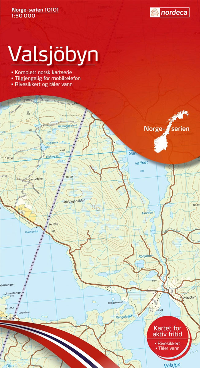
Map No. 10101, Valsjรถbyn, in the new topographic survey of Norway at 1:50,000 covering the country on 195 double-sided sheets and first published by Nordeca in 2011 – 2012; fully GPS compatible, indicating waymarked footpaths, campsites, tourist huts, illuminated ski runs, etc.The maps, now published by Nordeca, the successors to Statens Kartverk and its subsequent
Folda Nordeca 10102
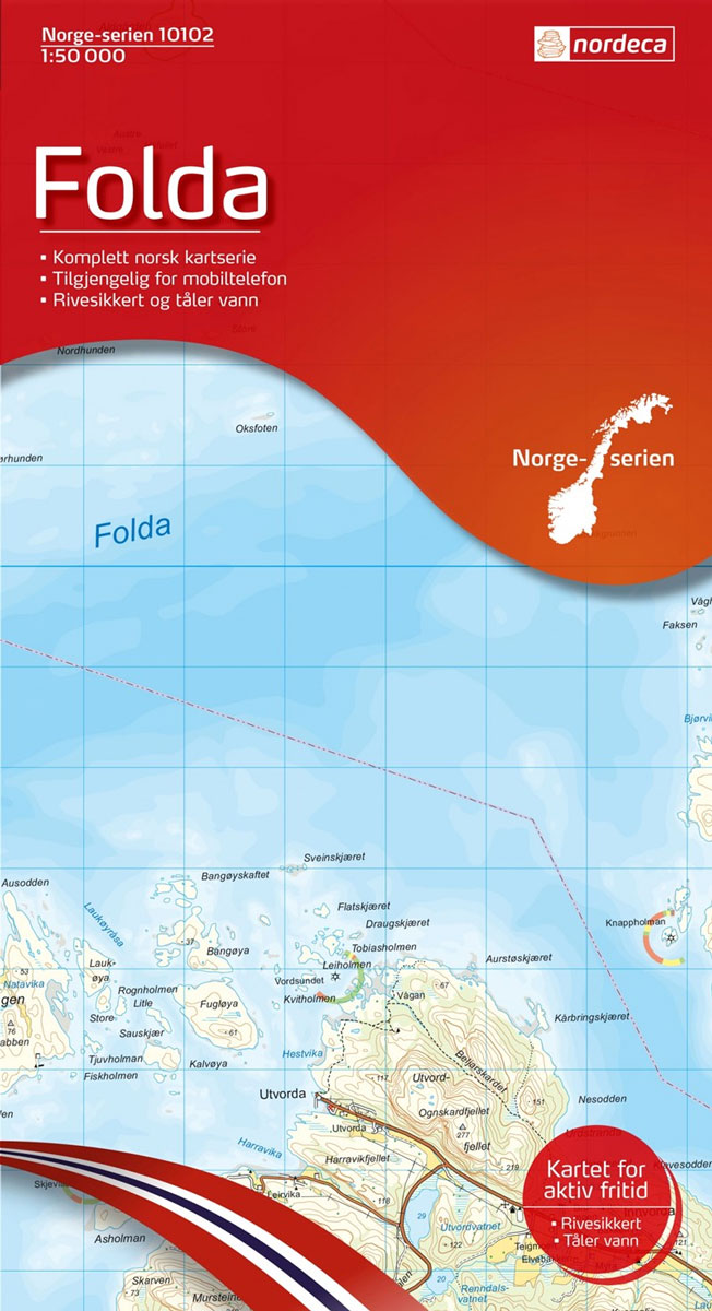
Map No. 10102, Folda, in the new topographic survey of Norway at 1:50,000 covering the country on 195 double-sided sheets and first published by Nordeca in 2011 – 2012; fully GPS compatible, indicating waymarked footpaths, campsites, tourist huts, illuminated ski runs, etc.The maps, now published by Nordeca, the successors to Statens Kartverk and its subsequent
Hรธylandet Nordeca 10103
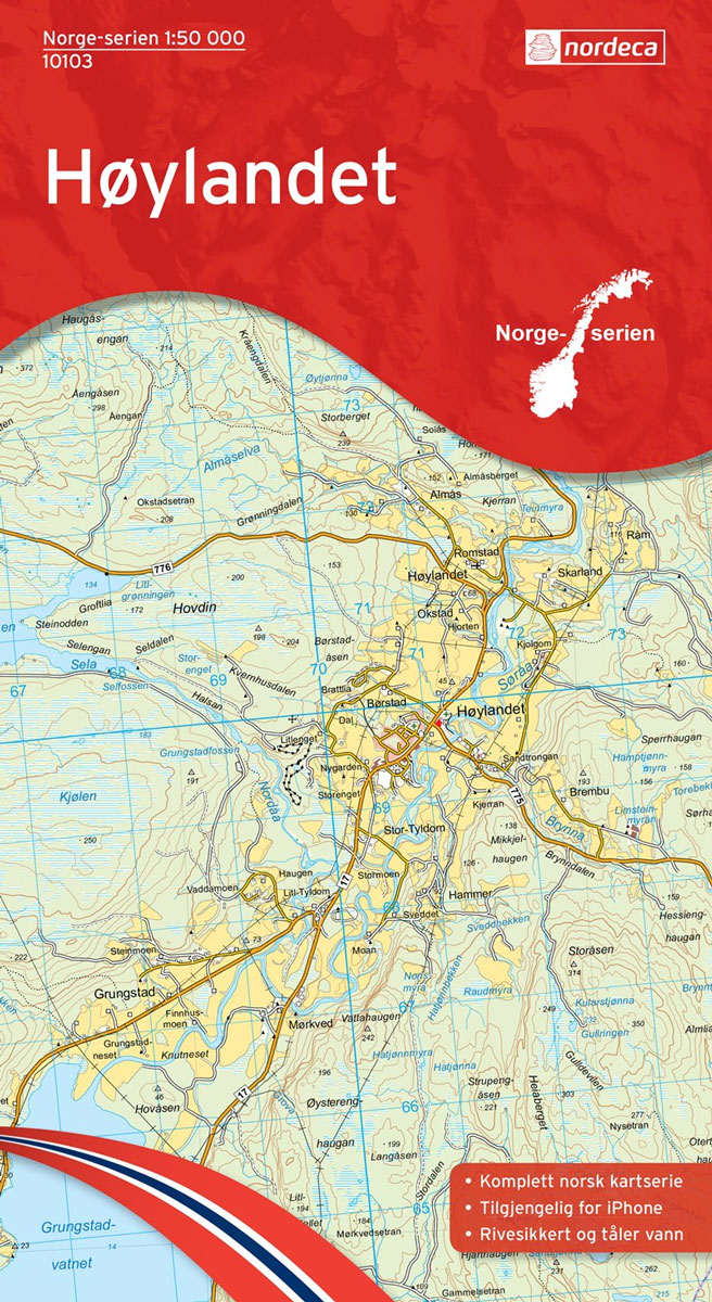
Map No. 10103, Hรธylandet, in the new topographic survey of Norway at 1:50,000 covering the country on 195 double-sided sheets and first published by Nordeca in 2011 – 2012; fully GPS compatible, indicating waymarked footpaths, campsites, tourist huts, illuminated ski runs, etc.The maps, now published by Nordeca, the successors to Statens Kartverk and its subsequent
Nordli Nordeca 10104

Map No. 10104, Nordli, in the new topographic survey of Norway at 1:50,000 covering the country on 195 double-sided sheets and first published by Nordeca in 2011 – 2012; fully GPS compatible, indicating waymarked footpaths, campsites, tourist huts, illuminated ski runs, etc.The maps, now published by Nordeca, the successors to Statens Kartverk and its subsequent
Folldal Nordeca 10073

Map No. 10073, Folldal, in the new topographic survey of Norway at 1:50,000 covering the country on 195 double-sided sheets and first published by Nordeca in 2011 – 2012; fully GPS compatible, indicating waymarked footpaths, campsites, tourist huts, illuminated ski runs, etc.The maps, now published by Nordeca, the successors to Statens Kartverk and its subsequent
Kyrksรฆterรธra Nordeca 10089
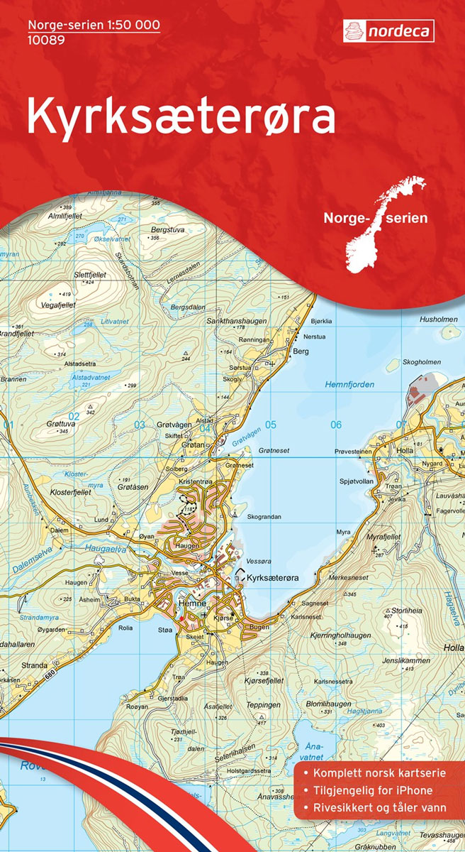
Map No. 10089, Kyrksรฆterรธra, in the new topographic survey of Norway at 1:50,000 covering the country on 195 double-sided sheets and first published by Nordeca in 2011 – 2012; fully GPS compatible, indicating waymarked footpaths, campsites, tourist huts, illuminated ski runs, etc.The maps, now published by Nordeca, the successors to Statens Kartverk and its subsequent
Raudsjรธen Nordeca 10074
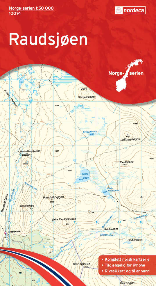
Map No. 10074, Raudsjรธen, in the new topographic survey of Norway at 1:50,000 covering the country on 195 double-sided sheets and first published by Nordeca in 2011 – 2012; fully GPS compatible, indicating waymarked footpaths, campsites, tourist huts, illuminated ski runs, etc.The maps, now published by Nordeca, the successors to Statens Kartverk and its subsequent
Trondheim Nordeca 10090
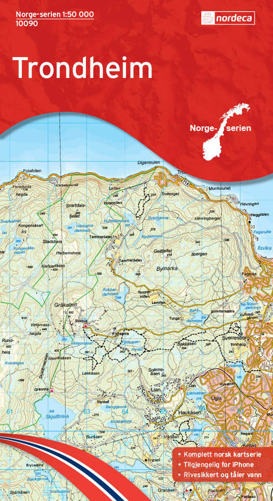
Map No. 10090, Trondheim, in the new topographic survey of Norway at 1:50,000 covering the country on 195 double-sided sheets and first published by Nordeca in 2011 – 2012; fully GPS compatible, indicating waymarked footpaths, campsites, tourist huts, illuminated ski runs, etc.The maps, now published by Nordeca, the successors to Statens Kartverk and its subsequent
Tรถfsingdalen Nordeca 10075
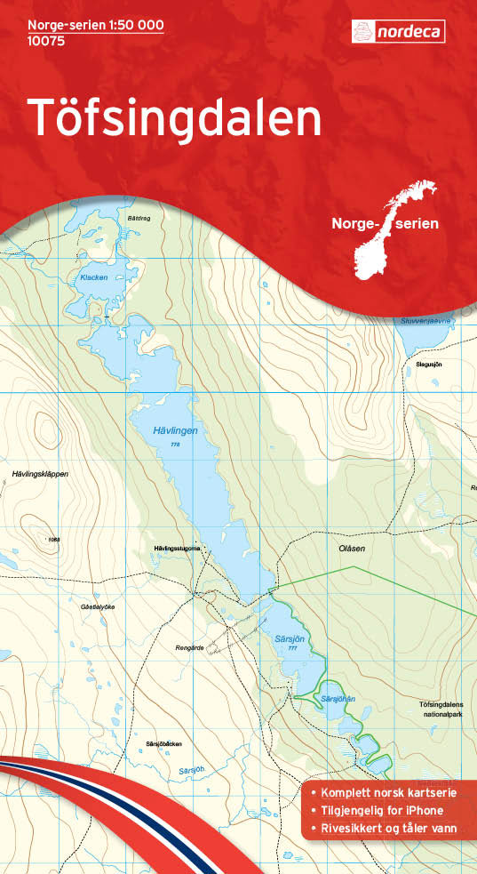
Map No. 10075, Tรถfsingdalen, in the new topographic survey of Norway at 1:50,000 covering the country on 195 double-sided sheets and first published by Nordeca in 2011 – 2012; fully GPS compatible, indicating waymarked footpaths, campsites, tourist huts, illuminated ski runs, etc.The maps, now published by Nordeca, the successors to Statens Kartverk and its subsequent
Stjรธrdalen Nordeca 10091

Map No. 10091, Stjรธrdalen, in the new topographic survey of Norway at 1:50,000 covering the country on 195 double-sided sheets and first published by Nordeca in 2011 – 2012; fully GPS compatible, indicating waymarked footpaths, campsites, tourist huts, illuminated ski runs, etc.The maps, now published by Nordeca, the successors to Statens Kartverk and its subsequent
ร…lesund Nordeca 10076
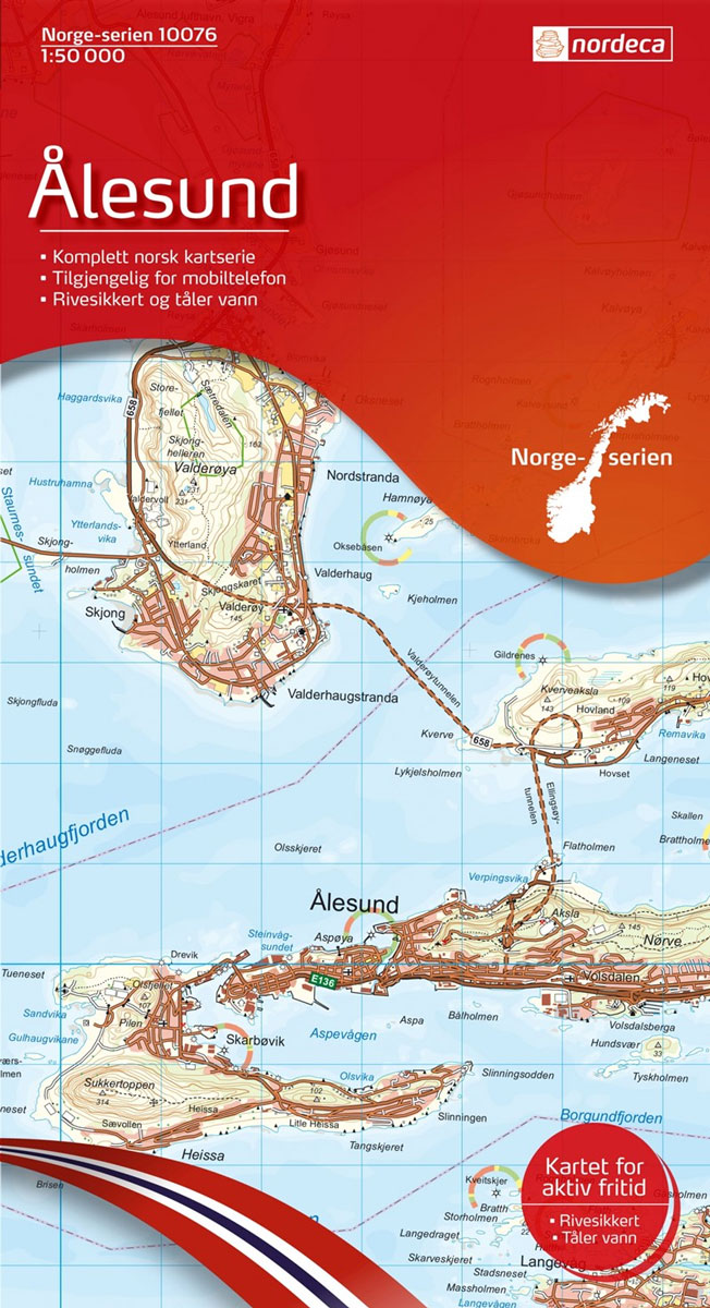
Map No. 10076, ร…lesund, in the new topographic survey of Norway at 1:50,000 covering the country on 195 double-sided sheets and first published by Nordeca in 2011 – 2012; fully GPS compatible, indicating waymarked footpaths, campsites, tourist huts, illuminated ski runs, etc.The maps, now published by Nordeca, the successors to Statens Kartverk and its subsequent
ร…re Nordeca 10092
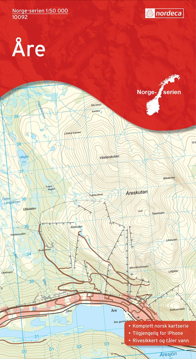
Map No. 10092, ร…re, in the new topographic survey of Norway at 1:50,000 covering the country on 195 double-sided sheets and first published by Nordeca in 2011 – 2012; fully GPS compatible, indicating waymarked footpaths, campsites, tourist huts, illuminated ski runs, etc.The maps, now published by Nordeca, the successors to Statens Kartverk and its subsequent
Romsdalsfjorden Nordeca 10077
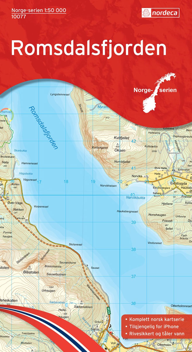
Map No. 10077, Romsdalsfjorden, in the new topographic survey of Norway at 1:50,000 covering the country on 195 double-sided sheets and first published by Nordeca in 2011 – 2012; fully GPS compatible, indicating waymarked footpaths, campsites, tourist huts, illuminated ski runs, etc.The maps, now published by Nordeca, the successors to Statens Kartverk and its subsequent