Category Archives: Maps
Nordkapp Nordeca 10193
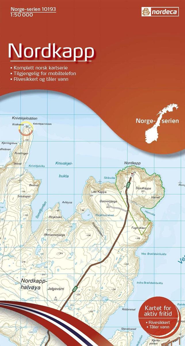
Map No. 10193, Nordkapp, in the new topographic survey of Norway at 1:50,000 covering the country on 195 double-sided sheets and first published by Nordeca in 2011 – 2012; fully GPS compatible, indicating waymarked footpaths, campsites, tourist huts, illuminated ski runs, etc.The maps, now published by Nordeca, the successors to Statens Kartverk and its subsequent
Gargano Global Map Tourist Map
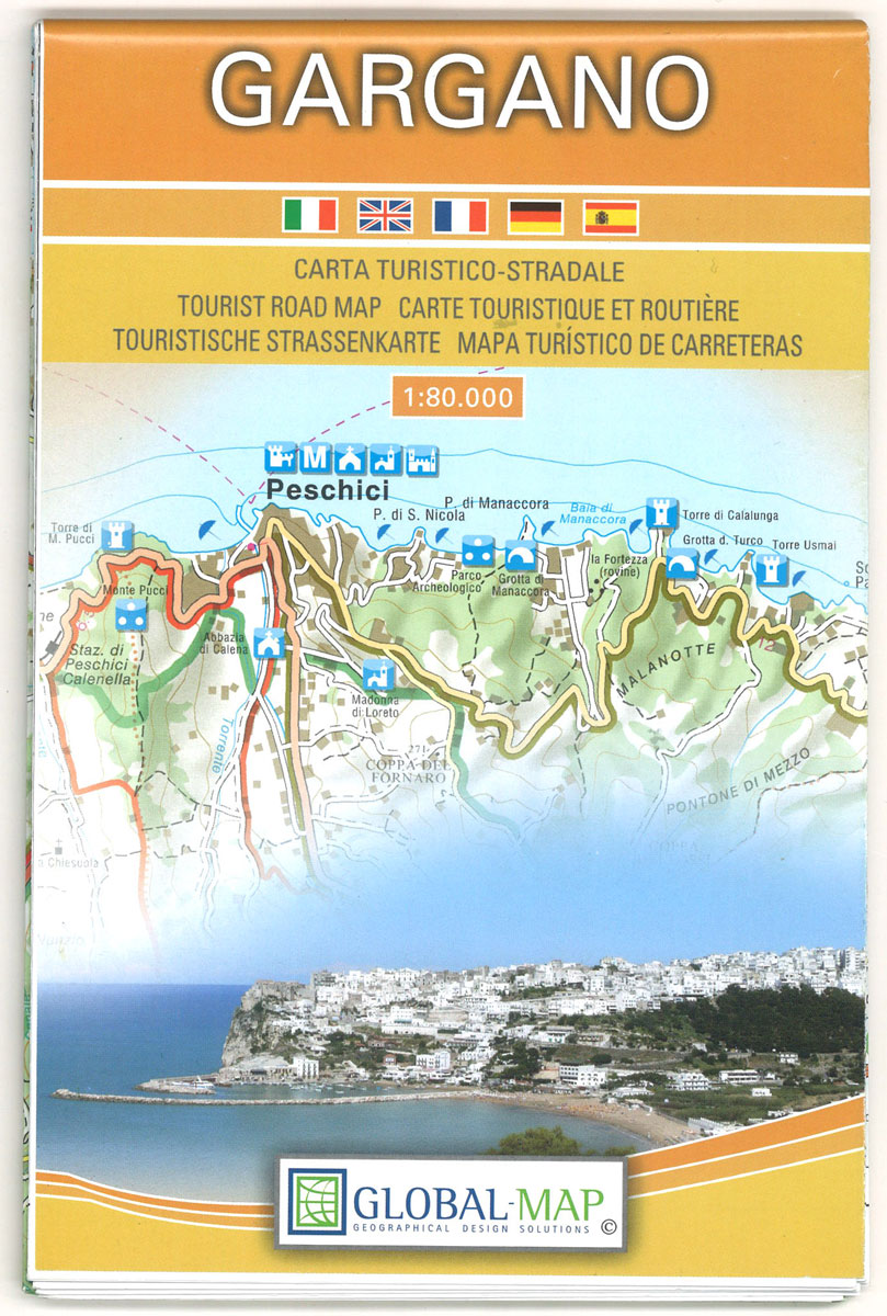
Gargano, the little spur of Italy jutting out into the Adriatic, on a detailed contoured map from Litografia Artistica Cartografica, highlighting the area’s picturesque towns and villages, campsites, ferry routes along its coast and to the nearby Trรจmiti Islands also included on the map, archaeological remains, etc.Topography is indicated by contours (although no interval is
Kjรธllefjord Nordeca 10194
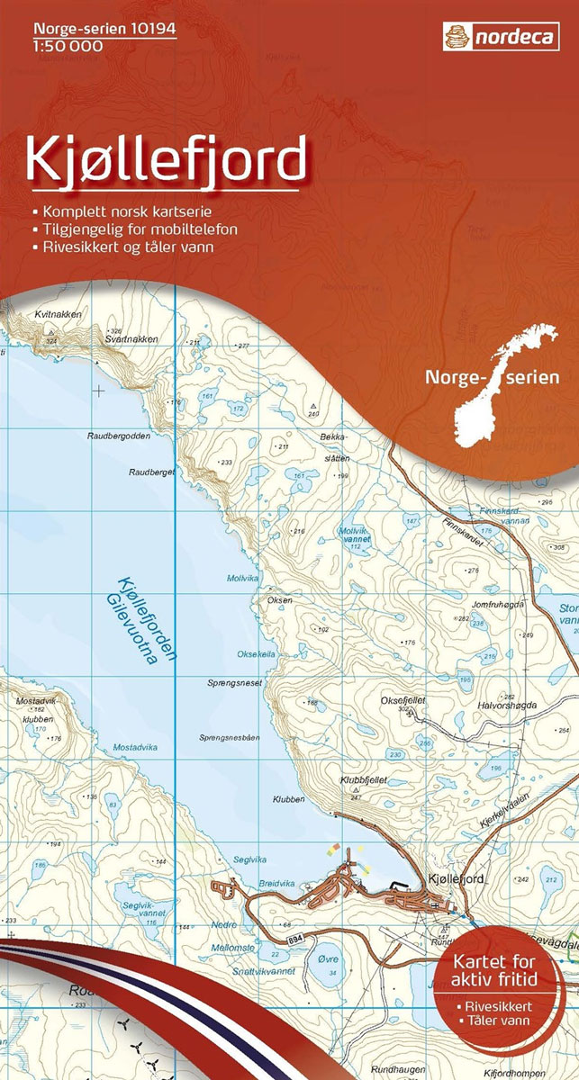
Map No. 10194, Kjรธllefjord, in the new topographic survey of Norway at 1:50,000 covering the country on 195 double-sided sheets and first published by Nordeca in 2011 – 2012; fully GPS compatible, indicating waymarked footpaths, campsites, tourist huts, illuminated ski runs, etc.The maps, now published by Nordeca, the successors to Statens Kartverk and its subsequent
Vall de Nรบria ‘“ Ulldeter

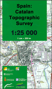
Topographic survey of Catalonia at 1:25,000 from the Institut Cartogrร fic i Geolรฒgic de Catalunya, an attractive alternative to Spain’s national topographic survey at this scale, offering a much larger area per sheet with extensive tourist information and vivid presentation of vegetation and land use.These large, detailed maps have contours at 10m intervals enhanced by hill
Mehamn Nordeca 10195

Map No. 10195, Mehamn, in the new topographic survey of Norway at 1:50,000 covering the country on 195 double-sided sheets and first published by Nordeca in 2011 – 2012; fully GPS compatible, indicating waymarked footpaths, campsites, tourist huts, illuminated ski runs, etc.The maps, now published by Nordeca, the successors to Statens Kartverk and its subsequent
El Pont de Suert
Topographic survey of Catalonia at 1:25,000 from the Institut Cartogrร fic i Geolรฒgic de Catalunya, an attractive alternative to Spain’s national topographic survey at this scale, offering a much larger area per sheet with extensive tourist information and vivid presentation of vegetation and land use.These large, detailed maps have contours at 10m intervals enhanced by hill
Map Measurer Plus – Electronic
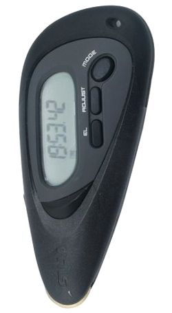
Silva Electronic Map Measurer is a digital, portable instrument used to measure distances accurately on maps in kilometres, miles and nautical miles up to a scale of 1:1,000,000. The instrument has a detachable lanyard and belt clip, a trip planning functionality which can add and subtract distances, and a time to go count down calculator.
Berga – Rasos de Peguera – Gironella – Casserres – Puig-reig
Topographic survey of Catalonia at 1:25,000 from the Institut Cartogrร fic i Geolรฒgic de Catalunya, an attractive alternative to Spain’s national topographic survey at this scale, offering a much larger area per sheet with extensive tourist information and vivid presentation of vegetation and land use.These large, detailed maps have contours at 10m intervals enhanced by hill
Map Measurer – Mechanical (Black Rubber Handled)
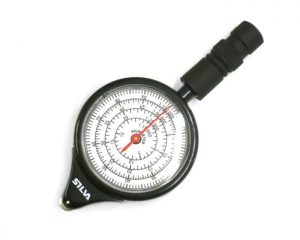
Map Measurer – Black Rubber Handled is a portable instrument used to measure distance accurately on maps of all types, giving readings for the following common map scales: 1:15.000, 1:25.000, 1:50.000, 1:100.000, 1:200.000, 1:400.000, 1:500.000, and 1:750.000. Directions for use – set the pointer to 0, and then trace the route to be measured with
Pocket Binoculars 10 x 25
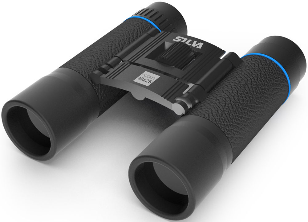
The Silva Pocket binocular is a compact, reliable low-weight companion, always there when you need it. We bet there have been times when you wished you had brought your binoculars, on a trek, in the boat, the car or away at the cottage. With the super compact Silva Pocket you will have a friend that
Pocket Monocular 7 x 18
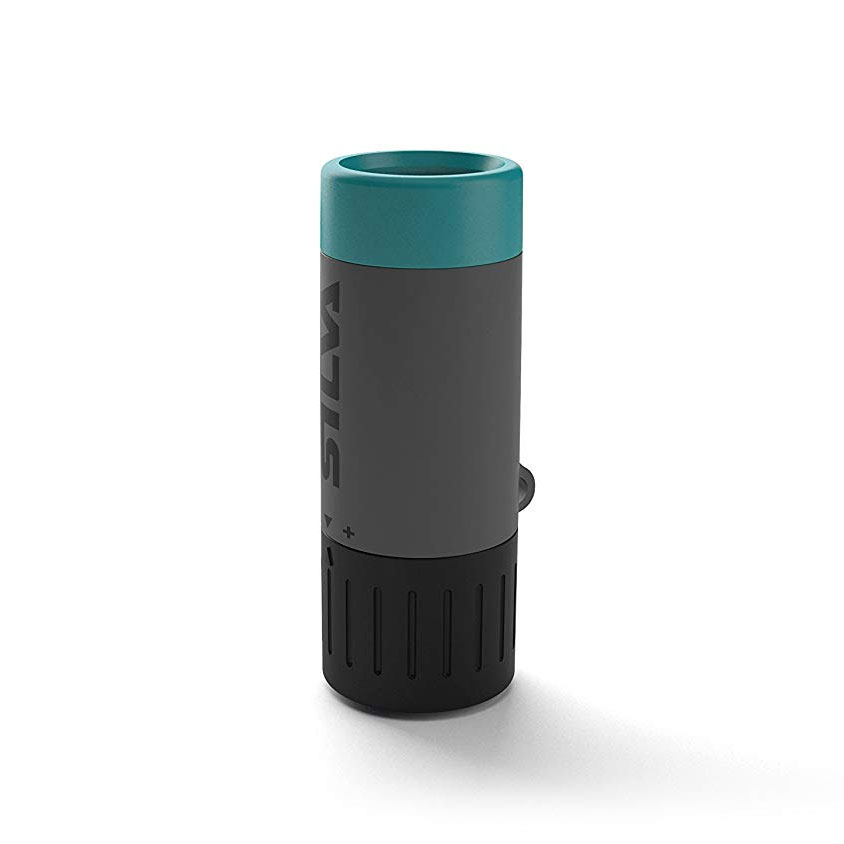
The Silva Pocket binocular is a compact, reliable low-weight companion, always there when you need it. We bet there have been times when you wished you had brought your binoculars, on a trek, in the boat, the car or away at the cottage. With the super compact Silva Pocket you will have a friend that
Jacobselva Nordeca 10184
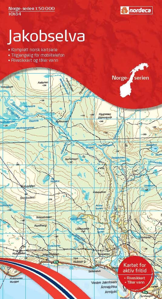
Map No. 10184, Jacobselva, in the new topographic survey of Norway at 1:50,000 covering the country on 195 double-sided sheets and first published by Nordeca in 2011 – 2012; fully GPS compatible, indicating waymarked footpaths, campsites, tourist huts, illuminated ski runs, etc.The maps, now published by Nordeca, the successors to Statens Kartverk and its subsequent
Vardรธ Nordeca 10185
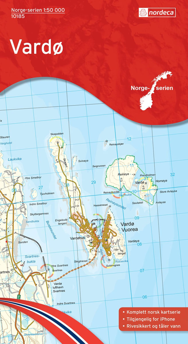
Map No. 10185, Vardรธ, in the new topographic survey of Norway at 1:50,000 covering the country on 195 double-sided sheets and first published by Nordeca in 2011 – 2012; fully GPS compatible, indicating waymarked footpaths, campsites, tourist huts, illuminated ski runs, etc.The maps, now published by Nordeca, the successors to Statens Kartverk and its subsequent
Sรธrรธya Nordeca 10186
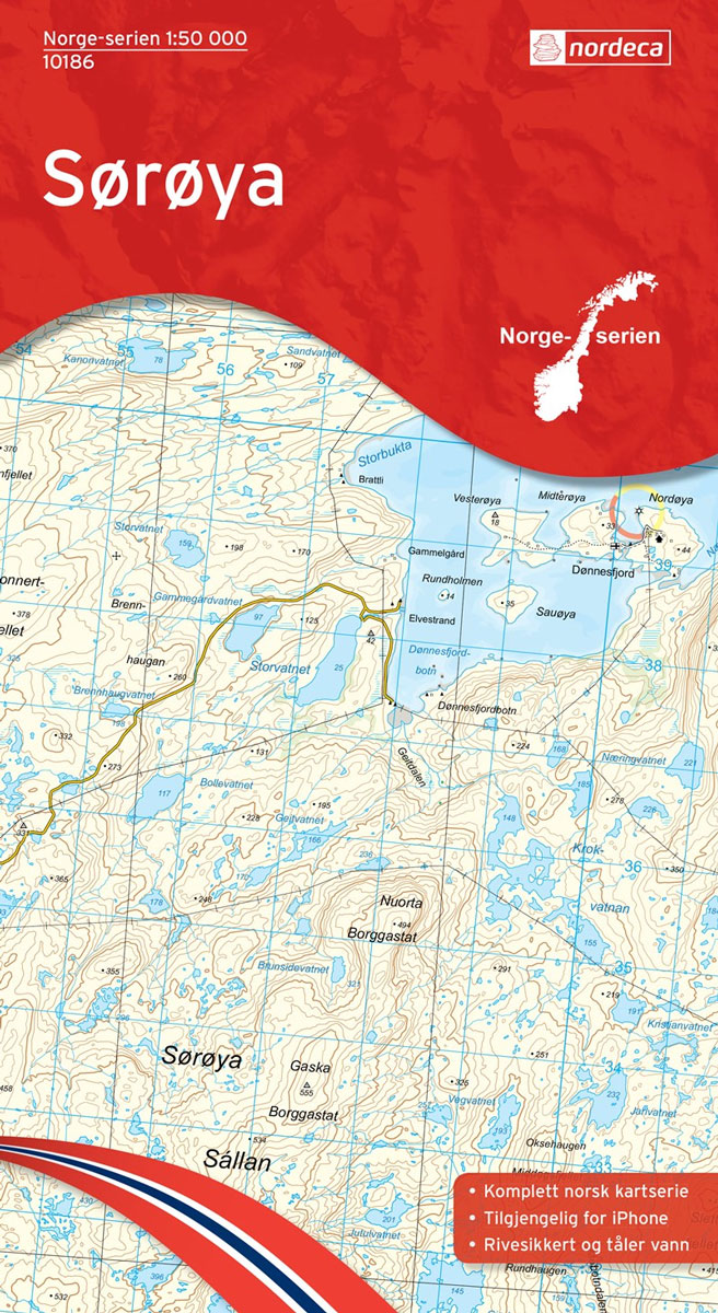
Map No. 10186, Sรธrรธya, in the new topographic survey of Norway at 1:50,000 covering the country on 195 double-sided sheets and first published by Nordeca in 2011 – 2012; fully GPS compatible, indicating waymarked footpaths, campsites, tourist huts, illuminated ski runs, etc.The maps, now published by Nordeca, the successors to Statens Kartverk and its subsequent
Hammerfest Nordeca 10187

Map No. 10187, Hammerfest, in the new topographic survey of Norway at 1:50,000 covering the country on 195 double-sided sheets and first published by Nordeca in 2011 – 2012; fully GPS compatible, indicating waymarked footpaths, campsites, tourist huts, illuminated ski runs, etc.The maps, now published by Nordeca, the successors to Statens Kartverk and its subsequent
Repvรฅg Nordeca 10188
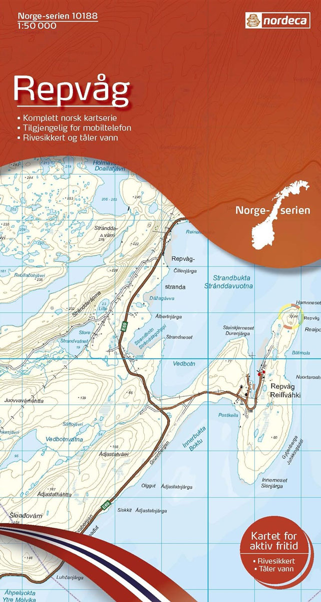
Map No. 10188, Repvรฅg, in the new topographic survey of Norway at 1:50,000 covering the country on 195 double-sided sheets and first published by Nordeca in 2011 – 2012; fully GPS compatible, indicating waymarked footpaths, campsites, tourist huts, illuminated ski runs, etc.The maps, now published by Nordeca, the successors to Statens Kartverk and its subsequent
Svanvik Nordeca 10173
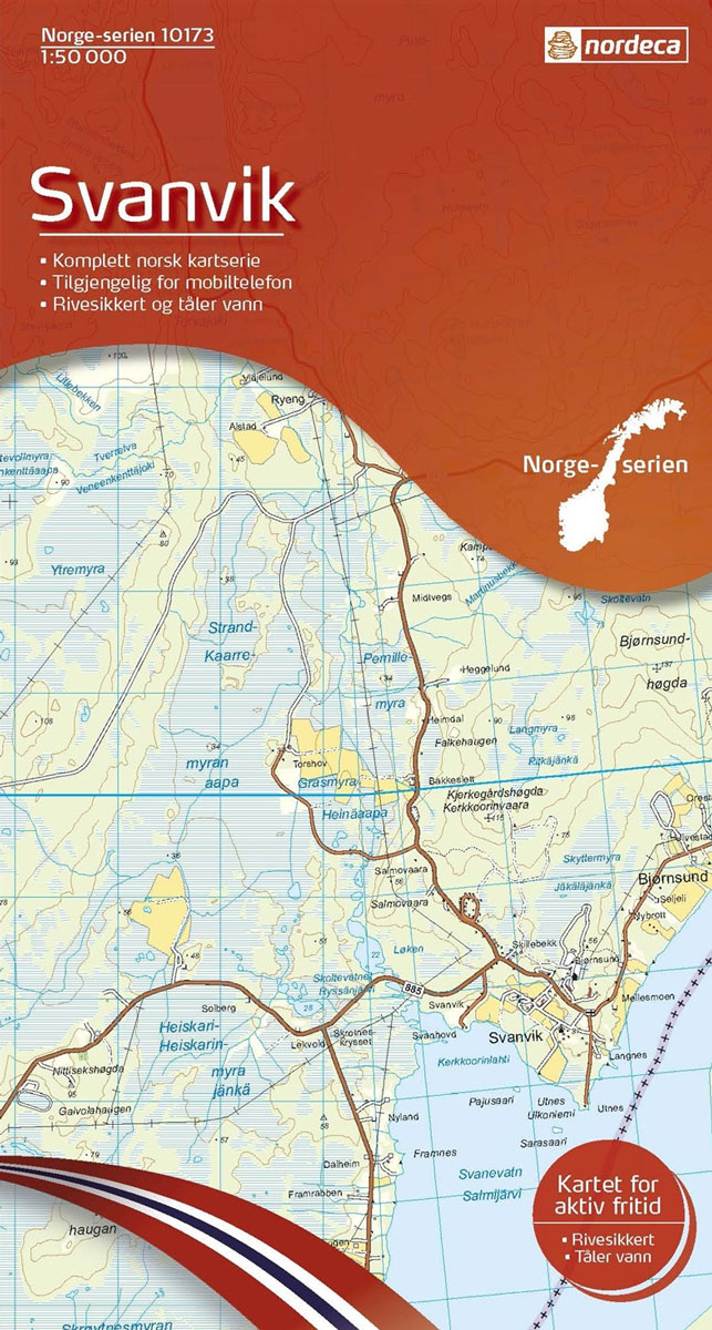
Map No. 10173, Svanvik, in the new topographic survey of Norway at 1:50,000 covering the country on 195 double-sided sheets and first published by Nordeca in 2011 – 2012; fully GPS compatible, indicating waymarked footpaths, campsites, tourist huts, illuminated ski runs, etc.The maps, now published by Nordeca, the successors to Statens Kartverk and its subsequent
Hopseidet Nordeca 10189

Map No. 10189, Hopseidet, in the new topographic survey of Norway at 1:50,000 covering the country on 195 double-sided sheets and first published by Nordeca in 2011 – 2012; fully GPS compatible, indicating waymarked footpaths, campsites, tourist huts, illuminated ski runs, etc.The maps, now published by Nordeca, the successors to Statens Kartverk and its subsequent
Lakkonjarga Nordeca 10174
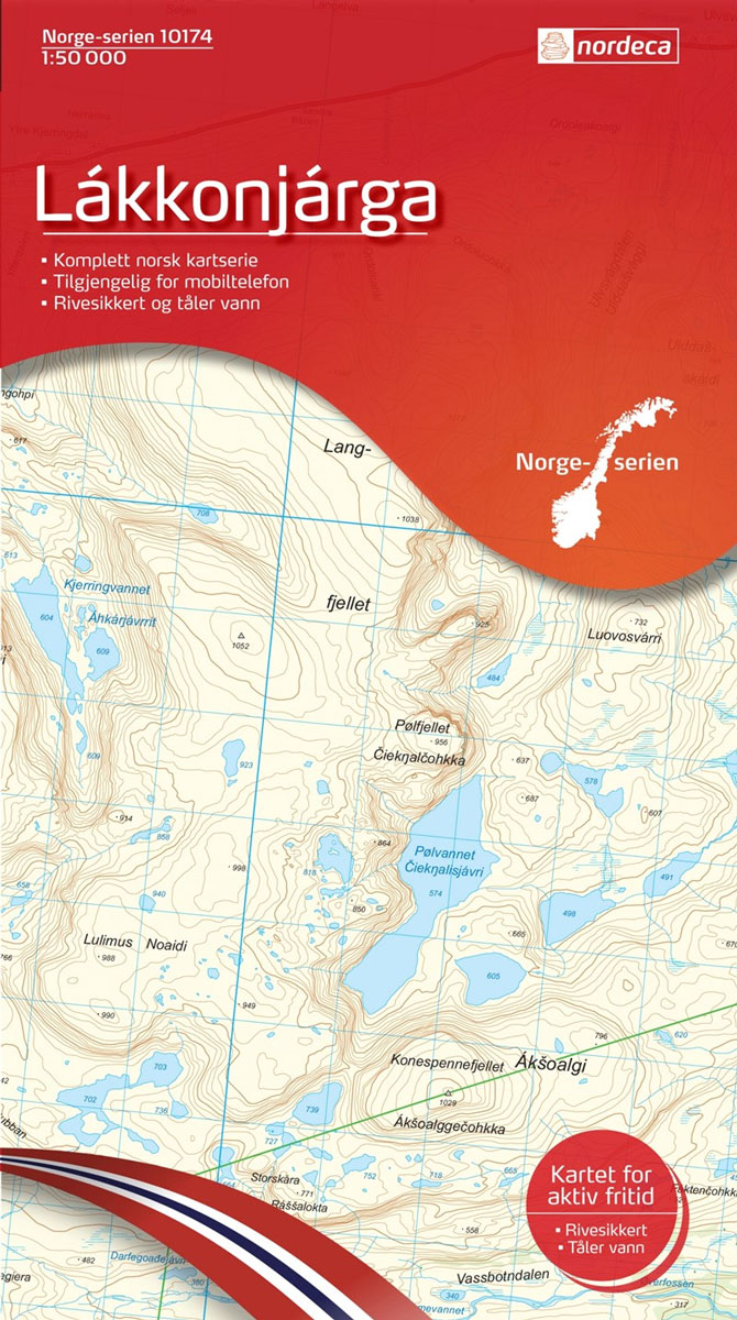
Map No. 10174, Lakkonjarga, in the new topographic survey of Norway at 1:50,000 covering the country on 195 double-sided sheets and first published by Nordeca in 2011 – 2012; fully GPS compatible, indicating waymarked footpaths, campsites, tourist huts, illuminated ski runs, etc.The maps, now published by Nordeca, the successors to Statens Kartverk and its subsequent
Berlevรฅg Nordeca 10190
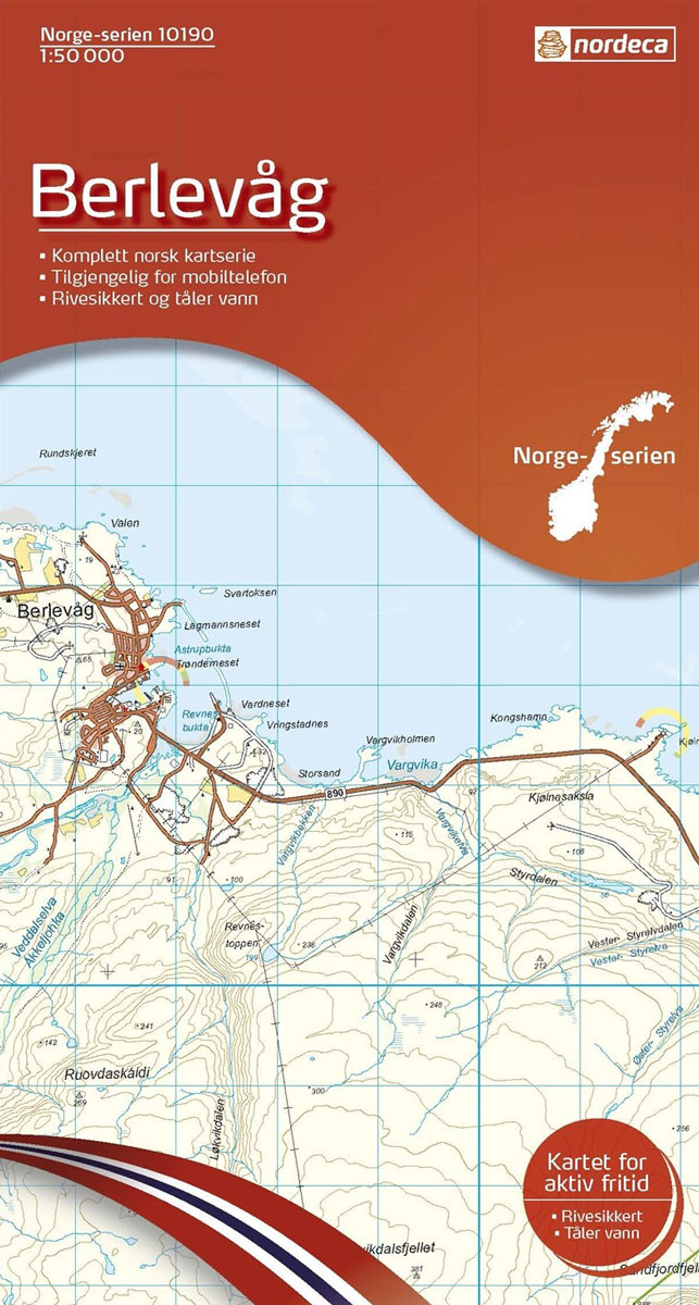
Map No. 10190, Berlevรฅg, in the new topographic survey of Norway at 1:50,000 covering the country on 195 double-sided sheets and first published by Nordeca in 2011 – 2012; fully GPS compatible, indicating waymarked footpaths, campsites, tourist huts, illuminated ski runs, etc.The maps, now published by Nordeca, the successors to Statens Kartverk and its subsequent