Category Archives: Maps
Montes de Mรกlaga Natural Park CNIG Map
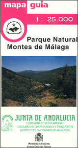
Montes de Mรกlaga Natural Park, the mountains north of Mรกlaga and El Palo, on a contoured and GPS compatible map at 1:25,000 from IGN/CNIG using cartography of their civilian topographic survey of Spain. Contours are 10m intervals, enhanced by relief shading and graphics to show different types of vegetation. The map shows the boundary of
Urbasa and Andรญa Natural Park CNIG Map
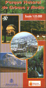
Urbasa and Andรญa Natural Park in Navarra Province west of Pamplona / Iruรฑa, on a contoured and GPS compatible map at 1:35,000 from IGN/CNIG using cartography of their civilian topographic survey of Spain. Contours are 10m intervals, with coloring to show different types of vegetation. The map shows the network of local roads, country tracks
Sierra Nevada – Las Alpujarras CNIG Map
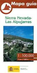
Sierra Nevada Mountain, southern Spain’s most popular national park, on GPS compatible map at 1:100,000 from IGN/CNIG with cartography based on their civilian topographic survey of Spain, plus a panorama drawing of the mountains as seen from the coast. The map covers a large area, extending from Granada in the west to beyond Gรฉrgal in
Valverde 25K Hierro CNIG Topographic Survey Map No. 1105-II

Topographic coverage of the Canary Islands at 1:25,000 published by the Instituto Geogrรกfico Nacional ‘“ Centro Nacional de Informaciรณn Geografica, the country’s civilian survey organization. The maps have contours at 10m intervals and colouring and/or graphics to show different types of vegetation or land use. Boundaries of national parks and other protected areas are marked.
California, Mexico & Florida 1616
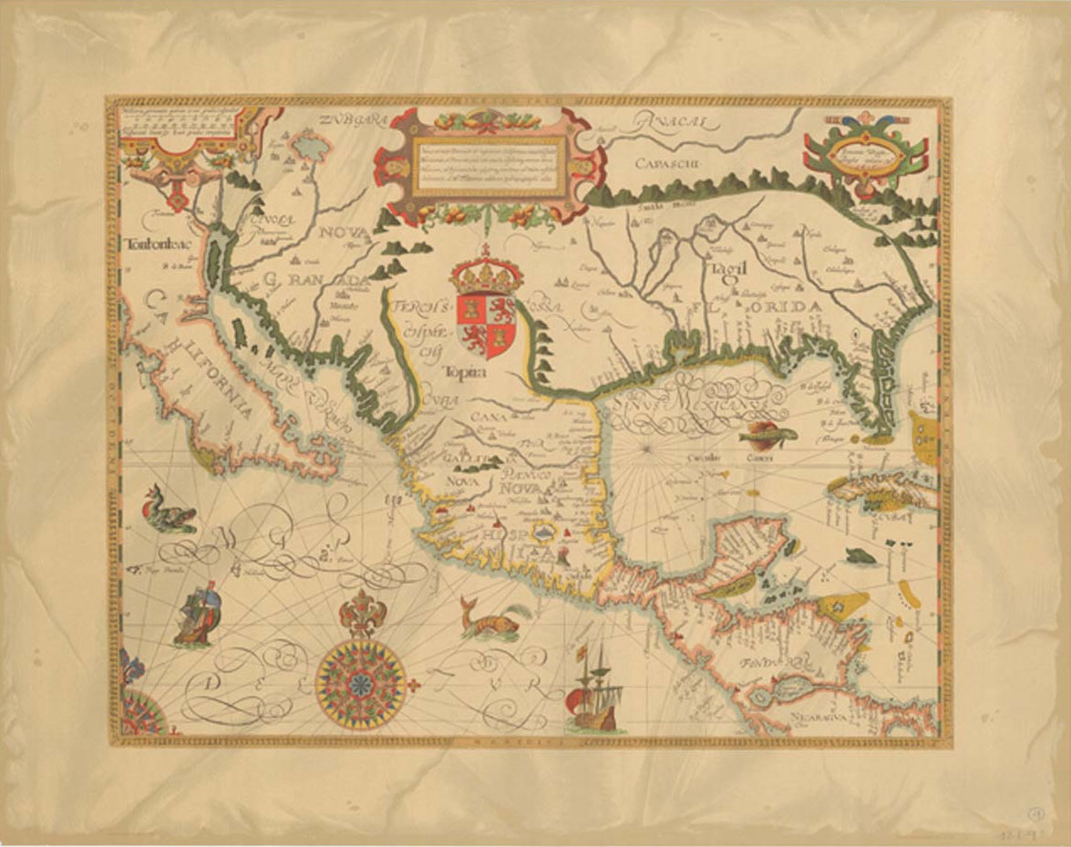
Reproduction of a map drawn by Gabriel Tatton and engraved by Benjamin Wright in 1616. Shows Spain`s territory in central America from the Baja Peninsula to the Caribbean.
Sabinosa 25K Hierro CNIG Topographic Survey Map No. 1105-III
Topographic coverage of the Canary Islands at 1:25,000 published by the Instituto Geogrรกfico Nacional ‘“ Centro Nacional de Informaciรณn Geografica, the country’s civilian survey organization. The maps have contours at 10m intervals and colouring and/or graphics to show different types of vegetation or land use. Boundaries of national parks and other protected areas are marked.
Spain and Portugal in the Reign of Charles III Wall Map
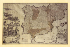
The Iberian Peninsula on a reproduction of a map published by the Dutch cartographic and engraving firm of Danckerts showing the theatres of regional conflicts during the rule of Charles III who reigned from 1759 to 1788.The map, to give its full title ‘Accuratissima Totius Regni Hispaniae, Tabula per Iustinium Dancherts ‘“ Theatre de la
Frontera 25K Hierro CNIG Topographic Survey Map No. 1105-IV
Topographic coverage of the Canary Islands at 1:25,000 published by the Instituto Geogrรกfico Nacional ‘“ Centro Nacional de Informaciรณn Geografica, the country’s civilian survey organization. The maps have contours at 10m intervals and colouring and/or graphics to show different types of vegetation or land use. Boundaries of national parks and other protected areas are marked.
Ingenio 25K Gran Canaria CNIG Topographic Survey Map No. 1107-II
Topographic coverage of the Canary Islands at 1:25,000 published by the Instituto Geogrรกfico Nacional ‘“ Centro Nacional de Informaciรณn Geografica, the country’s civilian survey organization. The maps have contours at 10m intervals and colouring and/or graphics to show different types of vegetation or land use. Boundaries of national parks and other protected areas are marked.
Iran Hand Flag
100% polyester, screen printed flag of Iran on a 30cm wooden pole with a white plastic ball cap.
El Tablero 25K Gran Canaria CNIG Topographic Survey Map No. 1107-III
Topographic coverage of the Canary Islands at 1:25,000 published by the Instituto Geogrรกfico Nacional ‘“ Centro Nacional de Informaciรณn Geografica, the country’s civilian survey organization. The maps have contours at 10m intervals and colouring and/or graphics to show different types of vegetation or land use. Boundaries of national parks and other protected areas are marked.
Vecindario 25K Gran Canaria CNIG Topographic Survey Map No. 1107-IV
Topographic coverage of the Canary Islands at 1:25,000 published by the Instituto Geogrรกfico Nacional ‘“ Centro Nacional de Informaciรณn Geografica, the country’s civilian survey organization. The maps have contours at 10m intervals and colouring and/or graphics to show different types of vegetation or land use. Boundaries of national parks and other protected areas are marked.
Islas de Cรญes Natural Park CNIG Map
Isla de Cรญes Natural Park on a contoured and GPS compatible map at 1:25,000 from IGN/CNIG with cartography from their topographic survey of Spain. The map has contours at 10m intervals enhanced by relief shading, plus colouring and graphics to show different types of vegetation, a 1km UTM grid and margin ticks for latitude and
Cordillera Cantabrica
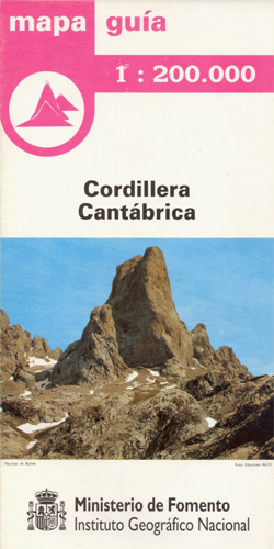
The mountains of Cordillera Cantรกbrica on detailed road map from the Spanish civilian survey organization, with the same cartography as their Provincial series at 1:200,000, but combining on one sheet a wider area centred on the Picos de Europa. The map has contours at 100m intervals enhanced by relief shading and shows plenty of names
Sierra de Ancares Natural Park CNIG Map
Sierra de Ancares Natural Park, a popular walking area south-east of Lugo along the main route of the Camino de Santiago (The Way of St. James to Compostela), on a contoured and GPS compatible map at 1:50,000 from IGN/CNIG with cartography from their topographic survey of Spain. The map has contours at 20m intervals enhanced
Bay of Cadiz Natural Park CNIG Map
Bay of Cadiz Natural Park on a contoured and GPS compatible map at 1:50,000 from IGN/CNIG with cartography from their topographic survey of Spain. The map has contours at 20m intervals enhanced by bold relief shading with colouring and graphics to show different types of vegetation, and a UTM grid plus margin ticks for latitude
Chiclana de la Frontera CNIG Topo 1069

Topographic coverage of mainland Spain at 1:50,000 in the MTN50 (Mapa Topogrรกfico Nacional) series from the Centro Nacional de Informaciรณn Geografica, the country’s civilian survey organization. The maps have contours at 20m intervals, enhanced by relief shading, plus colouring and/or graphics to show different types of terrain, vegetation or land use. Boundaries of national parks
Alcala de los Gazules CNIG Topo 1070
Topographic coverage of mainland Spain at 1:50,000 in the MTN50 (Mapa Topogrรกfico Nacional) series from the Centro Nacional de Informaciรณn Geografica, the country’s civilian survey organization. The maps have contours at 20m intervals, enhanced by relief shading, plus colouring and/or graphics to show different types of terrain, vegetation or land use. Boundaries of national parks
Lebrija CNIG Topo 1034
Topographic coverage of mainland Spain at 1:50,000 in the MTN50 (Mapa Topogrรกfico Nacional) series from the Centro Nacional de Informaciรณn Geografica, the country’s civilian survey organization. The maps have contours at 20m intervals, enhanced by relief shading, plus colouring and/or graphics to show different types of terrain, vegetation or land use. Boundaries of national parks