Category Archives: Maps
Palmerston North Pathfinder

Palmerston North region in a series of maps covering various districts of New Zealand, with each title combining a detailed road map with street plans of local towns, all with road and street indexes. The maps are published in two formats: handy Pocket Maps or Pathfinders with, as the publishers put it ‘Larger print so
North Island with 4 Town Centre Kiwimaps
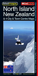
New Zealand’s North Island at 1:1,500,000 on a handy size, indexed touring map from the country’s leading map publishers, Kiwimaps, with indexed town centre street plans for four cities, traveling times map, a distance table, etc.The road network emphasizes state highways and indicates tourist routes such as the Pacific Coast Highway, Thermal Explorer Highway, etc.
Queenstown and Lakes Pathfinder
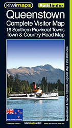
Queenstown region in a series of maps covering various districts of New Zealand, with each title combining a detailed road map with street plans of local towns, all with road and street indexes. The maps are published in two formats: handy Pocket Maps or Pathfinders with, as the publishers put it ‘Larger print so you
New Zealand Kiwimaps Travellers Road Atlas
New Zealand Travellers Road Atlas, spiral-bound, handy size (19x26cm), 178-page road atlas, with enlargements for environs of main towns, street plans of town centres, an index of localities, roads/tracks and streets, plus information driving regulations. The main section of the atlas is at 1:500,000 with detailed presentation of the road network from motorways to 4WD
Waikato Towns and District Pathfinder

Waikato region in a series of maps covering various districts of New Zealand, with each title combining a detailed road map with street plans of local towns, all with road and street indexes. The maps are published in two formats: handy Pocket Maps or Pathfinders with, as the publishers put it ‘Larger print so you
South Island New Zealand – 244 Provincial City & Towns Kiwimaps Travellers Street Directory
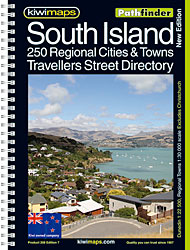
New Zealand`s South Island Provincial City & Towns Travellers Street Directory: spiral, handy size (19x26cm), 200-page street atlas, showing 244 provincial towns (except Christchurch). All the plans are presented at 1:30,000 with, where appropriate, enlargements for town centres provided at more detailed scales. The plans show information centres, one way streets and parking facilities, bus
North Island – New Zealand Kiwimaps Complete Drivers Atlas
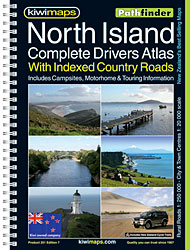
New Zealand`s North Island Road Atlas: spiral, handy size (19x26cm), 185-page road atlas with enlargements for environs of main towns, street plans of town centres, an extensive index of localities, roads/tracks and streets, plus information driving regulations. The main section of the atlas covers the North Island at 1:250,000, with very detailed presentation of the
Auckland Kiwimaps City & District Pathfinder Map
Auckland and environs in a series of maps covering various districts of New Zealand, with each title combining a detailed road map with street plans of local towns, all with road and street indexes. The maps are published in two formats: handy Pocket Maps or Pathfinders with, as the publishers put it ‘Larger print so
Northland: Whangarei, Bay of Islands and 61 Provincial Towns Pathfinder

Northland region at 1:275,000 in a series of maps covering various districts of New Zealand, with each title combining a detailed road map with street plans of local towns, all with road and street indexes. The maps are published in two formats: handy Pocket Maps or Pathfinders with, as the publishers put, it ‘Larger print
Rotorua and Taupo Pathfinder
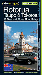
Rotorua and Taupo region in a series of maps covering various districts of New Zealand, with each title combining a detailed road map with street plans of local towns, all with road and street indexes. The maps are published in two formats: handy Pocket Maps or Pathfinders with, as the publishers put it ‘Larger print
Tauranga – Bay of Plenty Pathfinder

Tauranga and Bay of Plenty region in a series of maps covering various districts of New Zealand, with each title combining a detailed road map with street plans of local towns, all with road and street indexes. The maps are published in two formats: handy Pocket Maps or Pathfinders with, as the publishers put it
South Island with 6 Town Centre Kiwimaps

New Zealand’s South Island at 1:1,500,000 on a handy size, indexed touring map from the country’s leading map publishers, Kiwimaps, with indexed town centre street plans for six cities, traveling times map, a distance table, etc.The road network emphasizes state highways and indicates tourist routes such as the Southern Scenic Route, Great Alpine Highway, etc.
Christchurch Visitors` Street Plan
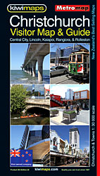
Christchurch Visitors’ Street Plan at 1:30,000 with a detailed enlargement for the town centre and a plan of the city’s international airport. The main plan covers the city with its outer suburbs and is extended by separate panels to include Lincoln, Templeton, Belfast, Rolleston, Kaiapoi, Rangiora and Ashley, all with street indexes.The plans show one
New Zealand Kiwimaps Compact Travellers Atlas SPIRAL-BOUND
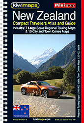
New Zealand Compact Travellers Atlas in a spiral, compact A5 size format, indexed and with enlargements for environs of main towns and street plans of town centres. The main section of the atlas at 1:1,000,000 shows the country’s road network, indicating unsurfaced roads and sections of highways which may be closed in winter. Railway lines,
Nelson, Picton and District Pathfinder

Nelson – Picton region in a series of maps covering various districts of New Zealand, with each title combining a detailed road map with street plans of local towns, all with road and street indexes. The maps are published in two formats: handy Pocket Maps or Pathfinders with, as the publishers put it ‘Larger print
Napier, Hastings and Hawke`s Bay Pathfinder
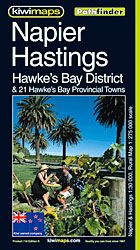
Napier – Hastings region in a series of maps covering various districts of New Zealand, with each title combining a detailed road map with street plans of local towns, all with road and street indexes. The maps are published in two formats: handy Pocket Maps or Pathfinders with, as the publishers put it ‘Larger print
North Island – Eastern & Southern Kiwimaps
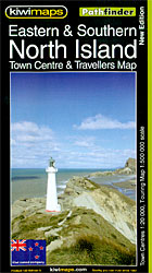
North Island Eastern and Southern in a series of double-sided, indexed touring maps with plenty of tourist information and street plans of town centres. The maps highlight main highways and regional roads, but also show small local roads and selected 4WD tracks. Railways and popular hiking tracks are also shown. National parks and forests are
South Island – Central & Southern Kiwimaps

South Island Central and Southern in a series of double-sided, indexed touring maps with plenty of tourist information and street plans of town centres. The maps highlight main highways and regional roads, but also show small local roads and selected 4WD tracks. Railways and popular hiking tracks are also shown. National parks and forests are
South Island – Northern & Central Kiwimaps
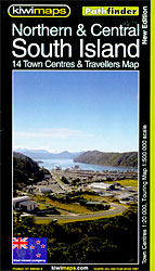
South Island Northern and Central in a series of double-sided, indexed touring maps with plenty of tourist information and street plans of town centres. The maps highlight main highways and regional roads, but also show small local roads and selected 4WD tracks. Railways and popular hiking tracks are also shown. National parks and forests are
High Country Victoria Hema Explorer 4 Map Pack
Part of a series of 4 waterproof maps of the Victorian High Country by Hema at 1:100,000.