Category Archives: Maps
Canterbury: Amberley, Christchurch, Ashburton, Temuka
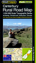
Canterbury region of New Zealand`s South Island, including Amberley, Christchurch, Ashburton and Temuka on a detailed, indexed road map at 1:250,000 from Kiwimaps, with extensive tourist information including a table of facilities in local campsites, a comprehensive index, etc.Maps in a series indicate unsurfaced roads and 4WD tracks, and show names of both major highways
Southern Lakes: Queenstown, Wanaka, Cromwell, Alexandra
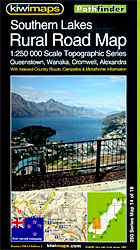
Southern Lakes region of New Zealand`s South Island, including Queenstown, Wanaka, Cromwell and Alexandra, on a detailed, indexed road map at 1:250,000 from Kiwimaps, with extensive tourist information including a table of facilities in local campsites, a comprehensive index, etc.Maps in a series indicate unsurfaced roads and 4WD tracks, and show names of both major
Otago – South Canterbury: Timaru, Oamaru, Wanaka, Alexandra

Otago – South Canterbury region of New Zealand`s South Island, including Timaru, Oamaru, Wanaka and Alexandra, on a detailed, indexed road map at 1:250,000 from Kiwimaps, with extensive tourist information including a table of facilities in local campsites, a comprehensive index, etc.Maps in a series indicate unsurfaced roads and 4WD tracks, and show names of
South Island – New Zealand Kiwimaps Complete Drivers Atlas
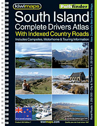
New Zealand`s South Island Road Atlas: spiral, handy size (19x26cm), 210-page road atlas with enlargements for environs of main towns, indexed street plans of town centres, an extensive index of localities, roads/tracks and streets, etc., plus information driving regulations. The main section of the atlas covers the South Island at 1:250,000, with very detailed presentation
Fiordland: Milford Sound, Te Anu, Manapouri, Otautau
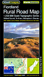
Fiordland region of New Zealand`s South Island, including Milford Sound, Te Anu, Manapouri and Otautau, on a detailed, indexed road map at 1:250,000 from Kiwimaps, with extensive tourist information including a table of facilities in local campsites, a comprehensive index, etc.Maps in a series indicate unsurfaced roads and 4WD tracks, and show names of both
Far North: Cape Reinga, Kaitaia, Kerikeri, Whangarei
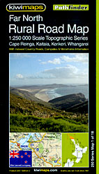
Far North region of New Zealand`s North Island, including Cape Reinga, Kaitaia, Kerikeri and Whangarei, on a detailed, indexed road map at 1:250,000 from Kiwimaps, with extensive tourist information including a table of facilities in local campsites, a comprehensive index, etc.Maps in a series indicate unsurfaced roads and 4WD tracks, and show names of both
Otago – Southland: Dunedin, Balclutha, Gore, Invercargill

Otago ‘“ Southland region of New Zealand`s South Island, including Dunedin, Balclutha, Gore and Invercargill, on a detailed, indexed road map at 1:250,000 from Kiwimaps, with extensive tourist information including a table of facilities in local campsites, a comprehensive index, etc.Maps in a series indicate unsurfaced roads and 4WD tracks, and show names of both
Northland: Whangarei, Dargaville, Wellsford, Warkworth
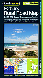
Northland region of New Zealand`s North Island, including Whangarei, Dargaville, Wellsford and Warkworth, on a detailed, indexed road map at 1:250,000 from Kiwimaps, with extensive tourist information including a table of facilities in local campsites, a comprehensive index, etc.Maps in a series indicate unsurfaced roads and 4WD tracks, and show names of both major highways
Stewart Island: Invercargill, Gore, Balclutha, Bluff
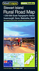
Stewart Island and the southern tip of New Zealand`s South Island, including Invercargill, Gore, Balclutha, Bluff, on a detailed, indexed road map at 1:250,000 from Kiwimaps, with extensive tourist information including a table of facilities in local campsites, a comprehensive index, etc.Maps in a series indicate unsurfaced roads and 4WD tracks, and show names of
Auckland – Coromandel: Thames, Hamilton, Tauranga
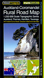
Auckland – Coromandel region of New Zealand`s North Island, including Thames, Hamilton and Tauranga, on a detailed, indexed road map at 1:250,000 from Kiwimaps, with extensive tourist information including a table of facilities in local campsites, a comprehensive index, etc.Maps in a series indicate unsurfaced roads and 4WD tracks, and show names of both major
Gruppi Argentera e Marguareis Edizioni Multigraphic 109/115
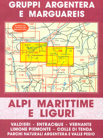
Gruppi Argentera e Marguareis, map no. 109/115 at 1:25,000 from Edizioni Multigraphic covering the Italian Alps along the southern part of the border between Piedmont and France, south of Cuneo. Coverage includes the Pallanfre Reserve, Colle di Tenda / Col de Tende, and Parco Naturale Valle Pesio. Map corners give latitude and longitude based on
Waikato – Bay of Plenty: Hamilton, Tauranga, Rotorua, Taupo
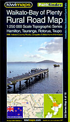
Waikato – Bay of Plenty region of New Zealand`s North Island, including Hamilton, Tauranga, Rotorua and Taupo, on a detailed, indexed road map at 1:250,000 from Kiwimaps, with extensive tourist information including a table of facilities in local campsites, a comprehensive index, etc.Maps in a series indicate unsurfaced roads and 4WD tracks, and show names
East Cape: Whakatane, Opotiki, Gisbourne, Wairoa
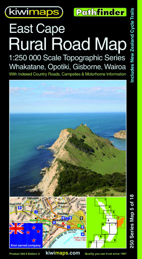
East Cape region of New Zealand`s North Island, including Whakatane, Opotiki, Gisbourne and Wairoa, on a detailed, indexed road map at 1:250,000 from Kiwimaps, with extensive tourist information including a table of facilities in local campsites, a comprehensive index, etc.Maps in a series indicate unsurfaced roads and 4WD tracks, and show names of both major
Taranaki – Ruapehu: New Plymouth, Ohakune, Wanganui, Foxton
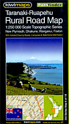
Taranaki ‘“ Ruapehu region of New Zealand`s North Island, including New Plymouth, Ohakune, Wanganui and Foxton, on a detailed, indexed road map at 1:250,000 from Kiwimaps, with extensive tourist information including a table of facilities in local campsites, a comprehensive index, etc.Maps in a series indicate unsurfaced roads and 4WD tracks, and show names of
Hawke`s Bay: Taupo, Napier, Hastings, Palmerston North
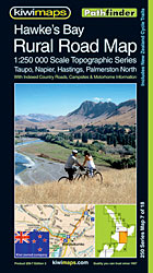
Hawke`s Bay region of New Zealand`s North Island, including Taupo, Napier, Hastings and Palmerston North, on a detailed, indexed road map at 1:250,000 from Kiwimaps, with extensive tourist information including a table of facilities in local campsites, a comprehensive index, etc.Maps in a series indicate unsurfaced roads and 4WD tracks, and show names of both
Wellington – Wairarapa: Palmerston North, Levin, Masterton
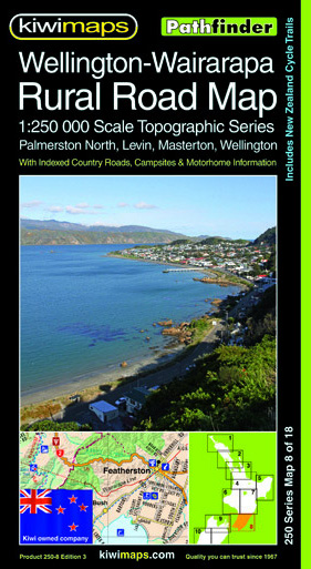
Wellington – Wairarapa region of New Zealand`s North Island, including Palmerston North, Levin and Masterton, on a detailed, indexed road map at 1:250,000 from Kiwimaps, with extensive tourist information including a table of facilities in local campsites, a comprehensive index, etc.Maps in a series indicate unsurfaced roads and 4WD tracks, and show names of both
Nelson – Marlborough: Motueka, Picton, Blenheim
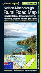
Nelson ‘“ Marlborough region of New Zealand`s South Island, including Motueka, Picton and Blenheim, on a detailed, indexed road map at 1:250,000 from Kiwimaps, with extensive tourist information including a table of facilities in local campsites, a comprehensive index, etc.Maps in a series indicate unsurfaced roads and 4WD tracks, and show names of both major
North Westland: Westport, Reefton, Greymouth, Hokitika
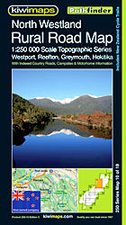
North Westland region of New Zealand`s South Island, including Westport, Reefton, Greymouth and Hokitika, on a detailed, indexed road map at 1:250,000 from Kiwimaps, with extensive tourist information including a table of facilities in local campsites, a comprehensive index, etc.Maps in a series indicate unsurfaced roads and 4WD tracks, and show names of both major
Marlborough – Kaikoura: Nelson, Blemheim, Kaikoura, Hanmer Springs
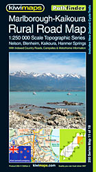
Marlborough ‘“ Kaikoura region of New Zealand`s South Island, including Nelson, Blemheim, Kaikoura and Hanmer Springs, on a detailed, indexed road map at 1:250,000 from Kiwimaps, with extensive tourist information including a table of facilities in local campsites, a comprehensive index, etc.Maps in a series indicate unsurfaced roads and 4WD tracks, and show names of
Coromandel Pocket Map

Coromandel region in a series of maps covering various districts of New Zealand, with each title combining a detailed road map with street plans of local towns, all with road and street indexes. The maps are published in two formats: handy Pocket Maps or Pathfinders with, as the publishers put it ‘Larger print so you