Category Archives: Maps
Strath Halladale & Strathy Point – Melvich & Forsinard OS Explorer Active Map 449 (waterproof)
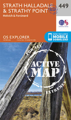
Strath Halladale, Strathy Point, Melvich and Forsinard area on a detailed topographic and GPS compatible map No. 449, waterproof version, from the Ordnance Survey’s 1:25,000 Explorer series. MOBILE DOWNLOADS: this title and all the other OS Explorer maps include a code for downloading after purchase the digital version onto your smartphone or tablet for viewing
Gairloch & Loch Ewe OS Explorer Active Map 434 (waterproof)
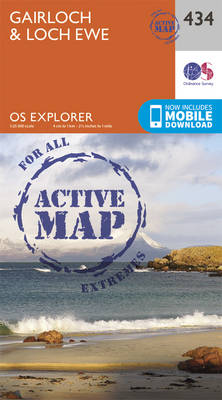
Gairloch and Loch Ewe area on a detailed topographic and GPS compatible map No. 434, waterproof version, from the Ordnance Survey’s 1:25,000 Explorer series. MOBILE DOWNLOADS: this title and all the other OS Explorer maps include a code for downloading after purchase the digital version onto your smartphone or tablet for viewing on the OS
Wick & The Flow Country – Lybster, Latheron & Dunbeth OS Explorer Active Map 450 (waterproof)
Wick, The Flow Country, Lybster, Latheron and Dunbeth area on a detailed topographic and GPS compatible map No. 450, waterproof version, from the Ordnance Survey’s 1:25,000 Explorer series. MOBILE DOWNLOADS: this title and all the other OS Explorer maps include a code for downloading after purchase the digital version onto your smartphone or tablet for
An Teallach & Slioch – Kinlochewe & Achnasheen OS Explorer Active Map 435 (waterproof)
An Teallach, Slioch, Kinlochewe and Achnasheen area on a detailed topographic and GPS compatible map No. 435, waterproof version, from the Ordnance Survey’s 1:25,000 Explorer series.MOBILE DOWNLOADS: this title and all the other OS Explorer maps include a code for downloading after purchase the digital version onto your smartphone or tablet for viewing on the
Beinn Dearg & Loch Fannich – Ullapool OS Explorer Active Map 436 (waterproof)
Beinn Dearg, Loch Fannich and Ullapool area on a detailed topographic and GPS compatible map No. 436, waterproof version, from the Ordnance Survey’s 1:25,000 Explorer series. MOBILE DOWNLOADS: this title and all the other OS Explorer maps include a code for downloading after purchase the digital version onto your smartphone or tablet for viewing on
Ben Wyvis and Strathpeffer
Ben Wyvis, Strathpeffer and Dingwall area on a detailed topographic and GPS compatible map No. 437, waterproof version, from the Ordnance Survey’s 1:25,000 Explorer series.MOBILE DOWNLOADS: this title and all the other OS Explorer maps include a code for downloading after purchase the digital version onto your smartphone or tablet for viewing on the OS
Dornoch & Tain – Alness & Invergordon OS Explorer Active Map 438 (waterproof)
Dornoch, Tain, Alness and Invergordon area on a detailed topographic and GPS compatible map No. 438, waterproof version, from the Ordnance Survey’s 1:25,000 Explorer series.MOBILE DOWNLOADS: this title and all the other OS Explorer maps include a code for downloading after purchase the digital version onto your smartphone or tablet for viewing on the OS
Coigach & Summer Isles – Inverpolly OS Explorer Active Map 439 (waterproof)
Coigach, Summer Isles and Inverpolly area on a detailed topographic and GPS compatible map No. 439, waterproof version, from the Ordnance Survey’s 1:25,000 Explorer series. MOBILE DOWNLOADS: this title and all the other OS Explorer maps include a code for downloading after purchase the digital version onto your smartphone or tablet for viewing on the
Glen Cassley & Glen Oykel OS Explorer Active Map 440 (waterproof)
Glen Cassley and Glen Oykel area on a detailed topographic and GPS compatible map No. 440, waterproof version, from the Ordnance Survey’s 1:25,000 Explorer series.MOBILE DOWNLOADS: this title and all the other OS Explorer maps include a code for downloading after purchase the digital version onto your smartphone or tablet for viewing on the OS
Huntly & Cullen – Portsoy & Aberchirder OS Explorer Active Map 425 (waterproof)
Huntly, Cullen, Portsoy and Aberchirder area on a detailed topographic and GPS compatible map No. 425, waterproof version, from the Ordnance Survey’s 1:25,000 Explorer series. MOBILE DOWNLOADS: this title and all the other OS Explorer maps include a code for downloading after purchase the digital version onto your smartphone or tablet for viewing on the
Banff, Macduff & Turriff – Fyvie OS Explorer Active Map 426 (waterproof)
Banff, Macduff, Turriff and Fyvie area on a detailed topographic and GPS compatible map No. 426, waterproof version, from the Ordnance Survey’s 1:25,000 Explorer series. MOBILE DOWNLOADS: this title and all the other OS Explorer maps include a code for downloading after purchase the digital version onto your smartphone or tablet for viewing on the
Skye: Trotternish & The Storr – Uig OS Explorer Active Map 408 (waterproof)
Skye: Trotternish, The Storr and Uig area on a detailed topographic and GPS compatible map No. 408, waterproof version, from the Ordnance Survey’s 1:25,000 Explorer series.MOBILE DOWNLOADS: this title and all the other OS Explorer maps include a code for downloading after purchase the digital version onto your smartphone or tablet for viewing on the
Peterhead & Fraserburgh OS Explorer Active Map 427 (waterproof)
Peterhead and Fraserburgh area on a detailed topographic and GPS compatible map No. 427, waterproof version, from the Ordnance Survey’s 1:25,000 Explorer series. MOBILE DOWNLOADS: this title and all the other OS Explorer maps include a code for downloading after purchase the digital version onto your smartphone or tablet for viewing on the OS smartphone
Raasay, Rona & Scalpay OS Explorer Active Map 409 (waterproof)
Raasay, Rona and Scalpay area on a detailed topographic and GPS compatible map No. 409, waterproof version, from the Ordnance Survey’s 1:25,000 Explorer series.MOBILE DOWNLOADS: this title and all the other OS Explorer maps include a code for downloading after purchase the digital version onto your smartphone or tablet for viewing on the OS smartphone
Kyle of Lochalsh, Plockton & Applecross OS Explorer Active Map 428 (waterproof)
Kyle of Lochalsh, Plockton and Applecross area on a detailed topographic and GPS compatible map No. 428, waterproof version, from the Ordnance Survey’s 1:25,000 Explorer series. MOBILE DOWNLOADS: this title and all the other OS Explorer maps include a code for downloading after purchase the digital version onto your smartphone or tablet for viewing on
Skye: Portree & Bracadale OS Explorer Active Map 410 (waterproof)
Skye: Portree and Bracadale area on a detailed topographic and GPS compatible map No. 410, waterproof version, from the Ordnance Survey’s 1:25,000 Explorer series.MOBILE DOWNLOADS: this title and all the other OS Explorer maps include a code for downloading after purchase the digital version onto your smartphone or tablet for viewing on the OS smartphone
Glen Carron & West Monar – Strathcarron OS Explorer Active Map 429 (waterproof)
Glen Carron, West Monar and Strathcarron area on a detailed topographic and GPS compatible map No. 429,waterproof version, from the Ordnance Survey’s 1:25,000 Explorer series.MOBILE DOWNLOADS: this title and all the other OS Explorer maps include a code for downloading after purchase the digital version onto your smartphone or tablet for viewing on the OS
Skye: Cuillin Hills – Soay OS Explorer Active Map 411 (waterproof)
Skye: Cuillin Hills and Soay area on a detailed topographic and GPS compatible map No. 411, waterproof version, from the Ordnance Survey’s 1:25,000 Explorer series.MOBILE DOWNLOADS: this title and all the other OS Explorer maps include a code for downloading after purchase the digital version onto your smartphone or tablet for viewing on the OS
Loch Monar, Glen Cannich & Strathfarrar OS Explorer Active Map 430 (waterproof)
Loch Monar, Glen Cannich and Glen Strathfarrar area on a detailed topographic and GPS compatible map No. 430, waterproof version, from the Ordnance Survey’s 1:25,000 Explorer series.MOBILE DOWNLOADS: this title and all the other OS Explorer maps include a code for downloading after purchase the digital version onto your smartphone or tablet for viewing on
Skye: Sleat – Broadford, Kyleakin & Armadale OS Explorer Active Map 412 (waterproof)
Skye: Sleat, Broadford, Kyleakin and Armadale area on a detailed topographic and GPS compatible map No. 412, waterproof version, from the Ordnance Survey’s 1:25,000 Explorer series.MOBILE DOWNLOADS: this title and all the other OS Explorer maps include a code for downloading after purchase the digital version onto your smartphone or tablet for viewing on the