Category Archives: Maps
New Orleans LA Rand McNally
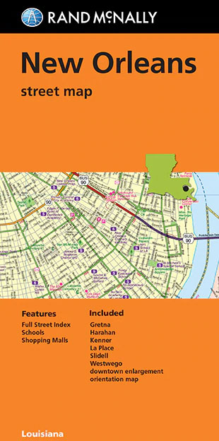
New Orleans in Louisiana on an indexed street plan from Rand McNally in their extensive range of maps covering cities in the United States, with an enlargement showing in greater detail downtown New Orleans including the French Quarter. Separate panels extend the coverage to include Laplace and vicinity and Poydras, plus Slidell across Lake Pontchartrain.
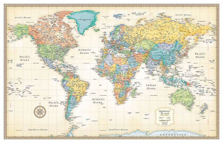
World Rand McNally Signature Wall Map PAPER
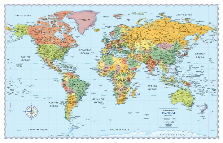
Medium size, 127 x 81.5cm (50″ x 32″ approx), political map of the world from Rand McNally in their Signature edition – PAPER version – with countries shown in lively pastel colours against light blue oceans. Place names are in their English versions. In USA, Canada and Australia boundaries and names of states/provinces are included.
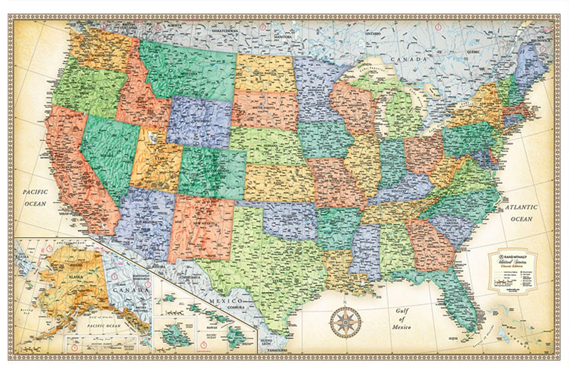
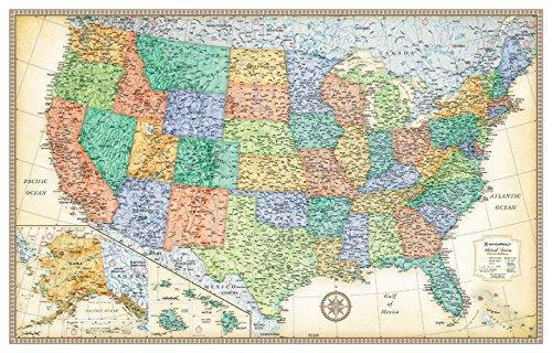
USA Rand McNally Signature Wall Map PAPER
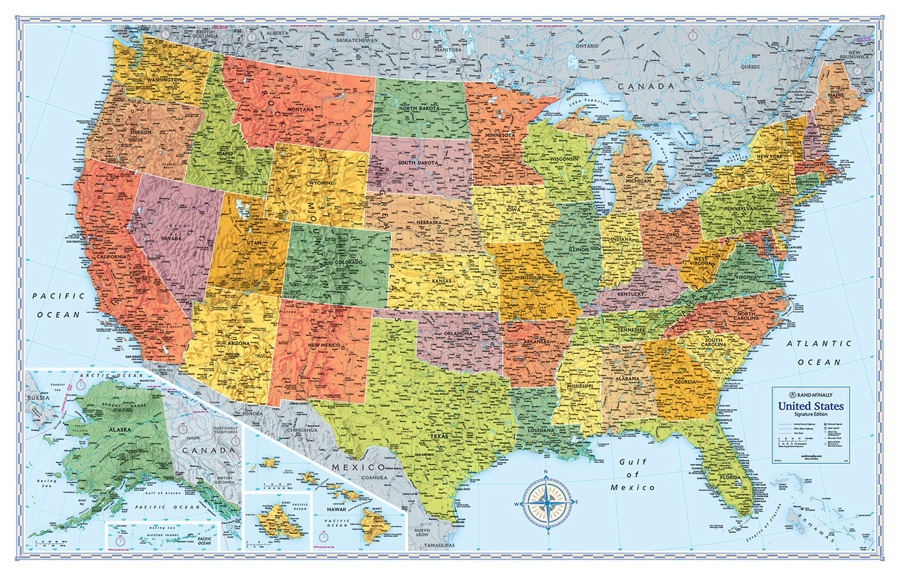
Signature edition wall map of USA, size 127 x 81.5cm (50″ x 32″) from Rand McNally presenting the states in bright colours and with their boundaries clearly delineated in white. The map indicates state capitals and shows the network of limited access and selected other major highways. Also marked are time zone boundaries. Relief shading
World Rand McNally Signature Wall Map ENCAPSULATED

Medium size, 129 x 83cm (51″ x 32.5″ approx.), political map of the world from Rand McNally in their Signature edition – ENCAPSULATED version – with countries shown in lively pastel colours against light blue oceans. Place names are in their English versions. In USA, Canada and Australia boundaries and names of states/provinces are included.
USA Rand McNally Signature Wall Map ENCAPSULATED
Signature edition wall map of USA, size 127 x 81.5cm (50″ x 32″) from Rand McNally presenting the states in bright colours and with their boundaries clearly delineated in white. The map indicates state capitals and shows the network of limited access and selected other major highways. Also marked are time zone boundaries. Relief shading
Orlando FL Rand McNally
Orlando in Florida, including Disney World, on an indexed street plan from Rand McNally in their extensive range of maps covering cities in the United States. An inset presents downtown Charleston in greater detail. Coverage extends south to include the Disney World complex and the city’s international airport, and includes communities of Altamonte Springs, Apopka,
World Rand McNally Classic Wall Map PAPER
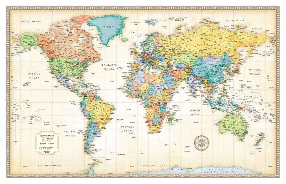
Medium size, 127 x 81cm (50″x 32″) political map of the world from Rand McNally in their Classic edition – PAPER version – with countries shown in lively pastel colours against pale beige oceans. Place names are in their English versions. In USA, Canada and Australia boundaries and names of states/provinces are included. The map
San Diego CA Rand McNally
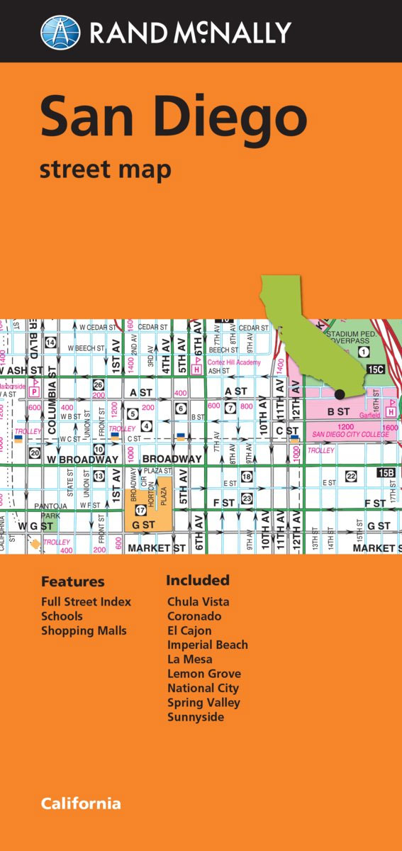
San Diego in California on an indexed street plan from Rand McNally in their extensive range of maps covering cities in the United States, with a road map of the surrounding region showing the road links with Los Angeles, Palm Springs, etc. Communities covered by this map include Chula Vista, Coronado, El Cajon, Imperial Beach,
USA Rand McNally Classic Wall Map PAPER
Classic edition wall map of USA, size 127 x 81.5cm (50″ x 32″) from Rand McNally presenting the states in pastel colours with the surrounding seas in light beige. The map indicates state capitals and shows the network of limited access and selected other major highways. Also marked are time zone boundaries. Relief shading shows
Indianapolis IN Rand McNally
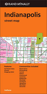
Indianapolis in Indiana on an indexed street plan from Rand McNally in their extensive range of maps covering cities in the United States. The map includes a more detailed enlargement of downtown Indianapolis. Other communities covered by this title include Beech Grove, Brownsburg, Carmel, Fishers, Greenwood, Lawrence, Noblesville, Southport, Speedway, Westfield and Zionsville.NEW STREET PLAN
World Rand McNally Classic Wall Map ENCAPSULATED
0Medium size, 129 x 83cm (51″x 32.5″ approx) political map of the world from Rand McNally in their Classic edition – ENCAPSULATED version – with countries shown in lively pastel colours against pale beige oceans. Place names are in their English versions. In USA, Canada and Australia boundaries and names of states/provinces are included. The
Fort Myers – Cape Coral FL Rand McNally
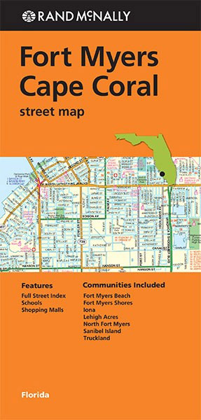
Fort Myers ‘“ Cape Coral area in Florida on an indexed street plan from Rand McNally in their extensive range of maps covering cities in the United States. Communities covered by this map include Fort Myers Beach, Fort Myers Shores, Iona, Lehigh Acres, North Fort Myers, Sanibel Island and Truckland.Rand McNally street plans provide coverage
USA Rand McNally Classic Wall Map ENCAPSULATED
Classic edition wall map of USA, size 127 x 81.5cm (50″ x 32″) from Rand McNally presenting the states in pastel colours with the surrounding seas in light beige. The map indicates state capitals and shows the network of limited access and selected other major highways. Also marked are time zone boundaries. Relief shading shows
Albuquerque NM Rand McNally
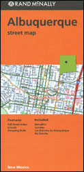
Albuquerque in New Mexico on an indexed street plan from Rand McNally in their extensive range of maps covering cities in the United States. Coverage includes communities of Bernalillo, Corrales, Los Ranchos de Albuquerque and Rio Rancho.NEW STREET PLAN CARTOGRAPHY FROM RAND McNALLY: Rand McNally are currently changing the cartography of their street plans to
Denver CO Rand McNally
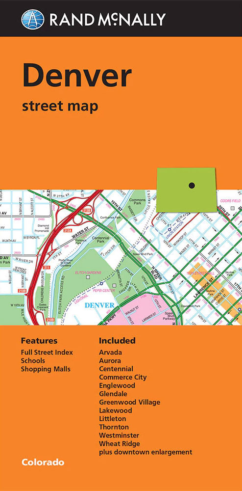
Denver in Colorado on an indexed street plan from Rand McNally in their extensive range of maps covering cities in the United States, with enlargements showing in greater detail downtown Denver and access to the city’s international airport. Communities covered by this map include Arvada, Aurora, Centennial, Commerce City, Englewood, Glendale, Greenwood Village, Lakewood, Littleton,
Fort Worth TX Rand McNally
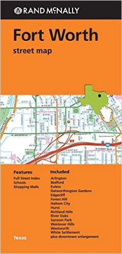
Fort Worth, Arlington, and Grand Prairie in Texas on an indexed street plan from Rand McNally in their extensive range of maps covering cities in the United States. Communities covered by this map Dalworthington Gardens, Edgecliff, Forest Hill, Kennedale, Lake Worth, River Oaks, Saginaw, Sansom Park, Westover Hills and Westworth.Rand McNally street plans provide coverage
Columbus OH Rand McNally
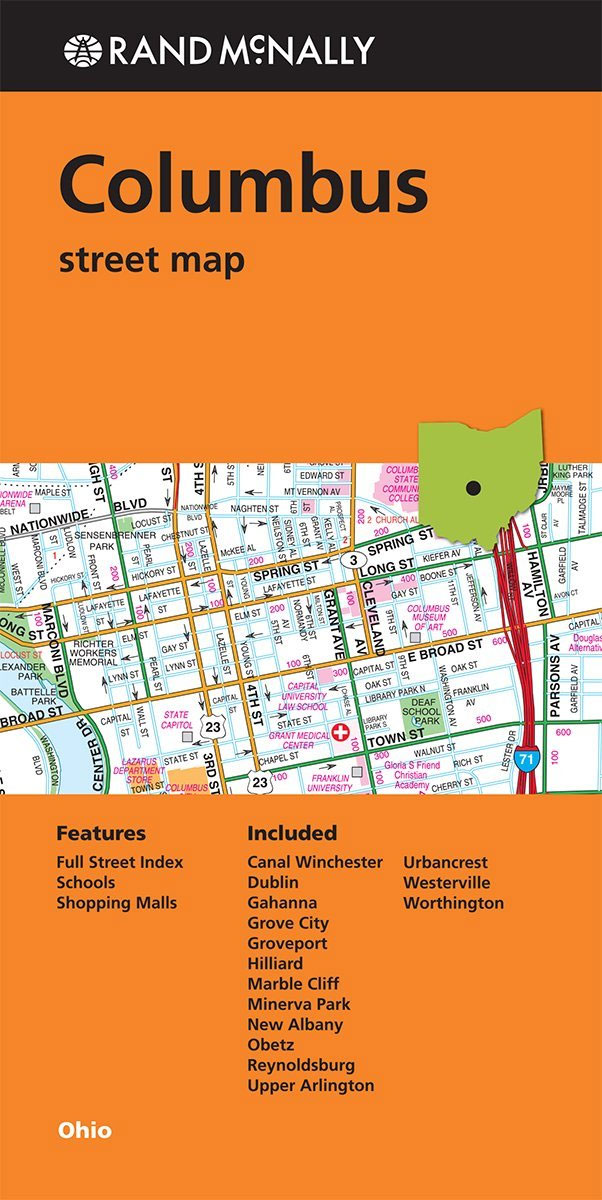
Columbus in Ohio on an indexed street plan from Rand McNally in their extensive range of maps covering cities in the United States. An inset provides a road map of Tulsa and vicinity. An inset shows downtown Columbus in greater detail. Communities covered by this title include Canal Winchester, Dublin, Gahanna, Grove City, Groveport, Hilliard,
Portland Regional Rand McNally
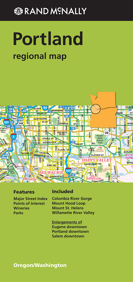
Portland Regional Map from Rand McNally including panels providing more detailed mapping of the region`s most visited areas.Maps in this series present the road network on a clear background with no relief shading to show the area’s topography, but with national or state parks, forests and other protected areas indicated by colouring. Roads are numbered
Jacksonville FL Rand McNally
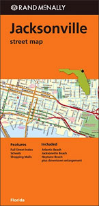
Jacksonville in Florida on an indexed street plan from Rand McNally in their extensive range of maps covering cities in the United States. Communities covered by this title include Atlantic Beach, Jacksonville Beach and Neptune Beach.Rand McNally street plans provide coverage of cities with their outer suburbs, clearly indicating main traffic arteries: highways (distinguishing between
St Louis MO Rand McNally
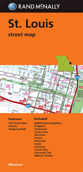
St. Louis on an indexed street plan from Rand McNally in their extensive range of maps covering cities in the United States. Insets show downtown St. Louis in greater detail, plus the city’s environs on both sides of the Mississippi. Coverage includes Lambert Saint Louis International Airport; communities include Bellefontaine Neighbors, Bridgeton, Crestwood, Creve Coeur,