Category Archives: Maps
USA Rand McNally EasyFinder Road Atlas 2022 A4 SPIRAL-BOUND
This spiral bound format features maps that are 35% larger than those found in Rand McNally`s standard Midsize Atlas. This updated North American atlas contains maps of every U.S. state and Canadian province, an overview map of Mexico, plus detailed maps of over 50 North American cities, all conveniently packaged for travel. Contains mileage chart
Nashville TN Rand McNally
Nashville in Tennessee on an indexed street plan from Rand McNally in their extensive range of maps covering cities in the United States. An enlargement shows the downtown area in greater detail, accompanied by an index of places of interest. Communities covered by this map include Belle Meade, Bellevue, Berry Hill, Brentwood, Forest Hills, Franklin,
Northern Virginia Rand McNally
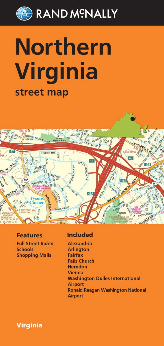
Northern Virginia urban conurbation on an indexed street plan from Rand McNally in their extensive range of maps covering cities in the United States. Coverage extends from the western districts of Washington DC in the north-eastern corner of the map southwards beyond Alexandria, and westwards beyond Herndon and Clifton. Other Communities covered by this map
Los Angeles CA Rand McNally
Los Angeles on an indexed street plan from Rand McNally in their extensive range of maps covering cities in the United States. Coverage includes the city’s international airport, Hollywood and Beverly Hills, and extends inland beyond the Los Angeles River and along the coast to include Malibu. Communities covered by this map include Bel Air
Greensboro – Winston – Salem NC Rand McNally
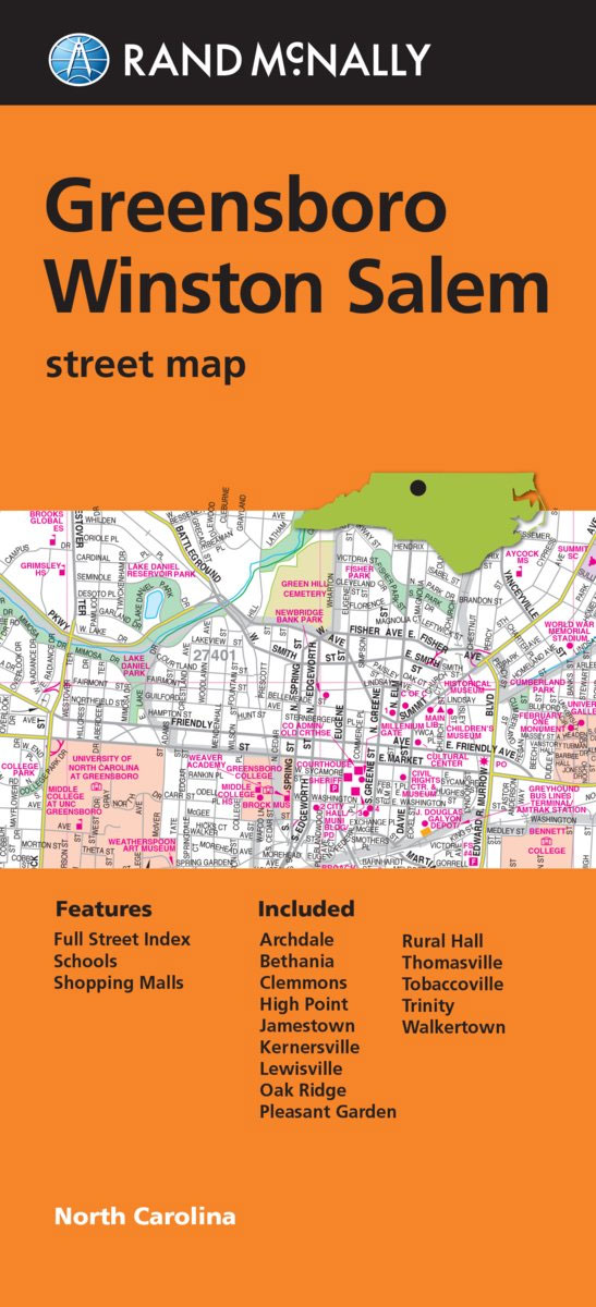
The Triad: Greensboro – Winston-Salem – High Point area of North Carolina on an indexed street plan from Rand McNally in their extensive range of maps covering cities in the United States. Communities covered by this map include Beesons Crossroads, Bethania, Colfax, Jamestown, Kernersville, Pfafftown, Sandy Ridge, Seward, Union Cross and Walkertown.Rand McNally street plans
Pittsburgh PA Rand McNally
Pittsburgh in Pennsylvania on an indexed street plan from Rand McNally in their extensive range of maps covering cities in the United States. Insets provide a more detailed street plan of downtown Pittsburgh and a road map of the city’s environs. Communities covered by this map include Bethel Park, Baldwin, Monroeville, West Mifflin, Mount Lebanon
Baton Rouge LA Rand McNally
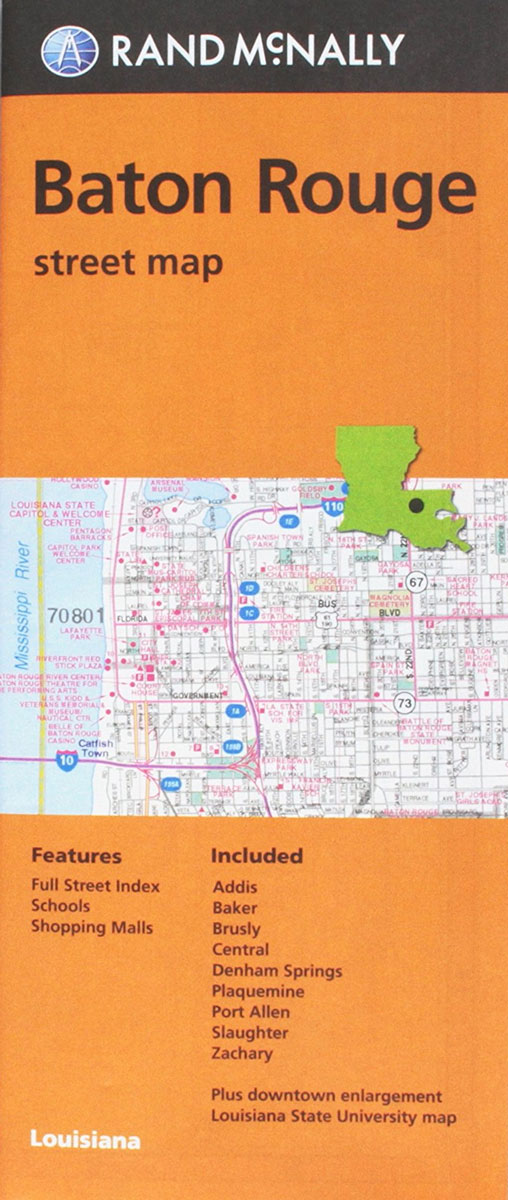
Baton Rouge, Shreveport and Bossier City, LA in Louisiana on an indexed street plan from Rand McNally in their extensive range of maps covering cities in the United States. Communities covered by this map include Baker, Port Allen and Zachary.Rand McNally street plans provide coverage of cities with their outer suburbs, clearly indicating main traffic
Arizona Easy-to-Read Rand McNally
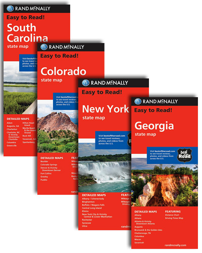
Arizona Easy-to-Read map from Rand McNally, US leading publisher of road maps and street plans, in their extensive series of state maps. Additional panels provide enlargements for the Petrified Forest National Park, Grand Canyon National Park, Phoenix and Vicinity, downtown Phoenix, Tucson and Vicinity, downtown Tucson, Lake Havascu City and Flagstaff.For clarity of road information
Chattanooga – Knoxville – Sevier County TN Rand McNally
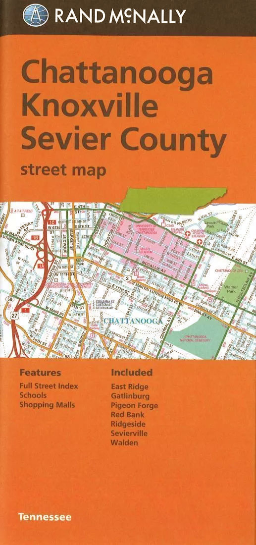
Towns of Eastern Tennessee: Chattanooga, Knoxville and the Sevier County on an indexed street plan from Rand McNally in their extensive range of maps covering cities in the United States. Communities covered by this map include East Ridge, Gatlinburg, Pigeon Forge, Red Bank, Ridgeside, Sevierville and WaldenRand McNally street plans provide coverage of cities with
Colorado Easy-to-Read Rand McNally
Colorado Easy-to-Read map from Rand McNally, US leading publisher of road maps and street plans, in their extensive series of state maps. Additional panels provide enlargements for Denver and Vicinity with a street plan of downtown Denver; plus Boulder, Colorado Springs, Fort Collins, Greeley, Pueblo, Mesa Verde National Park, and Rocky Mountain National Park.For clarity
Colorado Springs CO Rand McNally
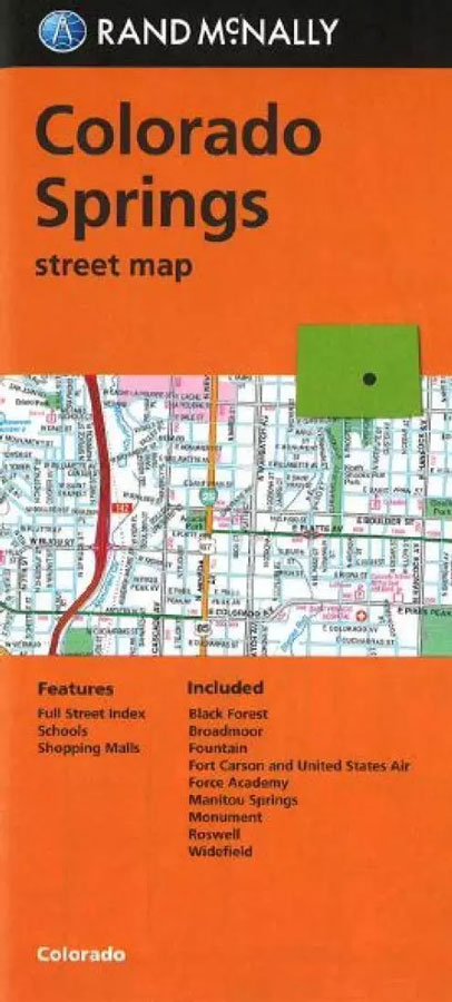
Colorado Springs on an indexed street plan from Rand McNally in their extensive range of maps covering cities in the United States. Communities covered by this title include Black Forest, Broadmoor, Fountain, Ivywild, Manitou Springs, Monument, Roswell and Widefield. Also provided is a road map of the surrounding area, linking Colorado Springs with Denver and
Anchorage – Fairbanks – Juneau – Ketchikan AK Rand McNally
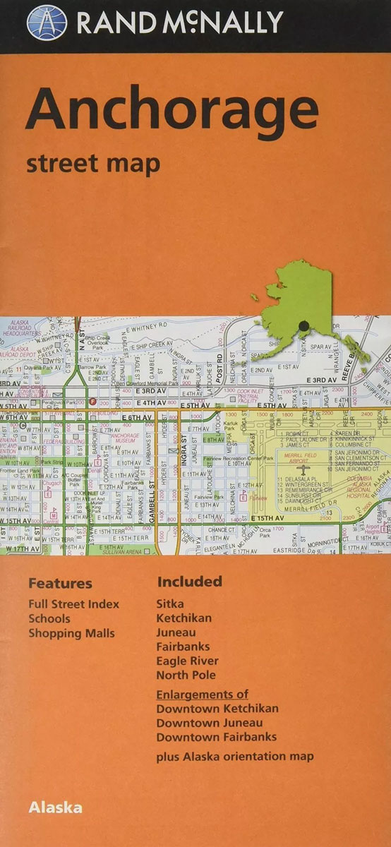
Anchorage, Fairbanks and Juneau in Alaska on an indexed street plan from Rand McNally in their extensive range of maps covering cities in the United States. The main plan covers Anchorage, with additional panels covering Juneau, Fairbanks Ketchikan and Sitka. Also provided are small road maps showing the areas around each of these towns. Other
USA Rand McNally Midsize Road Atlas 2020 PAPERBACK
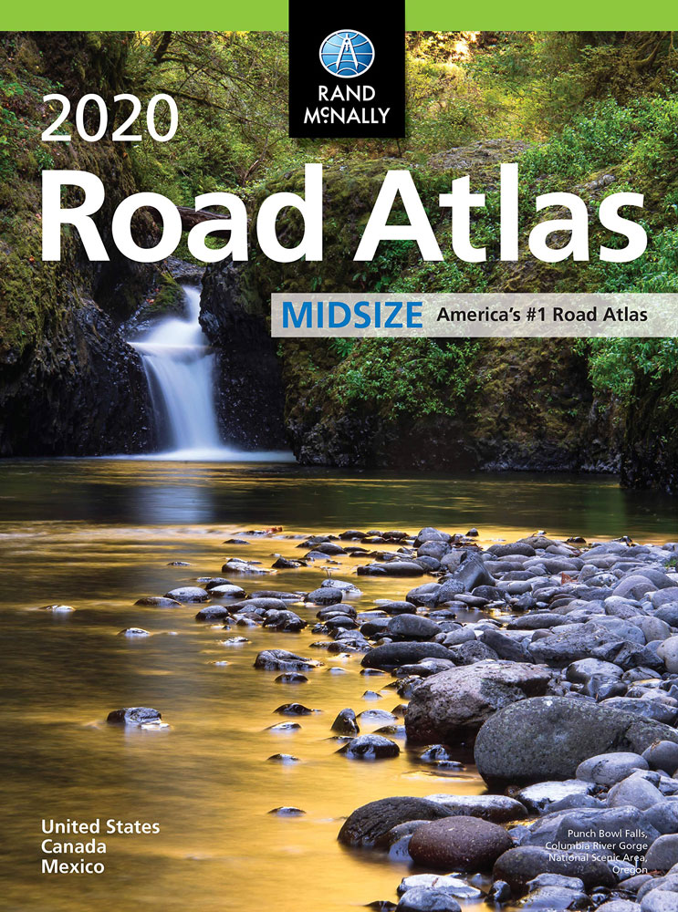
The most trusted and best-selling US atlas on the market made portable!. This updated North American atlas contains maps of every U.S. state and Canadian province, an overview map of Mexico, plus detailed maps of over 50 North American cities, all conveniently packaged for travel. Contains mileage chart showing distances between 77 cities and national
Birmingham AL Rand McNally
Birmingham in Alabama on an indexed street plan from Rand McNally in their extensive range of maps covering cities in the United States. Each plan covers the city with its outer suburbs showing places of interest, block numbers, one way streets and main traffic routes, etc. Communities included in the map`s coverage are Bessemer, Fairfield,
USA Rand McNally Compact Road Atlas 2021
Rand McNally`s best-selling Road Atlas conveniently packaged for on-the-go travel fits easily in your glove compartment, purse, or backpack! This compact North American atlas contains updated maps of every U.S. state and Canadian province, an overview map of Mexico, plus detailed maps of over 50 North American cities.Other FeaturesMileage chart showing distances between 77 North
USA Rand McNally Road Atlas & National Park Guide 2022 A3 SPIRAL-BOUND
Pinpoint the best in the best: America’s 60 national parks. With essential information and tips, hundreds of photos and maps, and a complete Road Atlas, the 2020 National Park Atlas & Guide is all you need to have extraordinary park experiences.A four-colour, 132-page National Park Guide details the best of the best in each park
World Rand McNally Signature Wall Map ENCAPSULATED
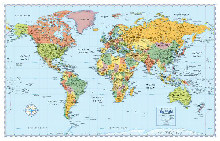
Medium size, 129 x 83cm (51″ x 32.5″ approx.), political map of the world from Rand McNally in their Signature edition – ENCAPSULATED version – with countries shown in lively pastel colours against light blue oceans. Place names are in their English versions. In USA, Canada and Australia boundaries and names of states/provinces are included.
USA Rand McNally Signature Wall Map ENCAPSULATED
Signature edition wall map of USA, size 127 x 81.5cm (50″ x 32″) from Rand McNally presenting the states in bright colours and with their boundaries clearly delineated in white. The map indicates state capitals and shows the network of limited access and selected other major highways. Also marked are time zone boundaries. Relief shading
Orlando FL Rand McNally
Orlando in Florida, including Disney World, on an indexed street plan from Rand McNally in their extensive range of maps covering cities in the United States. An inset presents downtown Charleston in greater detail. Coverage extends south to include the Disney World complex and the city’s international airport, and includes communities of Altamonte Springs, Apopka,
World Rand McNally Classic Wall Map PAPER
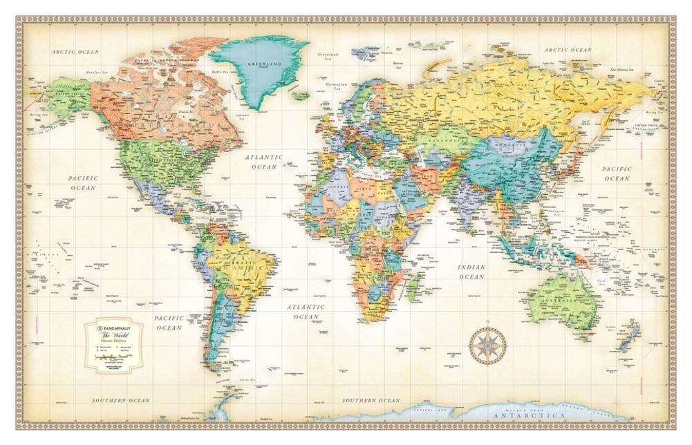
Medium size, 127 x 81cm (50″x 32″) political map of the world from Rand McNally in their Classic edition – PAPER version – with countries shown in lively pastel colours against pale beige oceans. Place names are in their English versions. In USA, Canada and Australia boundaries and names of states/provinces are included. The map