Category Archives: Maps
Western United States Easy-to-Read Rand McNally
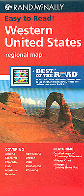
Western United States map at 1:2,650,000 from Rand McNally presenting the region’s road network on a base highlighting national parks or forests and Indian Reservations. Numerous enlargements show the areas around main cities in greater detail. Coverage starts at the eastern borders of Montana, Wyoming and New Mexico. The index is arranged by state.The enlargements
North Dakota – South Dakota Easy-to-Read Rand McNally
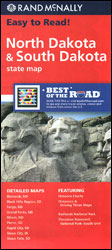
North and South Dakota Easy-to-Read map from Rand McNally, US leading publisher of road maps and street plans, in their extensive series of state maps. Additional panels provide enlargements for: Bismarck, Fargo, Grand Forks, Minot, Pierre, Rapid City, Sioux City and Sioux Fall, plus the Black Hills Region, Badlands National Park, and Theodore Roosevelt National
Nebraska Easy-to-Read Rand McNally
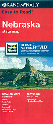
Nebraska Easy-to-Read map from Rand McNally, US leading publisher of road maps and street plans, in their extensive series of state maps. Additional panels provide enlargements for: Omaha, Grand Island, Lincoln, Sioux City – Sioux City IA, Scottsbluff and North Platte.For clarity of road information Rand McNally state maps present the road network on a
New England Easy-to-Read Rand McNally

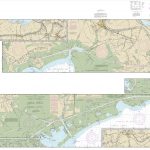
New England Easy-to-Read map at 1:560,000 approx. in a series of regional maps of United States from Rand McNally, with Maine on one side and Massachusetts, Connecticut, Rhode Island, Vermont and New Hampshire on the other. For clarity of road information, the road network is presented on a plain background with names and heights of
New Jersey Easy-to-Read Rand McNally

New Jersey Easy-to-Read map from Rand McNally, US leading publisher of road maps and street plans, in their extensive series of state maps. Additional panels provide enlargements for Newark – Jersey City and Vicinity, Long Brach, Camden – Philadelphia PA and Vicinity, Vineland – Millville, Cape May, Atlantic City and Trenton – Princeton.For clarity of
New Mexico Easy-to-Read Rand McNally
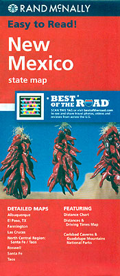
New Mexico Easy-to-Read map from Rand McNally, US leading publisher of road maps and street plans, in their extensive series of state maps. Additional panels provide enlargements of the North Central Region (Albuquerque – Santa Fe – Taos – Colorado border); the area around the Carlsbad Caverns NP – Guadeloupe Mountains NP in Texas; Albuquerque,
New Hampshire – Vermont Easy-to-Read Rand McNally

New Hampshire and Vermont Easy-to-Read map from Rand McNally, US leading publisher of road maps and street plans, in their extensive series of state maps. Additional panels provide enlargements for: Burlington, Concord, Manchester, Montpelier – Barre, Nashua, Portsmouth and Rochester.For clarity of road information Rand McNally state maps present the road network on a plain
New York State Easy-to-Read Rand McNally
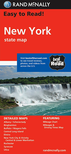
New York State Easy-to-Read map from Rand McNally, US leading publisher of road maps and street plans, in their extensive series of state maps. Additional panels provide enlargements for: Buffalo – Niagara Falls, Binghamton, Utica, Albany – Schenectady, Elmira, Rochester, Syracuse, as well as plans of New York City and vicinity, Central Long Island, Manhattan
Ohio Easy-to-Read Rand McNally
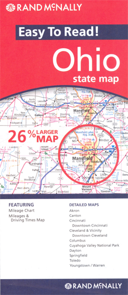
Ohio Easy-to-Read map from Rand McNally, US leading publisher of road maps and street plans, in their extensive series of state maps. Additional panels provide enlargements for Cincinnati and Cleveland – both with street plans of the downtown area, Akron, Canton, Columbus, Dayton, Springfield, Toledo and Youngstown – Warren, plus Cuyahoga Valley National Park. For
Oklahoma Easy-to-Read Rand McNally
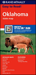
Oklahoma Easy-to-Read map from Rand McNally, US leading publisher of road maps and street plans, in their extensive series of state maps. Additional panels provide enlargements Oklahoma City and Vicinity, Tulsa, Bartlesville, Edmond, Lawton, Muskogee and Norman, plus Fort Smith AR, Joplin AR and Wichita Falls TX.For clarity of road information Rand McNally state maps
Oregon Easy-to-Read Rand McNally
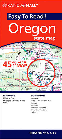
Oregon Easy-to-Read map from Rand McNally, US leading publisher of road maps and street plans, in their extensive series of state maps. Additional panels provide enlargements for: Corvallis, Eugene, Medford, Portland and Vicinity, downtown Portland, Salem and Crater Lake National Park.For clarity of road information Rand McNally state maps present the road network on a
Pennsylvania Easy-to-Read Rand McNally

Pensylvania Easy-to-Read map from Rand McNally, US leading publisher of road maps and street plans, in their extensive series of state maps. Additional panels provide enlargements for: Allentown – Bethlehem, Altoona, Erie, Gettysburg, Harrisburg, Johnstown, Lancaster, Philadelphia and vicinity, downtown Philadelphia, Pittsburgh and vicinity, downtown Pittsburgh, Reading, Scranton – Wilkes-Barre, and York.For clarity of road
South Carolina Easy-to-Read Rand McNally
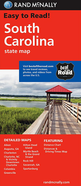
South Carolina Easy-to-Read map from Rand McNally, US leading publisher of road maps and street plans, in their extensive series of state maps. Additional panels provide enlargements for: Aiken, Charleston, Charlotte and Vicinity with a more detailed map of the downtown area, Columbia, Greenville, Hilton Head Island, Myrtle Beach – The Grand Strand, Rock Hill
Michigan Easy-to-Read Rand McNally
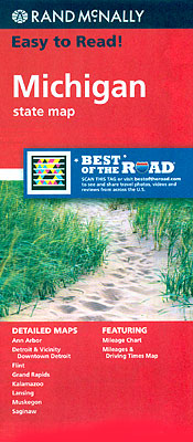
Michigan Easy-to-Read map from Rand McNally, US leading publisher of road maps and street plans, in their extensive series of state maps. Additional panels provide enlargements for Detroit and vicinity with a map of downtown Detroit, Ann Arbor, Flint, Grand Rapids, Kalamazoo, Lansing, Muskegon and Saginaw. Also provided is an overview map of the state
Texas Easy-to-Read Rand McNally

Texas Easy-to-Read map from Rand McNally, US leading publisher of road maps and street plans, in their extensive series of state maps. Additional panels provide enlargements for: Dallas – Fort Worth and vicinity, Houston and vicinity, and San Antonio ‘“with a street plan of the downtown area in each of these four cities; the Lower
Minnesota Easy-to-Read Rand McNally
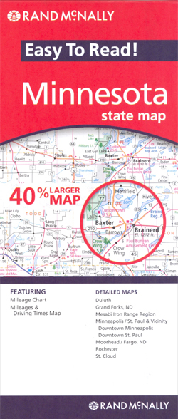
Minnesota Easy-to-Read map from Rand McNally, US leading publisher of road maps and street plans, in their extensive series of state maps. Additional panels provide enlargements for: Minneapolis – St.Paul and vicinity with enlargements for the downtown areas of each city, maps of Duluth, Moorhead – Fargo ND, St. Cloud, and the Mesabi Iron Range
Utah Easy-to-Read Rand McNally
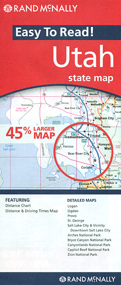
Utah Easy-to-Read from Rand McNally, US leading publisher of road maps and street plans. On the reverse is additional tourist information: a list of national and state parks, monuments and recreational areas indicating what facilities and recreational pursuits can be found there; descriptions of main places of interest accompanied by overview plans and/or enlargements covering
North Dakota & South Dakota Easy to Fold Rand McNally

North and South Dakota on a laminated and waterproof Easy-to-Fold map from Rand McNally, the country’s leading publisher of road maps and street plans. For clarity of road information Rand McNally state maps present the road network on a plain background, with no or little topographic detail. Driving distances are indicated on all principal highways
Oklahoma Easy to Fold Rand McNally

Oklahoma on a laminated and waterproof Easy-to-Fold map from Rand McNally, the country’s leading publisher of road maps and street plans. For clarity of road information Rand McNally state maps present the road network on a plain background, with no or little topographic detail. Driving distances are indicated on all principal highways and on many
California Easy-to-Read Rand McNally
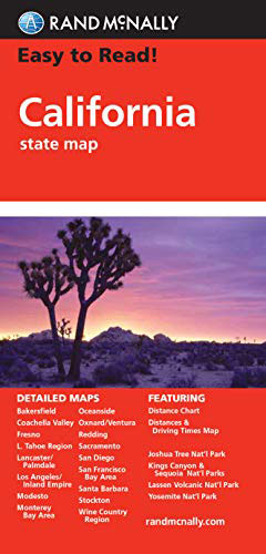
California Easy-to-Read map from Rand McNally, US leading publisher of road maps and street plans, in their extensive series of state maps. Additional panels provide enlargements for the three main urban conurbations: the San Francisco Bay area (SF ‘“ Oakland ‘“ San Jose), Los Angeles and Vicinity (extending east to San Bernardino and Riverside) and