Category Archives: Maps
Central Coast Suburban Streets NSW UBD Gregory`s 289
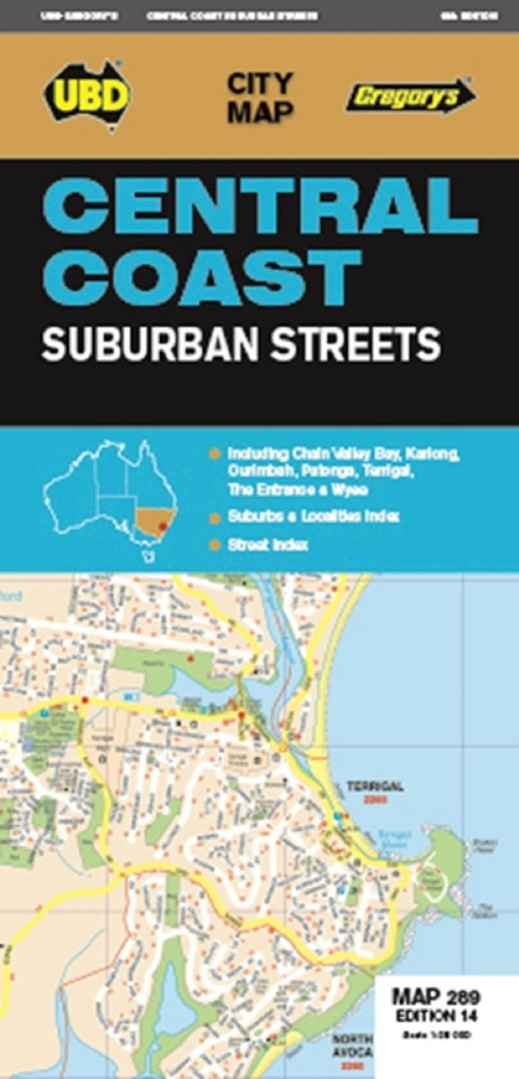
Central Coast of New South Wales Suburban Streets map from UBD Gregory’s at 1:25,000 with coverage including Chain Valley Bay, Ourimbah, Kariong, Patonga, Terrigal, The Entrance and Wyee. The map is indexed and highlight various facilities and places of interest.To see a list of other street plans and directories from UBD Gregory`s please click on
Melbourne Suburbs & City Centre UBD Gregory`s 318
Melbourne Suburbs and City Centre map from UBD Gregory’s combining a building-by-building very detailed street plan of the CBD, a street plan of the city’s central districts, and a more general map of the city with its outer suburbs, plus descriptions of the best sights, selected accommodation, etc. On one side is very detailed street
Darwin & the Top End NT UBD Gregory`s 590
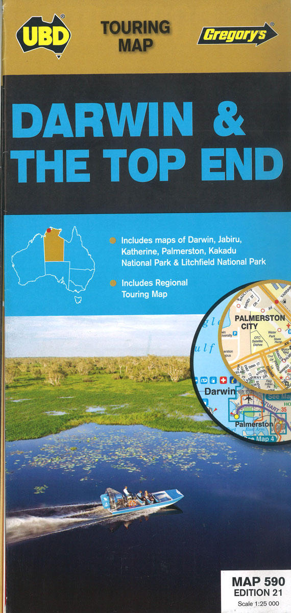
The 21st edition of the Darwin & Top End touring map is a useful tool when travelling in the area. There are regional touring maps covering Darwin in the north, Katherine and Mataranka in the south, as well as Daly River, Kakadu & Litchfield National Parks. Contains maps and a street index of Darwin &
World Schofield & Sims Political Wall Map
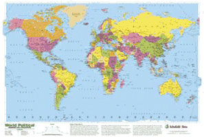
Glossy political map of the world (77 x 53cm / 30 x 21″ approx.) from Schofield & Sims, in bright colours, printed on thin, good quality card. Its Modified Gall projection is a compromise between traditional presentations and the equal area Peters projection.Countries are shown in bright colours against vivid blue oceans. All place names
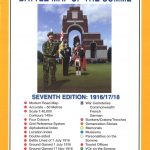
RITUAL & HONOUR
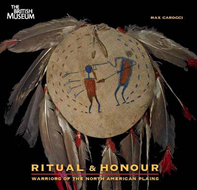
For thousands of years, Plains Indians and their ancestors have occupied the vast region that stretches from the Mississippi river to the Rocky Mountains and from the Canadian plains to the Gulf of Mexico. From about 1800 one of the most important units, beyond the extended family, was the warrior society a social, political and
Europe Schofield & Simms Political Wall Map
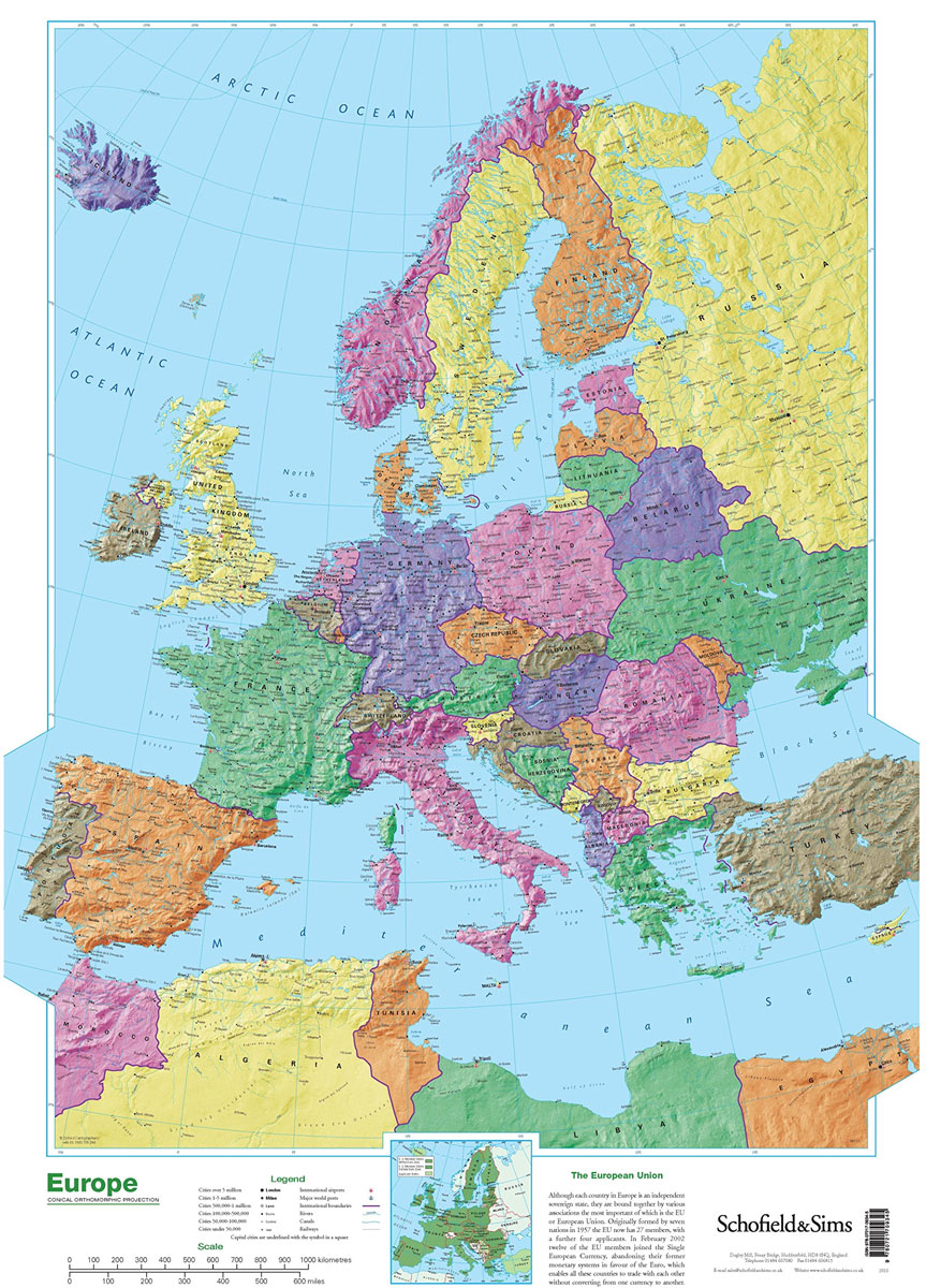
Attractive 53x77cm political wallmap of Europe. Coverage extends to Iceland, Moscow, Cyprus and Africa`s Mediterranean coast. Detail includes large towns, cities, major railways, rivers, canals, airports and ports. Cities are classified by symbols according to population size and capitals cities are distinguished. Hill shading gives an impression of the general relief.Latitude and longitude lines are
Ming: Art, People and Places
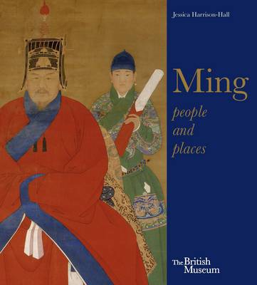
The Ming dynasty (1368-1644) is regarded as Chinas golden age, equivalent in British history to the Elizabethan era. Through the themes of people and places and a wealth of objects, this beautifully illustrated little book provides a concise and fascinating introduction to the Ming period. The colourful and rich nature of life for the emperors
United Kingdom & Ireland Schofield & Sims Wall Map
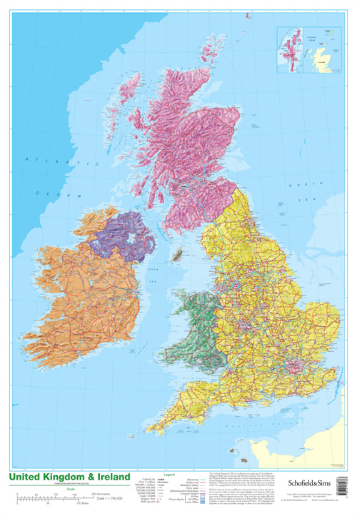
The British Isles at 1:1,700,000 on a small, 53 x 77cm (1’9″ x 2’6″ approx), wall map from Schofield & Sims, with pleasant bright colours showing the constituent parts of the United Kingdom, Irish Republic, Isle of Man and the Channel Islands. Shetland Islands are shown on an inset.The map shows the division into counties
Ming: 50 Years That Changed China
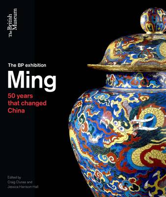
Ask anyone what single object they associate with China and the most common answer will be a Ming vase. Probably without even knowing the dates of the Ming dynasty (1368-1644), people are aware of the fragility of its porcelain, its rarity and value. But porcelain is just one part of the story of one of
World History Schofield & Sims Wall Map
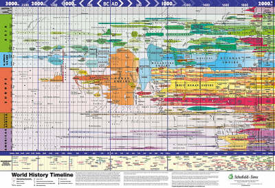
Although it is impossible to show everything that has happened in history on one poster, this one shows the rise and fall of the great empires and nations throughout history, from 3000BC to 2000AD. It is arranged by continent, and where possible, continents that are next to each other on the globe are next to
Football – Magnum
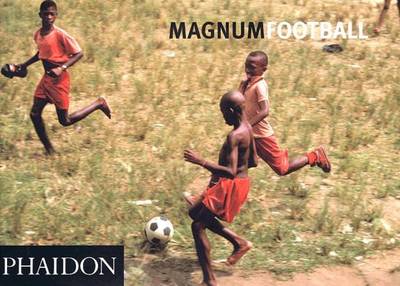
There are few things that unify people across the world better than the game of football. More than just kicking a ball about, football stirs passions beyond rational thought, affecting the mood of a nation or even the fortunes of a government. Since the 1930s, various members of Magnum have photographed the world of football,
Ancient Greece Poster
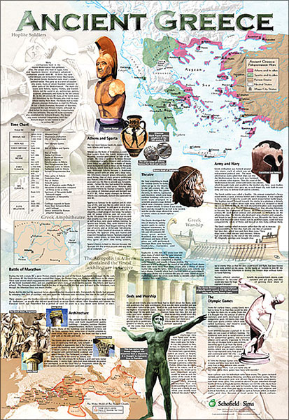
Ancient Greece on a colourful and informative poster from Schofield & Sims, size 53 x 77cm (21″ x 30″ approx), with maps, drawings, photos and extensive text on subjects such as the rivalry between Athens and Sparta, the Olympic Games, gods and worship, architecture, theatre, etc. Three maps illustrate the allegiances at the time of
Thailand: The Cookbook
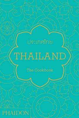
Thailand: The Cookbook is the definitive guide to the food and cooking of Thailand. It includes more than 500 easy-to-follow, authentic recipes collected from the length and breadth of Thailand, including snacks and drinks; soups; salads; curries; stir-fries; noodle and rice dishes; grilled fish and meat dishes; and desserts. The recipes have been extensively researched,
Map: Assembling the World in an Image: Exploring the World
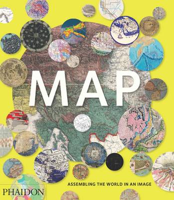
300 stunning maps from all periods and from all around the world, exploring and revealing what maps tell us about history and ourselves. Map: Exploring the World brings together more than 300 fascinating maps from the birth of cartography to cutting-edge digital maps of the twenty-fist century. The book`s unique arrangement, with the maps organized
Jutaku: Japanese Houses
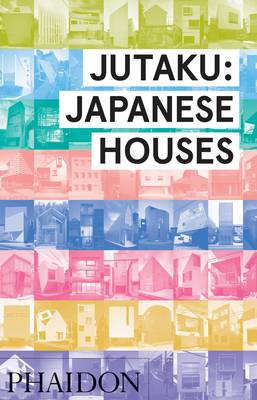
Quirky, surprising and entertaining – with more than 400 houses, Jutaku is architecture at the speed of Japan. Frenetic. Pulsating. Disorienting. Japan`s contemporary culture is constantly in flux. In stark contrast to the centuries old imperial architecture of Kyoto, recent Japanese architectural practices have ushered in an era of continuous experimentation. With 500 houses, one
The Mezze Cookbook: Sharing Plates from the Middle East
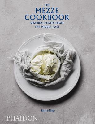
A vibrant collection of exciting, exotic, and sharing-plate recipes from across the Middle EastMore than 135 home-cooking recipes in this book explore the regional diversity of Middle Eastern sharing dishes, from Lebanon and Iran to Turkey and Syria. Divided by style of dish, the book features both meat-based and vegetarian dishes, along with suggested mezze-style
Seeing Stars: A Complete Guide to the 88 Constellations
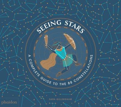
A graphically stunning, comprehensive introduction to the constellationsThis artful and accessible introduction to constellations equips readers with the information they need to locate, name, and explain all 88 internationally recognized constellations. Each cluster of stars is featured alongside the “story” (mythological or historical) behind its naming, tips on how to find it, what times of
Mountain Skills Training Handbook
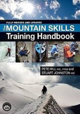
This is a complete guide to all aspects of climbing and mountaineering across the seasons for both instructors and amateur climbers alike. Extensively revised and updated with the latest safety guidance, techniques and equipment designs. Practical instruction and clear diagrams and photographs cover all of the techniques, equipment and skills for safe and enjoyable climbing
We Were the Future

The kibbutzim are collective settlements in Israel which have been written about extensively over the years, and are praised as the only example in world history of entire communities attempting, voluntarily, to live in total equality. Conceived as a socialist utopia by its early pioneers, the kibbutz was a radical experiment in communal living, gender
Leisure Cycling Near Dublin
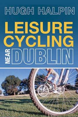
This book serves two practical purposes. The first is to encourage you to cycle – a good thing in itself. The second is to introduce you to the marvellous varieties of terrain and cycling routes that can be easily accessed from Dublin. To add spice to the mixture, Hugh Halpin includes snippets of history and