Category Archives: Maps
Idaho Raven Maps Physical Wall Map PAPER
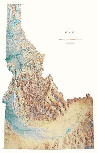
Detailed physical wall map of Idaho State at a scale of 1:500,000. The cartography shows relief through a stunning, highly detailed shading, with different elevations varing in colouring, giving an almost 3-dimensional feel to the map. Peak heights are also clearly marked.The map displays land only within the boundaries of the chosen states – there
Texas State Physical Wall Map
Detailed physical wall map of Texas State at a scale of 1:1,000,000. The cartography shows relief through a stunning, highly detailed shading, with different elevations varing in colouring, giving an almost 3-dimensional feel to the map. Peak heights are also clearly marked.The map displays land only within the boundaries of the chosen states – there
Illinois State Physical Wall Map
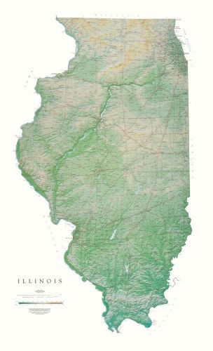
Detailed physical wall map of Illinois State at a scale of 1:500,000. The cartography shows relief through a stunning, highly detailed shading, with different elevations varing in colouring, giving an almost 3-dimensional feel to the map. Peak heights are also clearly marked.The map displays land only within the boundaries of the chosen states – there
Utah Raven Maps Physical Wall Map PAPER
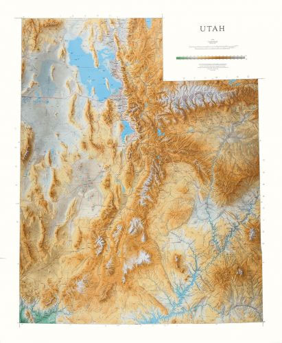
Detailed physical wall map of Utah State at a scale of 1:500,000. The cartography shows relief through a stunning, highly detailed shading, with different elevations varing in colouring, giving an almost 3-dimensional feel to the map. Peak heights are also clearly marked.The map displays land only within the boundaries of the chosen states – there
Indiana Raven Maps Physical Wall Map PAPER
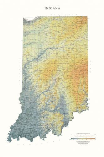
Detailed physical wall map of Indiana State at a scale of 1:500,000. The cartography shows relief through a stunning, highly detailed shading, with different elevations varing in colouring, giving an almost 3-dimensional feel to the map. Peak heights are also clearly marked.The map displays land only within the boundaries of the chosen states – there
Kentucky State Physical Wall Map
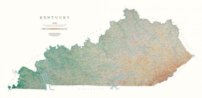
Detailed physical wall map of Kentucky State at a scale of 1:500,000. The cartography shows relief through a stunning, highly detailed shading, with different elevations varing in colouring, giving an almost 3-dimensional feel to the map. Peak heights are also clearly marked.The map displays land only within the boundaries of the chosen states – there
Louisiana Raven Maps Physical Wall Map PAPER
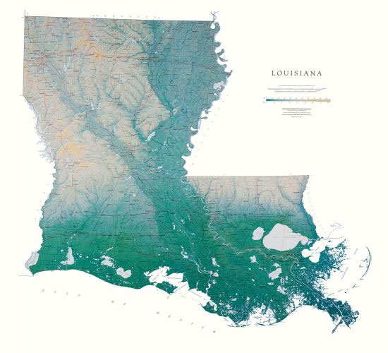
Detailed physical wall map of Louisiana State at a scale of 1:500,000. The cartography shows relief through a stunning, highly detailed shading, with different elevations varing in colouring, giving an almost 3-dimensional feel to the map. Peak heights are also clearly marked.The map displays land only within the boundaries of the chosen states – there
Massachusetts, Connecticut & Rhode Island Raven Maps Physical Wall Map PAPER
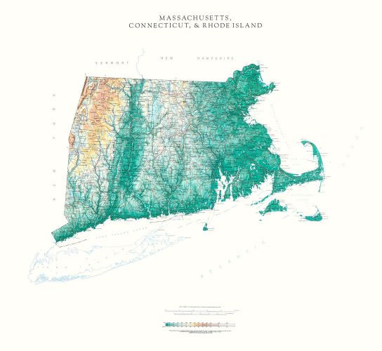
Detailed physical wall map of Massachusetts, Connecticut & Rhode Island States at a scale of 1:500,000. The cartography shows relief through a stunning, highly detailed shading, with different elevations varing in colouring, giving an almost 3-dimensional feel to the map. Peak heights are also clearly marked.The map displays land only within the boundaries of the
Michigan State Physical Wall Map
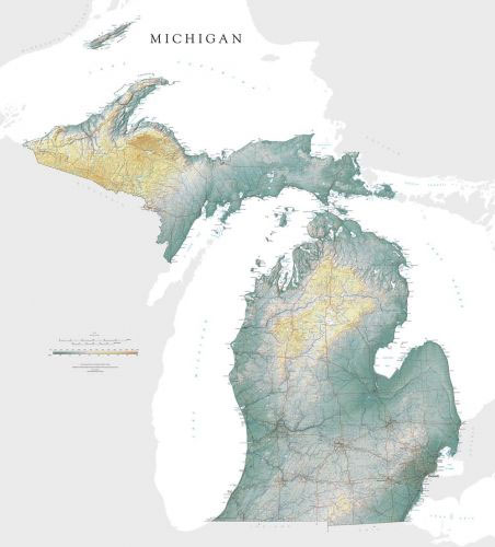
Detailed physical wall map of Michigan State at a scale of 1:700,000. The cartography shows relief through a stunning, highly detailed shading, with different elevations varing in colouring, giving an almost 3-dimensional feel to the map. Peak heights are also clearly marked.The map displays land only within the boundaries of the chosen states – there
Minnesota Raven Maps Physical Wall Map PAPER
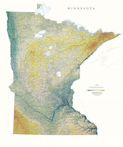
Detailed physical wall map of Minnesota State at a scale of 1:600,000. The cartography shows relief through a stunning, highly detailed shading, with different elevations varing in colouring, giving an almost 3-dimensional feel to the map. Peak heights are also clearly marked.The map displays land only within the boundaries of the chosen states – there
Missouri Raven Maps Physical Wall Map PAPER
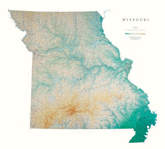
Detailed physical wall map of Missouri State at a scale of 1:550,000. The cartography shows relief through a stunning, highly detailed shading, with different elevations varing in colouring, giving an almost 3-dimensional feel to the map. Peak heights are also clearly marked.The map displays land only within the boundaries of the chosen states – there
Montana State Physical Wall Map
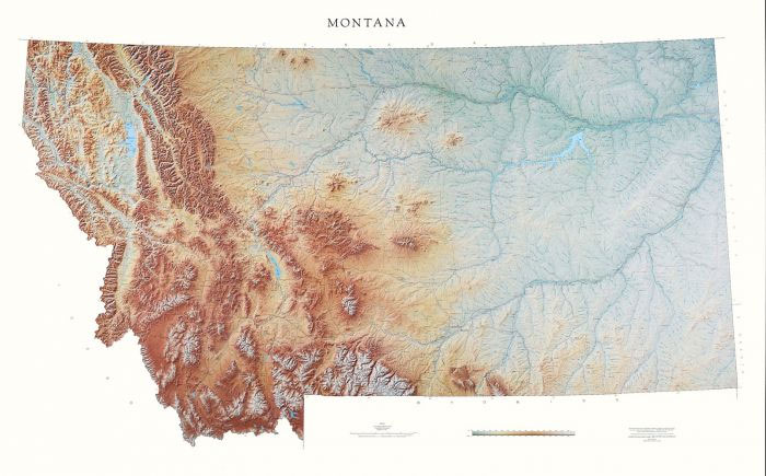
Detailed physical wall map of Montana State at a scale of 1:600,000. The cartography shows relief through a stunning, highly detailed shading, with different elevations varing in colouring, giving an almost 3-dimensional feel to the map. Peak heights are also clearly marked.The map displays land only within the boundaries of the chosen states – there
North Carolina State Physical Wall Map
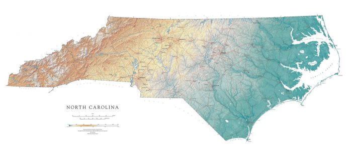
Detailed physical wall map of North Carolina State at a scale of 1:500,000. The cartography shows relief through a stunning, highly detailed shading, with different elevations varing in colouring, giving an almost 3-dimensional feel to the map. Peak heights are also clearly marked.The map displays land only within the boundaries of the chosen states –
New Mexico Raven Maps Physical Wall Map PAPER
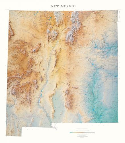
Detailed physical wall map of New Mexico State at a scale of 1:550,000. The cartography shows relief through a stunning, highly detailed shading, with different elevations varing in colouring, giving an almost 3-dimensional feel to the map. Peak heights are also clearly marked.The map displays land only within the boundaries of the chosen states –
Nevada State Physical Wall Map
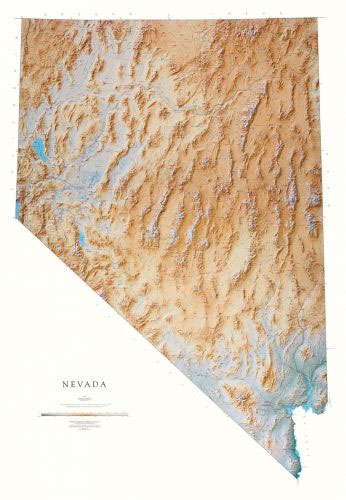
Detailed physical wall map of Nevada State at a scale of 1:550,000. The cartography shows relief through a stunning, highly detailed shading, with different elevations varing in colouring, giving an almost 3-dimensional feel to the map. Peak heights are also clearly marked.The map displays land only within the boundaries of the chosen states – there
Climbing Anchors
This completely revised and updated edition with all new color photos brings together in a single volume the anchoring systems most popular among climbers. Most climbers today learn their craft on artificial climbing walls and on sport routes with fixed protection. Their first efforts to lead on trad routes often come as a rude shock–they
Colorado Raven Maps Physical Wall Map PAPER
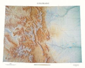
Detailed physical wall map of Colorado State at a scale of 1:500,000. The cartography shows relief through a stunning, highly detailed shading, with different elevations varing in colouring, giving an almost 3-dimensional feel to the map. Peak heights are also clearly marked.The map displays land only within the boundaries of the chosen states – there
Trad Climber`s Bible
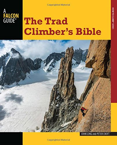
Traditional, or simply, trad climbing, is a do-it-yourself adventure requiring the climbing team to negotiate the climb and to carry, hand-place and remove most if not all components of the roped safety system. In The Trad Climber`s Bible, two of the most revered and respected trad climbers in the world, John Long and Peter Croft,
Eastern Armenian Dictionary and Phrasebook: Armenian-English/English-Armenian
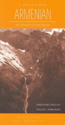
An estimated 8 million people speak Armenian world-wide, split between the 3 million people in the Republic of Armenia who speak Eastern Armenian, and the diaspora communities who primarily speak Western Armenian. A 3,000-word bilingual dictionary offers essential vocabulary, while the 32-chapter phrasebook helps travellers deal with topics such as shopping, travel, and healthcare. This