Category Archives: Maps
California Benchmark Road Map
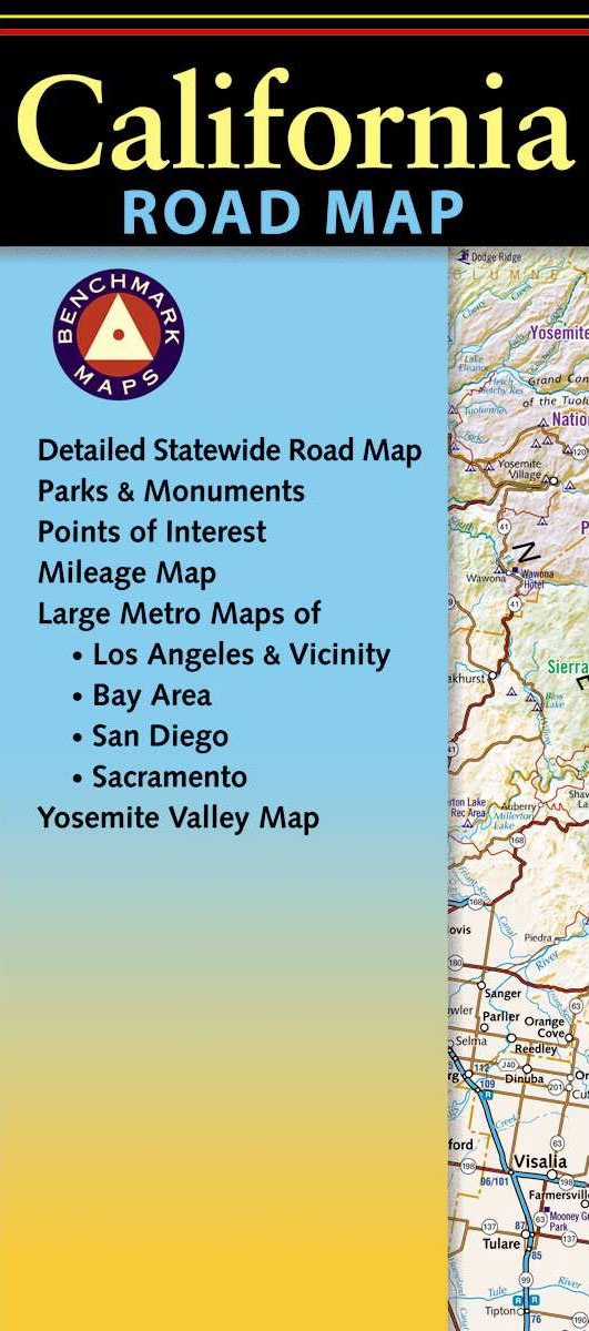
California at 1:1,318,821 in a series of very detailed state maps of the western states of USA from Benchmark Maps designed to highlight national/state parks or forests and other protected areas, and to provide information on recreational possibilities, campgrounds and RV parks, etc.The base map is derived from satellite imagery to show the topography, with
Britain and Ireland NGS Classic Wall Map PAPER
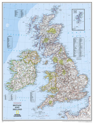
British Isles at 1:1,687,000 on a small wall map, 61 x 76cm (1’11″ x 2’5″ approx) – paper version, from the National Geographic Society showing the constituent parts of Man and Channel. Shetland Islands are shown on an inset.The map uses NGS’s classic presentation style of white background plus relief shading to show the topography,
United States NGS Physical Wall Map PAPER
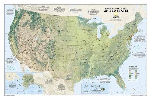
United States at 1:5,200,000 on a physical wall map from the National Geographic Society designed to present the country’s topography and land cover, with different colours and graphic showing grassland, mixed forest, wetland, cropland, etc.Vegetation colouring means that the Great Plains are clearly distinguished from the greener coastal regions of eastern USA, or from the
Oregon Benchmark Recreational Map
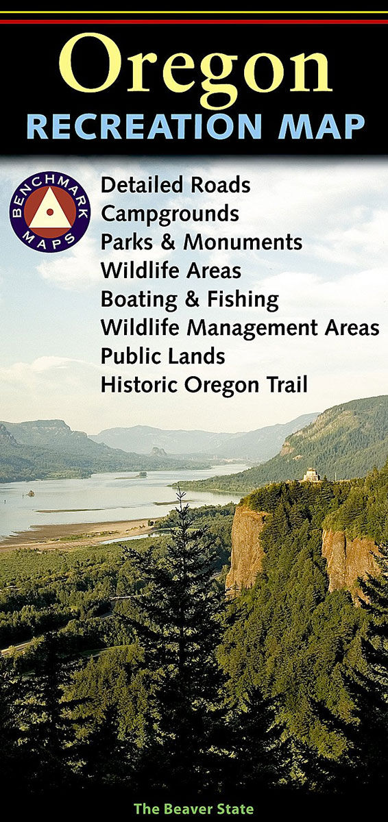
Oregon at 1:800,000 in a series of very detailed state maps of the western states of USA from Benchmark Maps designed to highlight national/state parks or forests and other protected areas, and to provide information on recreational possibilities, campgrounds and RV parks, etc.The base map is derived from satellite imagery to show the topography, with
China NGS Classic Wall Map PAPER
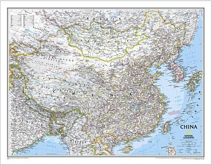
China NGS Classic Style Wall Map from the National Geographic Society, paper version, showing the country at 1:7,804,000 with its administrative boundaries and road/rail networks. Light base with international boundaries picked out in colour and the seas in blue are characteristic of the NGS Classic Style.Coverage includes the whole of Mongolia and the Koreas, southern
France, Belgium and Netherlands NGS Classic Wall Map PAPER
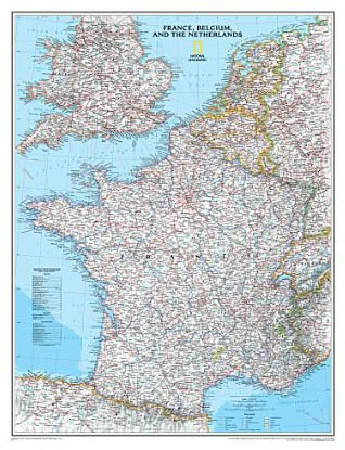
France with the Benelux counties at 1:1,953,000 on a wall map, size: 60 x 77cm (24″ x 30″ approx) ‘“ paper version, from the National Geographic Society presented in their traditional classic style, with a light base and country boundaries in contrasting colours.In France the map shows the division of the country into regions, with
Idaho Benchmark Recreational Map
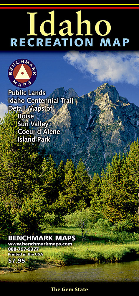
Idaho at 1:833,333 in a series of very detailed state maps of the western states of USA from Benchmark Maps designed to highlight national/state parks or forests and other protected areas, and to provide information on recreational possibilities, campgrounds and RV parks, etc.The base map is derived from satellite imagery to show the topography, with
Utah Benchmark Recreation Map
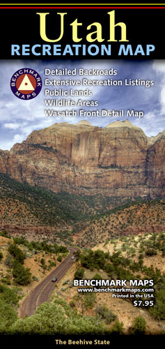
Utah at 1:730,000 in a series of very detailed state maps of the western states of USA from Benchmark Maps designed to highlight national/state parks or forests and other protected areas, and to provide information on recreational possibilities, campgrounds and RV parks, etc.The base map is derived from satellite imagery to show the topography, with
Northern California Benchmark Road Map
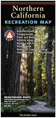
Benchmark Maps` newest folded map focuses on the northern half of The Golden State. The map side features Public & Tribal Lands, extensive highway detail, point-to-point mileages, recreation attractions, campgrounds, parks and wildlife areas, fishing access points, and more. The reverse side features categorized POI listings with helpful descriptions, current contact information, and map grid
The Bucket List Beer: Beer-Themed Adventures: Pubs, Breweries, Festivals and More

Finally a beer-centric bucket list! Celebrating beer worldwide, this is a must-have for any beer aficionado. Whether you re planning a pub crawl, a weekend in the country, or a longer vacation, this book is a trove of ideas for the beer lover. As is to be expected, this lively guide to beer-related travel contains
Cycling Atlas Europe: The 350 Most Beautiful Cycling Routes in Europe

Maps, technical details, tourist information, comments, hacks, and tips Claude Droussent has assembled the best cycling travel guide ever published with the aid of Strava, the mapping app that includes information from the world s most knowledgeable and expert cyclists who have actually ridden these trails and critically reviewed and rated them. The guide features
Virginia, Maryland, Delaware & DC Raven Maps Physical Wall Map PAPER
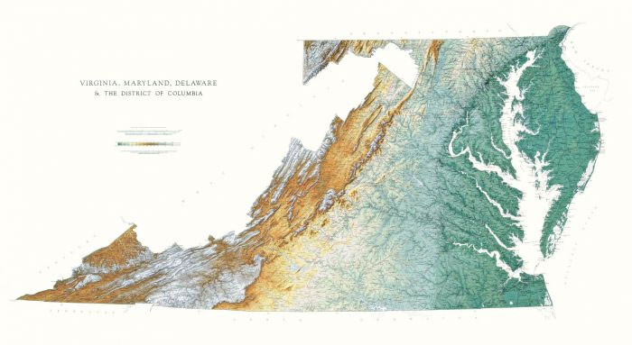
Detailed physical wall map of Virginia, Maryland, Delaware & DC at a scale of 1:500,000. The cartography shows relief through a stunning, highly detailed shading, with different elevations varing in colouring, giving an almost 3-dimensional feel to the map. Peak heights are also clearly marked.The map displays land only within the boundaries of the chosen
Mississippi Raven Maps Physical Wall Map PAPER
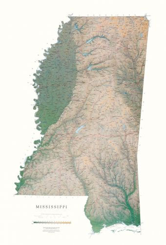
Detailed physical wall map of Mississippi State at a scale of 1:500,000. The cartography shows relief through a stunning, highly detailed shading, with different elevations varing in colouring, giving an almost 3-dimensional feel to the map. Peak heights are also clearly marked.The map displays land only within the boundaries of the chosen states – there
Vermont & New Hampshire Raven Maps Physical Wall Map PAPER
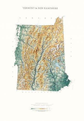
Detailed physical wall map of Vermont & New Hampshire States at a scale of 1:500,000. The cartography shows relief through a stunning, highly detailed shading, with different elevations varing in colouring, giving an almost 3-dimensional feel to the map. Peak heights are also clearly marked.The map displays land only within the boundaries of the chosen
Nebraska Raven Maps Physical Wall Map PAPER
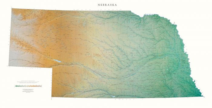
Detailed physical wall map of Nebraska State at a scale of 1:500,000. The cartography shows relief through a stunning, highly detailed shading, with different elevations varing in colouring, giving an almost 3-dimensional feel to the map. Peak heights are also clearly marked.The map displays land only within the boundaries of the chosen states – there
Washington State Physical Wall Map
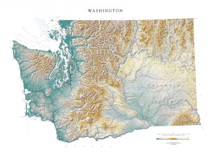
Detailed physical wall map of Washington State at a scale of 1:500,000. The cartography shows relief through a stunning, highly detailed shading, with different elevations varing in colouring, giving an almost 3-dimensional feel to the map. Peak heights are also clearly marked.The map displays land only within the boundaries of the chosen states – there