Category Archives: Maps
Milky Way NGS Wall Map ENCAPSULATED
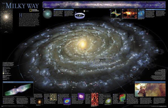
The Milky Way on a colourful and informative wall map, size 79.5 x 51.5cm (31″ x 20″ approx) ‘“ encapsulated version, from the National Geographic, showing the galaxy’s spiral-shaped system of a few hundred billion stars and where we sit inside it. Colouring indicates the galactic bulge, placed in the centre of the map, globular
Greece NGS Classic Wall Map PAPER
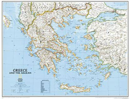
Greece at 1:1,491,000 on a wall map, size 77 x 60cm (30″ x 24″ approx) ‘“ paper version, from the National Geographic Society in their traditional classic style with a light base and country boundaries outlined in colour.All place names are shown in the Latin alphabet only, using in most cases current Greek versions with
Africa NGS Classic Wall Map ENCAPSULATED
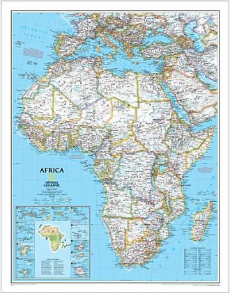
Africa wall map from the National Geographical Society, small size: 61 x 79cm (2ft x 2ft 7″ approx) ‘“ encapsulated version, presented in the NGS classic style with a light base and country boundaries in contrasting colours. The map presents Africa at 1: 14,244,000 and coverage includes the whole of the Mediterranean Basin, extending north
Holy Land NGS Wall Map
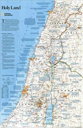
National Geographic`s Holy Land wall map provides a fascinating in-depth look at the faiths, peoples, and politics that have shaped this historic region. This detailed political map is overlayed with facts about significant religious sites. Information on Judaism, Christianity, and Islam, as well as historical periods from the Stone and Bronze ages to the Islamic
Africa NGS Classic Wall Map LARGE ENCAPSULATED

Africa wall map from the National Geographical Society, large size: 92 x 117cm (3ft x 3ft 10″ approx) ‘“ encapsulated version, presented in the NGS classic style with a light base and country boundaries in contrasting colours. The map presents Africa at 1: 9,328,000 and coverage includes the whole of the Mediterranean Basin, extending north
Italy NGS Classic Wall Map PAPER
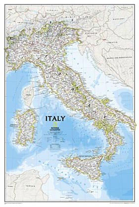
Italy at 1:1,765,000 on a wall map, size 59 x 87cm (23″ x 34″ approx) ‘“ paper version, from the National Geographic Society in their traditional classic style with a light base for the land and the surrounding oceans in shades of blue.The map shows the country’s division into administrative regions, with their names given
Mexico NGS Classic Wall Map PAPER
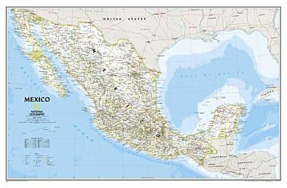
Mexico NGS Classic Style Wall Map from the National Geographic Society, paper version, presenting the country at 1:4,580,000 with internal administrative boundaries, surrounded by the blue colouring for the Pacific and the Gulf of Mexico.Internal administrative boundaries are easy to see on the light shading which provides the topographic background. Graphics show deserts, swamps, lava,
Russia NGS Classic Wall Map PAPER
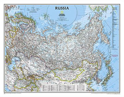
Russia on a wall map, size: 77 x 60cm (30″ x 24″ approx) ‘“ paper version, from the National Geographic Society in their traditional classic style with a light base and country or internal boundaries in colour.Coverage, using the two-point equidistant projection, includes all the ex-Soviet Union countries except Moldova, plus the whole of Mongolia,
Scandinavia NGS Classic Wall Map PAPER
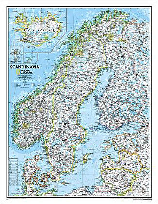
Scandinavia at 1:2,765,000 on a wall map, size: 77 x 60cm (30″ x 24″ approx) ‘“ paper version, from the National Geographic Society in their traditional classic style with a light base and country boundaries in bright colours.Coverage includes the whole of the Baltic Sea, Estonia, Latvia and Lithuania. Insets show Iceland, Faroe Islands and
Spain and Portugal NGS Classic Wall Map PAPER

Spain and Portugal Classic Style Wall Map, size 84 x 56cm (33″ x 22″ approx) – paper version, from the National Geographic Society, showing the Iberian Peninsula at 1:2,074,000 with a light base and country boundaries outlined in colour.Within Spain the map shows internal administrative boundaries with names of the regions. Road and rail networks
Shakespeare`s Britain NGS Wall Map PAPER
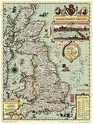
Picturesque map of Great Britain from the National Geographic Society designed to show the country in a style of antique maps, highlighting locations of Shakespeare’s plays with British settings, plus a panorama view of London, etc.The map is based on John Speed`s “The Kingdome of Great Britaine and Ireland,” from his 1611 atlas “Theatre of
The Americas NGS Classic Wall Map PAPER
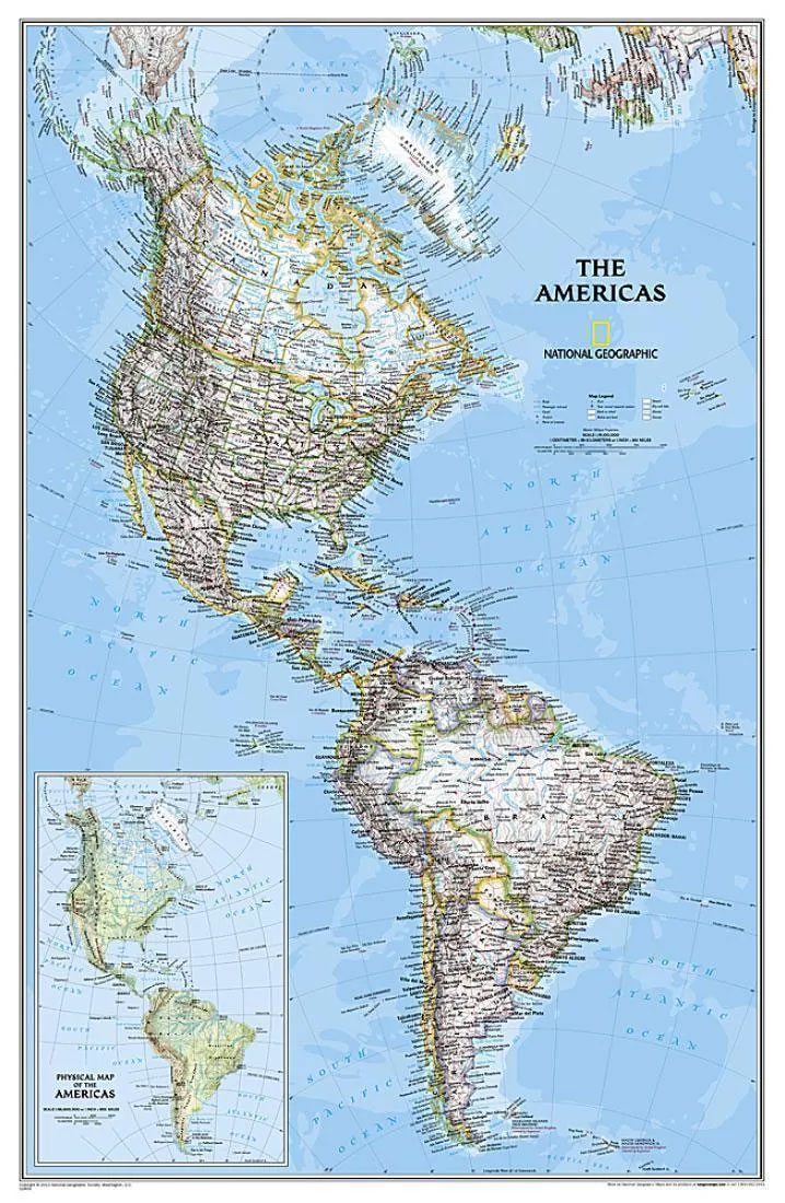
Attractive 59x92cm wallmap of the American continents, paper version, showing the New World in its entirety, from the North Pole to Cape Horn. The familiar NGS cartography is here: different colours distinguish political boundaries and hill-shading against a white background shows the general relief. Selected peak heights are marked, and generalized bathymetric tinting is applied
Mount Everest 50th Anniversary NGS Wall Map
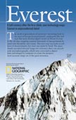
Mount Everest on a double-sided wall map from the National Geographic, produced to celebrate the 50th anniversary of the first ascent, combining on one side a spectacular panorama model highlighting three historical expedition routes, plus on the reverse a map of the Sagarmatha National Park, aerial views of the peak, etc.On one side is a
World NGS Physical / Ocean Floor Wall Map ENCAPSULATED

Superb representation of the ocean floor in this encapsulated version, 110x76cm/ (43″ x 30″ approx.) physical map of the world, one of the most interesting titles in the National Geographic Society’s long list of wall maps. Drawn with great skill to achieve a 3-D effect, ocean floor plains, basins, continental shelves, trenches, ridges and fractures
World NGS Physical / Ocean Floor Wall Map LARGE ENCAPSULATED
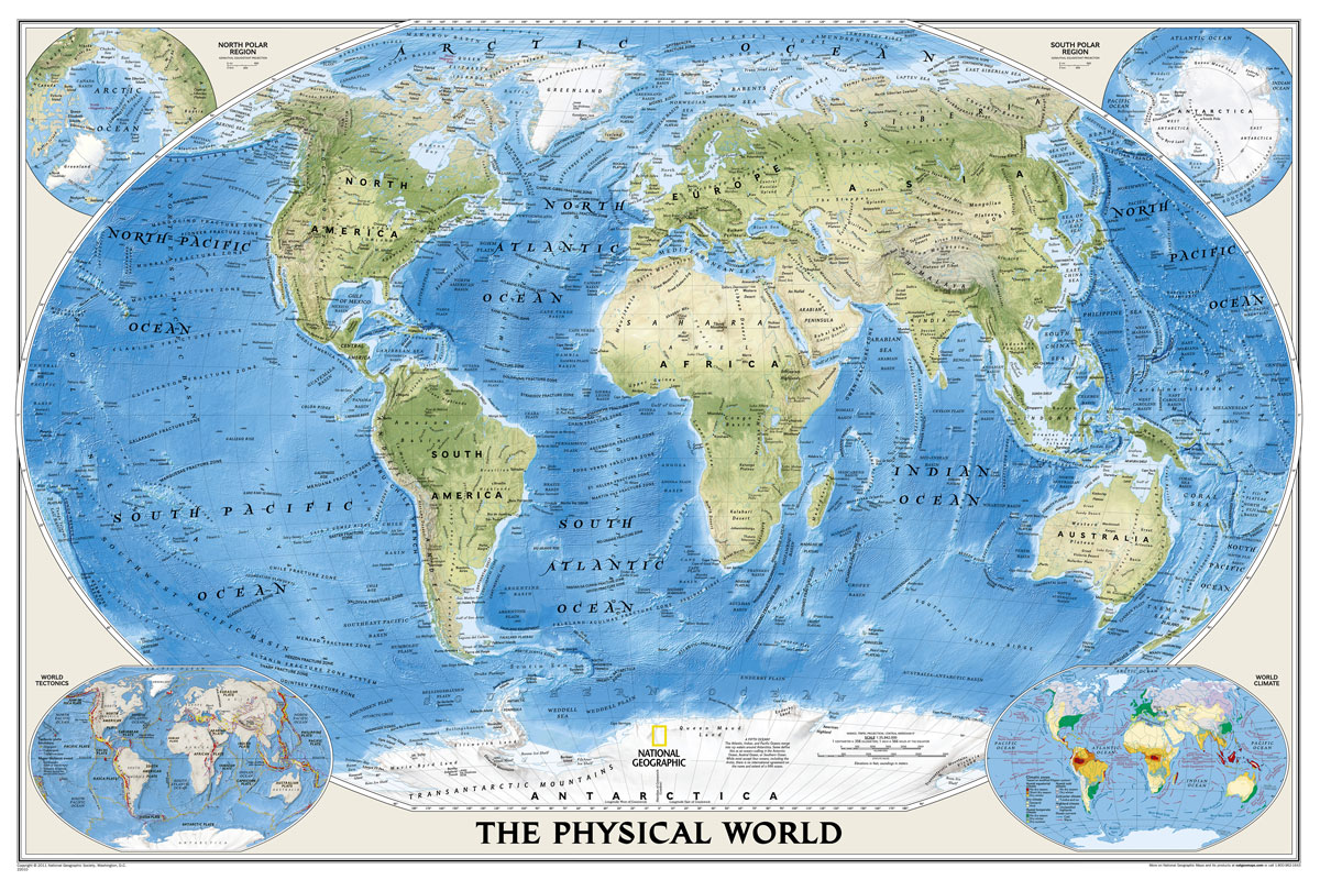
Superb representation of the ocean floor makes this enlarged, encapsulated 175.5 x 121.5cm (5ft 9″ x 4ft approx.) physical map of the world one of the most interesting titles in the National Geographic Society’s long list of wall maps. Drawn with great skill to achieve a 3-D effect, ocean floor plains, basins, continental shelves, trenches,
World NGS Explorer Wall Map ENCAPSULATED
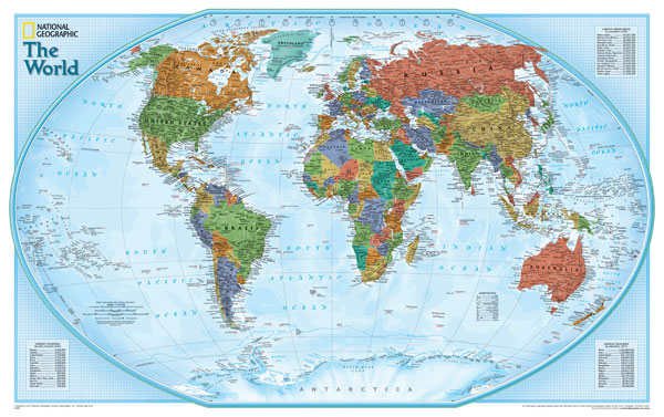
Encapsulated version of a small, colourful political map (82 x 51.5cm / 32″ x 20″ approx.) with the NGS’s usual presentation of the world within an oval frame providing an alternative to the more traditional wall maps. Countries are in dark colours, contrasted against light blue oceans.The map has relief shading and gives names of
France, Belgium and Netherlands NGS Classic Wall Map PAPER
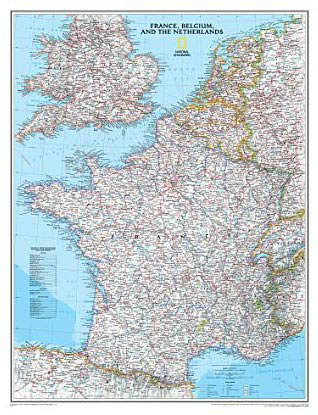
France with the Benelux counties at 1:1,953,000 on a wall map, size: 60 x 77cm (24″ x 30″ approx) ‘“ paper version, from the National Geographic Society presented in their traditional classic style, with a light base and country boundaries in contrasting colours.In France the map shows the division of the country into regions, with