Category Archives: Maps
Central America NGS Classic Wall Map ENCAPSULATED
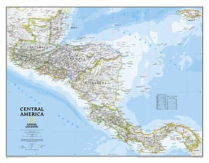
Central America, from Guatemala and Belize to Panama, on a wall map, size 73 x 56.5cm (30″ x 22″ approx), encapsulated version, published by the National Geographic Society in their traditional classic style: light coloured base with country boundaries in different colours. Topography of the region is shown by light relief shading with names of
China NGS Classic Wall Map ENCAPSULATED
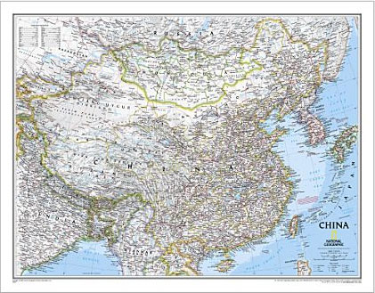
China NGS Classic Style Wall Map from the National Geographic Society, encapsulated version, showing the country at 1:7,804,000 with its administrative boundaries and road/rail networks. Light base with international boundaries picked out in colour and the seas in blue are characteristic of the NGS Classic Style.Coverage includes the whole of Mongolia and the Koreas, southern
Germany NGS Classic Wall Map ENCAPSULATED
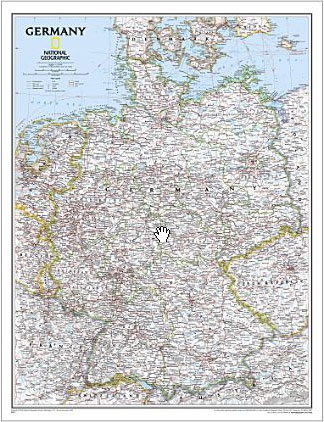
Germany at 1:1,375,000 on a wall map, size: 61 x 77cm (24″ x 30″ approx) ‘“ encapsulated version, from the National Geographic Society in their traditional classic style with a light base and country or internal state boundaries in colour.The map presents the division of Germany into individual states, showing their names in their English
Italy NGS Classic Wall Map ENCAPSULATED
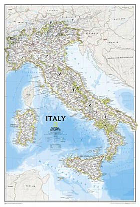
Italy at 1:1,765,000 on a wall map, size 59 x 87cm (23″ x 34″ approx) ‘“ encapsulated version, from the National Geographic Society in their traditional classic style with a light base for the land and the surrounding oceans in shades of blue.The map shows the country’s division into administrative regions, with their names given
Mexico NGS Classic Wall Map ENCAPSULATED
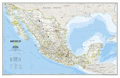
Mexico NGS Classic Style Wall Map from the National Geographic Society, encapsulated version, presenting the country at 1:4,580,000 with internal administrative boundaries, surrounded by the blue colouring for the Pacific and the Gulf of Mexico.Internal administrative boundaries are easy to see on the light shading which provides the topographic background. Graphics show deserts, swamps, lava,
Antarctica NGS Satellite Image Wall Map ENCAPSULATED
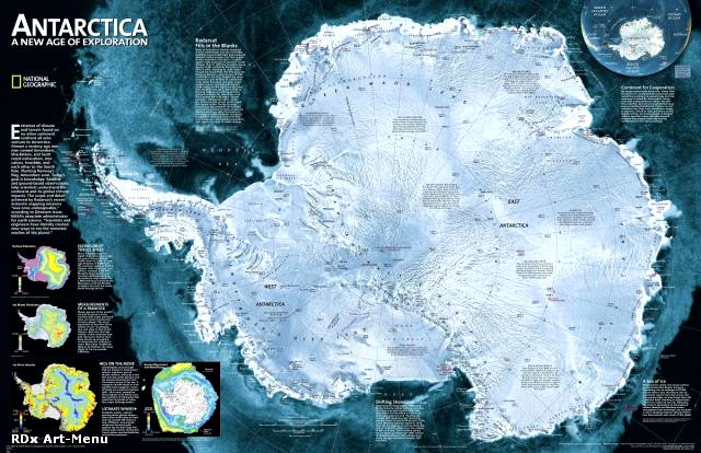
A wall map with a satellite image of Antarctica, size: 79 x 51cm – encapsulated version, from the National Geographic Society, with hill-shading to present the terrain and many peaks, glaciers and research stations. In 1997, in a joint project conducted by the Canadian Space Agency (CSA) and NASA, the satellite Radarsat I imaged the
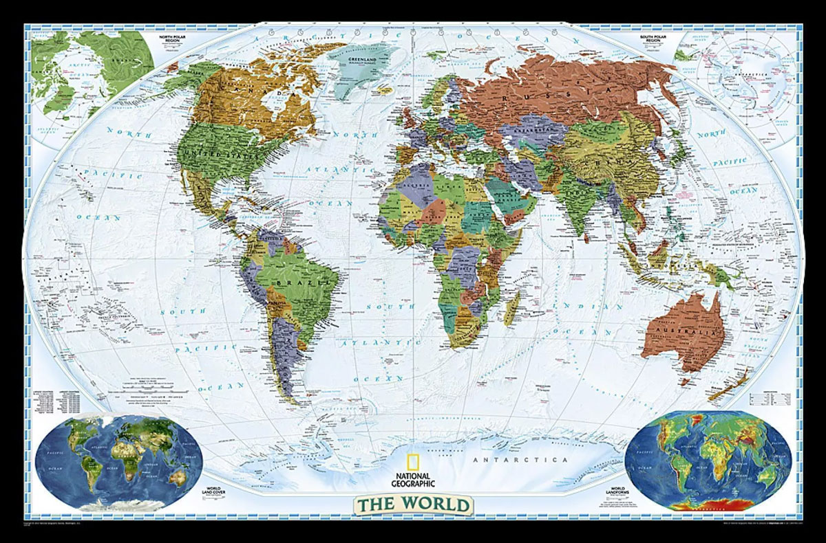
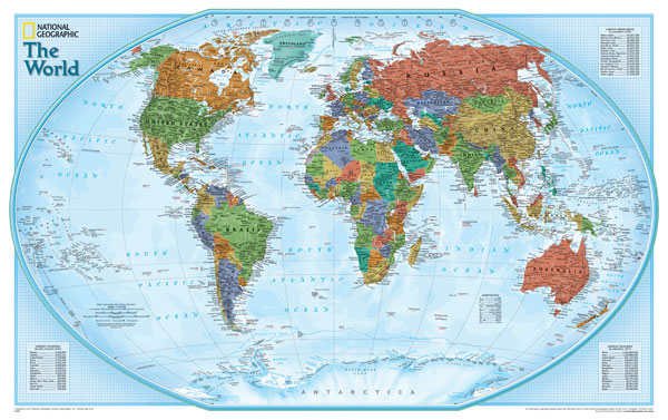
World NGS Decorator Wall Map PAPER
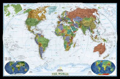
NGS Decorator Political World Map, standard size 116 x 75.5cm (45.5″ x 29.5″ approx) ‘“ paper version, a colourful political map of the world with pale blue oceans pleasantly contrasting with the darker shades used for countries, plus additional insets showing vegetation and physical geography. Relief shading used for mountain chains on land masses is
Asia NGS Classic Wall Map Laminated
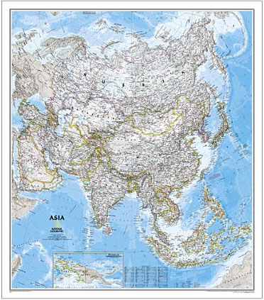
Asia wall map from the National Geographical Society, 86 x 97cm (2ft 10″ x 3ft 2″ approx) ‘“ paper version, in their traditional classic style with a light colour base and country boundaries outlined in different colours,The map presents Asia at 1: 13,8120,000. Coverage includes the whole of the European part of Russia, extending up
World NGS Decorator Wall Map LARGE PAPER
NGS Decorator Political World Map, enlarged size 186 x 122cm (73″ x 48″ approx) ‘“ paper version, a colourful political map of the world with pale blue oceans pleasantly contrasting with the darker shades used for countries, plus additional insets showing vegetation and physical geography. Relief shading used for mountain chains on land masses is
Australia NGS Classic Wall Map ENCAPSULATED
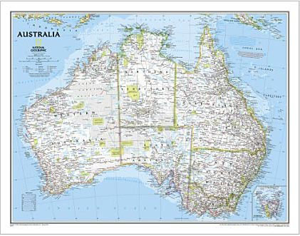
Australia on a wall map at 1:6,413,000, size: 77 x 60cm (30″ x 24″ approx) ‘“ encapsulated version, presenting the country in the National Geographic Society’s classic style: light base with relief shading and state boundaries in contrasting colours.The base map has relief shading to show the topography of the country, with further graphics to
World NGS Physical / Ocean Floor Wall Map LARGE PAPER
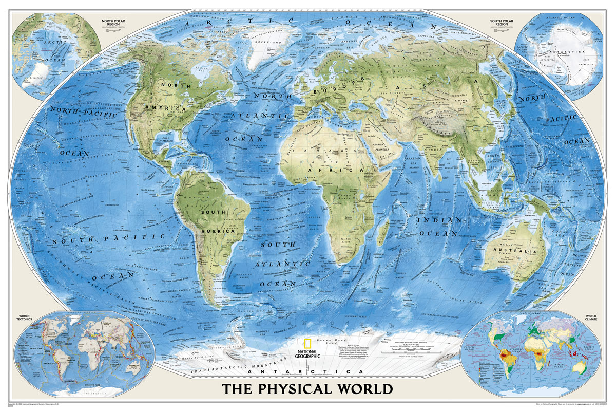
Superb representation of the ocean floor makes this 175.5 x 121.5cm (5ft 9″ x 4ft approx.) physical map of the world one of the most interesting titles in the National Geographic Society’s long list of wall maps. Drawn with great skill to achieve a 3-D effect, ocean floor plains, basins, continental shelves, trenches, ridges and
Europe NGS Classic Wall Map ENCAPSULATED
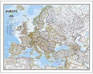
Political wall map of Europe from the National Geographic Society in their classic style with country boundaries indicated in different colours. Small size – 77 x 60cm (30″ x 24″ approx.) – encapsulated version.The map presents Europe in pale beige colour with relief shading to indicate mountainous regions. Additional graphics show topographic features such as
World Satellite Image NGS Wall Map PAPER

Global satellite mosaic of a cloud-free image of the Earth in its natural colours, as it would be seen from space. The map was produced for the NGS by NASA’s Jet Propulsion Laboratory using more than 500 satellite images prepared by the National Oceanic and Atmospheric Administration. One can easily identify the world’s major mountain
North America NGS Classic Wall Map ENCAPSULATED
North America NGS Classic Style Wall Map, small size: 61 x 76cm (24″ x 30″ approx), encapsulated version, published by the National Geographic Society in their classic style of presentation: light beige background with relief shading to show the topography and country borders outlined in contrasting colours. Coverage includes Central America and the Caribbean, extending
North America NGS Classic Wall Map LARGE ENCAPSULATED
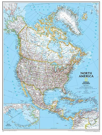
North America NGS Classic Style Wall Map, enlarged size: 92.5 x 117.5cm (3ft x 3ft 10″ approx), encapsulated version, published by National Geographic Society in their classic style of presentation: light beige background with relief shading to show the topography and country borders outlined in contrasting colours. Coverage includes Central America and the Caribbean, extending
South America NGS Classic Wall Map ENCAPSULATED
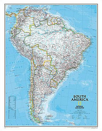
South America Wall Map, small size (61 x 76cm / 24″ x 30″ approx.) ‘“ encapsulated version, published by National Geographic Society in their classic style of presentation: light beige background with relief shading to show the topography and country borders outlined in contrasting colours.The map has relief shading to present the topography, with additional
Mount Everest 50th Anniversary NGS Wall Map
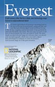
Mount Everest on a double-sided wall map from the National Geographic, produced to celebrate the 50th anniversary of the first ascent, combining on one side a spectacular panorama model highlighting three historical expedition routes, plus on the reverse a map of the Sagarmatha National Park, aerial views of the peak, etc.On one side is a
World NGS Physical / Ocean Floor Wall Map ENCAPSULATED

Superb representation of the ocean floor in this encapsulated version, 110x76cm/ (43″ x 30″ approx.) physical map of the world, one of the most interesting titles in the National Geographic Society’s long list of wall maps. Drawn with great skill to achieve a 3-D effect, ocean floor plains, basins, continental shelves, trenches, ridges and fractures
World NGS Physical / Ocean Floor Wall Map LARGE ENCAPSULATED

Superb representation of the ocean floor makes this enlarged, encapsulated 175.5 x 121.5cm (5ft 9″ x 4ft approx.) physical map of the world one of the most interesting titles in the National Geographic Society’s long list of wall maps. Drawn with great skill to achieve a 3-D effect, ocean floor plains, basins, continental shelves, trenches,
World NGS Explorer Wall Map ENCAPSULATED
Encapsulated version of a small, colourful political map (82 x 51.5cm / 32″ x 20″ approx.) with the NGS’s usual presentation of the world within an oval frame providing an alternative to the more traditional wall maps. Countries are in dark colours, contrasted against light blue oceans.The map has relief shading and gives names of