Category Archives: Maps
Australia NGS Classic Wall Map PAPER
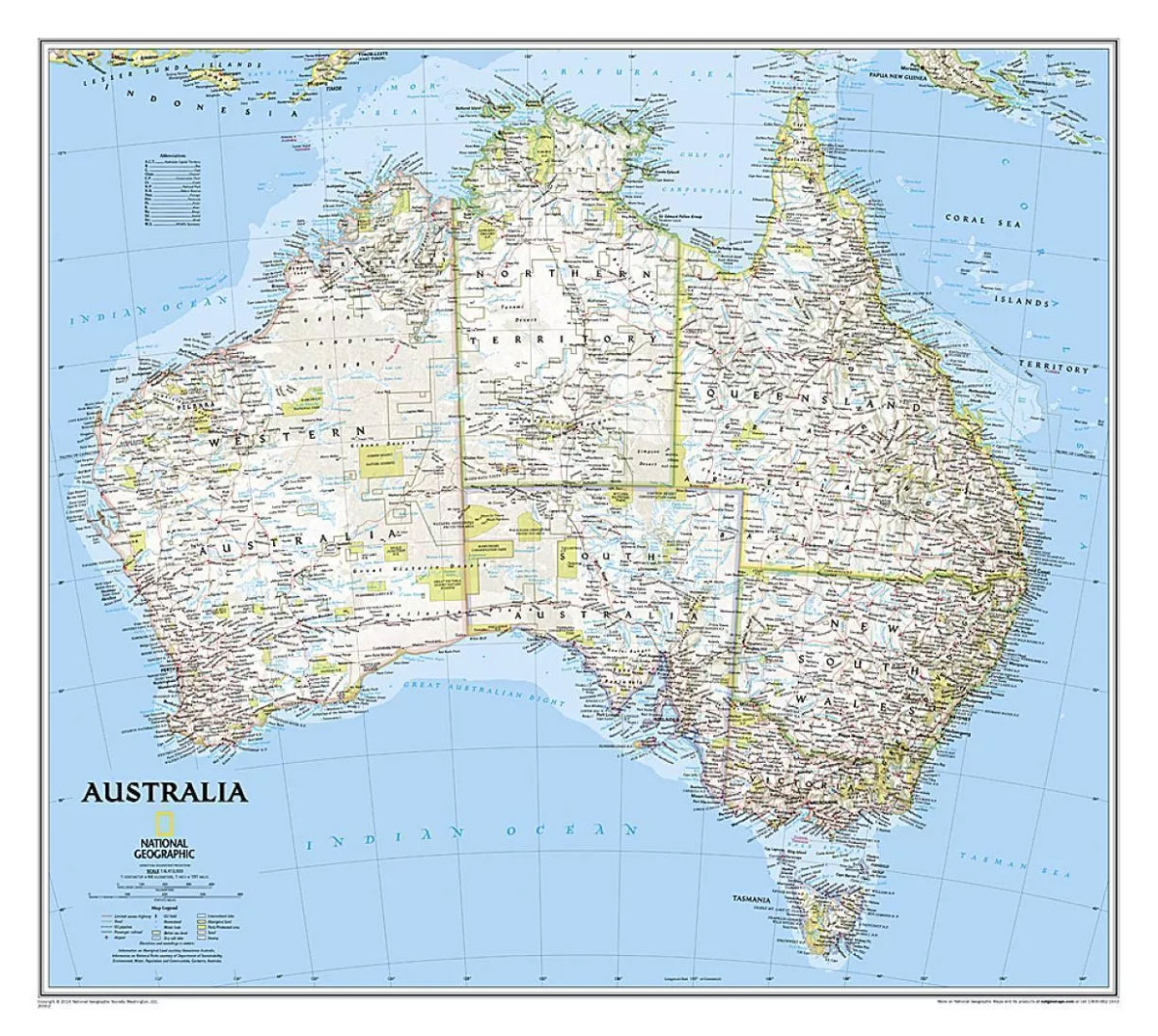
Australia on a wall map at 1:6,413,000, size: 77 x 60cm (30″ x 24″ approx) ‘“ paper version, presenting the country in the National Geographic Society’s classic style: light base with relief shading and state boundaries in contrasting colours.The base map has relief shading to show the topography of the country, with further graphics to
North America NGS Classic Wall Map PAPER
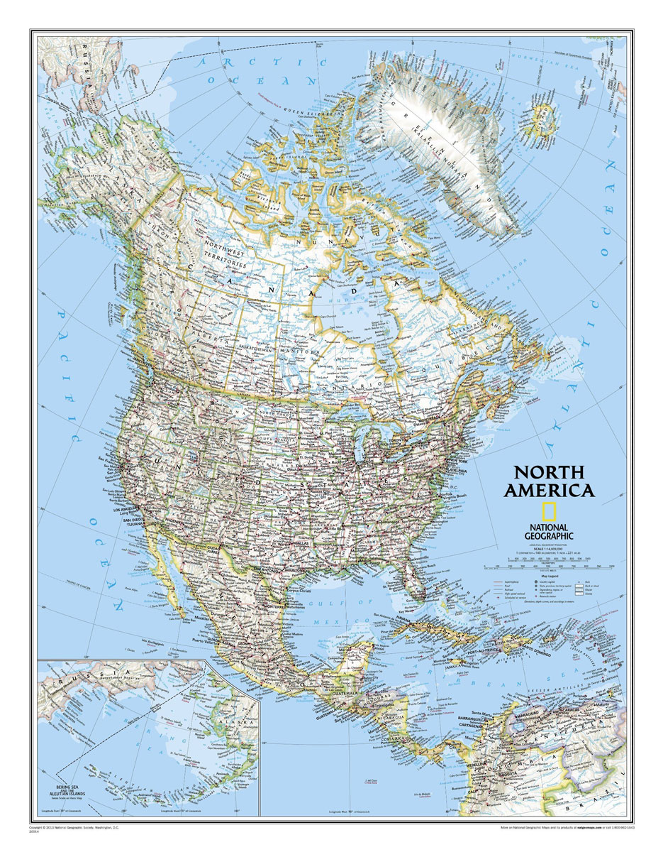
North America NGS Classic Style Wall Map, small size: 61 x 76cm (24″ x 30″ approx), paper version, published by National Geographic Society in their classic style of presentation: light beige background with relief shading to show the topography and country borders outlined in contrasting colours. Coverage includes Central America and the Caribbean, extending from
North America NGS Classic Wall Map LARGE PAPER
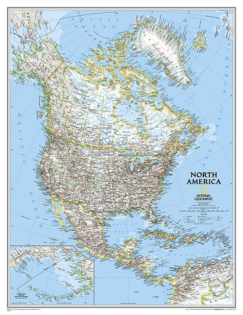
North America NGS Classic Style Wall Map, enlarged large size: 92 x 117cm (3ft x 3ft 10″ approx), paper version, published by National Geographic Society in their classic style of presentation: light beige background with relief shading to show the topography and country borders outlined in contrasting colours. Coverage includes Central America and the Caribbean,
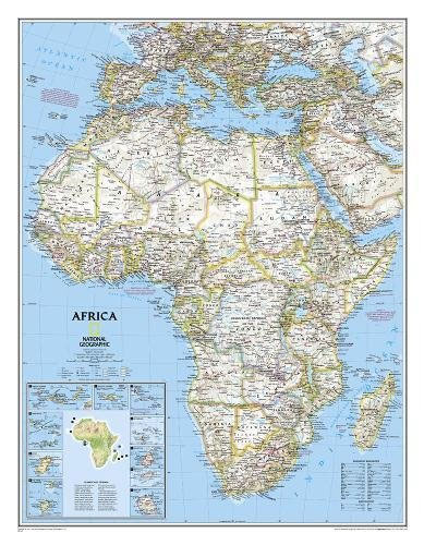
Africa NGS Classic Wall Map PAPER
Africa wall map from the National Geographical Society, small size: 61 x 79cm (2ft x 2ft 7″ approx) ‘“ paper version, presented in the NGS classic style with a light base and country boundaries in contrasting colours. The map presents Africa at 1: 14,244,000 and coverage includes the whole of the Mediterranean Basin, extending north
Africa NGS Classic Wall Map LARGE PAPER
Africa wall map from the National Geographical Society, large size: 92 x 117cm (3ft x 3ft 10″ approx) ‘“ paper version, presented in the NGS classic style with a light base and country boundaries in contrasting colours. The map presents Africa at 1: 9,328,000 and coverage includes the whole of the Mediterranean Basin, extending north
South America NGS Classic Wall Map PAPER
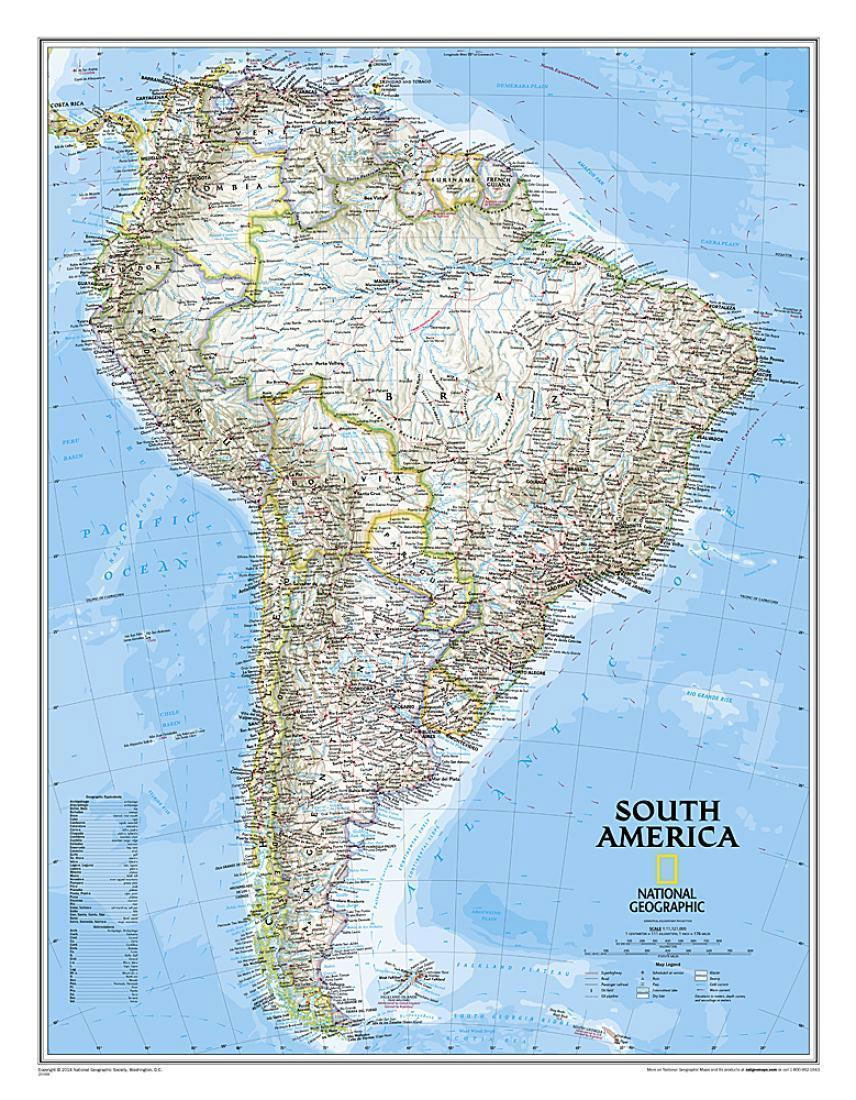
South America Wall Map, small size (61 x 76cm / 24″ x 30″ approx.) ‘“ paper version, published by National Geographic Society in their classic style of presentation: light beige background with relief shading to show the topography and country borders outlined in contrasting colours.The map has relief shading to present the topography, with additional
South America NGS Classic Wall Map LARGE PAPER
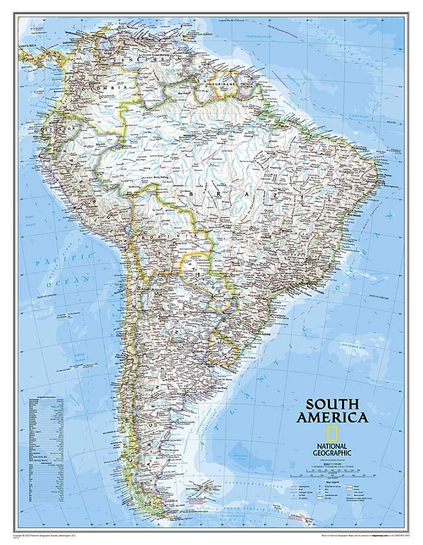
South America Wall Map, enlarged size (92 x 117cm / 36″ x 46″ approx.) ‘“ paper version, published by National Geographic Society in their classic style of presentation: light beige background with relief shading to show the topography and country borders outlined in contrasting colours.The map has relief shading to present the topography, with additional
Europe NGS Classic Wall Map PAPER
Political wall map of Europe from the National Geographic Society in their classic style with country boundaries indicated in different colours. Small size – 77 x 60cm (30″ x 24″ approx.) – paper version.The map presents Europe in pale beige colour with relief shading to indicate mountainous regions. Additional graphics show topographic features such as
Europe NGS Classic Wall Map LARGE PAPER
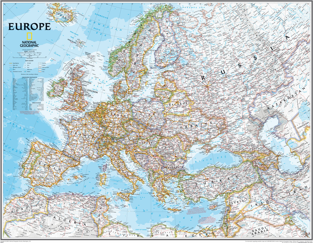
Political wall map of Europe from the National Geographic Society in their classic style with country boundaries indicated in different colours. Large size – 114 x 89cm (3ft 9″ x 2ft 11″ approx.) – paper version.The map presents Europe in pale beige colour with relief shading to indicate mountainous regions. Additional graphics show topographic features
Middle East NGS Classic Wall Map PAPER
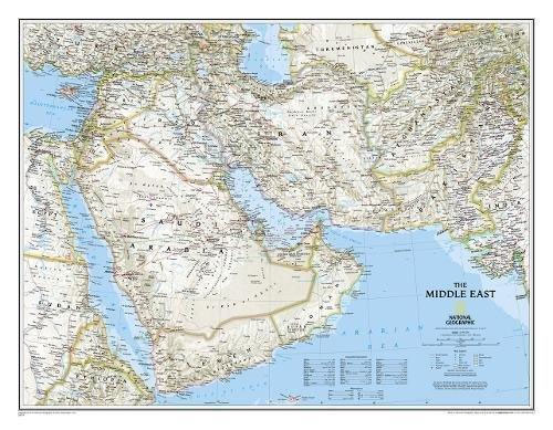
Middle East wall map, 77 x 60cm (2ft 6″ x 2ft approx) ‘“ paper version, presenting the region at 1:6,087,000 in the NGS classic style on a light base with country boundaries outlined in contrasting colours. Coverage extends from the Nile Valley in Egypt and Sudan to Pakistan and Tajikistan. Topography of the region is
World NGS Explorer Wall Map PAPER
Small, colourful political map (81.5 x 51cm / 32″ x 20″ approx.) with the NGS’s usual presentation of the world within an oval frame providing an alternative to the more traditional wall maps. Countries are in dark colours, contrasted against light blue oceans.The map has relief shading and gives names of some mountain ranges, deserts,
World Satellite Image NGS Wall Map ENCAPSULATED
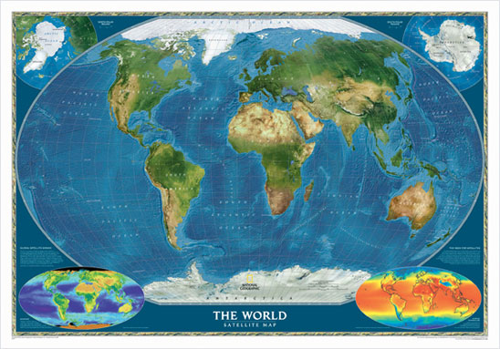
Encapsulated version of a global satellite mosaic of a cloud-free image of the Earth in its natural colours, as it would be seen from space. The map was produced for the NGS by NASA’s Jet Propulsion Laboratory using more than 500 satellite images prepared by the National Oceanic and Atmospheric Administration. One can easily identify
The Universe NGS Wall Map PAPER
The Universe map by the National Geographic Society attempts to give a sense of the enormous size of our universe and the relative scale of the star groups and galaxies within it. This innovative map features cylinders with grids measured in light-years that illustrate volumes of space.
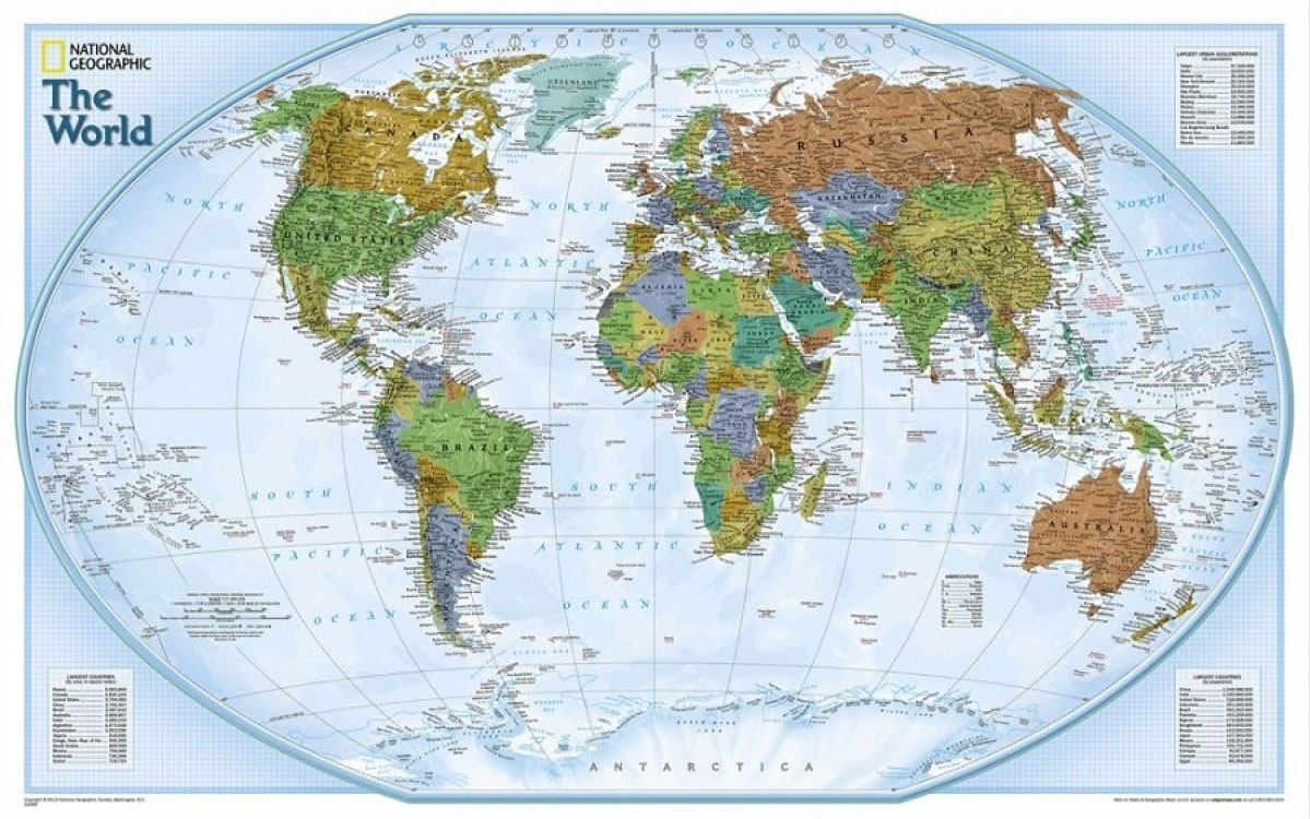
World NGS Decorator Wall Map ENCAPSULATED
NGS Decorator Political World Map, standard size 116 x 75.5cm (45.5″ x 29.5″ approx) ‘“ encapsulated version, a colourful political map of the world with pale blue oceans pleasantly contrasting with the darker shades used for countries, plus additional insets showing vegetation and physical geography. Relief shading used for mountain chains on land masses is
The Earth`s Moon NGS Wall Map PAPER

National Geographic`s The Earth`s Moon Map is like having an atlas and almanac in one. This incredible map/poster shows a detailed image of both sides of the Moon, with an index of hundreds of lunar features. In addition to showing landing spots for lunar missions, the map includes graphics and descriptions of the moon`s phases,
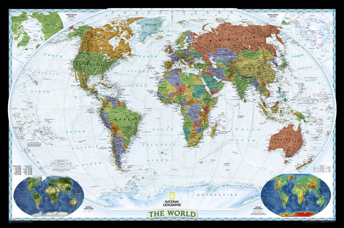
World NGS Decorator Wall Map LARGE ENCAPSULATED
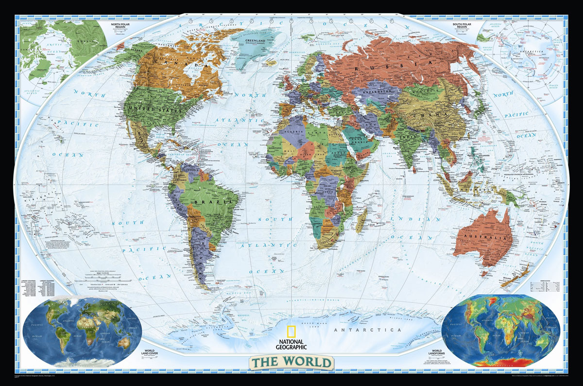
NGS Decorator Political World Map, enlarged size 186 x 122cm (73″ x 48″ approx) ‘“ encapsulated version, a colourful political map of the world with pale blue oceans pleasantly contrasting with the darker shades used for countries, plus additional insets showing vegetation and physical geography. Relief shading used for mountain chains on land masses is
South America NGS Classic Wall Map LARGE ENCAPSULATED
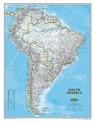
South America Wall Map, enlarged size (92 x 117cm / 36″ x 46″ approx.) ‘“ encapsulated version, published by National Geographic Society in their classic style of presentation: light beige background with relief shading to show the topography and country borders outlined in contrasting colours.The map has relief shading to present the topography, with additional
The Americas NGS Classic Wall Map ENCAPSULATED
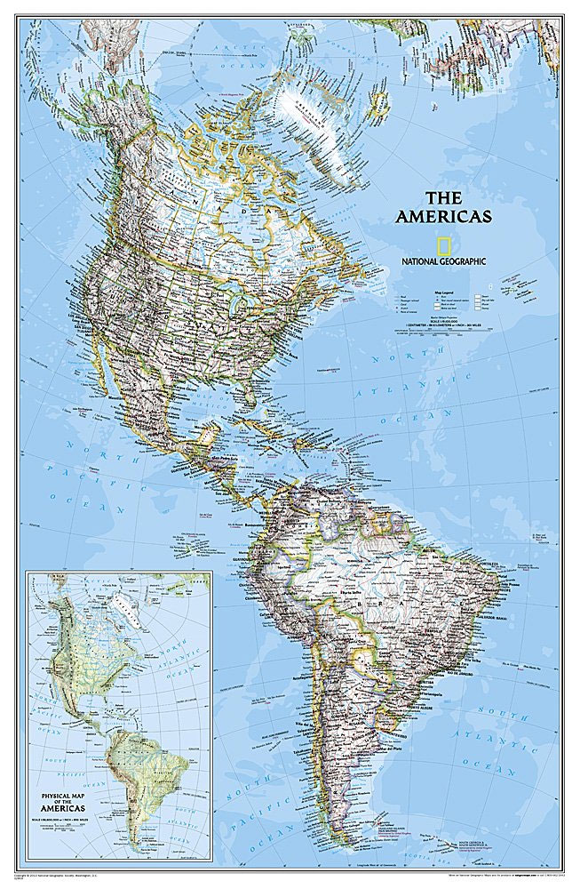
Attractive 59x92cm wallmap of the American continents, encapsulated version, showing the New World in its entirety, from the North Pole to Cape Horn. The familiar NGS cartography is here: different colours distinguish political boundaries and hill-shading against a white background shows the general relief. Selected peak heights are marked, and generalized bathymetric tinting is applied
Middle East NGS Classic Wall Map ENCAPSULATED
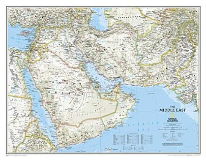
Middle East wall map, 77 x 60cm (2ft 6″ x 2ft approx) ‘“ encapsulated version, presenting the region at 1:6,087,000 in the NGS classic style on a light base with country boundaries outlined in contrasting colours. Coverage extends from the Nile Valley in Egypt and Sudan to Pakistan and Tajikistan. Topography of the region is
Britain and Ireland NGS Classic Wall Map ENCAPSULATED
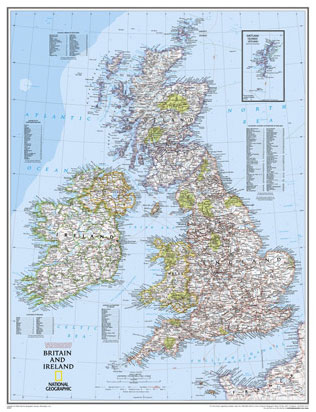
British Isles at 1:1,687,000 on a small wall map, 61 x 76cm (1’11″ x 2’5″ approx) – encapsulated version, from the National Geographic Society showing the constituent parts of the United Kingdom, Irish Republic, Isle of Man and the Channel Islands. Shetland Islands are shown on an inset.The map uses NGS’s classic presentation style of