Category Archives: Maps
United States NGS Classic Wall Map LARGE PAPER
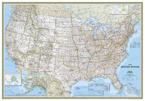
United States NGS Classic Style Wall Map in the *large 178 x 125cm / 70″ x 49″, size, paper version* with white background with relief shading for mountains, state boundaries in colour, and the surrounding seas in light blue. The map shows the administrative division of the country, with states boundaries picked out in different
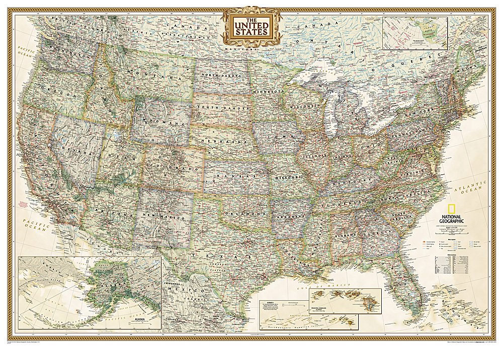
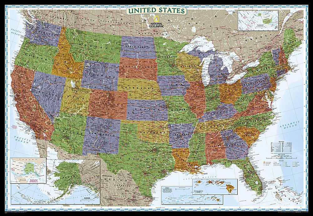
United States NGS Executive Wall Map PAPER
United States NGS Executive Style Wall Map in the standard 111 x 78cm (43″ x 30″ approx) size, paper version, designed to present current information in colouring reminiscent of antique maps, with shades of beige and brown. The maps show the administrative division of the country, with state boundaries picked out in different colours. Town
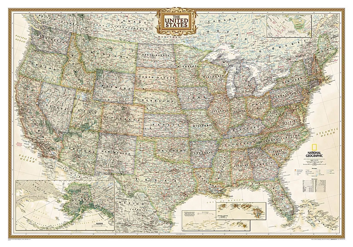
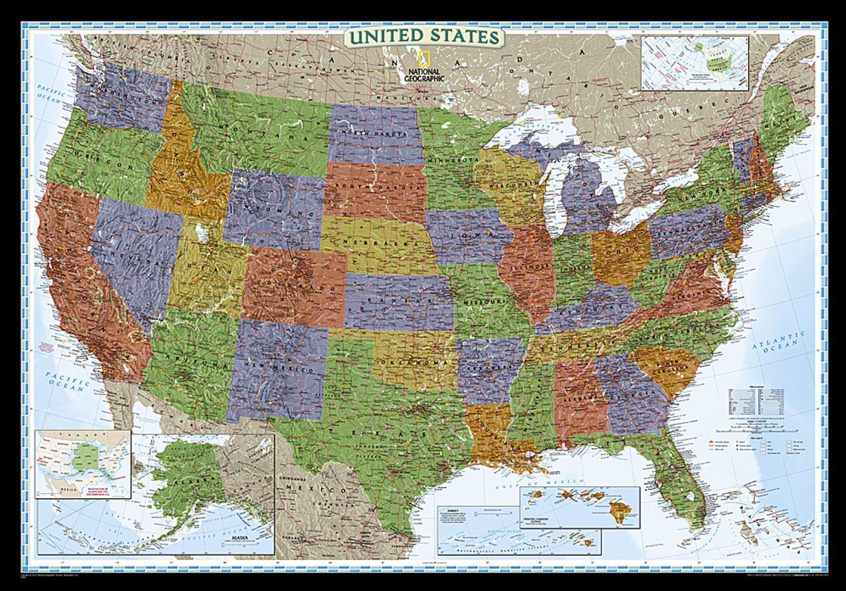
United States NGS Executive Wall Map LARGE PAPER
United States NGS Executive Style Wall Map in an enlarged 175 x 122m (69″ x 48″ approx) size, paper version designed to present current information in colouring reminiscent of antique maps, with shades of beige and brown. The maps show the administrative division of the country, with state boundaries picked out in different colours. Town
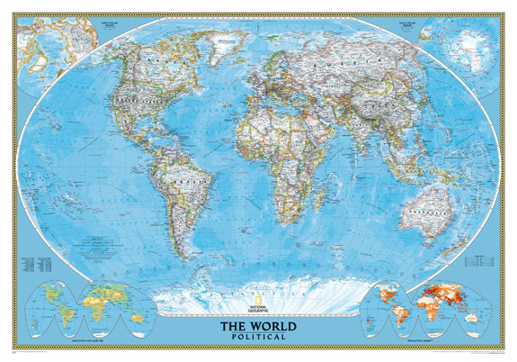
World NGS Executive Wall Map ENCAPSULATED
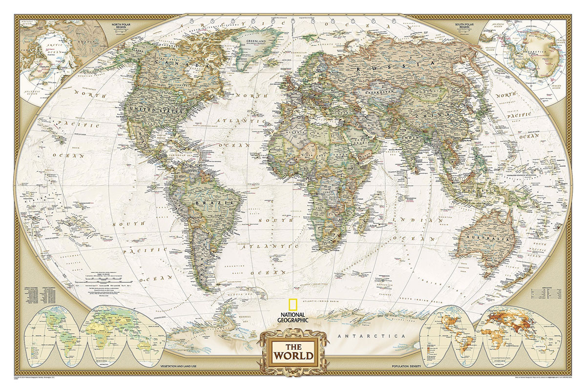
Encapsulated version of the standard size, 116.5 x 77.5cm (46″ x 30″ approx.), Atlantic centred NGS Executive political map of the world which offers current information presented in elegant antique style. Countries are in rich but muted colours and oceans in beige, with additional panels and framing in shades of brown.An unusual feature of this
United States NGS Decorator Wall Map PAPER
United States NGS Decorator Style Wall Map, in the standard 111x78cm (43″x30″) size – paper version, with the states presented in strong but muted colours against light blue oceans and the Great Lakes. NGS Decorator maps of USA show the administrative division of the country, with states in different colours. Town symbols indicate state capitals.
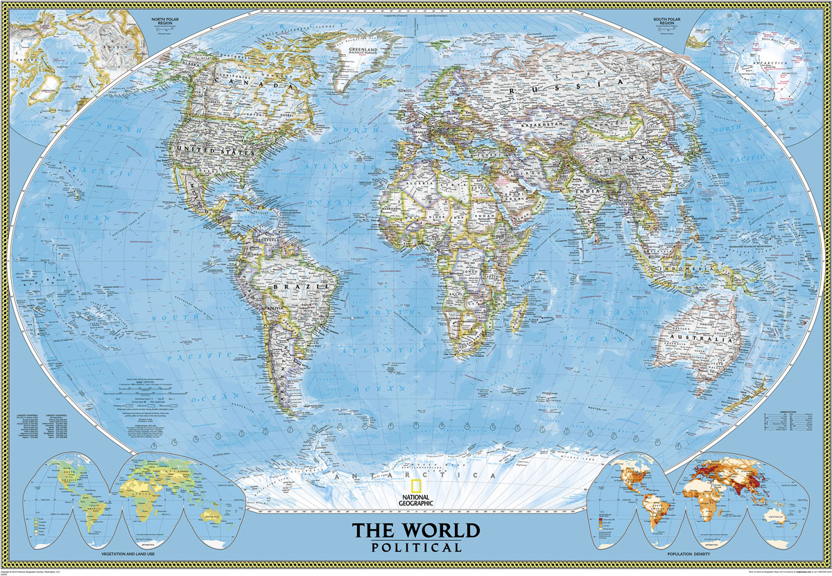
World NGS Executive Wall Map LARGE ENCAPSULATED
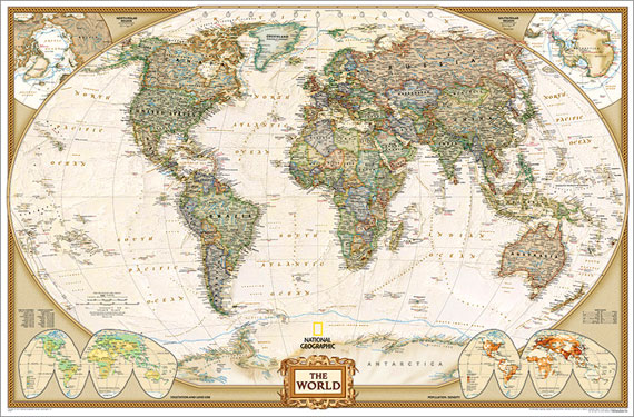
Enlapsulated version of the enlarged size, 185 x 122cm (73″ x 48″ approx), Atlantic centred NGS Executive political map of the world which offers current information presented in elegant antique style. Countries are in rich but muted colours and oceans in beige, with additional panels and framing in shades of brown.An unusual feature of this
United States NGS Decorator Wall Map LARGE PAPER
United States NGS Decorator Style Wall Map in the large 175x117cm (69″x46″)size – paper version, with the states presented in strong but muted colours against light blue oceans and the Great Lakes. NGS Decorator maps of USA show the administrative division of the country, with states in different colours. Town symbols indicate state capitals. Road
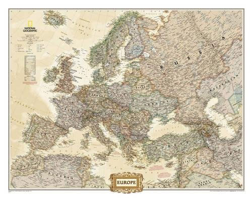
Europe NGS Executive Wall Map PAPER
Political wall map of Europe from the National Geographic Society in their executive style, offering current information in elegant antique presentation. Small size – 77 x 60cm (30″ x 24″ approx) ‘“ on paper.The map presents Europe with relief shading to indicate mountainous regions. Additional graphics show topographic features such as main swamps or areas
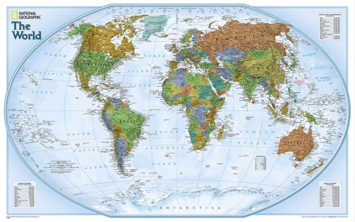
World NGS Classic Wall Map PAPER
NGS Classic political map of the world, standard size 110.5 x 77cm (43.5″ x 30″ approx) ‘“ paper version, with the publishers’ characteristic lay-out providing an attractive alternative to the more conventional world maps, countries in white but defined by different colour borders, oceans in bright blue, plus interesting additional features. All place names are
Europe NGS Executive Wall Map ENCAPSULATED

Political wall map of Europe from the National Geographic Society in their executive style, offering current information in elegant antique presentation. Small size – 77 x 60cm (30″ x 24″ approx) ‘“ encapsulated.The map presents Europe with relief shading to indicate mountainous regions. Additional graphics show topographic features such as main swamps or areas below
World NGS Classic Wall Map LARGE PAPER
NGS Classic political map of the world, enlarged size 178 x 123cm (70″ x 48″ approx) ‘“ paper version, with the publishers’ characteristic lay-out providing an attractive alternative to the more conventional world maps, countries in white but defined by different colour borders, oceans in bright blue, plus interesting additional features. All place names are
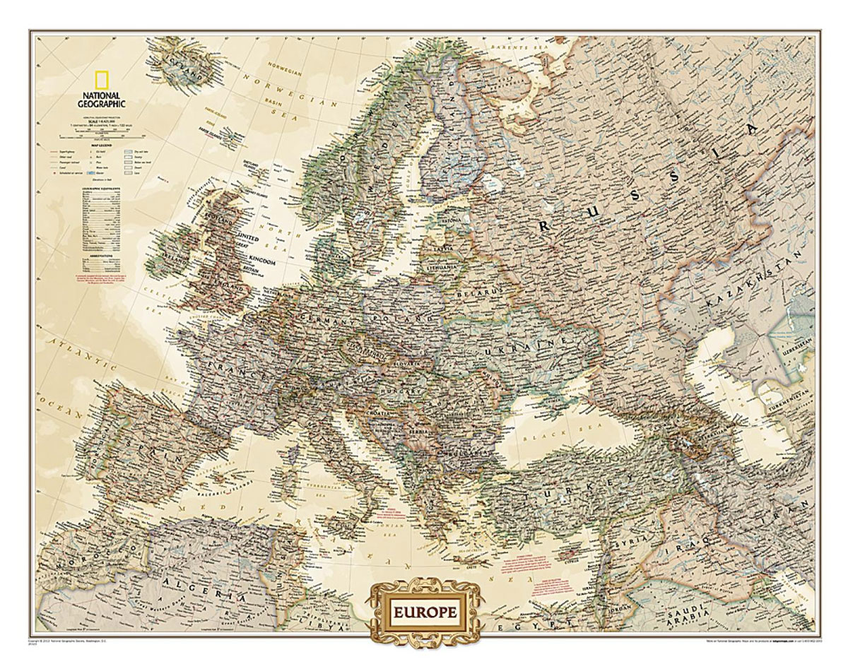
Europe NGS Executive Wall Map LARGE PAPER
Political wall map of Europe from the National Geographic Society in their executive style, offering current information in elegant antique presentation. Large size – 117 x 92cm (3ft 10″ x 3ft approx) – on paper.The map presents Europe with relief shading to indicate mountainous regions. Additional graphics show topographic features such as main swamps or
6
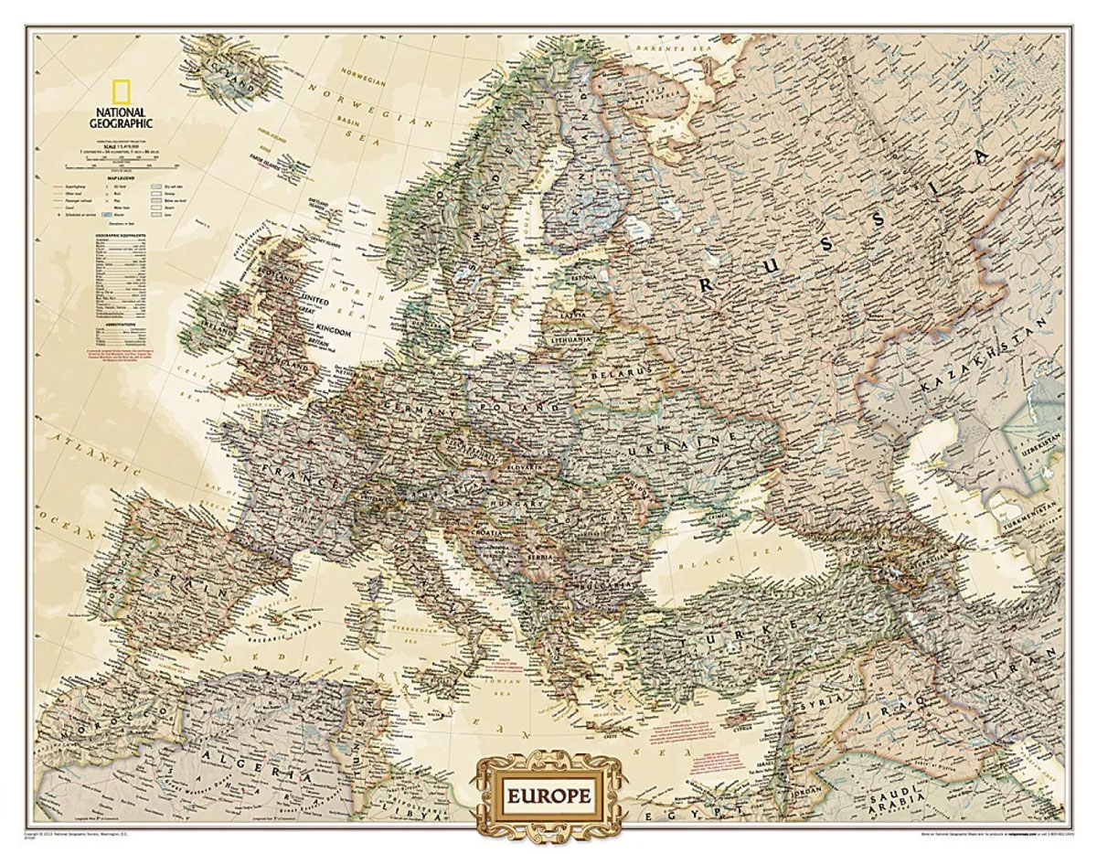
Political wall map of Europe from the National Geographic Society in their executive style, offering current information in elegant antique presentation. Large size – 117 x 92cm (3ft 10″ x 3ft approx) – encapsulated.The map presents Europe with relief shading to indicate mountainous regions. Additional graphics show topographic features such as main swamps or areas
USA NGS Adventure Edition Road Atlas A3 SPIRAL-BOUND
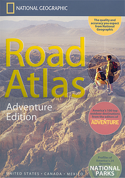
United States in an A3 spiral-bound road atlas from National Geographic, in a unique Adventure Edition that highlights America`s top 100 adventure destinations, selected by the editors of National Geographic Adventure magazine and discusses the most popular national parks. States are presented in alphabetical order, followed by Canadian territory on 11 pages, and a one-page
France, Belgium and Netherlands NGS Classic Wall Map LAMINATED
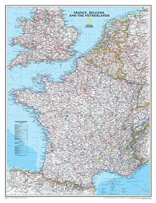
France with the Benelux counties at 1:1,953,000 on a wall map, size: 60 x 77cm (24″ x 30″ approx) ‘“ encapsulated version, from the National Geographic Society presented in their traditional classic style, with a light base and country boundaries in contrasting colours.In France the map shows the division of the country into regions, with
Scandinavia NGS Classic Wall Map LAMINATED
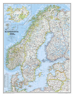
Scandinavia at 1:2,765,000 on a wall map, size: 77 x 60cm (30″ x 24″ approx) ‘“ laminated version, from the National Geographic Society in their traditional classic style with a light base and country boundaries in bright colours.Coverage includes the whole of the Baltic Sea, Estonia, Latvia and Lithuania. Insets show Iceland, Faroe Islands and
Europe NGS Classic Wall Map PAPER
Political wall map of Europe from the National Geographic Society in their classic style with country boundaries indicated in different colours. Small size – 77 x 60cm (30″ x 24″ approx.) – paper version.The map presents Europe in pale beige colour with relief shading to indicate mountainous regions. Additional graphics show topographic features such as
Europe NGS Classic Wall Map LARGE PAPER
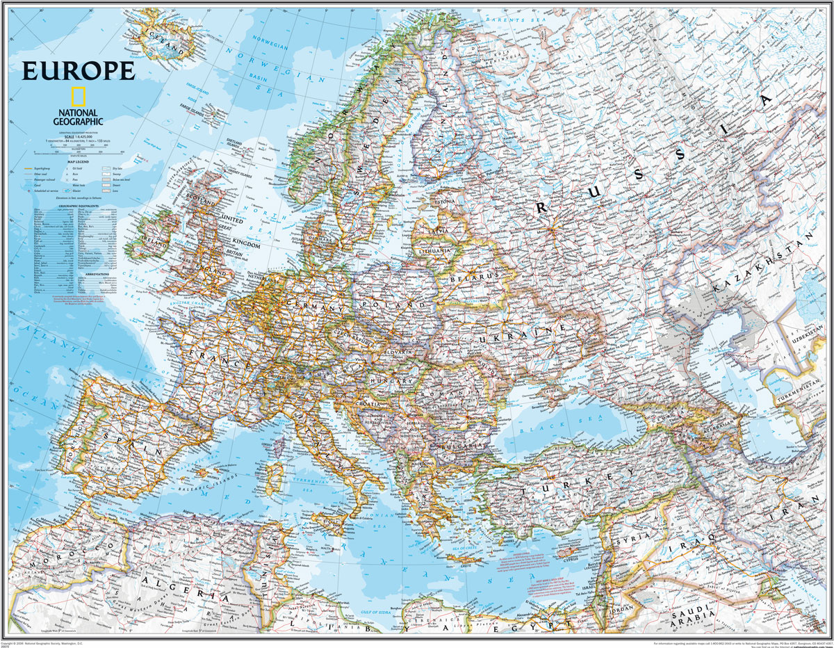
Political wall map of Europe from the National Geographic Society in their classic style with country boundaries indicated in different colours. Large size – 114 x 89cm (3ft 9″ x 2ft 11″ approx.) – paper version.The map presents Europe in pale beige colour with relief shading to indicate mountainous regions. Additional graphics show topographic features
Middle East NGS Classic Wall Map PAPER
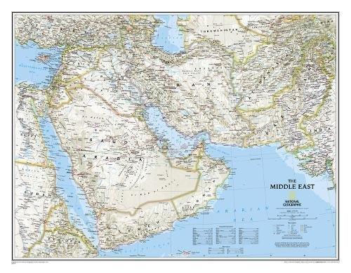
Middle East wall map, 77 x 60cm (2ft 6″ x 2ft approx) ‘“ paper version, presenting the region at 1:6,087,000 in the NGS classic style on a light base with country boundaries outlined in contrasting colours. Coverage extends from the Nile Valley in Egypt and Sudan to Pakistan and Tajikistan. Topography of the region is
World NGS Explorer Wall Map PAPER
Small, colourful political map (81.5 x 51cm / 32″ x 20″ approx.) with the NGS’s usual presentation of the world within an oval frame providing an alternative to the more traditional wall maps. Countries are in dark colours, contrasted against light blue oceans.The map has relief shading and gives names of some mountain ranges, deserts,