Category Archives: Maps
Indian Country NGS Wall Map PAPER
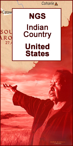
National Geographic Society’s Indian Country Wall Map of the United States presenting individual states annotated with information showing Native heritage and today’s homelands, plus historical maps and photos of well know Indian Americans.The main map shows the country’s division into states, with main towns also marked. General geography of the country is shown by relief
The Earth at Night NGS Wall Map

The Earth at Night wall map from the National Geographic Society, 94 x 56cm /(37″ x 24″ approx) a thought provoking satellite image with far more information that meets the eye at the first glance. The map was produced as a composite of satellite images from cloud-free nights gathered over a one-year period.White colour highlights
Tagalog Pocket Dictionary
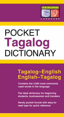
It`s never a good idea to be overly-relient on technology while traveling! Look up words quickly and easily with this great little Tagalog dictionary.Intended for use by tourists, students, and business people traveling to The Philippines Pocket Tagalog Dictionary is an essential tool for communication and a great way to learn Tagalog. It features all
Sri Lanka Periplus Travel Map
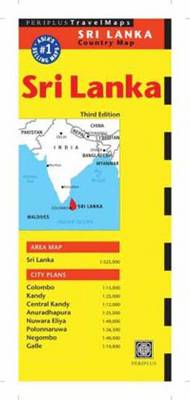
Sri Lanka road map at 1:525,000 from Periplus, plus on the reverse and indexed street plan of Colombo and maps of the island’s other most visited areas: Kandy, Anuradhapura, Polonnaruwa, Galle, Negombo and Nuwara Eliya.On one side is a map of Sri Lanka at 1:525,000, showing its road and railway network on a base with
Korea & Seoul Periplus Travel Map
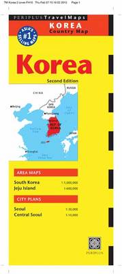
The Korea Travel Map from Periplus is designed as a convenient, easy-to-use tool for travelers. Created using durable coated paper, this map is made to open and fold multiple times, whether it`s the entire map that you want to view or one panel at a time. This 2nd edition includes maps and plans that are
Shanghai Periplus Travel Map
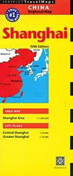
Shanghai on double-sided map from Periplus combining coverage of the city including its outer districts with a more detailed street plan of the central part of the city, plus a road map of Shanghai’s environs.On one side is a detailed, indexed street plan of the city’s inner districts at 1:20,000. Coverage extends roughly from the
Sumatra – Medan Periplus Travel Map
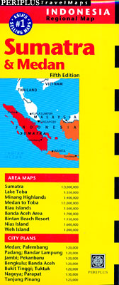
Sumatra on a double-sided map from Periplus combining a map the island with enlargements of its most visited areas and surrounding smaller islands, plus street plans of main towns, all annotated with places of interest.The maps have altitude colouring and relief shading to show the topography. Road network indicates distances on main routes. Ferry routes
Malaysia Periplus Travel Map
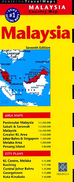
Malaysia on a double-sided map by Periplus, with enlargements for its most visited regions plus street plans for central Kuala Lumpur, Melaka, Georgetown, Johor Bahru, Kota Kinabalu and Kuching.Peninsular Malaysia is shown at 1:1,500,000, with Sabah and Sarawak at 1:2,000,000, accompanied by a map showing these two parts of the country in proper geographical context
Thailand Periplus Travel Map
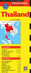
Thailand on a double-sided map at 1:2,000,000 from Periplus, with enlargements and/or street plans for Phuket, Ko Samui and Ko Phangan, central Bangkok, Chiang Mai, Pattaya, Phuket Town, Patong Beach, Karon and Kata Beaches, Northern Samui and Ayuthaya.Thailand is divided between the two sides of the map, with the bulk of the country and the
Hong Kong & Macau Periplus Travel Map
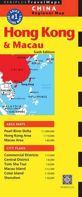
Hong Kong and Macau street plans from Periplus on a double-sided map which combines detailed street plans with more general maps, including the whole of the Hong Kong Special Administrative Region with the Shenzhen Economic Zone. The map provides for:HONG KONG & the adjoining areas: an indexed street plan of Hong Kong’s and Kowloon’s Central
United States NGS Classic Wall Map ENCAPSULATED
United States NGS Classic Style Wall Map in the *standard 111 x 78cm / 43″ x 30″ size, encapsulated version* with white background with relief shading for mountains, state boundaries in colour, and the surrounding seas in light blue. The map shows the administrative division of the country, with states boundaries picked out in different
Peninsular Malaysia Periplus Travel Map
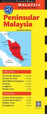
Peninsular Malaysia at 1:1,000,000 on a double-sided map from Periplus, with large street plans central Kuala Lumpur, Melaka and Johor Bahru, plus enlargements of the Greater KL and the Singapore/Johor Bahru areas, Penang and Langkawi.Peninsular Malaysia is shown on one side of the map at 1:1,000,000. The network of main and selected local roads and
World NGS Executive Wall Map PAPER

Paper version of the standard size, 116.5 x 77.5cm (46″ x 30″ approx), Atlantic centred NGS Executive political map of the world which offers current information presented in elegant antique style. Countries are in rich but muted colours and oceans in beige, with additional panels and framing in shades of brown.An unusual feature of this
Indonesia Periplus Travel Map
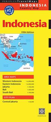
Indonesia on a double-sided map at 1:4,000,000 from Periplus, with more detailed presentation of Bali and Bali’s southern tourist region, a large street plan of central Jakarta, plus a map of the capital with its outer suburbs.On one side are the islands Western Indonesia: Sumatra, Kalimantan, Java, Bali, Lombok and most of Sumbawa, plus the
World NGS Classic Wall Map ENCAPSULATED
NGS Classic political map of the world, standard size 110.5 x 77cm (43.5″ x 30″ approx) ‘“ encapsulated version, with the publishers’ characteristic lay-out providing an attractive alternative to the more conventional world maps, countries in white but defined by different colour borders, oceans in bright blue, plus interesting additional features. All place names are
India Periplus Travel Map
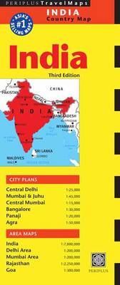
Indian Subcontinent at 1:7,000,000 on an overview map from Periplus, accompanied by enlargements for some of its most visited areas: Rajastan, Goa, and the environs of Delhi and Mumbai, plus street plans of Delhi, Mumbai and Juhu, Panaji, Agra and Bangalore.The main map provides an overview of the Subcontinent, including most of Pakistan, Nepal, Bhutan,
France, Belgium and Netherlands NGS Classic Wall Map LAMINATED
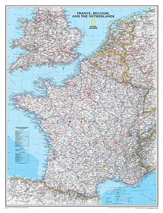
France with the Benelux counties at 1:1,953,000 on a wall map, size: 60 x 77cm (24″ x 30″ approx) ‘“ encapsulated version, from the National Geographic Society presented in their traditional classic style, with a light base and country boundaries in contrasting colours.In France the map shows the division of the country into regions, with
Scandinavia NGS Classic Wall Map LAMINATED
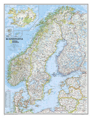
Scandinavia at 1:2,765,000 on a wall map, size: 77 x 60cm (30″ x 24″ approx) ‘“ laminated version, from the National Geographic Society in their traditional classic style with a light base and country boundaries in bright colours.Coverage includes the whole of the Baltic Sea, Estonia, Latvia and Lithuania. Insets show Iceland, Faroe Islands and
Spain and Portugal NGS Classic Wall Map ENCAPSULATED
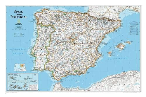
Spain and Portugal Classic Style Wall Map, size 84 x 56cm (33″ x 22″ approx) – encapsulated version, from the National Geographic Society, showing the Iberian Peninsula at 1:2,074,000 with a light base and country boundaries outlined in colour.Within Spain the map shows internal administrative boundaries with names of the regions. Road and rail networks
Europe NGS Classic Wall Map LARGE ENCAPSULATED
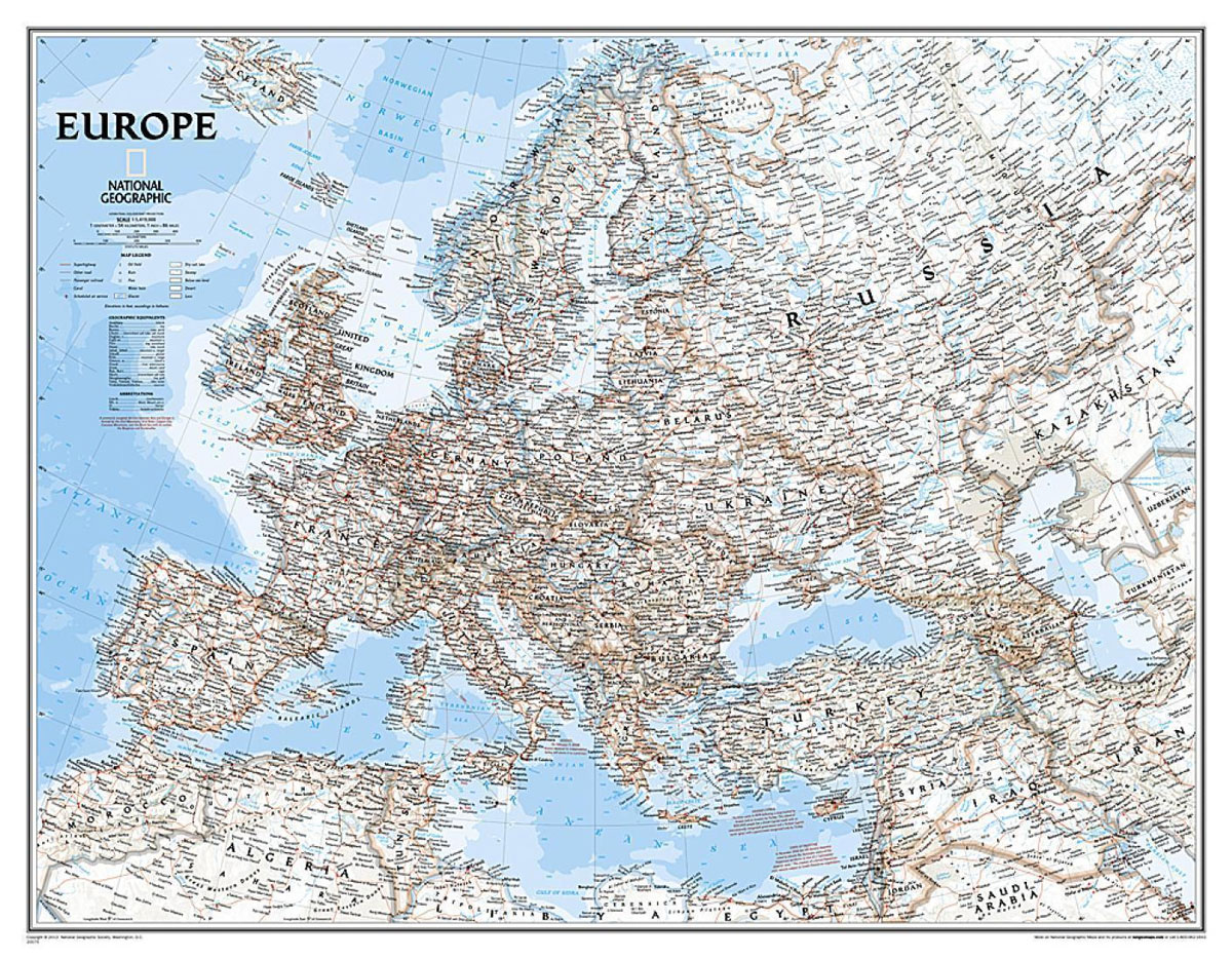
Political wall map of Europe from the National Geographic Society in their classic style with country boundaries indicated in different colours. Large size – 114 x 89cm (3ft 9″ x 2ft 11″ approx.) – encapsulated version.The map presents Europe in pale beige colour with relief shading to indicate mountainous regions. Additional graphics show topographic features