Category Archives: Maps
Sheffield (North) 1903 – 294.04b

Sheffield North in 1903 in a fascinating series of reproductions of old Ordnance Survey plans in the Alan Godfrey Editions, ideal for anyone interested in the history of their neighbourhood or family. Two versions have been published for this area. The maps cover the Shirecliffe, Pitsmkoor, Osgathorpe and Burngreave areas. Features on the 1892 version
Highbury & Islington 1914 – 39.3
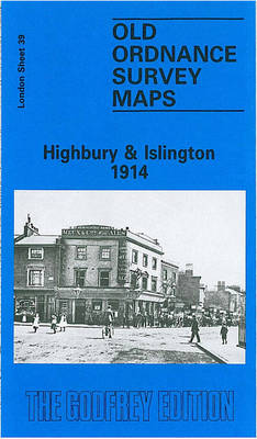
Highbury and Islington in 1914 in a fascinating series of reproductions of old Ordnance Survey plans in the Alan Godfrey Editions, ideal for anyone interested in the history of their neighbourhood or family. Three versions of this map cover the same area, York Road eastward to Rotherfield Street, and from Cloudsley Square northward to Witherington
Jesmond 1914
Jesmond in 1914 in a fascinating series of reproductions of old Ordnance Survey plans in the Alan Godfrey Editions, ideal for anyone interested in the history of their neighbourhood or family. Two maps have been published for this area to show how it has changed over the years. Features on the 1895 version show St
Glasgow High Street 1909
Glasgow High Street in 1909 in a fascinating series of reproductions of old Ordnance Survey plans in the Alan Godfrey Editions, ideal for anyone interested in the history of their neighbourhood or family. Two versions have been published for this area. Coverage stretches from Buchanan Street eastward to Whitevale Street and Armadale Street, and from
Wanstead Flats 1893
Wanstead Flats in 1893 in a fascinating series of reproductions of old Ordnance Survey plans in the Alan Godfrey Editions, ideal for anyone interested in the history of their neighbourhood or family. Two versions cover an area stretching from Montague Road and Odessa Road eastward to Forest Drive, and from Woodlands Avenue southward to Cobbold
Attercliffe 1903 – 295.01a
Attercliffe in 1903 in a fascinating series of reproductions of old Ordnance Survey plans in the Alan Godfrey Editions, ideal for anyone interested in the history of their neighbourhood or family. The map covers the Attercliffe area on the north-eastern side of Sheffield, including parts of Brightside, Carbrook and Greenland. Coverage stretches from Stevenson Road
Wincobank & Meadowhall 1902 – 289.13a
Wincobank and Meadowhall in 1902 in a fascinating series of reproductions of old Ordnance Survey plans in the Alan Godfrey Editions, ideal for anyone interested in the history of their neighbourhood or family. The map covers the area now known for the Meadowhall Shopping Centre. Coverage stretches from High Wincobank eastward to Tinsley Bridge, and
North Finchley 1894
North Finchley in 1894 in a fascinating series of reproductions of old Ordnance Survey plans in the Alan Godfrey Editions, ideal for anyone interested in the history of their neighbourhood or family. Two versions for this area have been published to show how it developed across the years. Each covers the same area, from the
Rotherhithe 1894 – 78.2
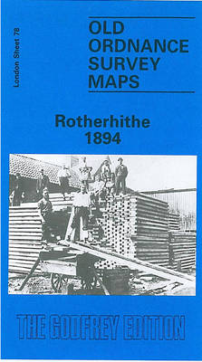
Rotherhithe in 1894 in a fascinating series of reproductions of old Ordnance Survey plans in the Alan Godfrey Editions, ideal for anyone interested in the history of their neighbourhood or family. Three versions of this map have been published, stretching from Lower Road and Thames Tunnel eastward to Alpha Road, and from Rotherhithe Road and
Conisbrough 1901
Conisbrough in 1901 in a fascinating series of reproductions of old Ordnance Survey plans in the Alan Godfrey Editions, ideal for anyone interested in the history of their neighbourhood or family. The map covers the historic town of Conisbrough with its great castle, which inspired Walter Scott`s novel Ivanhoe. Most of the town is covered,
Rose Grove and Habergham 1909
Rose Grove and Habergham in 1909 in a fascinating series of reproductions of old Ordnance Survey plans in the Alan Godfrey Editions, ideal for anyone interested in the history of their neighbourhood or family. The map covers the west side of Burnley, stretching from Wordsworth Street westward to the eastern edge of Padiham, and from
Central Glasgow 1909 – 6.10b
Central Glasgow in 1909 in a fascinating series of reproductions of old Ordnance Survey plans in the Alan Godfrey Editions, ideal for anyone interested in the history of their neighbourhood or family. Three versions have been published for this area. Coverage stretches from West Nile Street westward to Kelvinhaugh Street and Overnewton Square, and from
Bolton 1908 – 87.13b
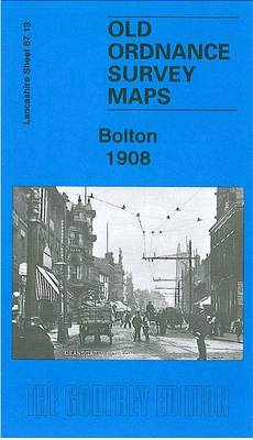
Bolton in 1908 in a fascinating series of reproductions of old Ordnance Survey plans in the Alan Godfrey Editions, ideal for anyone interested in the history of their neighbourhood or family. The map covers most of Bolton`s town centre, stretching from Dobson Road eastward to Dorset Street, and from Clarence Street southward to Burnaby Street
Burnley 1910
Burnley in 1910 in a fascinating series of reproductions of old Ordnance Survey plans in the Alan Godfrey Editions, ideal for anyone interested in the history of their neighbourhood or family. The map covers most of central Burnley with its many mills, stretching from Cog Lane and Gannow Junction eastward to Belvedere Road, and from
New Cross 1914 – 104.3
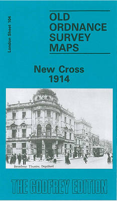
New Cross in 1914 in a fascinating series of reproductions of old Ordnance Survey plans in the Alan Godfrey Editions, ideal for anyone interested in the history of their neighbourhood or family. Three versions for this area have been published, stretching from Pomery St and Nunhead Junction eastward to Deptford Bridge; from Deptford station southward

Lake District Rock

Lake District Rock contains over 1,500 climbs on 85 crags and features clear maps, crisp photodiagram coverage for every crag and sensational images. The banners and sidebar reflect the familiar FRCC colours making it easy to find each section. Dow, Coppermines & Slate, Duddon & Eskdale and Borrowdale – receive the `modern` treatment and Bramcrag
Borrowdale: Fell & Rock Climbing Club Guides

Borrowdale is probably the most beautiful valley in the Lake District and offers the rock climber a huge variety of climbing styles often in stunning panoramic settings. The valley is well-known for accessible roadside climbing on crags such as Reecastle, the ever popular Shepherd`s Crag, Quayfoot Buttress and the Bowderstone area, with most crags enjoying