Category Archives: Maps
Padiham 1909

Padiham in 1909 in a fascinating series of reproductions of old Ordnance Survey plans in the Alan Godfrey Editions, ideal for anyone interested in the history of their neighbourhood or family. The map is double-sided. The main map covers the southern part of Padiham, extending southward to Shuttleworth Hall and westward to Simonstone Paper Mill.
Mexborough 1901
Mexborough in 1901 in a fascinating series of reproductions of old Ordnance Survey plans in the Alan Godfrey Editions, ideal for anyone interested in the history of their neighbourhood or family. The map is double-sided. The main map covers the southern part of Mexborough, including the station, High Street, Market Place, Bank Street, Market Place,
Downpatrick 1901
Detailed map reproducing Ordnance Survey mapping of Downpatrick in 1901. The map is double-sided and presents the three-part plan of the town reduced in scale to 24 inches to the mile. Most of the town centre is shown on the main side and features include the station, cathedral, infantry barracks, Court House, Ardmore, markets, St
Arthur`s Hill and Fenham 1913
Arthur`s Hill and Fenham in 1913 in a fascinating series of reproductions of old Ordnance Survey plans in the Alan Godfrey Editions, ideal for anyone interested in the history of their neighbourhood or family. The map covers the Arthur`s Hill and Fenham area north-west of Newcastle. The Westgae Road runs through the map and coverage
Templeborough & Tinsley 1921 – 289.14b
Templeborough and Tinsley in 1921 in a fascinating series of reproductions of old Ordnance Survey plans in the Alan Godfrey Editions, ideal for anyone interested in the history of their neighbourhood or family. The map covers the Templeborough and Tinsley area south-west of Rotherham and north of Sheffield. Templeborough Rolling Mills runs along the top
Piccadilly 1869
Piccadilly area of London in 1869 in a series of exceptionally detailed reproductions of old Ordnance Survey street plans for areas of larger cities which have undergone substantial redevelopment in the late 19th or the early 20th century, published in the Alan Godfrey Editions.The plans, printed in back and white, have been taken from the
Coatbridge 1897
Coatbridge in 1897 in a fascinating series of reproductions of old Ordnance Survey plans in the Alan Godfrey Editions, ideal for anyone interested in the history of their neighbourhood or family.Two versions have been published for this area. The maps cover the town centre and western portion of Coatbridge. Coverage stretches from Sunnyside Road and
Old Trafford 1905
Old Trafford in 1905 in a fascinating series of reproductions of old Ordnance Survey plans in the Alan Godfrey Editions, ideal for anyone interested in the history of their neighbourhood or family. Three versions have been published for this area around and to the west of Old Trafford, showing how it changed across the years.
Blackburn 1910
Blackburn in 1910 in a fascinating series of reproductions of old Ordnance Survey plans in the Alan Godfrey Editions, ideal for anyone interested in the history of their neighbourhood or family. Three versions of this map have been published, extending from Wimberley Street and Brockkhouse southward to Lower Audley Steet and Pringle Street, and from
Goole 1905
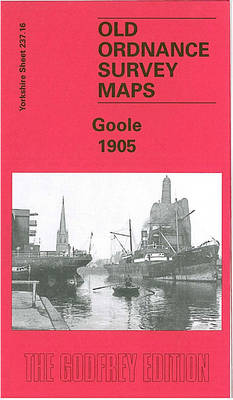
Goole in 1905 in a fascinating series of reproductions of old Ordnance Survey plans in the Alan Godfrey Editions, ideal for anyone interested in the history of their neighbourhood or family. The map covers most of the town and features include station, St John`s church, North Street, Booth Ferry Road, Clifton Gardens, Shuffleton, Tompits Holmes,
North Hammersmith and Bedford Park 1912
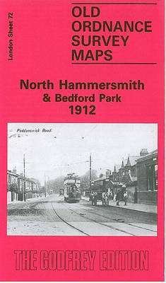
North Hammersmith and Bedford Park in 1912 in a fascinating series of reproductions of old Ordnance Survey plans in the Alan Godfrey Editions, ideal for anyone interested in the history of their neighbourhood or family. Four versions of this map have been published, with coverage extending from Acton Lane and Beaconsfield Road eastward to Devonport
Wickersley 1901
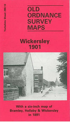
Wickersley in 1901 in a fascinating series of reproductions of old Ordnance Survey plans in the Alan Godfrey Editions, ideal for anyone interested in the history of their neighbourhood or family. The map covers the village of Wickersley, east of Rotherham. Coverage stretches from the cross roads, where the Three Horse Shoes, White Swan and
East Acton & Wormholt 1913 – 58.3

East Acton and Wormholt in 1913 in a fascinating series of reproductions of old Ordnance Survey plans in the Alan Godfrey Editions, ideal for anyone interested in the history of their neighbourhood or family. Three versions cover the same area, extending from Goldsmith Avenue eastward to Ellerslie Road, and from Friars Place Farm southward to
Leicester (NE) 1913 – 31.11
Leicester North East in 1902 in a fascinating series of reproductions of old Ordnance Survey plans in the Alan Godfrey Editions, ideal for anyone interested in the history of their neighbourhood or family. Leicester is covered on six maps.This title covers a busy area of east Leiecester, stretching from Southampton Street and the northern part
Stepney & Limehouse 1914 – 64.3
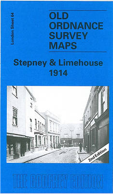
Stepney and Limehouse in 1914 in a fascinating series of reproductions of old Ordnance Survey plans in the Alan Godfrey Editions, ideal for anyone interested in the history of their neighbourhood or family. Three versions cover the area stretching from Sidney Street and Shadwell station eastward to Stainsby Road, and from the Mile End Road
The West End 1914 – 61.3
The West End in 1914 in a fascinating series of reproductions of old Ordnance Survey plans in the Alan Godfrey Editions, ideal for anyone interested in the history of their neighbourhood or family. Three versions of this map each cover the same area of central London, stretching from Marble Arch eastward to Charing Cross Road,
Rotherhithe 1894 – 78.2
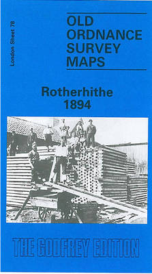
Rotherhithe in 1894 in a fascinating series of reproductions of old Ordnance Survey plans in the Alan Godfrey Editions, ideal for anyone interested in the history of their neighbourhood or family. Three versions of this map have been published, stretching from Lower Road and Thames Tunnel eastward to Alpha Road, and from Rotherhithe Road and
Conisbrough 1901
Conisbrough in 1901 in a fascinating series of reproductions of old Ordnance Survey plans in the Alan Godfrey Editions, ideal for anyone interested in the history of their neighbourhood or family. The map covers the historic town of Conisbrough with its great castle, which inspired Walter Scott`s novel Ivanhoe. Most of the town is covered,
Rose Grove and Habergham 1909
Rose Grove and Habergham in 1909 in a fascinating series of reproductions of old Ordnance Survey plans in the Alan Godfrey Editions, ideal for anyone interested in the history of their neighbourhood or family. The map covers the west side of Burnley, stretching from Wordsworth Street westward to the eastern edge of Padiham, and from
Central Glasgow 1909 – 6.10b
Central Glasgow in 1909 in a fascinating series of reproductions of old Ordnance Survey plans in the Alan Godfrey Editions, ideal for anyone interested in the history of their neighbourhood or family. Three versions have been published for this area. Coverage stretches from West Nile Street westward to Kelvinhaugh Street and Overnewton Square, and from