Category Archives: Maps
Rock Ferry and New Ferry 1898

Rock Ferry and New Ferry in 1898 in a fascinating series of reproductions of old Ordnance Survey plans in the Alan Godfrey Editions, ideal for anyone interested in the history of their neighbourhood or family. The map is double-sided. The main map covers the area from Rock Ferry to New Ferry, including part of Bebington
Aberdeen 1900 – 75.11
Aberdeen Central in 1900 in a fascinating series of reproductions of old Ordnance Survey plans in the Alan Godfrey Editions, ideal for anyone interested in the history of their neighbourhood or family. The map covers the city centre, stretching from Thomson Street eastward to St Clement`s Street, and from Urquart Road southward to Affleck Street.
Bridport 1901
Bridport in 1901 in a fascinating series of reproductions of old Ordnance Survey plans in the Alan Godfrey Editions, ideal for anyone interested in the history of their neighbourhood or family.The map is double-sided to provide maximum coverage. On the main map the town centre is in the top left corner, with West Street, East
Sheffield Ecclesall Road and Sharrow 1903
Sheffield Ecclesall Road and Sharrow in 1903 in a fascinating series of reproductions of old Ordnance Survey plans in the Alan Godfrey Editions, ideal for anyone interested in the history of their neighbourhood or family. The map covers the south-western area of Sheffield, along the Ecclesall Road. Coverage stretches from South Street westward to Endcliffe
St Michael`s and Aigburth Vale 1908
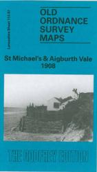
St Michael`s and Aigburth Vale in 1908 in a fascinating series of reproductions of old Ordnance Survey plans in the Alan Godfrey Editions, ideal for anyone interested in the history of their neighbourhood or family. The map covers the area of south Liverpool around St Michael`s, Aigburth Vale and the southern part of Sefton Park.
Knottingley 1905
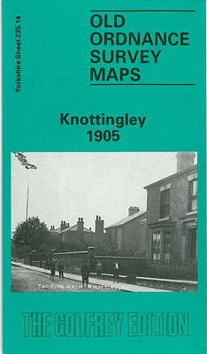
Knottingley in 1905 in a fascinating series of reproductions of old Ordnance Survey plans in the Alan Godfrey Editions, ideal for anyone interested in the history of their neighbourhood or family. The map is double-sided. The main map covers the centre and south of the town, with coverage from The Croft and St Botolph`s church
Camberwell & Stockwell 1913 – 102.3
Camberwell and Stockwell in 1913 in a fascinating series of reproductions of old Ordnance Survey plans in the Alan Godfrey Editions, ideal for anyone interested in the history of their neighbourhood or family. Three versions for this area have been published, stretching from South Lambeth Road and Stockwell station eastward to Camberwell Green and from
Keswick 1898
Keswick in 1898 in a fascinating series of reproductions of old Ordnance Survey plans in the Alan Godfrey Editions, ideal for anyone interested in the history of their neighbourhood or family. The map is double-sided. The main map covers the town centre, extending southward to Derwent Isle and westward to the western bank of Derwent
Hendon 1895
Hendon in 1895 in a fascinating series of reproductions of old Ordnance Survey plans in the Alan Godfrey Editions, ideal for anyone interested in the history of their neighbourhood or family. Two versions have been published to show how this area developed across the years, stretching from The Burroughs eastward to Finchley Road, and from
Sherborne 1901
Sherborne in 1901 in a fascinating series of reproductions of old Ordnance Survey plans in the Alan Godfrey Editions, ideal for anyone interested in the history of their neighbourhood or family. The town centre is covered, and the map extends eastward to Sherborne Castle. Other features include the Abbey Church, King`s School, station, workhouse, Castleton,
Dumfries South 1899
Dumfries South in 1899 in a fascinating series of reproductions of old Ordnance Survey plans in the Alan Godfrey Editions, ideal for anyone interested in the history of their neighbourhood or family. The map covers the southern part of Dumfries, stretching from Queensberry Square southward to Castledykes and the Comyn`s Castle site, and from the
Oswaldtwistle and Church 1909
Oswaldtwistle and Church in 1909 in a fascinating series of reproductions of old Ordnance Survey plans in the Alan Godfrey Editions, ideal for anyone interested in the history of their neighbourhood or family. The map covers the west end of Accrington, together with much of Church and Oswaldtwistle. Coverage stretches from Monk Street Accrington westward
Malvern Wells 1903
Malvern Wells in 1903 in a fascinating series of reproductions of old Ordnance Survey plans in the Alan Godfrey Editions, ideal for anyone interested in the history of their neighbourhood or family. The map is double-sided; the main map covers the area from the Wyche Cutting southward to Green Lane, and from Hanley Road westward
Blackheath 1914 – 105.3
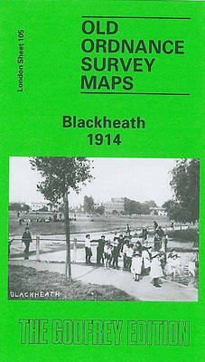
Blackheath 1914 in a fascinating series of reproductions of old Ordnance Survey plans in the Alan Godfrey Editions, ideal for anyone interested in the history of their neighbourhood or family. Two versions been published for this area, stretching from Brookmill Road, Beaufort Gardens and the east end of St Johns station eastward to Vanbrugh Terrace
Whitehaven 1923
Whitehaven in 1923 in a fascinating series of reproductions of old Ordnance Survey plans in the Alan Godfrey Editions, ideal for anyone interested in the history of their neighbourhood or family. The map covers the centre of Whitehaven, extending from Whitehaven Castle northward to Beatty Road and South View Road, and eastward to Low Harras.
Isle of Portland: Castletown 1927
Isle of Portland: Castletown in 1927 in a fascinating series of reproductions of old Ordnance Survey plans in the Alan Godfrey Editions, ideal for anyone interested in the history of their neighbourhood or family. The Isle of Portland is covered by four maps. This Castletown map covers the northern part of the island, and features
Dundee East 1901
Dundee East in 1901 in a fascinating series of reproductions of old Ordnance Survey plans in the Alan Godfrey Editions, ideal for anyone interested in the history of their neighbourhood or family. The map covers the eastern half of Dundee, stretching from Brown Constable Street eastward to the Eastern Necropolis, and from Sandeman Street southward
Tamworth 1900
Tamworth in 1900 in a fascinating series of reproductions of old Ordnance Survey plans in the Alan Godfrey Editions, ideal for anyone interested in the history of their neighbourhood or family. The map is double-sided. The main map covers the centre and east of the town, extending eastward about a mile to Royals Farm and
Carlisle South-East 1924
Carlisle South-East in 1924 in a fascinating series of reproductions of old Ordnance Survey plans in the Alan Godfrey Editions, ideal for anyone interested in the history of their neighbourhood or family. Carlisle is covered by four maps. This title covers the south-eastern area, stretching from Cecil Street eastward to Durranhill Park and southward to
Pimlico, Sloane Square & Nine Elms 1894 – 88.2
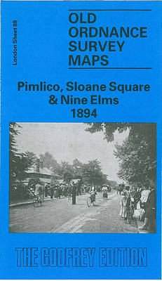
Pimlico, Sloane Square and Nine Elms in 1894 in a fascinating series of reproductions of old Ordnance Survey plans in the Alan Godfrey Editions, ideal for anyone interested in the history of their neighbourhood or family. Three versions have been published for this area, stretching from Chelsea Royal Hospital eastward to Vauxhall Bridge, and from